

From FT3 to CC3: how to maintain and represent scale properly?

Hello,
After a long break, I've gotten back into CC3 and started playing with the new FT3. My skills are sadly limited. After many clicks, I managed to generate a perfect world for my campaign, and zooming in, saved the area as a .bmp and inserted it into CC3 on a temp sheet. Then I traced the contours, elevated areas, rivers, etc, and that's come out mostly okay. (I tried doing it with export to CC3 and tracing, but my laptop can't handle tracing very well--especially since I can never get trace to go in the right direction; help?)
What I'm struggling with is maintaining size and scale between FT3 and CC3. The FF3 view that I export gives the n/s, e/w dimensions, so I use those for the size of the CC3 map. However, when I insert the .bmp, it never seems to fit, so I'm wondering if I'm throwing distances off. How can I maintain accurate scale between the two pieces of software?
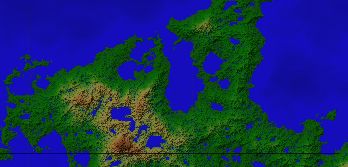
Attached is my first effort at adapting a piece of the world into CC3, using the recent Vielink style.
Also--I can't figure out how to insert the scale bar cartouche and have it give an accurate distance. Help?
After a long break, I've gotten back into CC3 and started playing with the new FT3. My skills are sadly limited. After many clicks, I managed to generate a perfect world for my campaign, and zooming in, saved the area as a .bmp and inserted it into CC3 on a temp sheet. Then I traced the contours, elevated areas, rivers, etc, and that's come out mostly okay. (I tried doing it with export to CC3 and tracing, but my laptop can't handle tracing very well--especially since I can never get trace to go in the right direction; help?)
What I'm struggling with is maintaining size and scale between FT3 and CC3. The FF3 view that I export gives the n/s, e/w dimensions, so I use those for the size of the CC3 map. However, when I insert the .bmp, it never seems to fit, so I'm wondering if I'm throwing distances off. How can I maintain accurate scale between the two pieces of software?
Attached is my first effort at adapting a piece of the world into CC3, using the recent Vielink style.
Also--I can't figure out how to insert the scale bar cartouche and have it give an accurate distance. Help?
Comments