

Laying Mountains

Alright, I understand the concept that you do the mountain ranges from north to south and don't overkill it. Cool. Check. Roger.
I made a little mistake though, and I'm not entirely sure how to fix it, as I've tried to use Change Layer and the Bring to Front to fix the problem.
I set out the rivers before actually adding any other terrain to the map itself, and now I need to place mountains, I don't have a grey/brown mountain base
on which to set the mountains...so instead I have grass underneath the mountains which won't really fly.
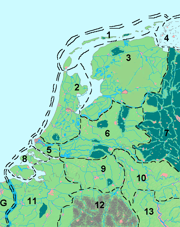
I've attached the current map and http://img.photobucket.com/albums/v312/dire5/Lotus/Lotus-Region-Political.png is the map I'm trying to duplicate. THe mountains are at the south end.
Is there a specific command I have to use that I'm not laying the grey base overtop of those rivers to the south? Or am I stuck with having to lay the base first then redo the rivers?
Any help is much appreciated... once I get this done then I go back to the forests, which is fun in and of itself.
Thanks again folks! And I've cut out a LOT of the rivers from that map... I have a version with all the rivers but it was far too cluttered and didn't look that great.
I might try redrawing this map after I complete it, in a different style mind you...just to see what turns out better. Not sure how I'm going to
do all the population centers (pink dots). Might just crack open Photoshop and do a low opacity polygon over each of the spots. Suggestions there as well?
I made a little mistake though, and I'm not entirely sure how to fix it, as I've tried to use Change Layer and the Bring to Front to fix the problem.
I set out the rivers before actually adding any other terrain to the map itself, and now I need to place mountains, I don't have a grey/brown mountain base
on which to set the mountains...so instead I have grass underneath the mountains which won't really fly.
I've attached the current map and http://img.photobucket.com/albums/v312/dire5/Lotus/Lotus-Region-Political.png is the map I'm trying to duplicate. THe mountains are at the south end.
Is there a specific command I have to use that I'm not laying the grey base overtop of those rivers to the south? Or am I stuck with having to lay the base first then redo the rivers?
Any help is much appreciated... once I get this done then I go back to the forests, which is fun in and of itself.
Thanks again folks! And I've cut out a LOT of the rivers from that map... I have a version with all the rivers but it was far too cluttered and didn't look that great.
I might try redrawing this map after I complete it, in a different style mind you...just to see what turns out better. Not sure how I'm going to
do all the population centers (pink dots). Might just crack open Photoshop and do a low opacity polygon over each of the spots. Suggestions there as well?
Comments
- Layers are just for grouping of entities, and doesn't affect the order they appear on in the map. You'll want to make sure the entities are on the right sheet, as well as make sure the sheet order is correct (Remember that the sheets near the bottom of the sheet list are drawn on top of those higher up in the list)
- Send to front/back only works within a sheet, so even if you use "send to back", the entity will still cover up other entities if it is on a sheet that is later in the drawing order.
So, as long as you place the mountain contour on the Contours (Land) sheet, and the rivers on the rivers sheet, everything should draw correctly. If not, check sheet ordering, and make sure the rivers are further down than the contours.
No need to use Photoshop for such a feature. If you need polygons with a low opacity, just create a separate sheet for them, and set the transparency effect on that sheet. Everything you draw on this sheet will be semi-transparent (amount determined by the effect setting).
In general, I would advice against using Photoshop for such tasks, because if you decide you need to go back in CC3 to change land features a little bit, you will then have to redo everything you did in photoshop as well. By keeping as much as possible withing CC3, it is easier to handle changes.
Hmm, hadn't thought of that - I'll do it in CC3 again. Thanks.
Once more Profantasy Community to the rescue!