

Matatau Coast - Trace from IA map
 Ricko
🖼️ 107 images Mapmaker
Ricko
🖼️ 107 images Mapmaker
I created a generic map from the IA in a 4:7 ratio to use as a base for a trace.
Here is the image that I used Handdraw Fantasy for in a size of 400x700 (I don't remember if it's metric or imperial), for the purpose that I used the map, it doesn't matter either.


Comments
Now, the step-by-step process of creating the image in CC3, using the photos I sent to Royal Scribe during the process. (Thankfully, it served as a backup).
first save.
As you can see, on this map, I also started working on the same sheet for 95% of the images (symbols). So, yes or yes, I should start from top to bottom, icon by icon, slowly changing the colors of the mountains and hills to achieve a greater diversity of tones.
work in progress - save 3
Save 4 - In this type of work, since the mountains often overlap the continent line to create a more realistic perspective, I usually leave the landmass tracing for last. Either way, I have the trace image at 20 to 35% transparency to give me the references I need.
Already in save 5, with the work well advanced, I was finally able to shape this coast.
While trying to use as many images as possible, I realized I had forgotten the volcano, but I also realized that its smoke was obstructing the images in a place on the map where the view is very attracted. I decided to remove it.
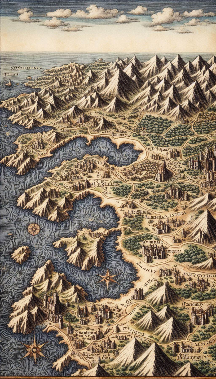
Finally, the final version with random names and colors retouched in Lightroom to give more life to the map.
And here is the file for anyone who wants it.
Cheers
Just unbelievably good. And thanks for sharing the process.
As Quenten said, thanks for sharing your workflow, Ricko. Amazing map!