

Hand-drawn Fantasy
 Ricko
🖼️ 107 images Mapmaker
Ricko
🖼️ 107 images Mapmaker
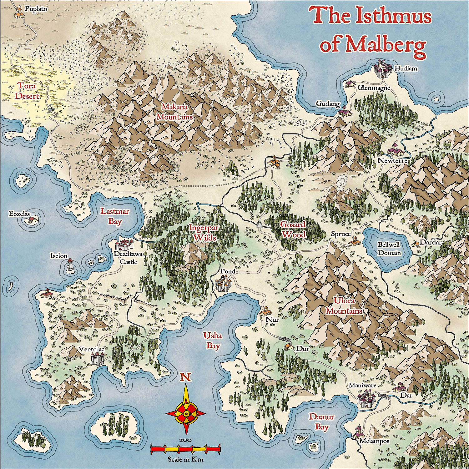
A random map to try out the new Annual Hand-drawn Fantasy.
Cheers


 and 1 other.Ricko
🖼️ 107 images Mapmaker
and 1 other.Ricko
🖼️ 107 images Mapmaker
A random map to try out the new Annual Hand-drawn Fantasy.
Cheers
and 1 other.
Comments
I think this shows altitude a bit more than some other maps. The center of the map, Gosard Wood, looks like it's actually in a valley of sorts. The mountains pop, but they do as much to show the depressions, too.
This can also be achieved in other styles by increasing the size of the mountains and decreasing the size of the trees. I use this technique a lot when working with Mike Schley, for example.
Another possibility is to change the X and Y proportions in the symbol parameters.
Clever!
This time with a more local view.