

Show us your map collection!
 MatthewBertram
🖼️ 5 images Traveler
MatthewBertram
🖼️ 5 images Traveler
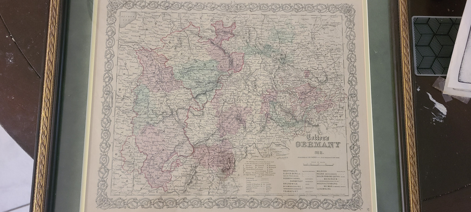
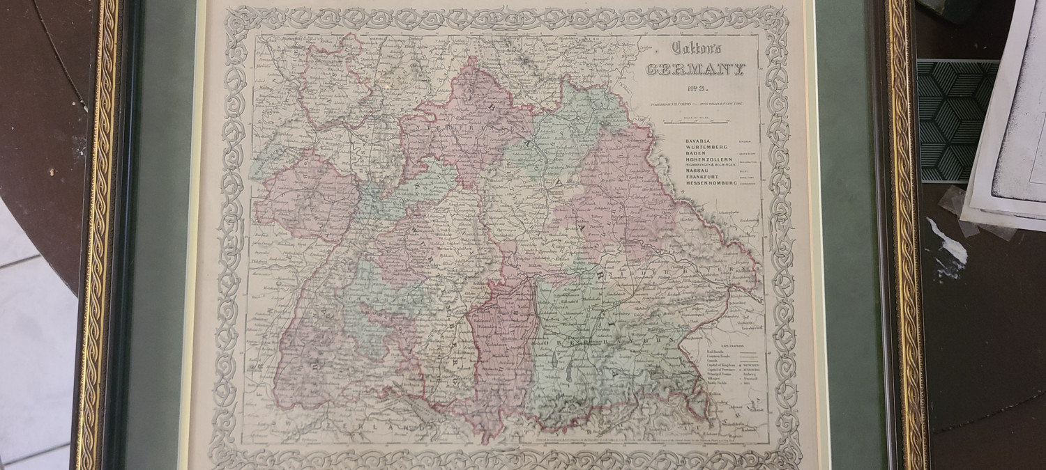
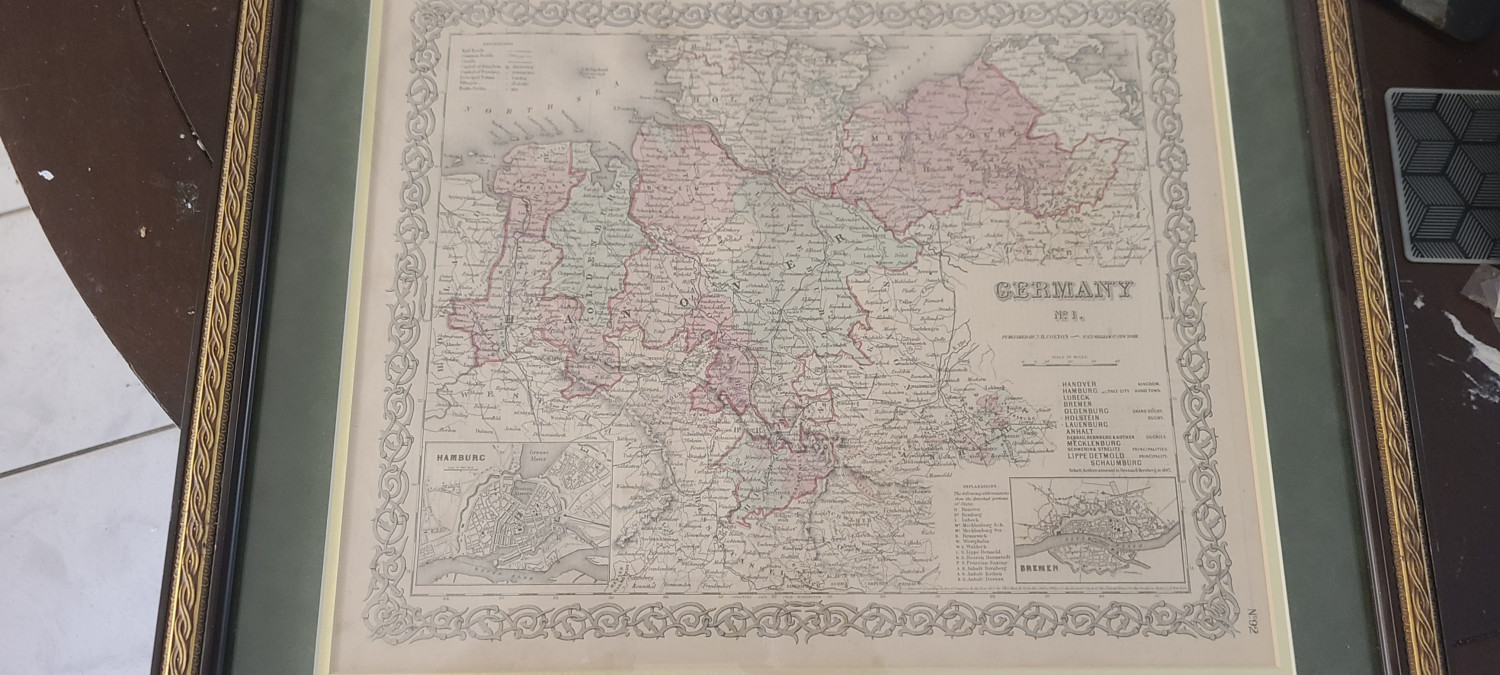
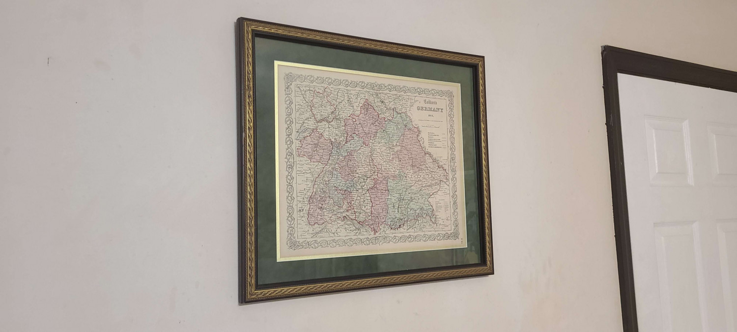
I recently bought 3 maps on Facebook Marketplace of Germany circa 1864, I put one of them up on the wall and the other two I'm giving to my dad for his birthday and father's day (both within a day of each other).
What sorts of real world maps do you all own? Any that serve as influence/inspiration to your own personal cartography?
Tagged:


Comments
I would really love to have a good copy of part of the Ferraris Map. I did a mapping style for CC3 based on it some time ago now, and fell in love with it.
However, in reality all I have is a print of a Saxton map of my home county, Dorset, drawn in 1575. The light is bad here at the moment. Sorry about the glare of the lightbulb.
I ended up with this by accident. A neighbour was moving house and was about to throw this in the skip.
I have a couple hanging around. All reproductions unfortunately, no originals.
Sorry for the image quality, but most of my stuff is hanging in a narrow hallway, so it is nearly impossible to get the camera far enough away to take a proper picture and getting proper lighting.
The one I kind of like the most is my tapestry though. The type of medium do lower the quality of details in the map, because it is woven, not just a simple cloth print, but that also makes it look very nice on my wall.
And some other ones, often purchased during travels:
Northern Europe
Iceland:
Europe:
I am also fascinated with the Ferraris maps, it is fun trying to find things that still exist, mostly churches, farms and the occasional pond! comparing with openstreetmap, which I plan to use to keep my maps reasonably accurate distance wise.
the letters Clle is used for religious buildings and also normal buildings, what does it stand for? chapelle? also found a red X where a stream crosses a road. a stone bridge I guess) a lot 'cabaret' xxxx makes google searches harder!
not been able to access the maps online for a few days, I emailed them
also ordered the atlas, very expensive but hopefully worth it, waiting for confirmation from the Belgian bookseller.
managed to get an image of Frasne into CC3+ then thought maybe I could add the OSM equivalent, but CC3+ got confused and crashed lol.
last note - can I change the default size of roads? they all come out at 53m when really should be 7-9m max, and trying to rescale to already scaled roads is a nightmare to match up.
must admit I'm struggling with CC3 but hopefully it will get easier
Mark
btw if I wanted a map on my wall it would be Tolkiens middle earth)
Ralf did a great video a month or so back. He did lots of custom stuff with Roads and Path's. I'll look for it and post a link to the specific video.
I went back and found the video where he modifies lots of roads. What you need may be here. Bookmarked at 43 minutes or so.
https://youtu.be/Aq2Vh5oz05Q?t=2616
There's a guy who does US state maps (and other things) in that style. I have California on the wall in my office.
I have a coffee table book of his maps. His name is Isaac Dushku and his website is Lord of Maps.
Does this count? I made a simple map of my homeland and engraved it on leather. I traced a screenshot from Google Maps, so the distances are reasonable, but the whale and volcano are my additions. I gave it to my mum.
There's a larger version in my gallery: https://forum.profantasy.com/profile/gallery/11261/KertDawg/415
That's a great gift, Kurt! I once asked Isaac over social media if he would do one of the San Francisco Bay Area. Now it occurs to me that there are plenty of compatible CC3 styles for me to do my own. Great gift idea!
Here are three maps I have - of Australia, Western Australia where I live now, and Tasmania where I used to live, all done in Tolkien style.
Well, had a quick look at the video, think it might be really helpful, the trace ability is amazing, one area I thought was going to be difficult.
who would have guessed, , so many Tolkien fans))