How do I fix the lines on my map?
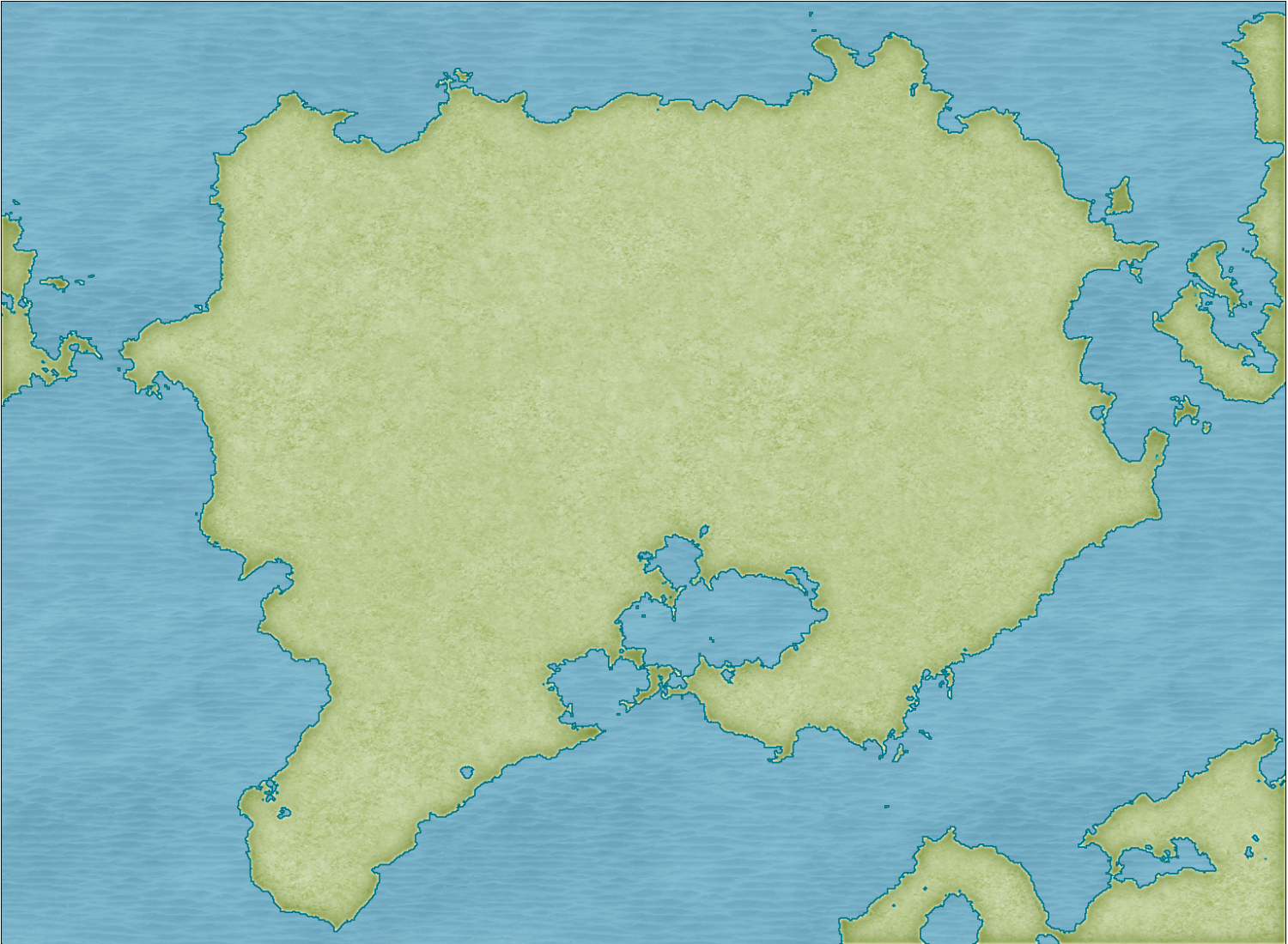
I used FT3+ 3.5.1 and exported a portion of that world using Mike Schley's settings and I have these very faint blue lines when I view the entire map. They disappear if I zoom in.
I have tried copying/pasting from FT3+ following Joe's vid from 14 years ago and using his Q&A vid on modifying a land mass to remove nodes/points that are really close - but then I cannot put it back together to apply the style, it just fills with the coast outline color.
How do I fix this
Here is my export.
Much thanks in advance.
Best Answer
-
Thank you for the excellent step-by-step. I will have this completed one day. My ADHD doesn't let me focus too long on one part of my world.


Answers
Hi Otaku :)
The blue lines are eminating from the objects on the CONTOURS (LAND) sheet because the line width there is greater than zero.
There are duplicate entities on the LAND sheet, and the COASTLINE entities aren't behaving properly at all, I recommend working with just the CONTOURS (LAND) sheet entities and deleting the entities on the LAND and COASTLINE sheets. I've written a more detailed suggestion below.
Please work on a copy of your original map in case anything goes wrong, or in case I've completely forgotten to tell you about something.
Step 1 - The first thing to do is isolate and delete all the duplicated entities on the LAND and COASTLINE sheets by hiding all the other sheets. Then reshow just the CONTOURS (LAND) sheet.
Step 2 - Switch off the sheet effects (uncheck the Activate Sheet Effects checkbox at the top right of the dialog). Make sure that only the CONTOURS (LAND) sheet is visible. Ok the Sheets and Effects dialog and use the Change Properties tool to set the line width to zero for all the visible entities. This should get rid of those grid lines. At this stage you can then use SIMPLIFY on the visible entities if you wish. I found that the shapes were already quite simple and didn't look any more simple until I used a distance factor over 1 (I used 2).
Step 3 - Whether or not you use SIMPLIFY, the polygons on this sheet have artefacts you probably don't want to keep, such as these single lines - 2 node polygon islands and peninsulars. You can use the delete node tool to get rid of them.
Step 4 - Once you have tidied up all the undesirable bits use the Change Properties tool again to set the Fill style (choose the land fill), and the Sheet (LAND), and hit OK.
Step 5 - show all the sheets again and turn the sheet effects back on.
Notes...
There are other ways of doing the same thing, but this one worked best for me in this situation.
The reason I haven't recommended recreating the COASTLINE polygons (the blue line around the edge) is because the staggered nature of the coast does not lend itself well to that method of delineating the land. Any increase in line width, which is what the coastline is - a line with a width, will most likely cause the grid to reappear. If you want to have a blue line around the land as if there is still a coastline present, you can use sheet effects on the LAND sheet to simulate one without that grid problem. If you are unsure of how to do that shout again. Either I or another member will help you.
Thank you for the excellent step-by-step. I will have this completed one day. My ADHD doesn't let me focus too long on one part of my world.
This is a great start. Looking forward to seeing what you come up with.
It's looking good.
Glad I could help :)