

Community Atlas - A huge metropolis somewhere
 Quenten
🖼️ 125 images Mapmaker
Quenten
🖼️ 125 images Mapmaker
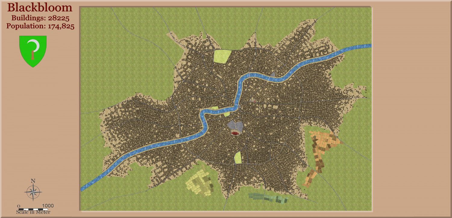
I hanker to create a huge city like I did with Dun Fingolfin.
I also wanted to stress Watabou to the max. So here is a city with 28,000+ buildings.
I intend to detail each building, using mainly CD3A, Medieval Buildings and SS5. Obviously, various areas will be demolished to make way for Stadiums, etc, and grand hotels, big mansions, university, museums, theatres, bathhouses and red light district etc.
But this is the start. I don't expect progress to be ultra fast - Dun Fingolfin took over a year.
Also, I detail two small areas I am concentrating on this week.


Comments
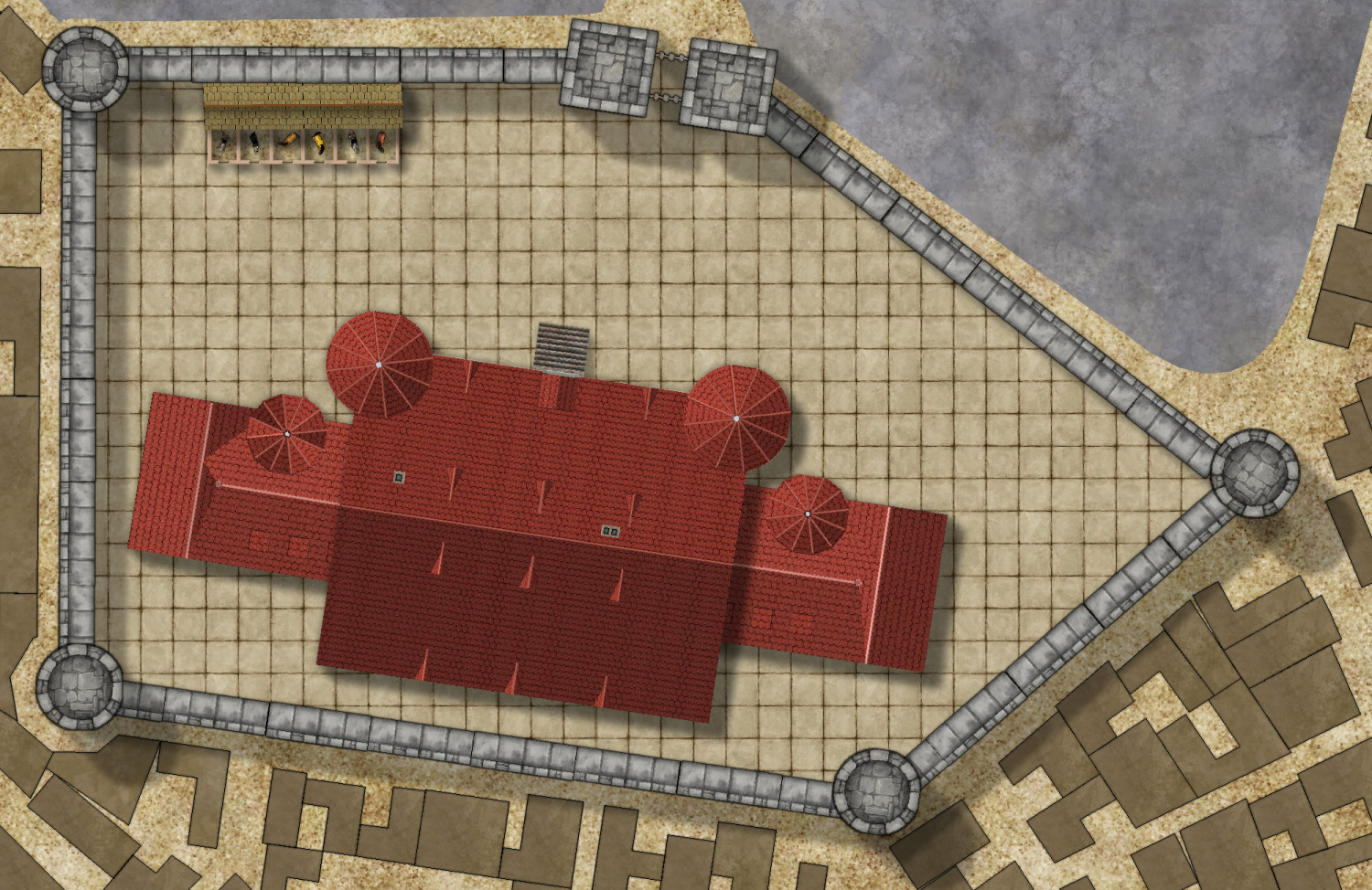
Here is progress on the Palace area. Next will be the other area.
I = Inns and Taverns
T = Temples and Shrines
1 = Palace
2 = Triumphal arch
3 = City Hall
@Monsen and @Ralf I am having a recurring problem with getting the chimney size on the house tool to be the size I want. Furthermore, it often changes from one size to another for different mapping sessions.
All these houses were drawn with the house tool, using SS5. I want the chimney size to be the smaller one, not the larger one, (which was the more recent mapping session). How do I control, or change the chimney sizes? Otherwise I am going to have to add the chimney's manually for each building which will be a chore.
Here is the fcw, in case you need it.
You need to use the right house tools. There are separate house tools for metric (the SS5C m ones) that uses frills that are scaled for metric maps.
Thank you, makes sense. Thanks for responding so quickly.
As an aside, I really hate it that whenever I use metric, things are never 100%, especially with connecting symbols, while they always work for Imperial. Perhaps I should just use imperial, but regard the units as meters rather than feet. Is there any reason why the units have to be made imperial or metric, rather than measurement system independent?
Actually, the mapping units CC3+ itself uses are just "map units", completely independent of any of the two.
The real problem isn't if the map is in metric or imperial, CC3+ doesn't actually give a damn about that, it is the scaling that is the issue.
If you just use an imperial template and pretend it is meters, everything gets gigantic. For example, if you place down a car in SS3, that car is designed to be about 15 map units long. On an imperial map, that results in a car 15' long, or about 5 meters, but if you treat feet as meters, you have a gigantic 15 meter long car. So, the solution is simply to scale that car by 0.3048 to get it correctly sized, and that is exactly what the metric template do for you, but unfortunately, there are some issues with some of the tools when it comes to handling things that are scaled (connecting symbols for example).
The house drawing tools always place the frill symbols at scale 1, which is why there exist a separate metric scaled chimney symbol, and metric variants of the tools which are use that symbol instead of the imperial sized one.
If the only goal of the map is to produce an image, you can kind of ignore this and just map using the imperial template, and simply change the values on the scale bar in the end. But fudging it this way means that none of the values in CC3+ makes any sense. All measurements will be off, effects sizes doesn't read correctly, and so on. So while it may be fine if you just need the image, it is not fine for future use of the .fcw (Which is why I require all atlas maps to be scaled correctly)
Thanks. I understand why the frill symbols need to be chosen as either metric or imperial. Still don't quite understand why you can't just use imperial, then rescale everything once completed to make that car less of a Presidential limosine by rescaling the map by 0.3048, using your excellent rescaling tool (SCALEDRAWING) that unfortunately is still not part of the CC3+ command suite - I admit I use it quite often.
Well, sure you can do that, but it means you'll do all the mapping work using the wrong scale.
If you do it that way, make sure to also change the number format to numeric by issuing the
DISTFMT 0command. The number display is purely visual, but it looks weird if set to Imperial formats in a metric-scaled map.Thanks for that last bit of info. Any chance of convincing either you or Ralf to make SCALEDRAWING an official CC3+ command?
Not really up to me, I don't decide on what goes in.
Well, I might message Ralf and Jo to see if they would. That command saves so much fiddling around when resizing/rescaling an already made map.
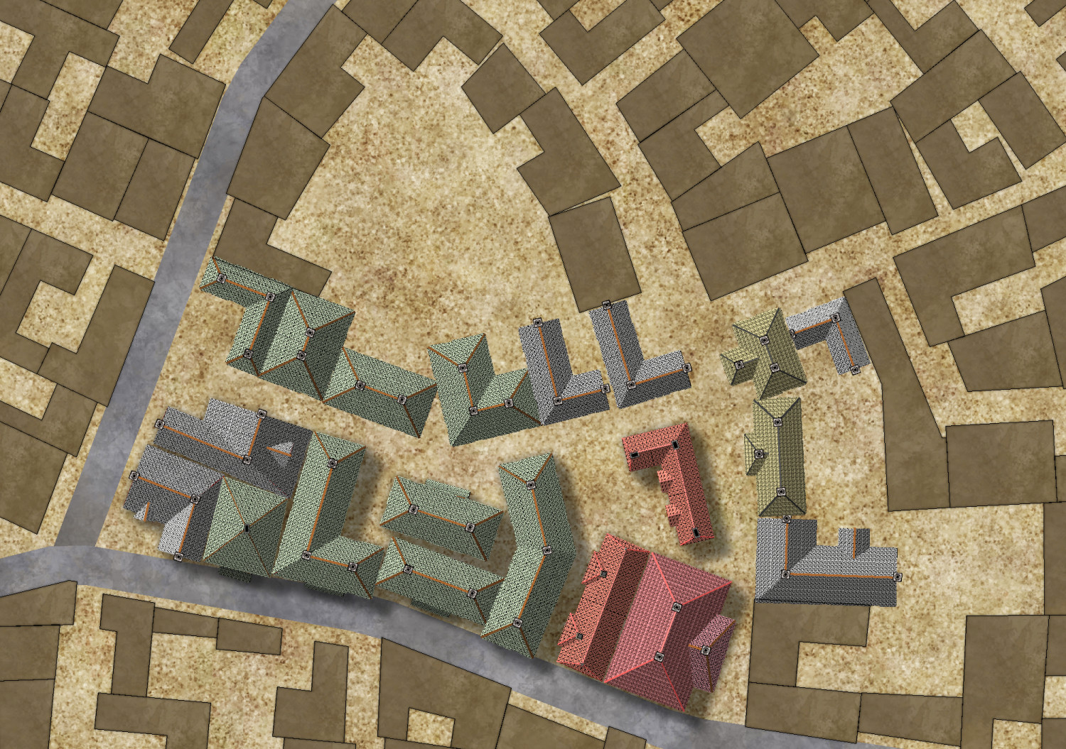
Here is the first update on a more ordinary part of the city. I used the house tool almost exclusively, to keep as much to the Watabou layout as possible. The only special building is the Temple in the lower left hand corner.
I will next concentrate on all the street furniture and background - dirt, grass, mud etc.
Finally, I will do the text, labels, and also use the city commands to assign buildings to various function types.
So far, no slowing of speed in redrawing. with all effects on.