

Dealing with Hex Maps at the coast
 debreos
Newcomer
debreos
Newcomer
I am in the process of redrawing my forty year old fantasy campaign map in CC3+. It was originally drawn using a hex map layout, with each hex being a terrain type, which enables easy assessment of movement rates, resources, etc. I'm getting on well, but wanted to see if someone had an easier answer for a problem I found
To start with, I scanned the maps (all 50 A4 pages) and assembled them together with software to form a megamap which I used as a background image. I then overlaid (as best as possible) a hexgrid on top.
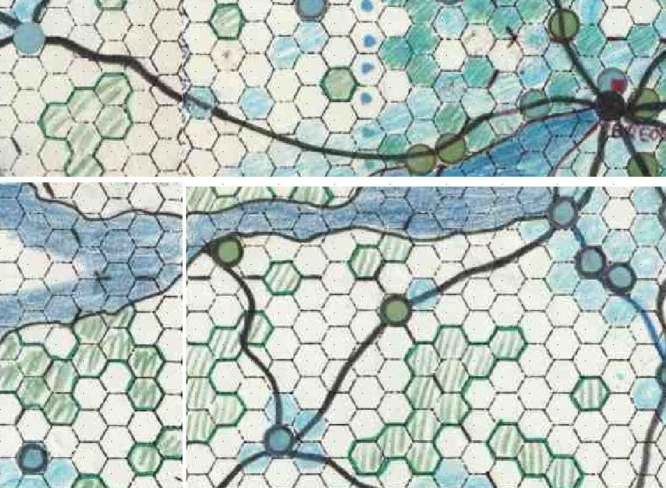
This shows the different terrain types at the coast (the hexes are to a 5km scale).
I then created the base land, added contours and shading (subject of previous questions!) and then started adding hex symbols for the different terrain types. Of course, I ran into the coast problem - the hexes extended out to sea!
What to do? I didn't want to leave them short of the coast, because I would end up with partially empty hexes. I didn't want to have the coastline follow the edge of the hexes, because I find that exceptionally artificial, and I like the natural coast. I didn't want to "cut" each hex where the coast crosses it, because I would go blind before finishing it.
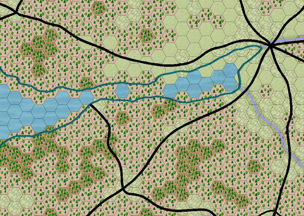
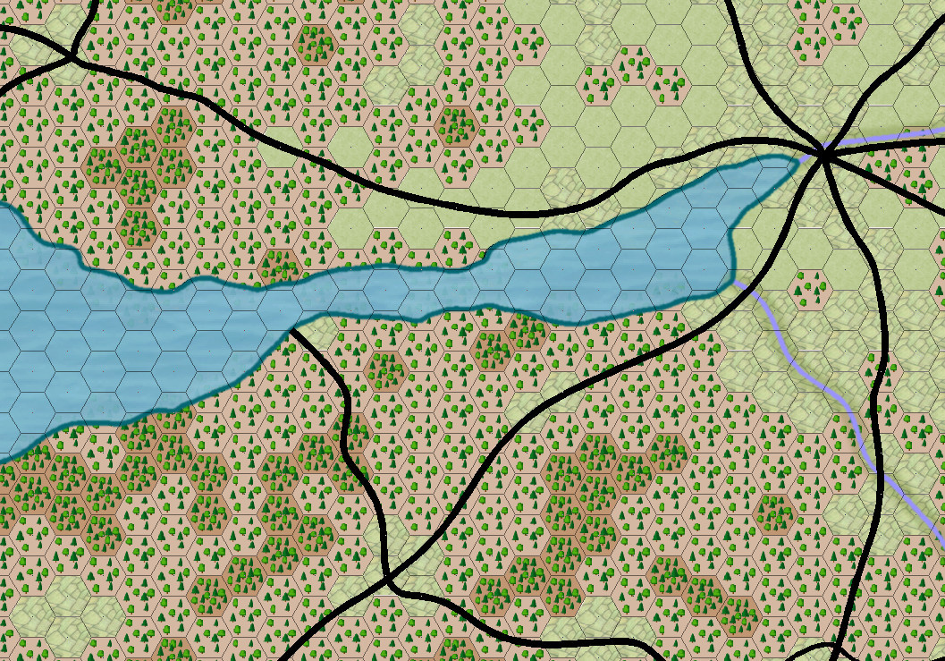
My solution was to draw a duplicate of the continent, using a simple polygon outside the coastline, and make it a zero line thickness polygon colored the same as the sea. I then used the coastline to make a cutout from that polygon, leaving the strip of sea just offshore (I made a multipoly of the coast). I then put put that coastal strip of sea on a higher level sheet so that it overlaid the hex symbols. Voila! the extraneous bits of hex disappeared.
My question is this - does anyone have a better or simpler solution, please?
(NB I'm already changing the map - the forest hex symbols don't look good enough, so I'm making my own!).

Comments
I'm not sure I've quite followed what you've drawn here, but if all the terrain hexes are on the same sheet, you could use a Color Key effect on that sheet to cut through to whatever sheet you've placed underneath (say one showing the sea bitmap texture). That would avoid the use of multipolys (because it's hard to do anything further with a multipoly once you've converted it to one, if you need to make changes to it, for instance). You could then keep that thicker coastline on its own separate sheet, although you might be able to achieve something similar using a Glow or Outer Glow effect on the sheet with all the hex terrains on too.
However, so long as you're happy with what you've achieved now, I'd stick with that, as it looks pretty good already! It may be worth thinking of changing the river lines colour to match the coastline, so it looks less like the rivers "dead end" there, but that's a pretty minor concern.
Sorry if I was unclear. The whole landmass is one poly, and I drew a larger poly outside it (I couldn't just enlarge the whole thing, because problems occurred where the coastline dipped in). I then subtracted the smaller from the larger, giving me a multipoly which was the equivalent of the first few kilometers offshore. The sea was then the lowest sheet, above that was the land, above that was the sheet with the hex symbols, and the top sheet was the sea offshore (which hid the extraneous bits of the hexes). There are obviously more sheets involved, but that gives the flavor of things.
Yes, titivating the colors is something I need to do, but I'm currently rebuilding the forest symbols, and there are a lot of those to do!