

Assistance with Map Overview Export
 SkidAce
Traveler
SkidAce
Traveler
I have done some research and feel like I am not "quite" there understanding optimum export setting for large city maps.
I dont expect to zoom from city area to single building and have it be crystal clear, but need some help.
My city is 10000x8000. (I vaguely understand that is CC3 terms and not pixels, got it).
However, I would like an exported file to zoom in three or so steps (i.e. 5000x4000, then maybe 2500x2000 and have a reasonably non pixelated/pretty view.
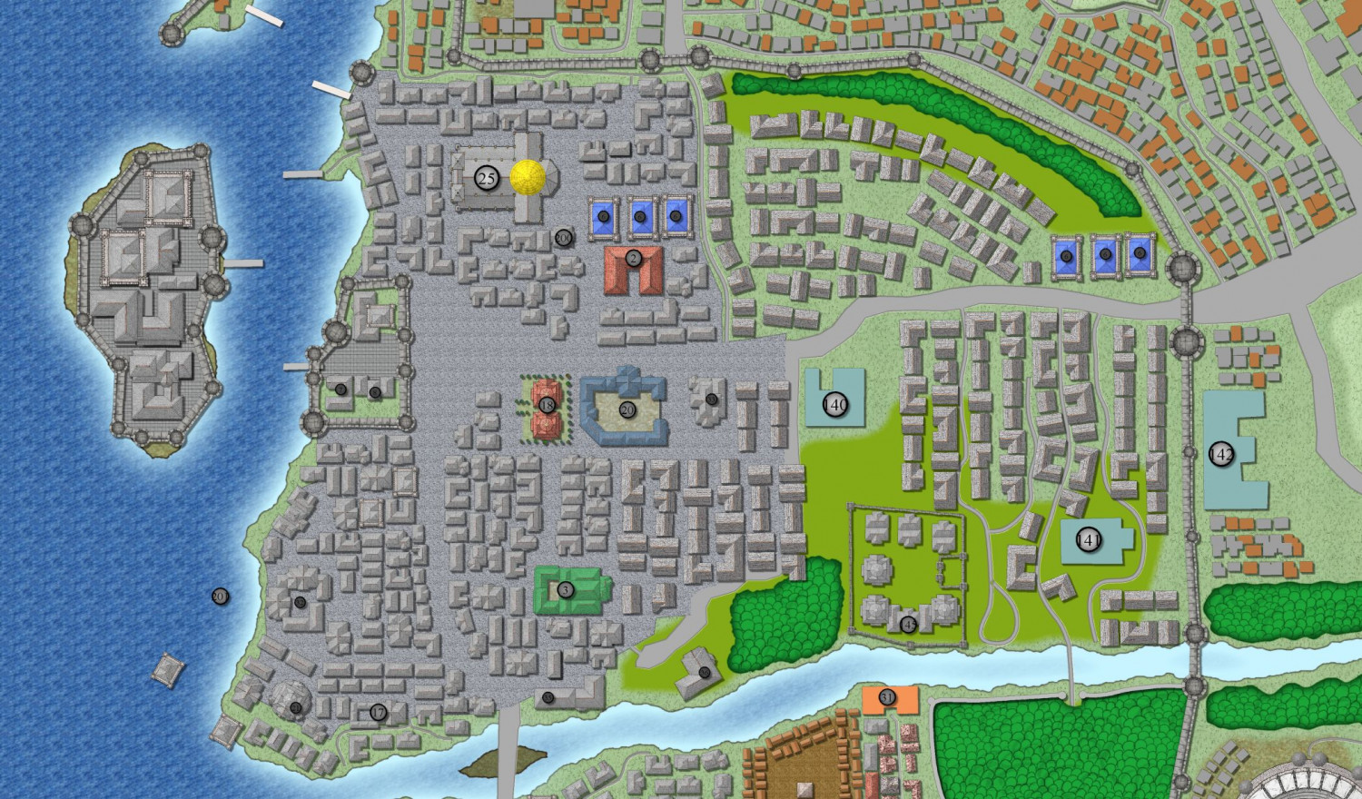
I took the nuclear approach of exporting a png at 10000x8000 and 300 pixels per inch as a test. It looks decent and meets my needs but the file is like 350MB and likely to large for the site I host my campaign on. (and took about 45 minutes to export)
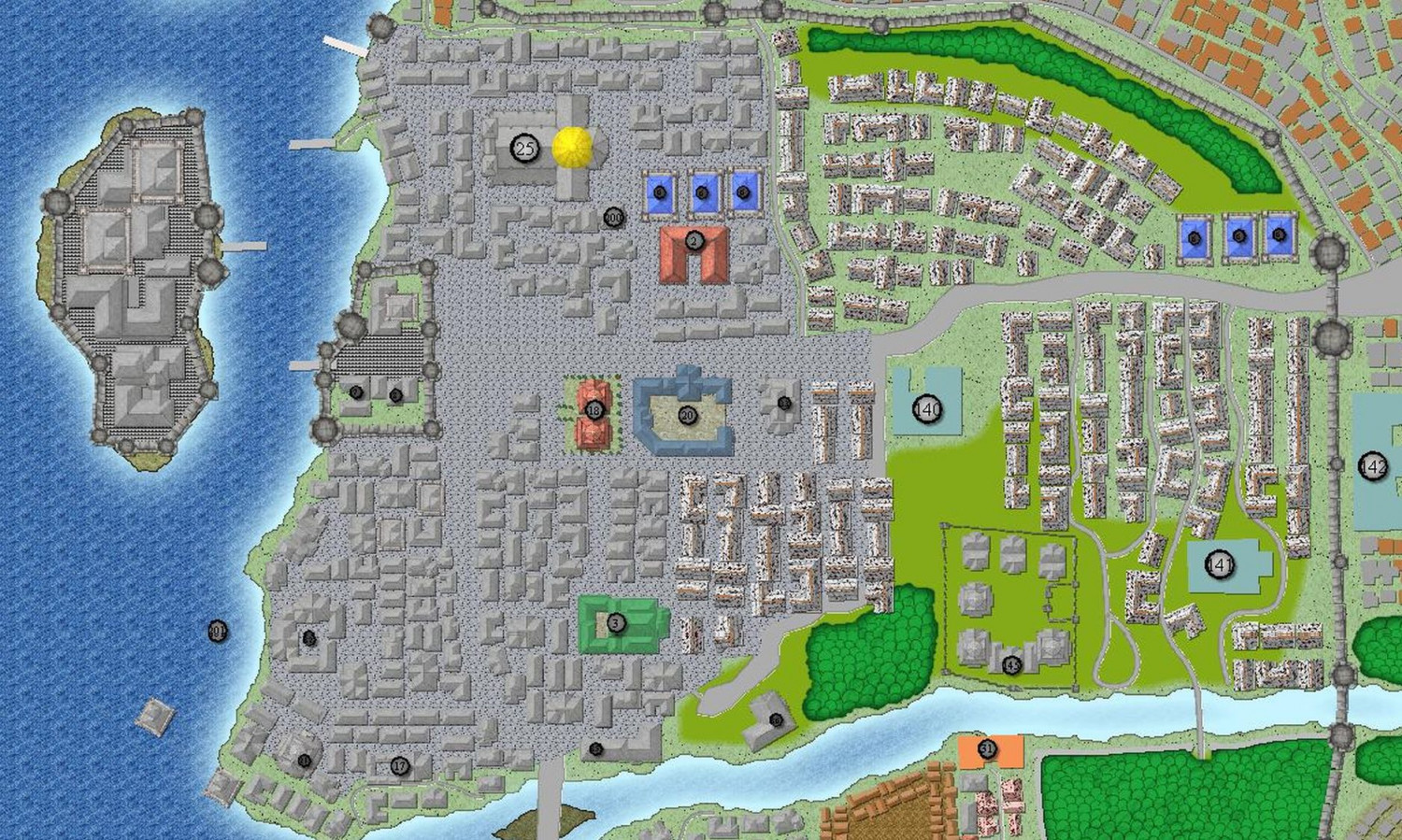
I tried smaller for fun and learning and got really bad results, (file size was 3MB though,. hehe) still at 300 pixels per inch.
Here are screenshots of the images (not the CC3 files), first is the huge one, second is the smaller one.
Any hints on getting better results than the smaller one in a file not as big? (My fcw file is attached for reference in case I have something messed up.)
Comments
Have you tried JPG? I understand the thought that it's not perfect, but with the right settings I find that it works very well. Try different compression levels. I think that might be something worth looking at.
Good luck.
I agree with Kertis
These are the settings I use to export the largest of my example maps as JPG files. The file size resulting is usually around 5.7MB and visually no different to a png file.
Notice the Antialias setting, and also keep tabs on the "work size" shown lower right. More antialias is a smoother result, but it also increases the work size. Try to keep that no larger than 10,000 x 10,000.
Incidentally, with this setup you can export the map as JPG without having to use the rectangular section options. The export will be automatically trimmed to the map border so that the longest side is 5000 pixels. These settings also do away with the white space around the map.
You can also use Irfanview.
Under the Image menu, after you open the image in this program, you can change the color depth, save as various graphics types, etc.
Then save it.
Thank you all for the advice. I will test today.
If I cant quite get there, I will make an "overview" map for the presentation of the city in a less graphic style, and use this map for exporting districts.
In case you are interested with the results ya'll helped me with.
https://app.kanka.io/w/Alfaysia/maps/79947/explore
I am interested in why you have had so much trouble doing this city, when i have done several cities far larger with less problem. I would be interested in why you have had this problem and I have not - is it because you are using vector symbols rather than pngs? What do other people think.
Here are the links to two bigger cities I did for the Atlas.
Browse Maps - Archesyne - ProFantasy Community Atlas (monsen.cc)
Browse Maps - Torstan - ProFantasy Community Atlas (monsen.cc)