

Fractal Terrains to CC3+ - Three Approaches
 Royal Scribe
🖼️ 388 images Mapmaker
Royal Scribe
🖼️ 388 images Mapmaker
I have been experimenting with three different approaches of taking a portion of a world designed in Fractal Terrains and then expanded upon in CC3+. All three of these experiments export the same view in FT.
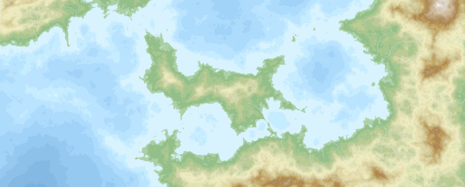
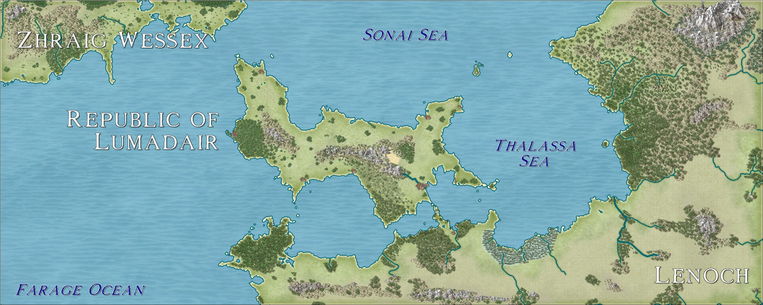
The portion of the world I practiced on is an equatorial island nation called the Republic of Lumadair. The coastline is 10,099 miles long, with a length of about 2,000 miles long, depending where you measure from. (For reference, Australia has a mainland coastline (excluding islands) of 22,258 miles.)
Here's what it looks like from Fractal Terrains:
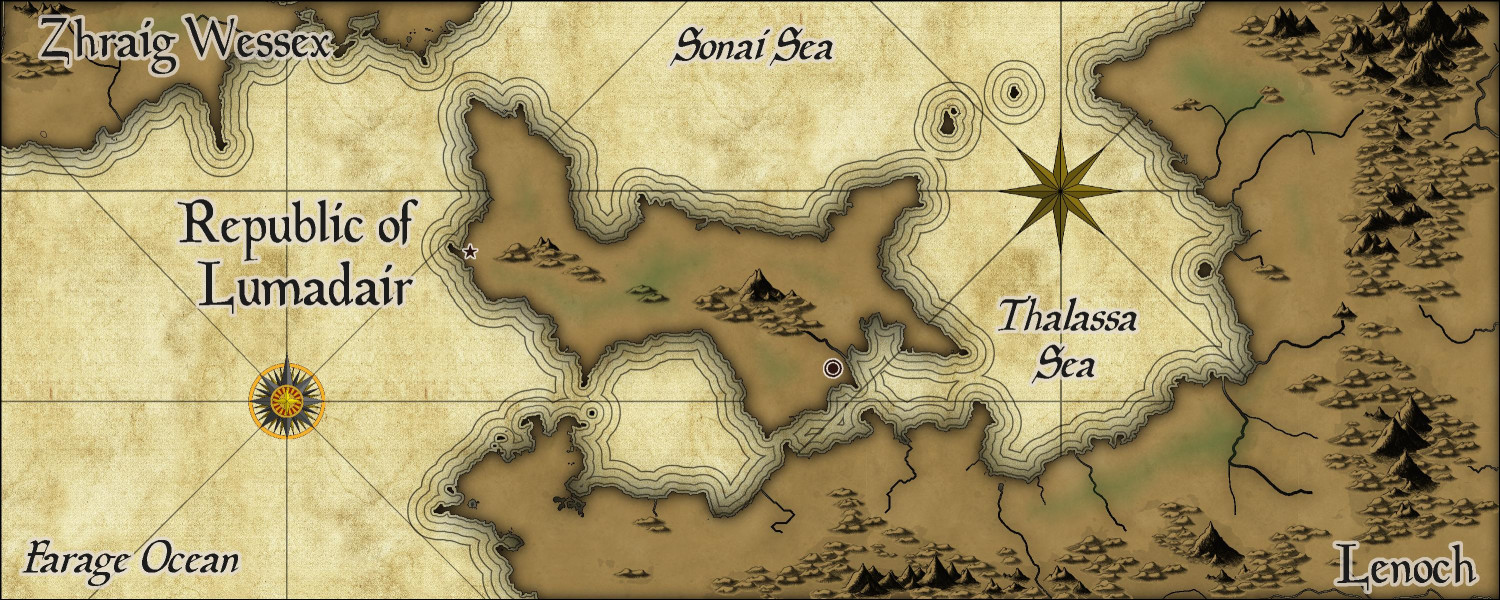
Approach 1: Parchment Maps
As previewed in a separate thread, this was my attempt to render it in the Parchment Maps style from the February annual using a technique that Ralf demonstrated in this video. It's scant on details -- the kind of map my players might find in old ruins somewhere giving them a clue where to continue their adventures.
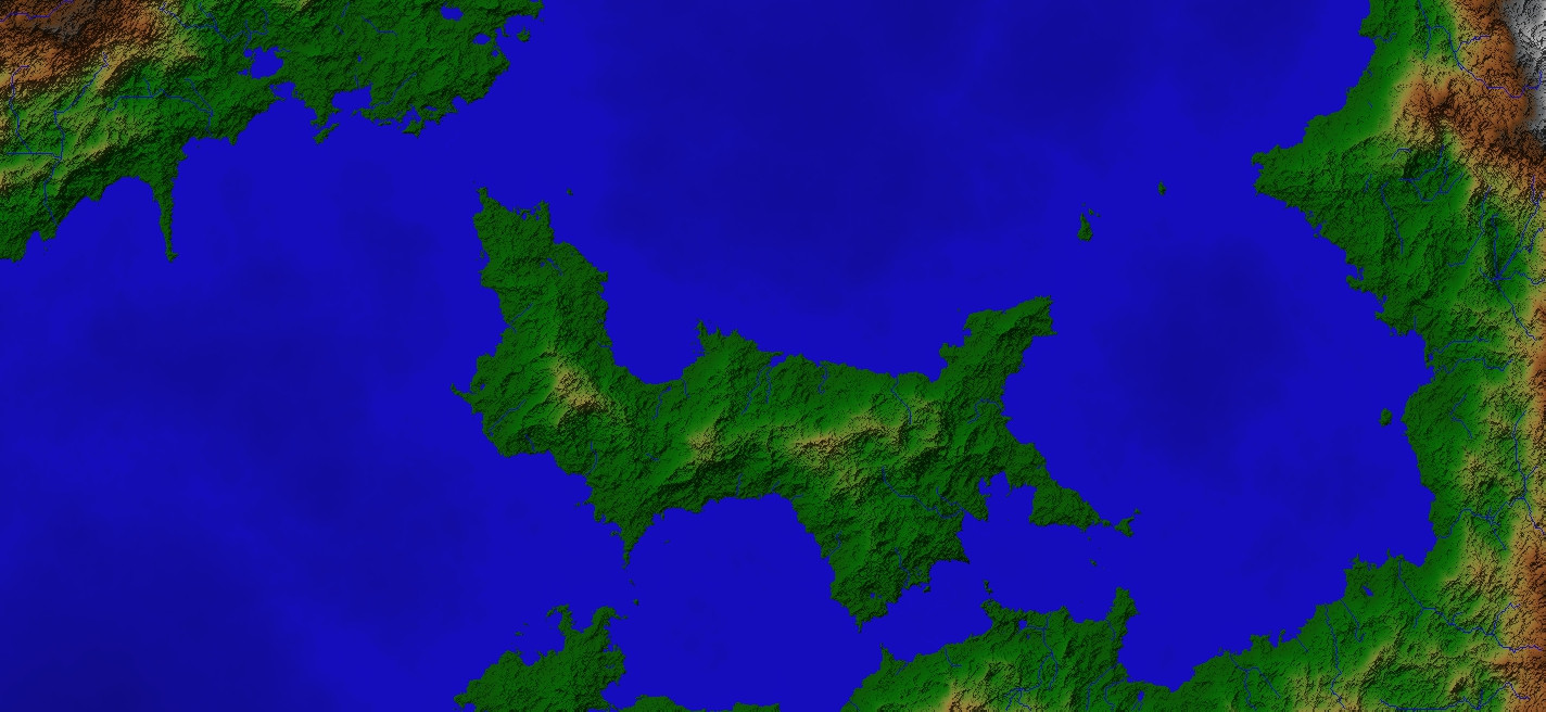
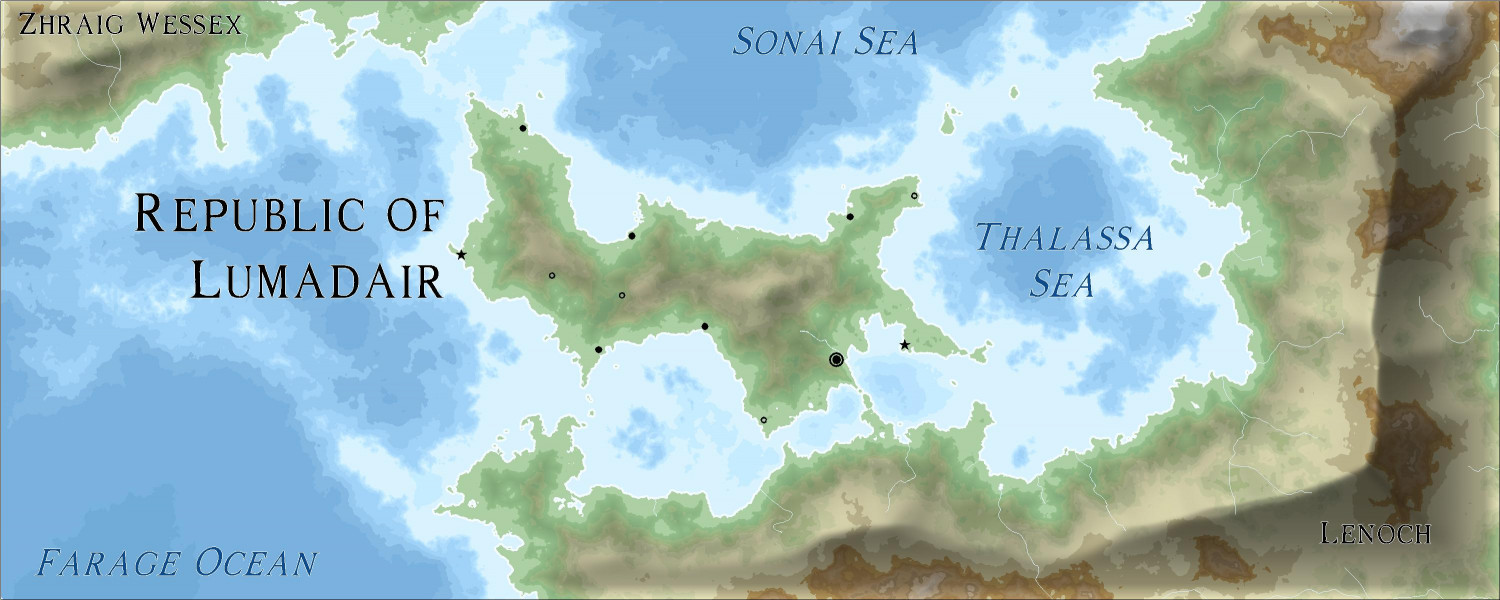
Approach 2: Jerion Shading
This approach, also previewed in another thread, using the technique in this demo from Ralf to take the Jerion style and add beveling effects to some of the contours to create shading effects. I added cities and major towns (and a few magical places) but only named the major bodies of water and the two close continents.
Approach 3: Mike Schley Style
This approach exports the same land mass into the Schley style (which I only recently discovered was an option in FT), then added some contours brought in from the Jerion style. This is the slowest-to-render map I've ever done due to some techniques (and lessons learned) that I will describe later in this thread.
I just love the versality here -- I can have identical coastlines for all three maps, but they all have different looks and vibes.


Comments
There were already separate threads seeking advice on the Parchment Maps and Jerion Shading approaches. I wanted to share a little about my technique for the Mike Schley style, including things that I would do differently next time.
I wanted to have some contours consistent with the other maps, so I opened the Jerion export and copied one of the contour areas onto the Schley map, just where the Jerion contour colors started to turn brown (I think around 5,000 or 7,000 feet in elevation). Playing with a technique that Ralf showed in the Jeriod shading demo, I moved that contour to a contour sheet and changed the fill to the Solid 10 fill. I added Edge Fade, Inner and Transparency effects to that sheet. I then created a second contour sheet with the same effects, and did the same thing with a somewhat higher elevation (I think it was around 11,000 feet in elevation). That worked well. I liked how it gave shading and depth without being too intense like a bevel effect would have done.
Here's what I did next that I would do differently next time. First, I look an even higher level of elevation and did the same thing. But instead of putting it on a contours sheet with a Solid 10 fill, I put it on a Land Features Hills Background sheet and changed it to the Hills Background fill style. I also added a Transparency effect to that sheet. And then I did the same with an even higher elevation, putting it on a Land Features Mountain Background and changing the fill style to the Mountain Background fill. At this point, the file got massively big. I think it had a lot of nodes to contend with. Next time I try this approach, I might still do the two Solid 10 contour imports, but instead of also importing contour lines for the hills and mountains, I will draw them on using a JPG image of the original export as a rough guide for where to draw them.
Here are a few zoomed in maps in the Jerion shading style:
And here are some of the Mike Schley style:
I love the Mike Schley style. I applaud you for taking the time to manually throw down all your symbols on the Mike Schley export. I’m definitely going to take your techniques into consideration for the future.
When I did my recent FT3 export for a fantasy world. I exported my contours based off the climate. Then copied everything layer by layer into a 13th Age style map converting each contour into the appropriate 13th age terrain fill for that climate. Probably was overkill, but I’m not upset how it came out for my first attempt at a map that size.
great work!