

Trouble getting Wilbur MDR into binary FT3 map.
 Quenten
🖼️ 125 images Mapmaker
Quenten
🖼️ 125 images Mapmaker
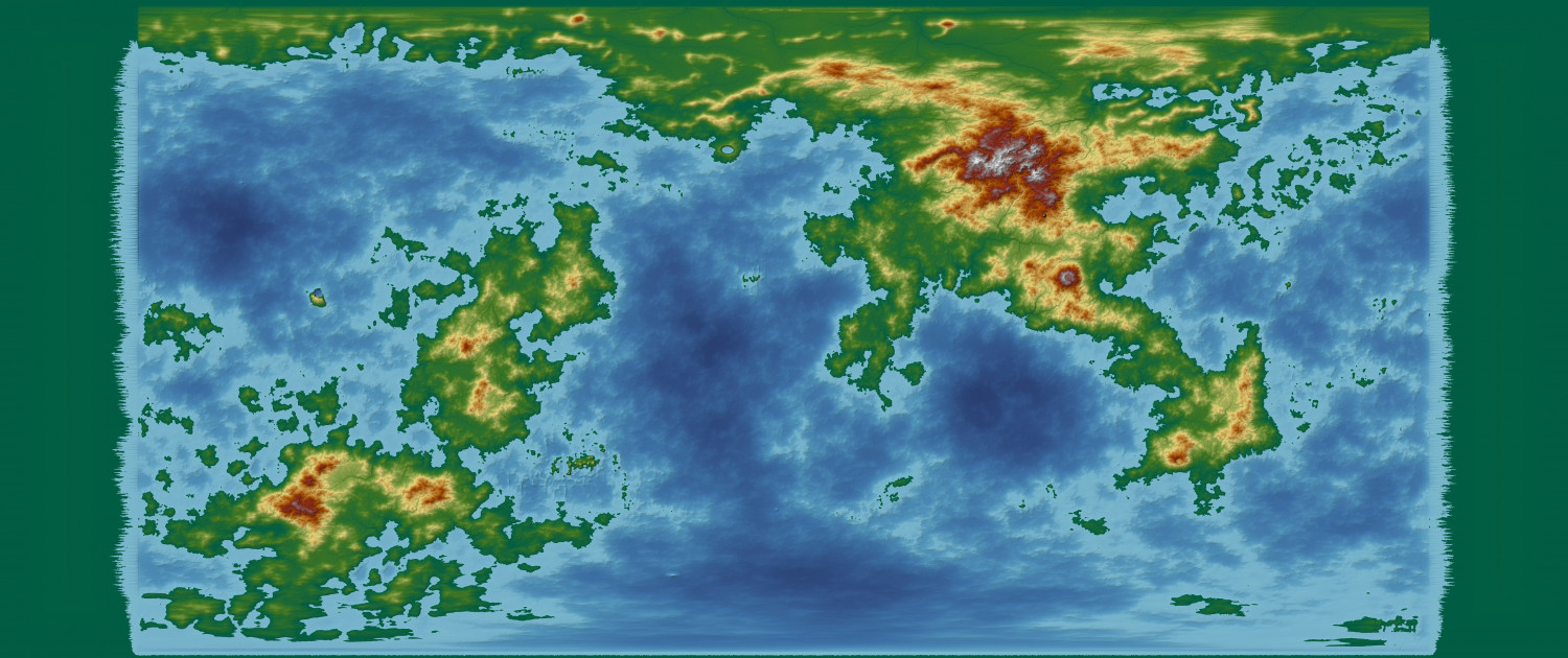
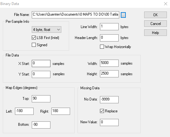
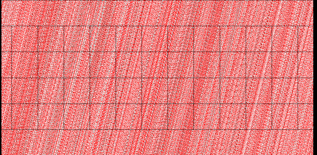
I am having difficulty getting my MDR to work in FT3. Here is the jpg of my completed MDR file. Here is the set up I used to get the mdr into a binary FT3 map. And here is the result. Any clues please?
Comments
Second problem. Once I have Wilbur map, how do I add lakes after I have the rivers incised. I can't seem to edit anything once i put it into FT3, even before I permanently embed it into FT3. This is a problem i found for maps I did manage to get the mdr successfully into FT3.
So, how can I alter the altitudes in Wilbur? i cannot seem to find my way to do this.
And once more, when I try to run it again, I find that no matter what, i am now getting just a flat coloured map - and i am following all the instructions.
I'm not sure what happened there, but when you picked the MDR file using the "..." button, it should have populated the Line Width and Header Length fields with 20000 (4 bytes per sample for float multiplied by 5000 samples on the line) and 1024 (the size of the descriptive header in MDR files), respectively. Here's a sample Binary Data for an MDR file that's 5000 samples wide and 2500 samples high:
And what it looked like imported into FT3 and where it was generated in Wilbur:
The binary world data is stored externally in the file and can't be edited with the FT3 tools. My original concept was that FT3 would work as a viewer for the binary data and so it never added the binary data to the editing data. That behavior is still on the wish list, but you can bring the editing data into FT3 by using Tools>>Actions>>Burn In To Surface, which copies the current shown altitudes into the offset editing channel and sets the roughness channel to zero (effectively turning off the fractal function). You probably want to use Map>>World Settings:Editing and set a custom editing size equal to your binary input width in order to preserve all of your input information.
As far as why lakes don't appear with rivers, FT's river routing algorithm doesn't allow it. The first thing that FT does when you ask for rivers is to generate an internal image of the world at the river resolution you request, and then it fills basins on that image to ensure that you get long rivers and only then calculates the river flow. Unfortunately, that means no lakes because the basins are already filled. However, you get the appearance of lakes by using Tools>>Actions>>Fill Basins as Lakes after running rivers because the basins will be filled with water and the rivers will run through them. If the river color and the lake color are the same, then you won't see the rivers going through the lakes. Note that if you find lakes before running rivers, rivers will flow into lakes and not to the sea. If you have a problematic river that you don't want to be there, the River Exclusion Mask (Tools>>Rivers>>Enable River Exclusion Mask) option creates an Image Overlay named "RiverExclusionMask" that you can paint into for areas where you don't want rivers to work. Probably.