

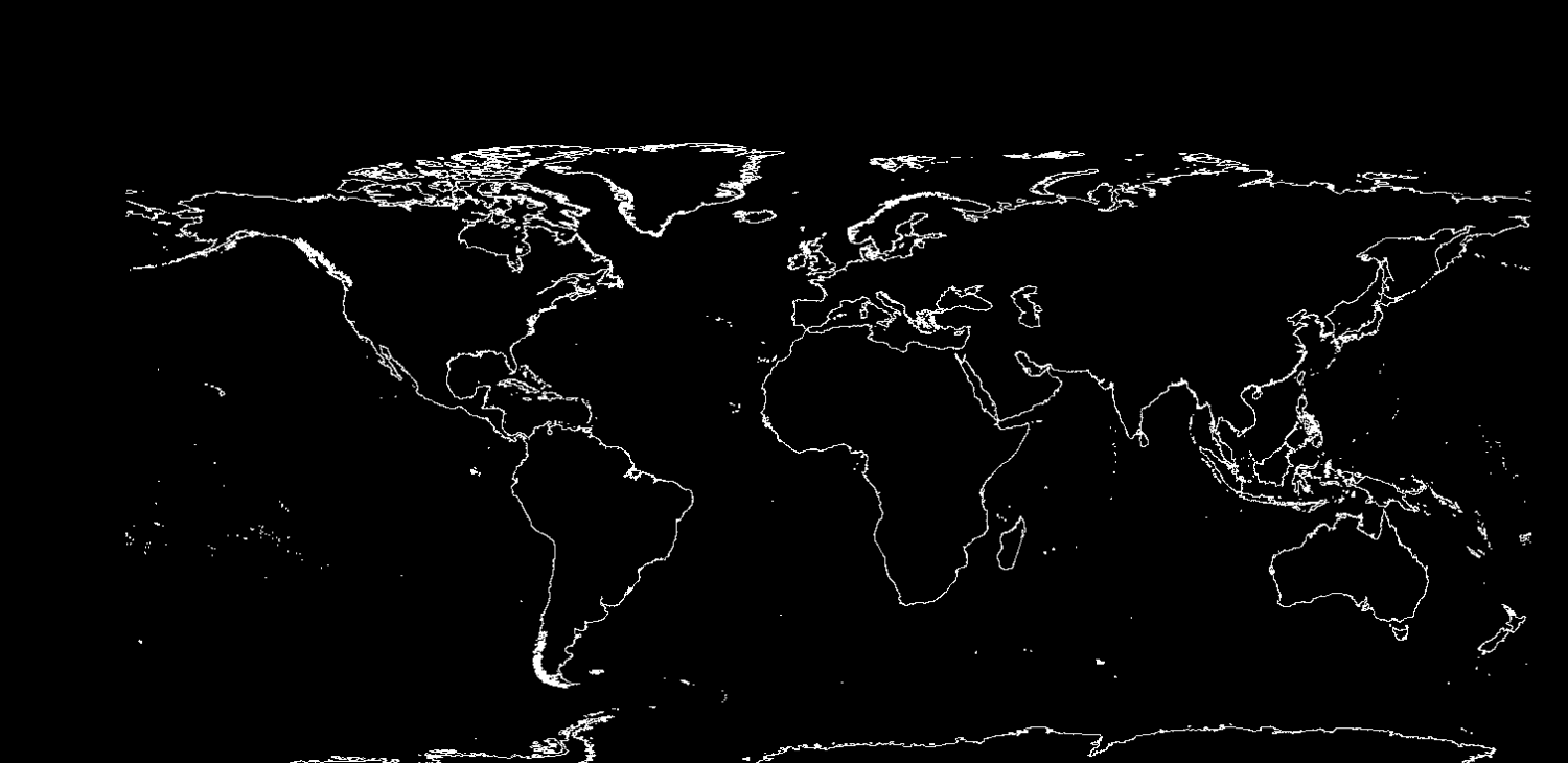
Vector Mapping and natural Earth data from 2014 Annual
 Frosty
🖼️ 22 images Surveyor
Frosty
🖼️ 22 images Surveyor
Hey folks, hoping someone can point me in the right direction. I recently purchased the 2014 annual and installed it and I noticed one entry was vector mapping using data from www.naturalearthdata.com. I followed the instruction and managed to convert the coastlines file and get a coastline image. The instructions then call for change properties to change the map color which seems to do nothing for me. I was also wondering if there might be a video or additional insturctions as I would ideally like to import most of the geographic data for a small map (not world) Maybe say South Dakota or part of South Dakota (USA).
Annual instructions title - Vol 8 2014
Mapping Guide:
Using Real-world Vector Data in CC3


Comments
Not sure why you can't change the colors here. I went through the instructions and it seemed to work as described for me.
Which color is it you have problem changing? The color of the costlines, or the background color?
I don't know about any videos or additional instructions, unfortunately, but the data is quite detailed, so you should be able to cut out the pieces you need and not use the entire world after importing it.
After saving coastlines as an FCW file instructions say click the Change properties button or right click it but when i do the first time i get a menu and think selected change background color but got an error and then after that when I right clicked on it nothing appeared.
Check which layer it is on by using List command on the command line. If the layer is frozen, you will need to thaw the layer it is on.
The error stems from that map not having a background color.
This might immediately sound a bit weird, but in CC3+, a bacground color is associated with an actual entity on the BACKGROUND layer, while the color you see in the map isn't the background color, but the view window color. One way you can see a difference between the two is that a background color is only behind your map, while if there is a different view-window color, you'll see it behind the symbols in the symbol catalog window as well.
In short, you don't want to use the Change Background color on that map. You'll want to use change properties to change the color of the coastline, and View -> View-Window Color to change that dark "background" color.
Ah,I learned something new. Thanks Remy.