

Any Feedback to my first CC3+ Map?

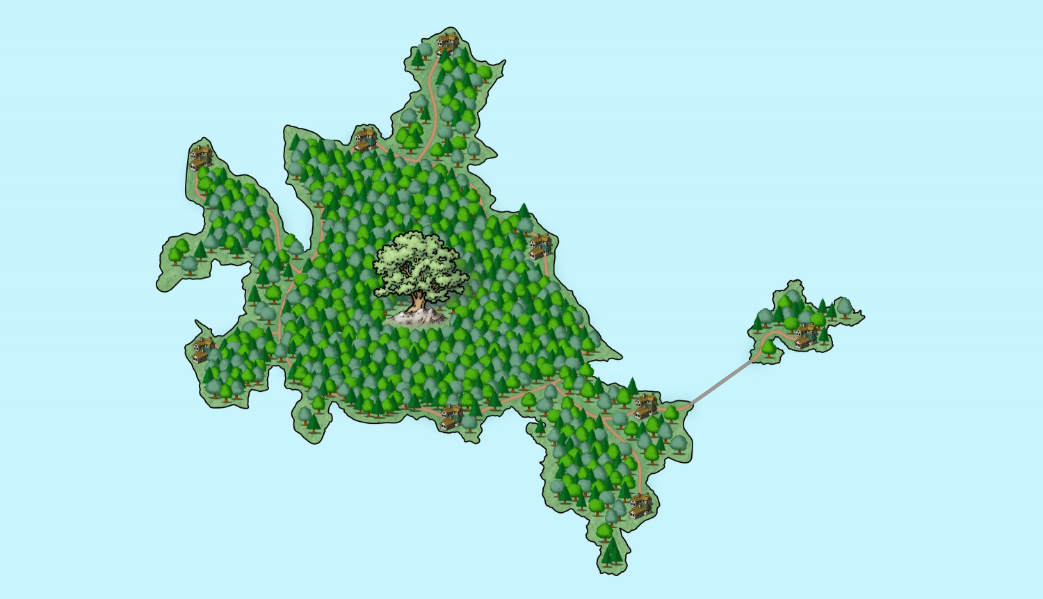
This is my first finished map in CC3+ and shows an floating island in my own campaign world. Because of it's background story, I made the island quite flat and almost completely overgrown by trees. The line between the big and small island is a special bridge construction visualized as a grey road. It's also just a small part of three islands that form the nation of the elves, but this is the first one that's finished for now.
Would love to get some feedback about it, so I can improve my skills.
Have a nice day and stay healthy :)


Comments
It's a good first map :)
Is this an island floating in the sea, or in the air?
A lot depends on what look you are going for. There are three things that I notice off hand.
First, the tree symbols seem big especially compared with the town symbols. I would rather see small trees and more of them. But I suppose you could just use larger town symbols.
Second, the light blue background doesn't do a great job at conveying water. I would change the color, or probably add darker color contours farther out from the island
Third, I do not see any sheet effects turned out. If you add an outer glow to the land and shadows to your symbols (especially trees), I think it will look better. The effects matter a lot for turning a humdrum map into something spectacular.
It's floating high up in the sky and thx :)
Thx for the feedback. I want to begin with a response to the second point. It seems I wasn't specific enough in my explanation. The island is floating in the sky so I used a light blue for representing this. Also there is another reason, why I used a background just of one color. When all my sky islands are finished I want to cut them out in Affinity Photo 2 and make a big world map. I think it's easier done this way for me. Also I want to give the sky island map a transparent background layer, so I can put a blurred world map of the continents on sea level below. Since I didn't thought this information would be needed, I didn't wrote about it and I see that it would seem things are missing without that context. I'm very sorry for failing to give the right informations about the usage of my map.
Now about the symbols. I used at first smaller symbols, but it had the effect that the forest just looked like a big green mass, because the trees were indistingable, therefore I made them bigger what in my opinion made the look better. Hmmm... seems like I will have to play a bit with the symbol sizes to get more references and variations 🤔
Thx for pointing this out for me. At least for sheet effects - since I want to cut out the island, a glow effect on the whole island makes it just harder to do this, but as before I failed to give this information. The symbols of the trees at the other hand have little shadows on their own, so I hadn't thought about a shadow effect, but I will definitly try this out. I definitly didn't experiment much with effects by now, since I wanted to learn how to work for the program first. So thanks for this tip, too.
I will see what I can do, to improve the points you had. I'm glad I had asked for feedback here :)
A sky island...
When you turn the sheet effects on you could try dding a Drop shadow sheet effect to the LAND sheet, to make it look more like it is flying.
Looks good for the basic terrain elements. For how you describe you want to use the map, it sounds like you'll be doing the labeling and other frills in an external tool, so there's not much more to do here. I do recommend exporting the map with relatively high antialiasing to get things smoothed out, though.
I'm also a beginner. It's inspiring to see a complete map like this. I should employ the kind of artistic restraint you showed here.
Ah, cool, will try it out for using this map alone. Thanks
Yeah, in the export options I used 100%. But for posting here I switched to jpg for a smaller data size. Saving as rectangular section worked fine like this, but I didn't tried out the whole map area yet. I hope my PC will get it to work 😅
I also didn't decide yet how to do the labeling. Until now I didn't put my teeth into these option in CC3+, but in case I'm to stupid to get it I will have some other tools for backup, yes.
Wow 😲 Didn't expect to receive such praise. Thanks a lot.
I appreciate the feedback and help. Can't put in words how much it means to me and how glad I'm to learn from the tips and advices. CC3+ is still a riddle wrapped up in an enigma for me, but slooooowly I get the basics. Thanks for helping myself to improve 😊