Dunes Varicolor in Overland Schley Symbols not changing color
 OwlishlyTaboo
Traveler
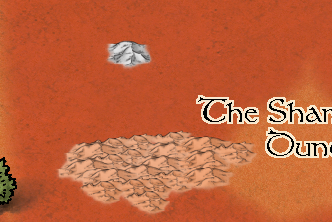
As title says, one of the dunes VC symbols in Overland Schley Style does not change the color and remains grey.
Is it a mistake on my part or do others share the same issue?
Kind regards,
Sam


Comments
Try using Change Properties to change the colour and see if you can get it to respond that way.
Which symbol is it?
Indeed there is an error in the catalog with Dune 1 vc and Dunes vc not working correctly. I've attached fixed vc files for the symbols. To fix this unzip them to /Symbols/Maps/Mike Schley/ in your CC3+ programdata directory, overwriting existing files.
Note that you'll need to remove the symbol definition from existing maps and re-add the symbol to correct it there.
I did try using Change Properties to change the color and it did not work.
It is this one:
Also for some reason I am losing some hue and saturation while exporting the map. Is that normal? How can I fix it? I was really happy with the sand texture I adjusted through colorize effects+blend+hue/saturation but the effects do not seem to stay there once exporting.
The way it looks in CC3+:
The way it looks exported:
@OwlishlyTaboo - You and Ralf posted at the same time. Ralf's update will solve the varicolour issue.
As for the export problems I think you may need to adjust your settings a bit.
There appears to be some horizontal banding going on. Type EXPORTSETMPPP and hit return. You will see a number in the command line at the bottom that is probably 4 million (4000000). Type 40000000 (40 million) and hit enter again. That will greatly increase the width of each band and make those stripes less likely to happen.
When you export your map using Save as... pick the type of export and then click the Options button. These settings seem to do quite well at most maps, giving you a map that is 3000 px on the longest side.
Thank you both for the fix. Map looks accurate now!
Thanks for the update ! edit: I meant the zip file.