

One Day Worldbuilder Question
 Mike Patterson
🖼️ 11 images Surveyor
Mike Patterson
🖼️ 11 images Surveyor
I'm playing around with the ODW, and have run into an issue.
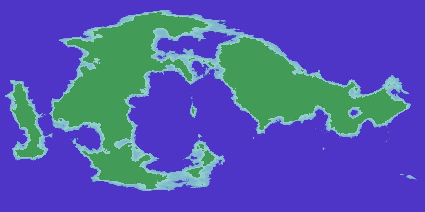
- When I save as the Special MDR File, there are only two elevations - land and sea. Each of these is flat.
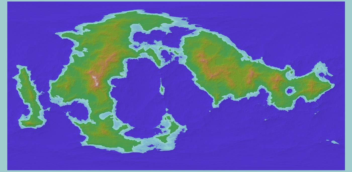
- I can save as a "regular" Wilbur MDR file and get the appropriate elevations, but this always leaves a grey border around the world. This gray border is apparently counted as an elevation, because when I run the precipitation based erosion, it also erodes this border. Then when I export to CC3+ these border areas are included in the land & sea elevation polygons.
- Note: I can reduce the size of the gray border in the Wilbur MDR file by fiddling with what toolbars are shown in FT3 and zooming in so that the entire window is filled with map (no black borders in FT3+ view). But I can't eliminate them entirely - there is always at least a 4 or 5 pixel border on the left and top sides, which gets eroded.
Screenshots attached. Can anyone tell me where I might be messing up?
Special MDR:
Wilbur MDR:
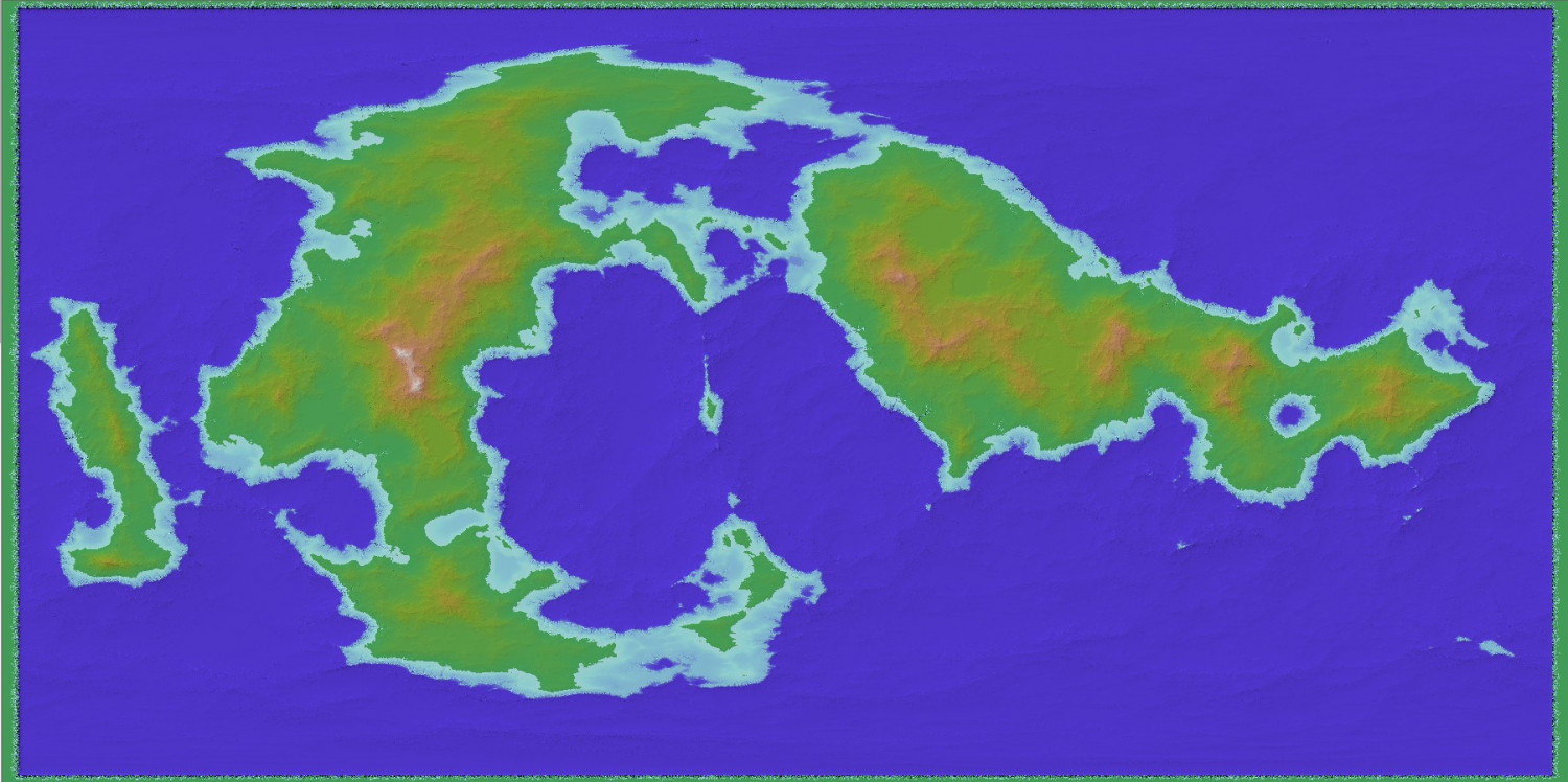
Wilbur MDR Eroded (I only did the Precipitation Based, with no other map prep, so it doesn't look exactly like it does when I go through all the steps. But it gives you the idea of what I'm talking about.)
Comments
Use the Special MDR.
The problem is there are 'Outliers' and NANs generated by FT. These are extreme altitudes and data that is Not A Number.
To fix it follow the instructions on page 11 of the Supplemental Notes.
In Wilbur, use window>>histogram to show the altitudes of the data in the special mdr file. If there are very large outliers, it will mess with drawing in Wilbur.
Try filter>>height clip with -10000 to +10000 and see if that helps any.
Well, now I feel a little silly. We learned way back in first grade to read all of the instructions completely before starting to work :)
Thank you!
It's a looooong tutorial ;)
I missed a few things, my mind's eye skipped a paragraph or 2 or 3, in the instructions. After I realized that, I got it to work fine.
OK, Joe's instructions have me on track so I'm all good. However, I'm not seeing "Supplemental Notes" in the PDF - do I need to get them from elsewhere, or are they there and I'm just not seeing them? (Entirely possible - my wife is constantly finding things in the fridge that I've sworn aren't there anywhere…)
There should be 2 pdfs with that issue - the Mapping Guide, and the Supplemental Notes. No worries, though. You're all sorted.