

Rivers cover whole map in FT3+
 JoeyD473
Betatester 🖼️ 2 images Traveler
JoeyD473
Betatester 🖼️ 2 images Traveler
I created a map in FT 3.5.1. I edited the map by raising and lowering land int eh prescale offset t get rid of some the wholes in the land mass. I then filled, the basins, smoothed the basins, incise flow, fill basing then smooth one last time. Then I when I went t find rivers most of the map became a river. I went back to an unedited version of the map and the river command worked fine.
I haven't made a map in FT in over a year so this was my first time using FT3+. I used the above method for my maps several times before and never had this issue. What is happening and how do I stop it?
Images below and here are links to the ftw files
Files with Edits: https://drive.google.com/file/d/1L8dkT0yL7Hc13_sRgJFJRflnCAKLNxTb/view?usp=sharing
File with no edits (Rivers Not run): https://drive.google.com/file/d/1fq_Jy5d0VIaa9qy8E22LTyQZIYa69TxP/view?usp=sharing
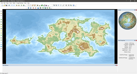
Map after editing
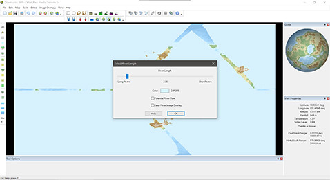
Finding Rivers
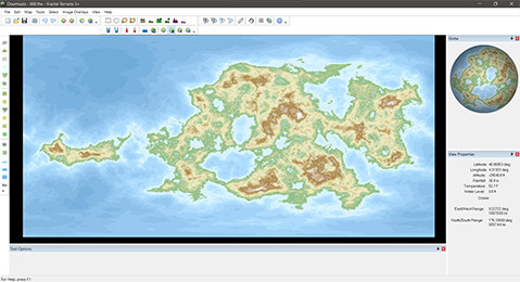
Map before editing with Rivers