A few final questions before I start adding text to my map
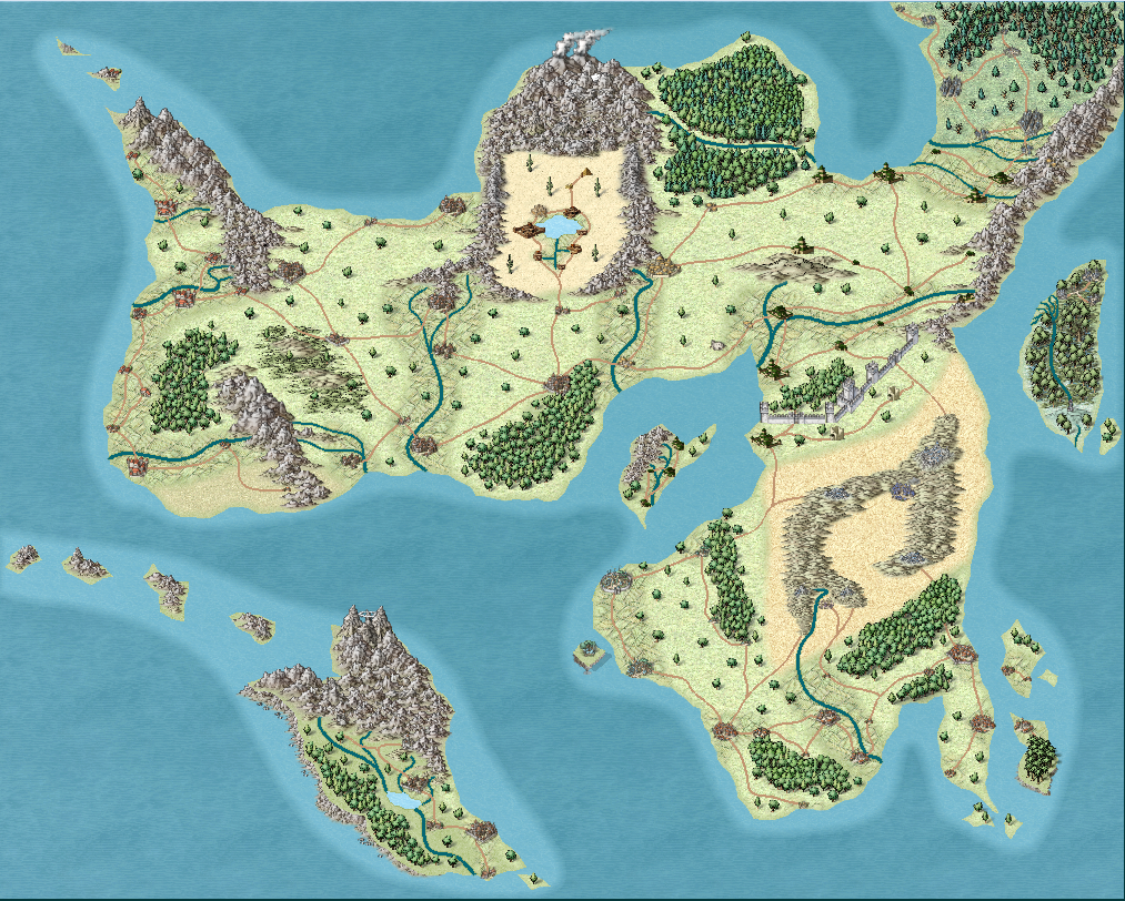
For my first non-tutorial map, I feel like this is coming along quite nicely. I do have a few questions left before I can start adding text to my map.
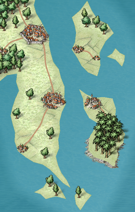
I'm still unsure how I'll handle farmland on this map. I tried to cover large areas at first so you could definitely see that it's supposed to be farmland, but many areas were too large in my opinion so I tried to scale them down. Other areas just have farmland around the settlement or a few settlements near each other. It's quite difficult to see the farmland in those areas though. So I'm still unsure how I should handle this. Any advice? Here are a few close-ups in case it helps.
I also wanted to flesh out the terrain a bit more. There were quite a lot of big empty spaces so I placed a few trees in between most of them. I'm not sure if this looks that good though. Any advice on how I make that look better?
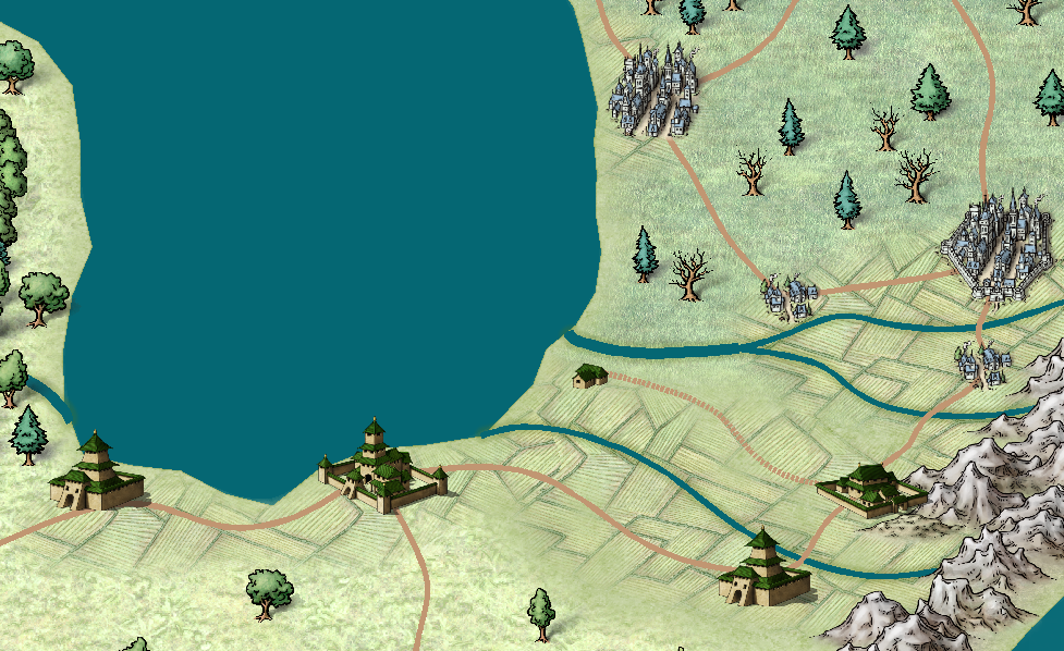
This picture also shows another issue I have with this map. One of my empires is based around Asian culture and history. I wanted settlements in a fitting style but found none in the "Mike Schley Overland" style I'm using. I thought I could use symbols from a different style, but these ones clash a bit with the more cartoonish style of my other symbols. It's not a big issue, but I still would appreciate to know your opinions on this.
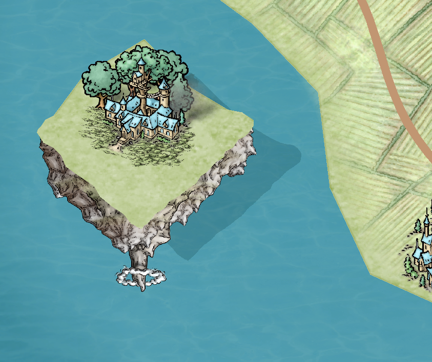
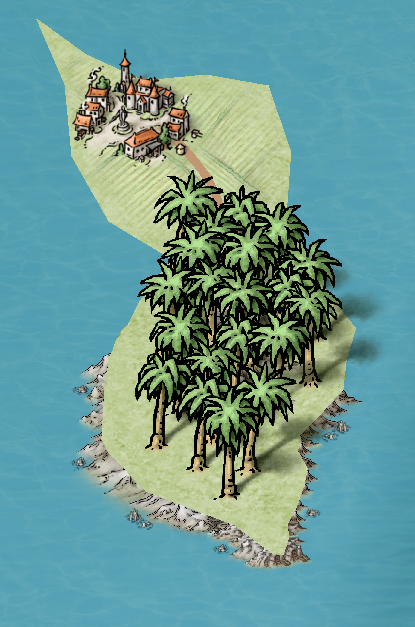
My last questions are about a floating island and a cliff. I followed your advice from a previous thread, but I just want to know if these look good or how you would handle this differently.
Any other advice would also be appreciated. Just keep in mind that the desert, the surrounding mountains and the big hilly grassland area are explained through lore in my world. I just hope it doesn't look that bad.
Thanks for all of your help in my previous threads. I know I'm asking a lot here (it's quite a long message). Any input would be appreciated though. Thanks in advance!



Comments
that is one of the gaps in the Schley overland style - east asian settlements. There are only the west asian ones.
On large maps I make, I rarely use symbols for continents other than to mark a large city. Maybe a seaport as well.
For areas like farmland, mountains, prairies, and forests, I just put a large color area, color not a fill, and label it. For close in areas, I add symbols and labels.
In terms of scale, one thing to consider if the output size/PPI of the map. The larger it is and the more PPI there is (and higher quality) the more likely you are going to see the farmland. As it is, I can see the farmland around almost every settlement.
You can make the fills bigger. I am not sure if that would help them be more viewable or not.
Another thing to consider is that farming was very inefficient so most fantasy worlds really underestimate how much land around settlements needs farmland. So you could always expand it a bit.
I suppose you could also apply a type of sheet effect to the fill. Perhaps a glow or some sort would make the areas "pop" more, then making them more viewable with it takes up a smaller amount of screen space.
Thank you all for your insights. You've helped me a lot with this map and I'm happy with it now.
Now I just need to choose the remaining names, add a scale and political borders. Then my map'll be complete.
Alternative to Julian's suggestion, and if that doesn't work, try making the farmland texture smaller, so that more of the detail shows in each patch of farmland.
I would follow Sue's advice.
Well, either could work.
I think the secret is to try both and pick the one you like best.
When mapping large areas like this, it's important to decide exactly how much detail is worth showing, and what the map is going to be used for (both of which go hand-in-hand).
A settlement will always require farmlands of some kind nearby, so any settlement means there will be such areas around it, even where the map doesn't show them. Then you can use the actual farmland areas to show those places that are particularly important farming areas - key places that the whole country/nation may rely upon, for instance. There, you wouldn't need to show any but the larger or most significant settlements (e.g. like the hamlet the party will be starting from!); all the other hamlets and villages can be assumed as present scattered among the farmland region without you needing to show each one.
For the non-cliff coastlines, I'd be inclined to soften the edges somewhat, maybe with a small Edge Fade effect, or reintroduce the "coastline" blue line for them. Softening the land edges on the cliff coasts wouldn't go amiss either, perhaps.
The aerial floating island looks interesting. Depending on how your floating lands like this work, you might also consider adding some crystal symbols (e.g. from one of the Dungeon sets, suitably enlarged of course!), or by using varicolor mountain symbols. With the settlement on top, it may be worth placing that directly onto the rocky mountain symbols, or with only a much smaller area of grassland fill texture behind the settlement image, then using just the mountain symbols (probably on their own, new Sheet) to cast a suitable drop-shadow. If the grass needs to definitely run right to the very edge of the stony platform, maybe make that more ragged, to closely match the symbol lines underneath indicating where that edge is.