

Kasuga - Japanese Temple Complex
 JulianDracos
Mapmaker
JulianDracos
Mapmaker
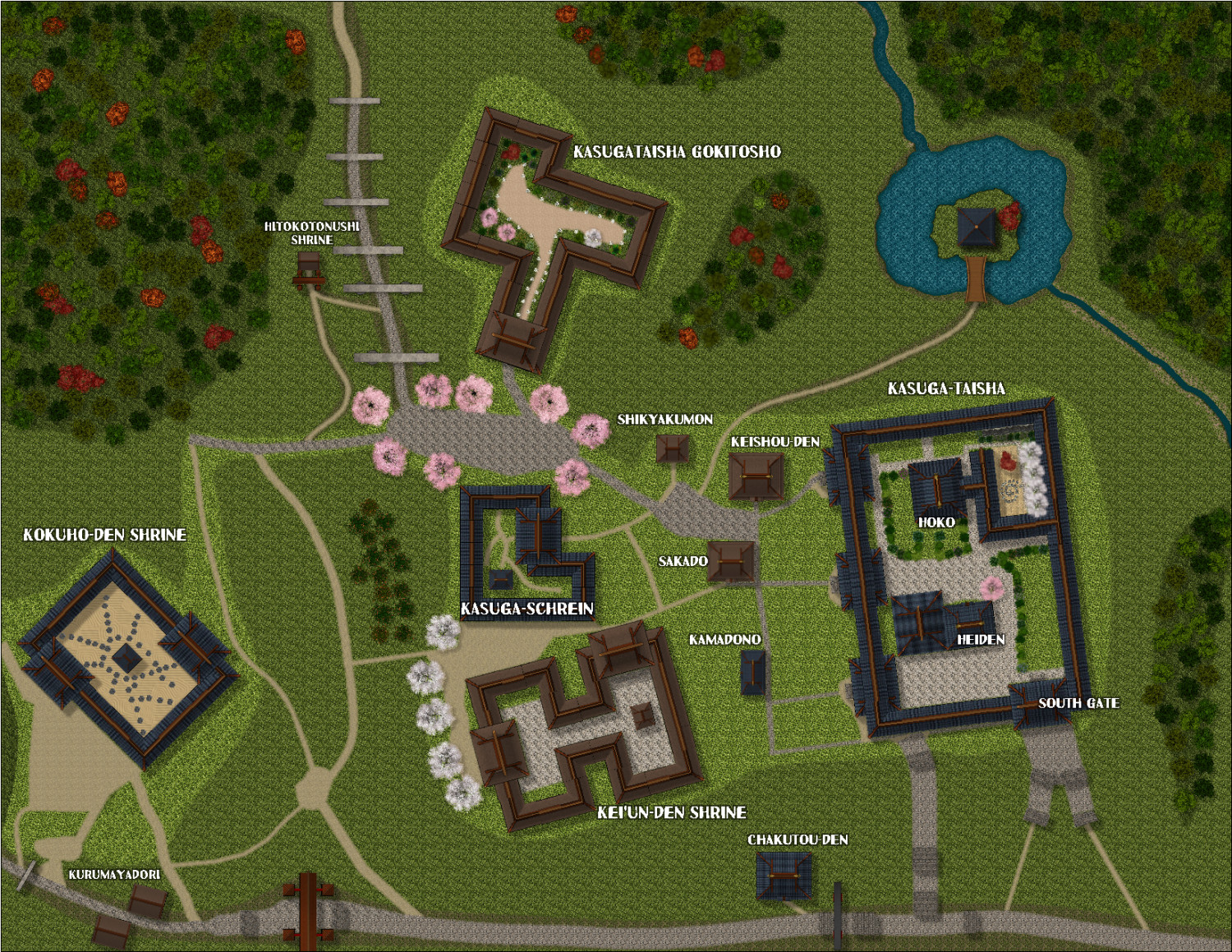
So Nara Park is a park in Nara Japan controlled my a group of deer yakuza. If you can make it past them, there area is filled with tons of temples and shrines. My goal was to map out part of the Kasuga-taisha shrine area on the east side of the park area. To that extent, I used google maps to measure the distance between buildings as well as the size of the buildings. I then proceeded to make the buildings. To match the appropriate size, I had to reduce the size of the symbols in most cases. I then tried to make the road areas as accurate as possible.
Anyway, I think reducing the symbols for accuracy was a mistake (although things would not have fit if I had not so maybe I should have double the map size, but then maybe things would still look too small.)
Another issue I ran into is that with the top down design and lack of symbols to use, I really could not make the insides look interesting. There needs to be stone walls, stone post things, koi flags, shi-shi dogs, orange wooden fences, moss, etc. But with the top down, none of that would show (such as buildings that consist of tori gate paths can't show because of the roof.
So I abandoned interior accuracy for trying to make the map look interesting. For example, there is now a small lake and river. I made some rocks to mix in with the sand. I used a lot of plants. I changed up a few of the sheet effects. Overall, I think that trying to do less accurate maps and mixing in other styles will be necessary to make the map more interesting. Perhaps just focusing in on a detailed single complex would help.
Here is the map I made.


![[Deleted User]](https://secure.gravatar.com/avatar/c75d9a245b74d9c59be0999ea81ca541/?default=https%3A%2F%2Fvanillicon.com%2F92add7f8c954488718110edc4896ad39_200.png&rating=g&size=200)
Comments
I have no idea why the background looks so blocky. It is smooth in CC3. Certainly not acceptible to have such an obvious repeating pattern.
Looks good :)
That blocky look is the tiling of the textures. It looks like you could get away with scaling the fills up a bit so it's not as noticeable.
How do I go about scaling the fills so it looks like it does in CC3?
If you click the fill style box and open the Fill Style Properties dialog, then pick the Bitmap Files tab and select one of the troublesome fills you should see that it is Scaled and that it has a set Width and Height.
(Sorry about the jiggly red lines - my hand is a bit shaky, as I have Covid right now and I'm not terribly coordinated at the moment)
To make the fill appear larger in the map and reduce that pattern a bit you could increase the dimensions in those boxes. As with all things, though, there is a limit to how far you can push it like that before you get pixilation issues.
It's the same scale in CC3 as it is in your export. The appearance may differ a lot, though, depending on the size of your export.
Another thing that might be affecting the export is if you are using less than 85% JPEG Quality. Some of that pattern reminds me very much of the kind of artefacts you get when exporting low quality jpegs.
It was the file scale that was the issue. I doubled its size and that seems to have solved the problem.
Don't worry about a squiggle line. I'm impressed you here if you are sick.
That looks better doesn't it :)
It's not got me that badly. Only given me a really sore throat and messed up my motor control a bit ;)