Community Atlas: Constructing Errynor Map 40 - Faerie Land
 Wyvern
🖼️ 281 images Cartographer
While I know some folks that comment and contribute here like to present and view Work In Progress topics, I rarely map in a way that allows this, as I tend to simply change things as I'm going along and don't record what's been done or when. It also needs extra time and effort, which is something I rarely have available either. However, when I started the second of the 40 250 x 200 mile maps for "my" corner of Alarius, that did seem a rare opportunity to try to do a bit more in this line. So while not a WIP thread as such - because the map's already completed, and will be submitted for the Atlas shortly - it may be of interest to some to have an overview of how it got to be as it is.
When I started preparing for this whole Errynor project, one of the first things I did was to set up the grid for where the 250 x 200 mile maps were going to be on Shessar's Alarius map:
I then hand-drew onto squared paper details extracted from this map for each of the planned 40, including things like where the exact lines for the different background terrain fills lay on land, where the edge of the contour-colour fills were for the sea, and so forth. Although these wouldn't be so critical for the later mapping (the edges of the fills being softened in the map as shown above here means there will always be a degree of leeway in such things), they were important for some of the more detailed features I wanted to add, such as creatures which tend to be biome-specific.
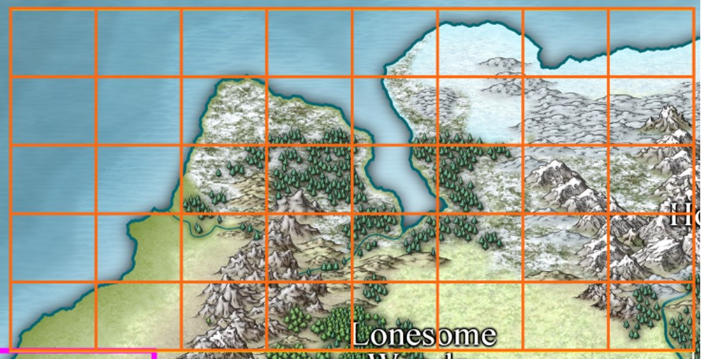
Zooming in to the Map 40 area (lowest right corner of the full gridded map above) showed what I'd be dealing with here:
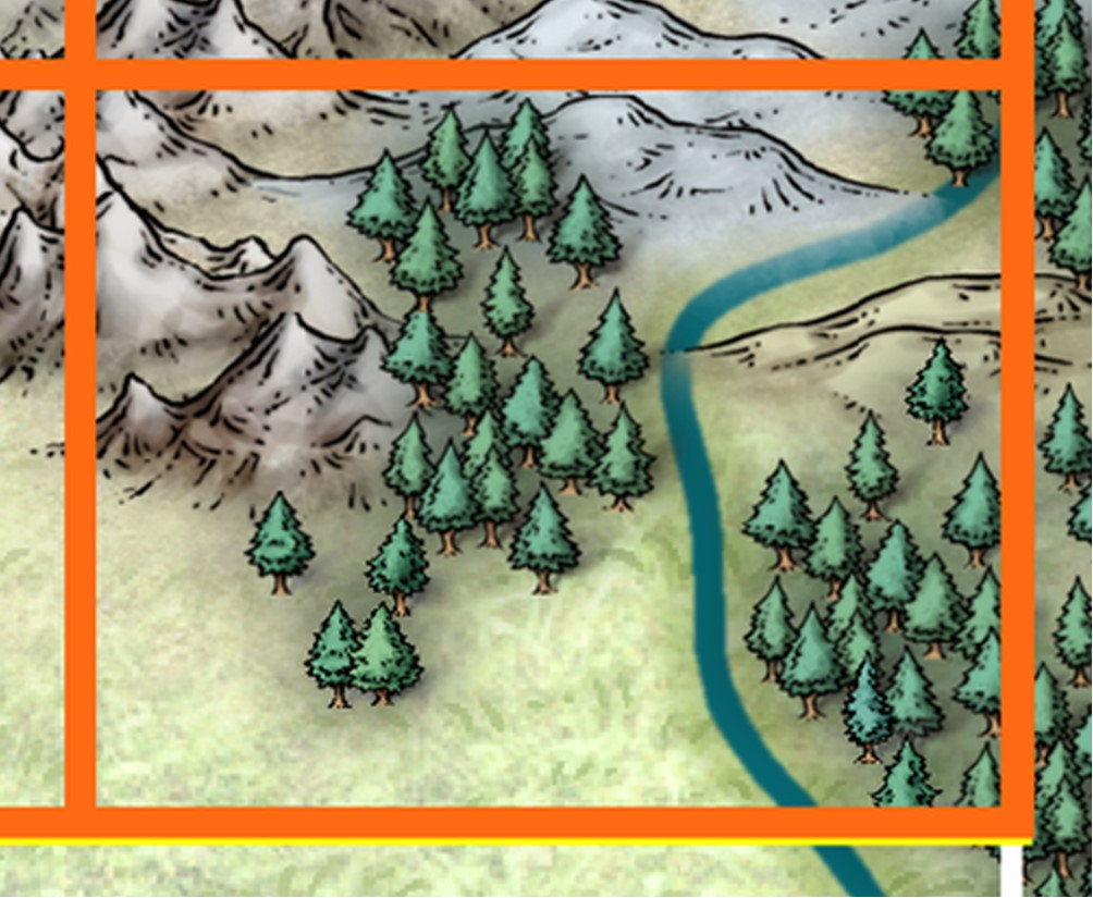
The yellow line that's just peeping out from under the lowest outer orange line is for the southern limit of the Errynor mapping area (it also extends up the right-hand edge of Map 40, but is better hidden there), while the thinner white line extending south of the right-hand corner of Map 40 is because when this mapping began several years ago, the area east of Errynor had been reserved by another Atlas mapper. Ultimately, the person who was hoping to map that region had to drop out unfortunately, but Shessar subsequently stepped-in and completed part of it, although that no longer extends south to the southern edge of my Errynor area, as a comparison of where the major river (now named as the Faerie Run) lies in relation to the lowest corner of the illustrations above and below this paragraph. On the following extract from the bottom left corner of Shessar's "Alarius North Central" map, I've added a 250 x 200 mile orange rectangle for scale:
The left edge of this rectangular area immediately adjoins part of the right edge of my Map 40, and also part of Map 32 to Map 40's north.
Returning to Map 40, to the hand-drawn map of landforms and terrain features, I added randomly-rolled creatures and places using a series of tables based on ones I'd constructed decades ago, updated and amended here where that seemed necessary. The squared-paper maps had been designated so that every square would be five miles on a side, and each 5-mile square was allocated a maximum 10% chance of having something noteworthy in it at this mapping scale (variably reduced for anything less favourable than temperate surface land conditions). Of those features, about 17% - 1 in 6 - might be settlements of some sort, with a maximum 60% chance of being inhabited, or deserted/ruined otherwise, again partly condition-dependent.
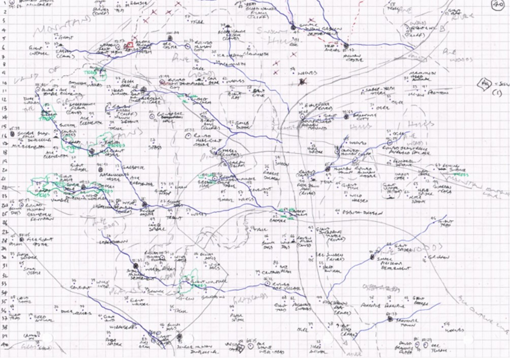
All of which got me to the point where I could also begin filling-in some of the lesser terrain features based on what had been rolled-up. Settlements need a significant water supply, as would some types of creature, which allowed new river lines to be sketched-in. Certain creatures also need a lair of some kind, and that meant smaller areas of cliffs, caves, trees, marshes and lakes could be added, all again based on random rolls determined by the creatures in question. Thus the map came to look like this:
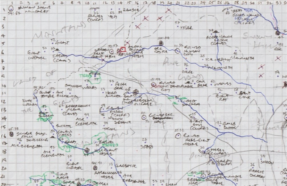
This isn't very clear at the size suitable for the Forum, and the scan I made of it has cut-off the column numbering along the top edge. This wasn't important for what I intended, as it was simply meant as the traceable background bitmap image for the CC3+ map. I can't re-scan it like this, as it's been further amended since, and indeed right into the creation of Map 40 in CC3+ changes were still being made, not all of which ended up on the hand-drawn version anyway! It is still possible though to see this is a "warts and all" sketch, with crossings-out, amendments and annotations. Even the original map isn't as clear as it might be now, and I can't remember which of the various lines represent which terrain type in places where the annotations have become too dense! Note too that the line of the map's only major river (that is, the one shown on the original Alarius map) hasn't been finalised here. It's still drawn at the scale it was, so is about ten miles wide, hence why the new tributaries end at its edge. As this also illustrates, the size of the paper means the edge of the mapped area is seven squares short of this image's right-hand edge.
Features were allocated one or two numbers as well as a written note of what each was, as I learnt early on the importance of recording these (they're the dice roll values) after making some mistakes in identifying which thing was in which terrain type, and thus what the random tables said it was meant to be... In the map's centre-top, that Yeti that became a Blood Hawk Flock with a cliff lair turned out to have been a Yeti after all, as you may be able to tell from this close-up of a later version of just the top left corner (now so you can see the top column numbers too):
If you can see some dots that don't have any annotations, or other faint markings, that's because I hand-drew all these maps on both sides of the paper, and occasionally that shows through weakly.
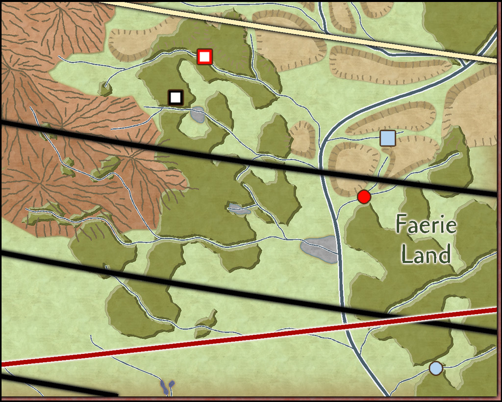
Selecting only the main features, such as the major settlements and ruins, as well as the new lesser watercourses and vegetation areas, was what let me build-up the final Errynor map, of which the Map 40 segment is shown below, here with its latitude lines and the southern limit for Nibirum's northern polar auroral zone (red arc). Only the cream-coloured latitude arc, for 55°N, features in the Atlas CC3+ Errynor map. The black arcs for each 1° were added in preparation for these individual 250 x 200 mile maps, and will feature there:
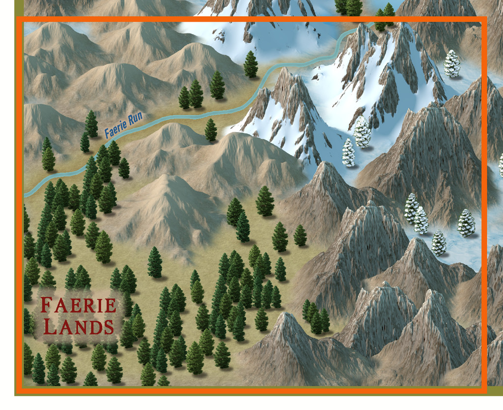
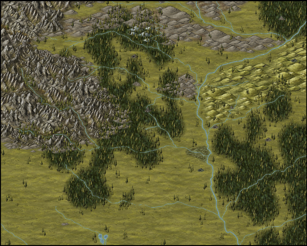
I'll present and discuss the final CC3+ map for the Atlas in more detail in a subsequent Forum topic. For now, merely a teaser view of the final Map 40's terrain (only) - no settlements, or creatures, or anything else. Yet!


