

[WIP] Hyboria Map
 JulianDracos
Mapmaker
JulianDracos
Mapmaker
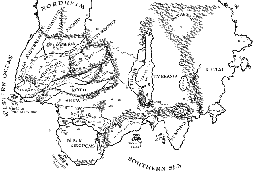
So what I wanted to do was make a B&W map of Conan's Hyboria similar to this: https://hyboria.xoth.net/maps/hyboria.gif
I thought Mike Schley ink would be a good choice. I am not sure it is. For whatever reason, the land fill is blank allowing the background to show through. That is one of the reasons I dislike the map. I turned the background off so it looks a bit better.
I would like a nice looking B&W Hyboria map. Should I use a different style? Or are there changes to improve this one? I thought about adding in forests or labels.


Comments
I think you've done pretty well as it is.
When you say a nice looking map, what is it you don't like apart from the background?
That is part of the problem. It is a more I know it when I see it. One thing that bothers me is the mountains seem "inked" but the continent lines do not.
Have you thought of making the continent lines thin enough to match the average thickness of the ink in the mountain lines? That will make the coastline look less distinct, but you can counteract that by adding a Glow effect to the LAND sheet, set to Outer and a dark grey, so that the water is shaded away from the land a set distance all around.
I know the old 'I'll know it when I see it' issue. I have that myself quite a lot. So lets try to get the coastline looking good first, and then maybe you will have a better idea of what you want for the land.
Are you going to use this with a pure white background, or are you looking to add a subtle paper texture? A plain white background is what you want if you intend to use the map printed on paper, which will be its own paper background, but if you only ever intend to use it as an image file you might want to add the paper texture in.
First, I would like to fix the background. The continent should be white and the oceans will have the gray background color. I am not sure how to do that. When I go to the land sheet, there is just the line and changing the color only changes the line color. If that is changed, then some of the effects will work or at least work better.
I have reduced the thickness of the lines. I guess I have not made it thin enough yet to match.
If I can get those things done, then I will probably work on the rivers a bit to make them look a bit more natural. I will then add text like the source map. Then I will see if that makes it look better.
I have your parchments and for that fact paper texture I have made for other purposes. However, I have no idea how to use these in CC3. When I go to the background I can't figure out how to swap it out for the parchment files. I suppose I can just import the file to a new layer, but I was hoping for other options.
Oh I see.
If you change the line thickness of the landmass to zero, and the fill to solid and white (all using the Change Properties tool), you will then have a solid white shape as the land. After that you can add a black Outer Glow without any blur to make a coastline (without actually having a line there), and as long as there is nothing on the BACKGROUND sheet you can draw a solid grey rectangle on the BACKGROUND sheet for the sea.
If you already have an entity on the BACKGROUND sheet it's probably a white rectangle, which you can change to an appropriate grey colour for the sea.
The background is already set to light gray. The land tool is supposed to have the land mass with white. CC3 just never drew it for some reason. I was able to follow your instructions to get the land mass white and then use glow for the line. Not sure if this is the best way to get the ink effect for the land masses though. If there is no way to get that without using sheet effects I will probably need to redraw the map.
I can't really see what you are saying.
Could you upload the FCW?
Here you go.
Thanks :)
I copied the existing land shapes to the COASTLINE sheet, and then hid everything but the land sheet and turned that solid white. With the COASTLINE in place there was no longer a need for the glow, so I switched it off, though it is still there in case you want it in the future.
I thought, but couldn't be sure, that there was a COASTLINE entity as well as a LAND entity in this style. It sounded like there should be. The drawing tool draws an identical polygon on both sheets. All I have done is replace the missing poly on the COASTLINE sheet.
Thanks, that solved the problem. Now, how do I add parchment to CC3 maps?
Make a new sheet over the top of everything else (bottom of the list), then either import a seamless bitmap fill of your choice and draw a rectangle of it on that new sheet to cover the entire map, or import an image of parchment that is of a suitable size and resolution on that sheet.
Add a Blend Mode effect to the new sheet and set it to Multiply and 100% opacity.
If you have used an image instead of a seamless bitmap fill you will also need to use the DELAYDRAWSYM command and set it to zero, so that the Blend Mode effect works.
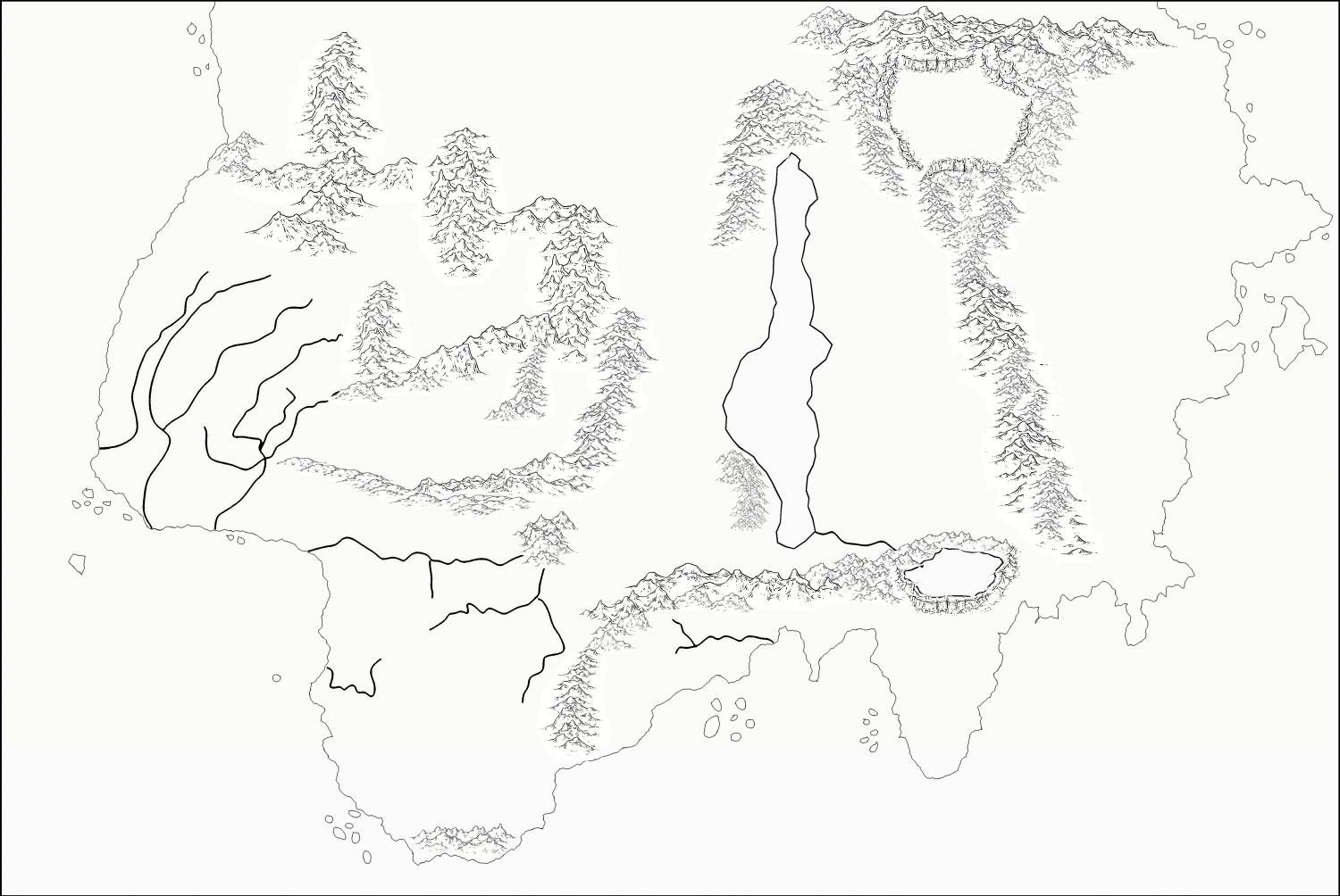
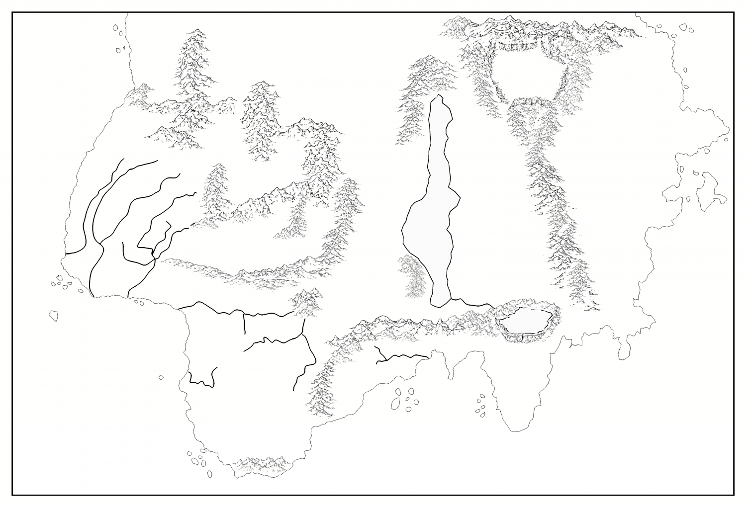
Here is the latest version of the map. No parchment yet. I will have to see if any of the CC3 parchments are seamless bitmaps. I know one I tried just made it look like tiles.
Anyway, the issue I am having now is symbol size. It turns out that there are rivers cutting through mountains. So I have to make the mountain symbols smaller to fit in to the area by the rivers. They look different from the other mountain symbols. Not sure how to address this
I can't really see the mountain issue at this scale, but I might be tempted to hand draw hachured gorges instead of trying to use tiny mountain symbols in that one place. You have tiny mountain symbols by the southern end of that lake as well. I would be tempted to do them the same size as the rest of the mountains where they don't have to be that small.
A single mountain symbol doesn't necessarily mean there is a single mountain in this spot. It can mean a whole mountain range, especially on a world or continent map, and especially if there is a line of single mountains. If you look at some of the continent maps in the Community Atlas you will see the colour version of this same style used to map comparable sized continents, and how the mountains represent huge mountain ranges, but are shown large enough to be easily identifiable as being symbolic of that mountain range, rather than the actual size of the mountains as they would be 'on the ground'.
Thanks for the suggestions. The problem I am having is a single mountain would cover up the river. If I shrink it down to fit between the rivers, then it looks that small. I suppose I could make the mountain symbols unsymetrical and shrink the width but not the height. That could help.