

Historical Topo Map
 choppinlt
Traveler
choppinlt
Traveler
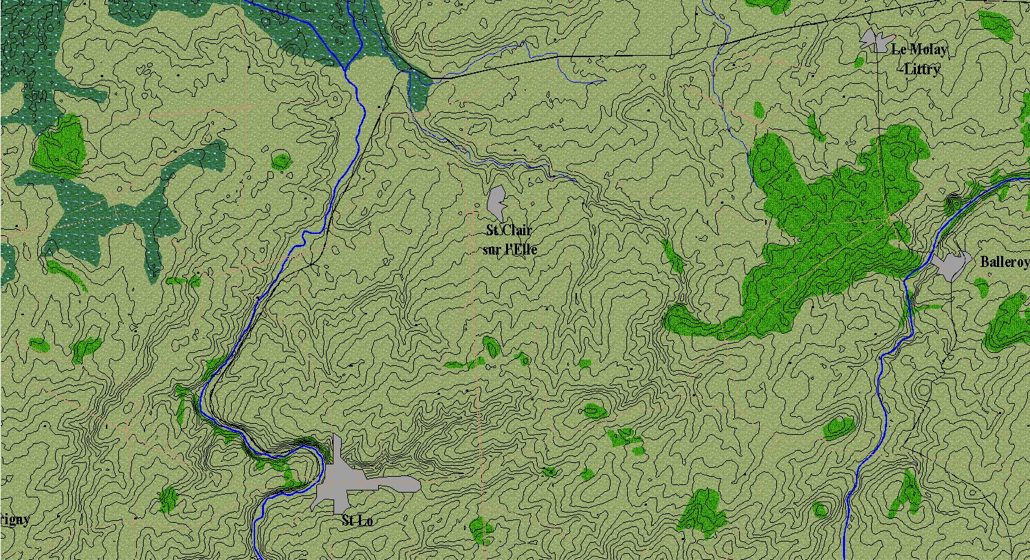
I'm relatively new to this forum (and using CC3), but thanks to several of you I present a sample of my topo maps. The exciting part (to me at least) is that the contours were imported from SRTM data and I overlaid a real topo map with them and drew in the rest. This is still a WIP, but you can see what I am trying to do. This map is mostly finished with the details I am trying to show, but I need to make the roads more visible at this zoom level. Again thanks to those that have been answering my questions!


![[Deleted User]](https://secure.gravatar.com/avatar/c75d9a245b74d9c59be0999ea81ca541/?default=https%3A%2F%2Fvanillicon.com%2F92add7f8c954488718110edc4896ad39_200.png&rating=g&size=200)


Comments
Very Nice Work!
Here is my latest iteration thanks to some additional guidance from the fine folks on this forum. The map may not seem drastically different, but the colored contours underneath really creates depth and feel to the map now.
Here is my nearly final product. There will be some tweaks and final corrections as I go along, but this is pretty much a completed view. I couldn't have done it without all the help I have gotten on this forum, so thanks again!