

Start of a New Campaign Map
 Kathleen Ann Cox
Surveyor
Kathleen Ann Cox
Surveyor

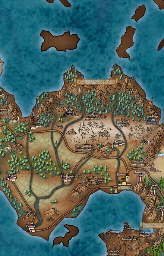
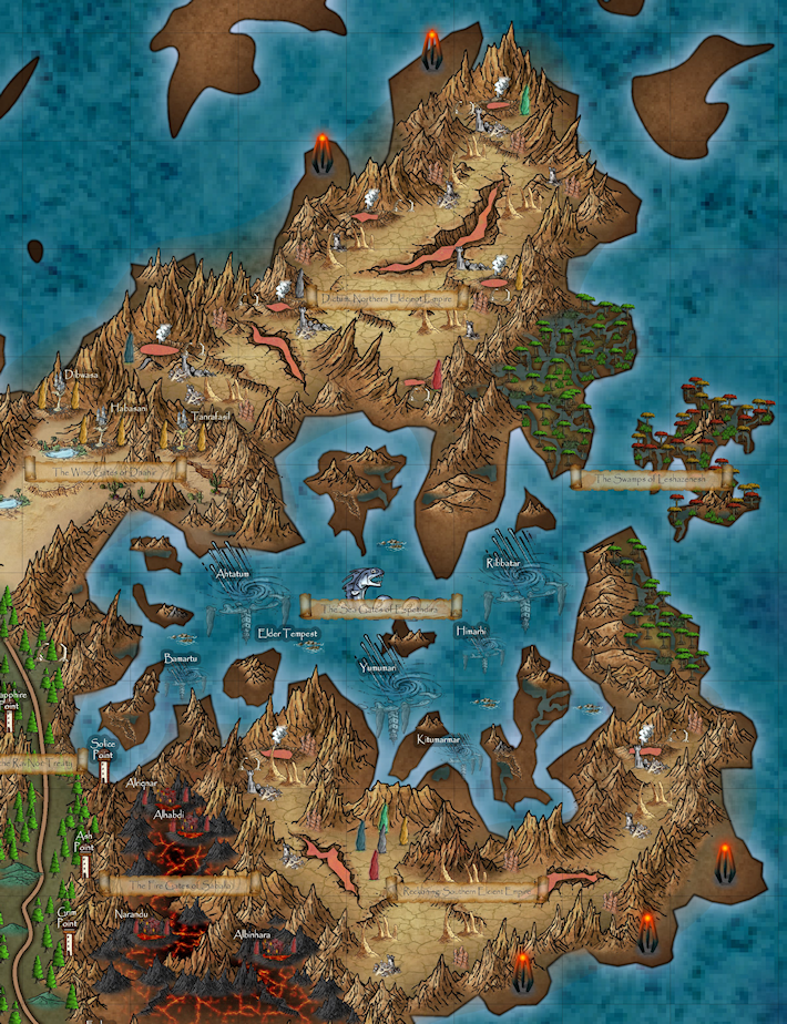
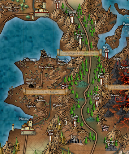
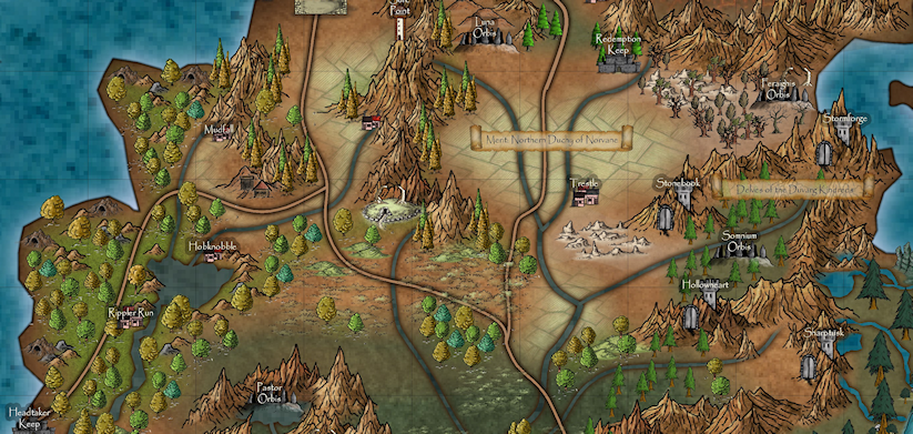
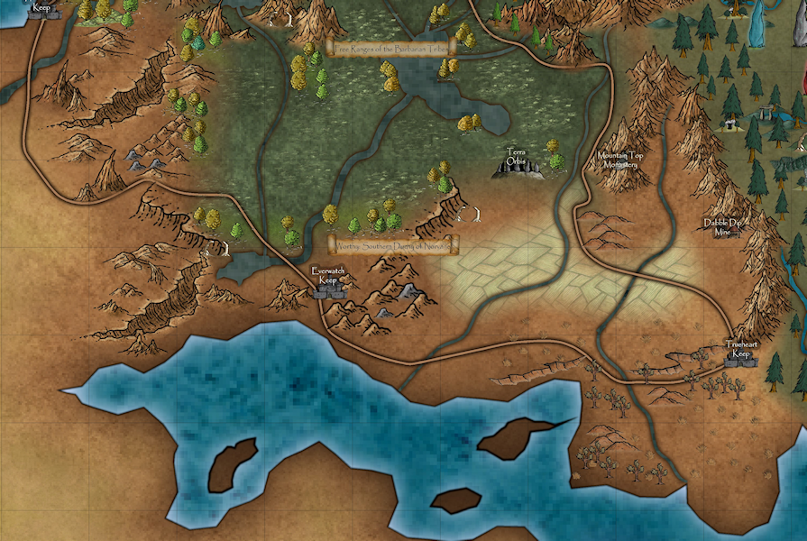
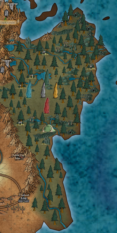
Believe it or not, this map (and campaign) was inspired by the floating island symbol from worlds of Erdan and the new banner annual and this was the end result. Here are some smaller sections of the map where the details are a little clearer.
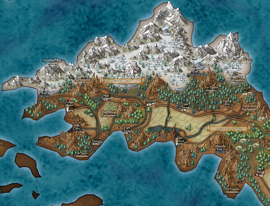
I used assets (bitmaps and symbols) from a whole bunch of annuals and add-ons including:
Dark Realms
Alyssa Faden
Havenland
Myrklund
Mike Schley
Par Lindstrom
Wild West
And more ...
For being such a mongrel of a map, I don't think it turned out too bad.
Tagged:


 and 1 other.
Comments
A very nice map. Your coastline could probably have benefited from one extra level of fractalization though, I notice the coastline of the main landmass seems to have less definition than the islands close to it.
I agree with Monsen. I often the 'smooth' the coastline as a final touch. However, if the land and coastline are separate entities, I delete the land; do a 'copy' of the coastline; put the copy on the land sheet and 'convert line to poly' - this will keep the coastline and land matched.This is yet another reason I hate separate coastline and land sheets.
Very nice!
I like the look of the map very much! very well use of the symbols and the colours. Wtg!
Okay, I went in and frac'd my map with a 50%/2 setting (since I have no clue about what settings I should use) and here is a small portion of the map. I am not sure what issue Quenten was referencing because I just hid everything but LAND and COASTLINE and applied the frac to them and I think it worked except for those weird stray lines that show up sometimes. I am still not sure about the level of detail that I am looking for in my coastline. Is this too much? too little? just right?
I have been playing around with CC for years and I still learn some cool trick or pick up some basic feature all the time. Just recently, I discovered the COPY and PASTE feature available in sheets. I am not sure how I missed that one for so long since it is right there in front of my face in the menu. ~sigh~ I should probably also buckle down and view all the videos and read all the guides available, but my inner child just wants to get into the "paint" and make a pretty picture and she is a spoiled, overindulged little brat.
I do have an excuse for avoiding the frac'n thing for so long. Living in West Virginia who would have guessed frac'n could ever make my world better?
Seriously though...thanks so much to everyone who makes comments and suggestions. They are greatly appreciated.
Peace and good health to all,
Kat
Love it!
Looks much better now.
Those weird stray lines you mention are caused by nodes being too close together leading to a very sharp corner, you can usually go in and remove these with the Delete Node command. Note that the nodes causing the spike is at the base of the spike, not the spiky end of it. Another way to avoid them is to not have the coastline as an entity, but rather as a glow effect on the landmass instead.
The issue i was referring to is exactly what has happened with the spikes, nearly always due to the coastline sheet.
Just curious, how many miles is each grid square?
20 miles.