

Need Help with Image imports
 DemmiUrgoss
Newcomer
DemmiUrgoss
Newcomer
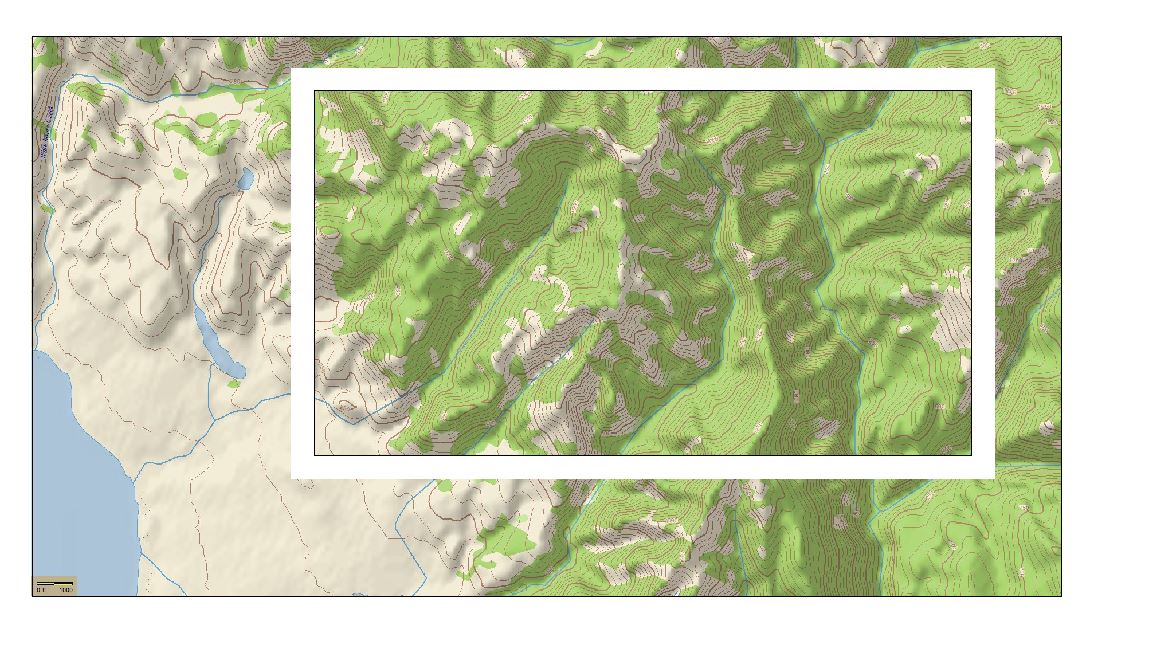
When I import an image into CC3, I get the below effect where the map I uploaded does not fit into the map field, and I get this rectangle in the middle of the imported image that I can't seem to get rid of. Any help either fitting the import into the rectangle, or resizing the rectangle or getting rid of it would be appreciated, thanks in advance
Comments
Without seeing exactly how you did it its quite difficult to know what went wrong.
If this is a bitmap rather than anything else it should work if you have set up the map to be the same proportions as the image (ie if the image has a width to height ratio of 2:1 the map can be any dimension as long as the ratio is 2:1), and if you are careful you only click twice (once to position each of two corners at the corners of the map, and then hit ESC to prevent duplicate copies. The only way I can explain the extra copy in the middle is if you click a third time. Perhaps you are thinking that you need to right click or press D to finish the operation? But like I say, it's really difficult to say without seeing the process as it happens.
The rectangle in the middle represents the map dimensions you chose when you started the map in CC3+. The image you have inserted have simply been placed as a much larger size than the map area which is why you see this. There are multiple ways to make it fit, but the easiest is to just Erase the image you have inserted, then insert it again.
After erasing the first try, use Zoom Extents to zoom to the actual map area, then turn on Snap (bottom right corner). Now, do a Draw -> Insert file and pick the bitmap, and do as Sue says, click once in the upper left corner of the map area and once in the bottom right corner to define the size of the imported image, and hit esc to stop placing more copies.
Note that Snap will only help if your map size is reasonably round numbers, if you find that Snap doesn't seem to help you click accurately in the corners, turn it off and do it by eye instead, or use the Endpoint modifier on the map border which is also a great way to accurately place something.
You know what - I didn't see it as a single image at all, but two copies of the same thing. I think I must be tired.
Thank you for the quick answers all, I'm new to CC3 and am finding it a bit of a steep learning curve for me.
Actually, the map size I selected (if that is the rectangle in the middle) was larger than the image file I added to the CC3 map. I tried this with both .jpg and .png files. The image file is 1800x800, the map size I selected is 2000x1000. Thinking that there might have been an issue with the image file, I also tried creating a map that was 4000x2000 and got the same result when I dragged the image onto the map file.
As there is no import function in CC3 (at least that I could find) I ended up trying just a drag and drop, which worked to get the file into CC3.
I will see if I can figure out your suggestions above.
The import function you are looking for is Draw menu -> Insert file. That allows you to size the image upon insertion as me and Sue described above.
Also note that maps in CC3+ are in map units, not pixels, so a 1000x800 map is not in any way made to fit a 1000x800 pixel image (although in my example there, they are the same aspect ratio, which makes the image easy to fit.)