

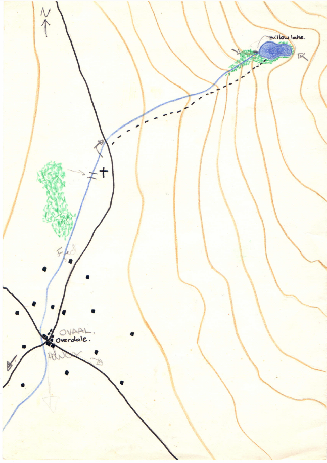
Small terrain map
 Dak
🖼️ 37 images Surveyor
Dak
🖼️ 37 images Surveyor
This is the first map I made for the very first game of AD+D I ran as a DM (I can't believe I still have it), it must be after April 1984 as the adventure I ran was from White Dwarf of that year and month. The map still has the notes I added to it during the game.
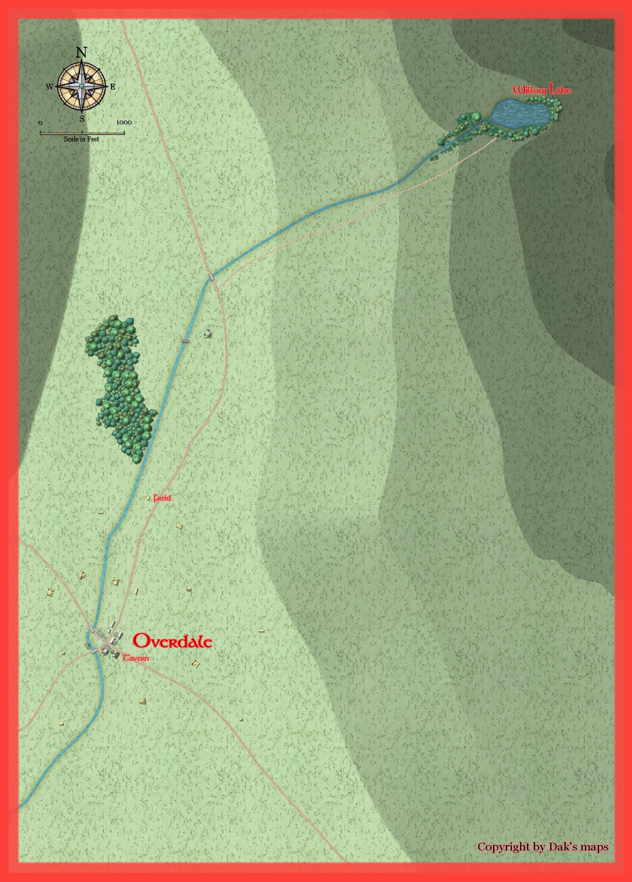
I thought it would be nice to give it the CC3+ treatment, so I did two new maps, one in M Schley overland, and the other in M Schley cities. I'm not sure either scale is suitable as the map seems to be about 30 miles in length. I'm thinking of running this as a one off in roll20 as my first attempt to DM there.
Any suggestions for improvement on either map would be appreciated.


![[Deleted User]](https://secure.gravatar.com/avatar/c75d9a245b74d9c59be0999ea81ca541/?default=https%3A%2F%2Fvanillicon.com%2F92add7f8c954488718110edc4896ad39_200.png&rating=g&size=200)

Comments
Scale will quickly get an issue when you try to combine things that covering a somewhat largish area, and then adding minuscule things like individual buildings. Personally, I think the overland map is the best approach, and then make a separate detail map for the village in a city style.
Thanks Monsen,
I'm working on a city that's 5 miles by 3 miles, and I've come across the problem you describe above of covering a huge area with tiny symbols like thousands of buildings. I'm not sure how viable a city map that size will be. It has pyramids in it and they look great at that scale (I made them the same size as the great pyramid at Giza), but the smaller buildings and the sandy terrain don't look right.
But I think you right about using the overland map for the general area, and then making a more detailed city map of the town and its surroundings.
A city that size is doable, but symbols do get small with lots of symbols, so I would strongly recommend against it. I would have considered making a district map where districts are more simple polygons, and then separate detail maps of each district.
For a big city, look at @Quenten 's Dun Fingolfin which is "only" about 2 by 1 mile, and notice how small things get. It is also a very heavy map, which means it is rather slow to work with. It also takes a huge amount of time mapping the complete city in that detail.
Hi Monsen,
Great idea, I'm already thinking about how I can do it. I'm using a trace of the big city map, and it's already kind of partitioned into wards and districts, so if I can recreate the areas of the city using simple polygons, I can still add large features like the river and pyramids and gardens etc. Then I can do more detailed maps of each area as needed.