[WIP] Commission for Fantasy world - Wideworld.
I have received a commission (huzzah) to make a client's fantasy world - Wideworld - into a good FT3 map, with decent biomes and rivers as well as altitude.
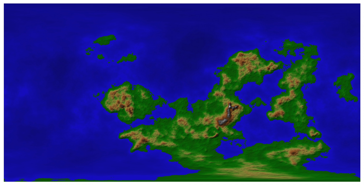
First pic is of the map given:
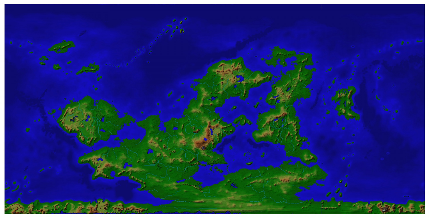
The next is of the map added to, modified via Wilbur, then returned to FT3, with rivers made, and finally lakes added via freehand selection, and actioned with Create Profiled Mound from selection, with min value of -500, and max value of 0. Several meteor strikes hit the surface while mapping - very distracting! ?
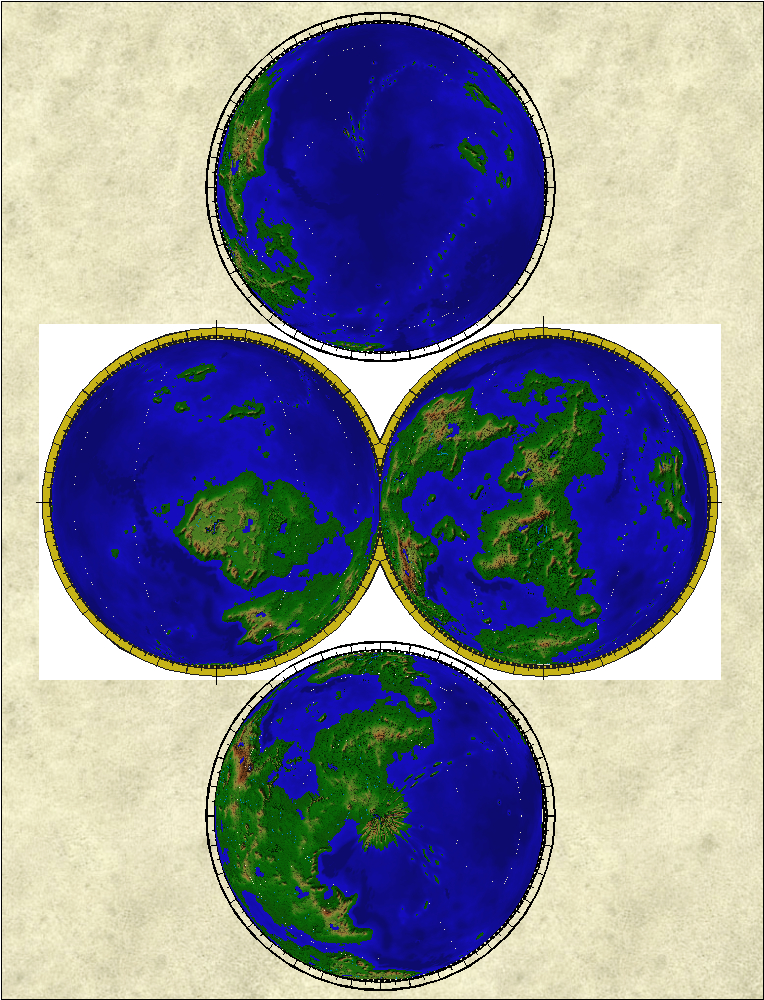
I have also defined a setting for orthogonal views - E,W, N and S.


Comments
Looking good.
If you think the meteor strikes where distracting for you, thing of the poor people living down there... They must have been terrified...
Not terrified at all - just dead. Well and truly squelched into the wet sand. ?
This is an edit of my former recommendation (of which I have no copy).
I found Quenten highly skillful and amazingly generous with his time and effort. We worked on several mapping projects. His mapping expertise certainly took all the projects many levels up. His creativity added any amount of fun for both of us. Quenten did come through with all the work he had proposed (much more than I had envisioned) in the end. Nothing more could be wanted on these points.
Nobody is perfect: unless the project is short, if you want to receive progress reports about the commission over time, expect to keep asking for them yourself. I strongly recommend against expecting that he should follow through on updating you; this will be frustrating.
I highly recommend working with Quenten if you want high quality mapping skill and input, and will not mind relatively few updates as it goes.
Wow, I am truly humbled, and blown away by your high praise.
Here is an update. CC3+ map of climate, temperature and rainfall, with all contours and waterways behaving properly.
Climate is the last step for the CC3+ maps, then a translation of the altitudes to FT3 if I can manage it.
The final product. World map, showing climate, geology (Tectonics, currents and winds), and regional maps showing altitude and climate, plus a bonus city.
A great experience for me.
Absolutely amazing work Quenten.
Any chance you’d be willing to give a write-up on your process? I would love to create a world with that much natural detail before I even start putting flora, fauna, and peoples in it!
Professional secrets can stay so, of course. I want to be a better mapper, not compete with you for commissions. ;-)
No professional secrets, and I have no problem with competition - i only do them for a bit of pin-money (to buy books mainly).
I will do a complete write up later on.
Here is a brief outline.
Fractal terrains - pick a world that suits roughly what you want. In this case, the client did this.
Edit it by adding islands, reducing land on one mountain range side and increasing it on the other, except where you want a Himalayas or Alps. Improve the elevations of your mountains, and ranges.
Edit your climate biomes, either by altering temperature and rainfall, of just painting them in. I prefer the former. Take not of Earth patters - deserts about 30 lat, tropics at 0-15 lat, savannah in between. Taiga and tundra over 65, and arctic about 75-80. Your world may be warmer or colder, dryer or wetter than earth though. Also, a lot of coastal deserts/semi-arid on west coasts as opposed to east coasts because of cold currents and easterly trade winds hitting mountain ranges - eg Chile, west Australia, Namibia, Morocco, California. I recommend delving into the Koppen classification and a few Artifexian You Tube videos on creating climates.
Then do a Sue Daniel's Wilbur go-over (in 2020 annual, I think). Export to CC3+ as high resolution as possible - include at least climate and altitude, and a grid of at least 10 degrees steps so you can guage longitude and Latitude better.. I also use multipoly contours, but it doesn't really matter. Getting the FT map right is imperative if you go this way. Of course, you can create your own continents and islands in CC3+ without using FT.
In CC3+, you will need to edit a lot. Do Altitude first - I often revise the coastline, making it less clunky and converting many islands back fro the peninsulas that can turn into, same with narrow sea entrances. I often put a PNG of the FT final altitude map into the CC3+ map as a guide. If you don't care too much about the FT version for later use, then you can be even more bold. If I am not redrawing the whole coast (which is what I usually do - I can get more detail with less nodes than the FT import), I use SIMPLIFY to reduce the vast amount of nodes FT exports if using high res. Also see below. I NEVER use fractalization on world coasts if importing from FT - a surefire way to crash. Making the world from scratch in CC3+, I do use fractalization.
Once that is done, then using your FT3 climate map as a guide, put in your biomes. I use plain solid colours for this, as I have above. Really big continents often need their land masses cut into 2-4 sections so as to make Tracing feasible, and prevent crashes, as it is the number of nodes in an object that causes this. I do this when editing/making the coastlines at the Altitude step.In the long run, I use an effect on the land mass, such as Outer Glow of black or dark blue, with very little blur and high strength and appropriate range (so you can see it). This avoids horrid artefacts where nodes are too close or at weird angles.
Once climate is done, I use Earth type meterological and geological patters to add currents (and indicate where warm and cold), winds and tectonics (with direction of shift if I am feeling OCD). I also like monsoon areas - look up what is required - esp Indian Ocean and off northern Australia. I do recommend sticking to solid colours, though some Google Earth bitmaps are available in one of the annuals.
For regional areas, I recommend sticking to no more than 1600x1600 km (1000x1000 miles for you recalcitrant Imperialists). Use what ever style you like. I use Mike Schley, Jon Roberts, Erdan, Spectrum, and now darklands for this size regional maps - or mixtures. I love Spectrum for Desert areas, which is what I have used above. I love the Ghost gums.
I make heavy use of Watabou city conversion for my settlements of towns and cities, though occasionally OCD steps in so I create cities such as Torstan, Vertshusen and Dun Fingolfin as seen in the Atlas.
Hope this helps.
Thank you for sharing! I look forward to reading said complete write-up in the future.
I have been reading up on Koppen classifications, a fascinating subject! Artifexian makes great videos and I am still working through them.
I would be particularly interested in a description of the tool settings used during some of the detailed edit operations. Specifically in FT3. I’ve gotten the hang of larger edits, but when it comes to making smaller changes or finely-detailed area edits, I feel a bit ham-handed. I can never seem to make mountain chains like everyone else.
Still, your advice here is absolutely appreciated and if you do a further write-up later I will count myself doubly-blessed.
Also really appreciate the advice on SIMPLIFY and node edits in CC3+, as I noticed I wasn’t truly happy with how the land masses looked once imported. I figured I would work on that once I got my FT3 maps more to my liking.
When you say tectonics, I’m curious if you spend any time thinking about plates and movement during your FT3 work, or only thereafter as additional detail layers?
Once again, thank you so much for the info provided!
After - too complex to do them before, and it limits my scope as to what goes where.
Thank you. I'm trying to get my campaign up and running and it looks like I can make the world map piecemeal, editing maps imported from FT3 to CC3. I've been looking at this massive machine and feeling like I'd never get it working right.
One thing I did with ft3 was to do an export of a bmp of a continent.
Then imported that continent into an island sized template. Tracing it as a guide. Export as a png and add it to my Crestsr site.