

Fractal Terrains 3 and loading a bitmap
 Zombee
Newcomer
Zombee
Newcomer
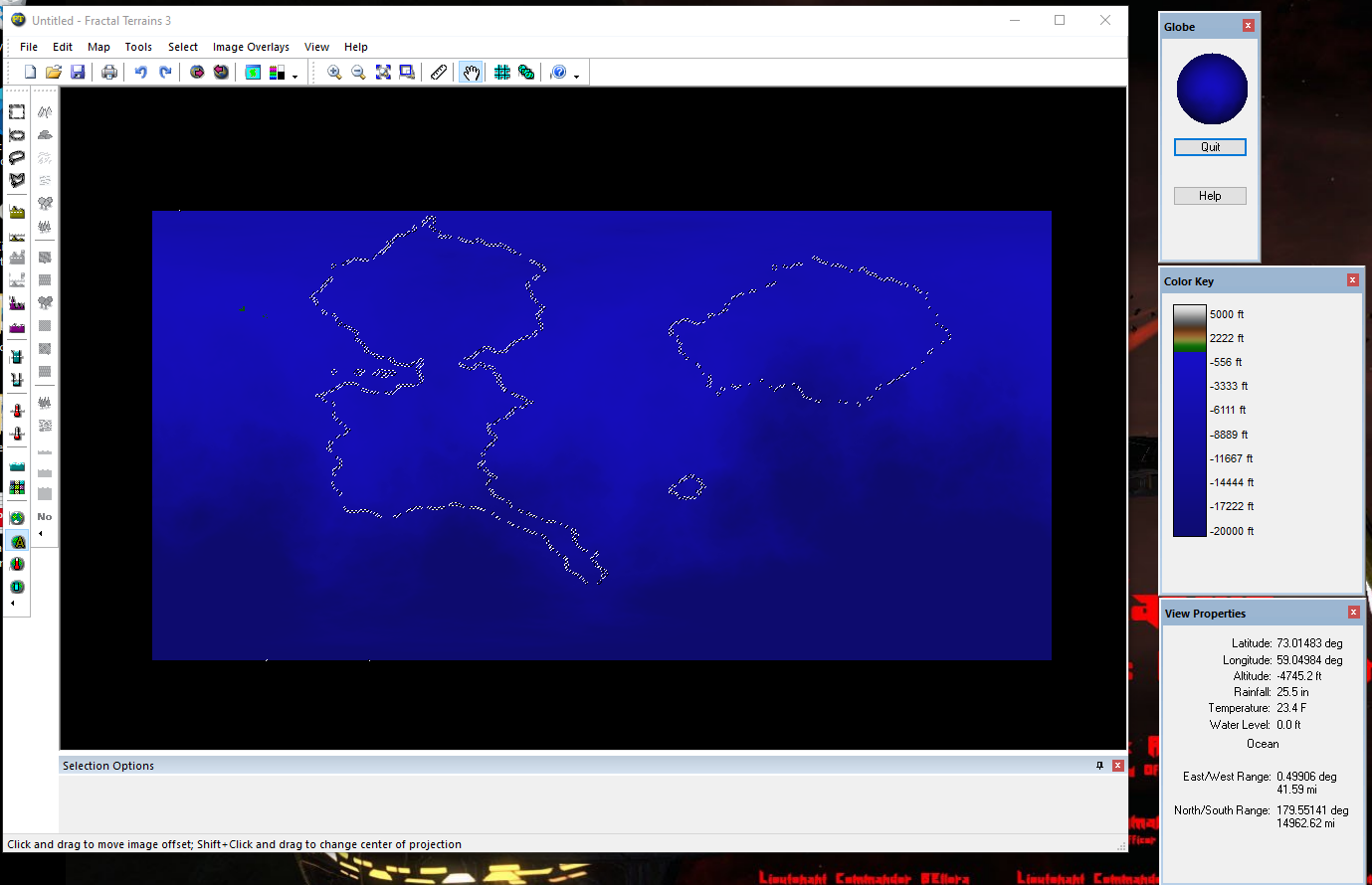
I followed the instructions to load my bitmap into FT3. But I get this. Those white spots are the edge of the continents. But the are not contiguous. And and they "move". I would like to convert the map to solid lines. But how?
Comments
When you say it moves, do you mean that it seems to change as you zoom in and out? If so, then that is just the size of the view changing relative to the fixed resolution of your monitor.
What does the original look like? And which instructions are we talking about?
When I say it moves, I mean it "twinkles". It does this from the moment of import. No action necessary. Even when you zoom in or out it continues to twinkle.
The instructions are the ones in The Tome of Ultimate Mapmaking.
This is the original map. When imported this map is inverted and flipped to be as the first pic I embedded.
Those lines you see are a selection. You didn't say which tutorial in the tome you followed, but since you are getting selection lines, I am guessing the one on page 717. If so, you are getting exactly what you should. That tutorial is for loading a selection matching the shapes of your continent, and then you can use FT3 commands on that selection, for example raise land and such. Once you use those commands, you should see actual land forming inside that selection, giving you your landmass.
Your map is a pretty poor selection mask though, as the sidebar by that tutorial explains, white is used to determine inland areas, black is sea. So right now, your map depicts a planet that is basically just land, except for a few very thin river-sized lines of sea.
To clarify, your selection mask should look more like the attached image.
Two things to note here are that only the land is white, while everything else is black and that there is only black and white on this image (your original image had grayscale artifacts suggesting that it was a JPEG at least once in its life).
Page 717 is correct. I did not catch that the water had to be black and land white. I see it now in the side bar. But sidebars is not where I expected Ted important setup information to be.
the original image was made in Campaign Cartographer 2. Then converted to jpeg for to be stored in the cloud. Then I lost the hd that CC2 was on. Bought CC3+ and converted the Joey to bmp to input into FT3.
I will try a backed out version of my bit map tonight.
I put black on all of seas and tried importing again. Got the same results. Twinkling lines.
At a loss here as to what to do now..
Hmm. I got it figured out. The twinkling is just that it's selected.
Once I deselected the twinkling stopped. But now I need to figure out how to get the mountains to go the way I want them to.