

Noob question I am sure...
 Terenn
Newcomer
Terenn
Newcomer
Hello,
I am in the process of working on my first overland map on the software (a traced map from paper)
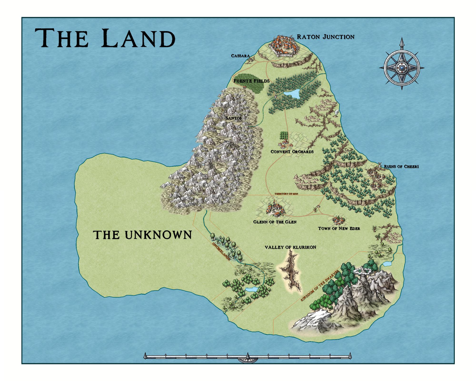
. There is an image below for reference... Two questions (please point me to the right direction if there is already in on either):
- Is it possible to show gradual elevation gain? The map has mountains with hill stamps, as well as plateau & cliff stamps - But the rest is flat flat - I am thinking some elevation change may be a good way to fill some of the void.
- There is a large region of the map that is unexplored by society (with the highly unique name of "The Unknown") - Any thoughts or recommendations on adding a fog-of-war type effect over this area?
Thanks!


Comments
1) You can use different colors, or bitmap fills, to show increases in elevation.
2) Just have two maps, one for you and one for the players.
I would give depth to #2, but I'm yawning and would likely mess it up. Someone else will have to give a couple of ways to do that.
To hide things from your players, I would consider putting things on different layers, then you can reveal one layer at a time as they explore the area. You'll have to predetermine which chunks to reveal of course, but this is a good idea revealing things piece by piece.
For elevation, as JimP suggested, contours are the best. Since you are using Mike Schely Overland, there is a contour tool called Height Contour in the Minerals/Mountains catalog. It looks white int he preview, but it is transparent, and you can lay multiple on top of each other to lighten it bit by bit.