

Battlemap Resolution and Scale
 Durandal
Newcomer
Durandal
Newcomer
Hello there, I'm a new user of CC3+ and VTTs in general. I've spent some time learning a bit about how to use CC3+ and I'm a bit more comfortable now than when I first opened it. However, I still have some issues regarding image resolutions and scale when exporting to the VTT I intend to use.
I'm going to be hosting my first session as a DM using MapTool, which by default has a 50 pixel per 5' grid square. I tried to set up a grid in CC3+ that matched the 5' increments, but every time I export the map and then import it into MapTool, there is a mismatch in grid sizes.
I know I can resize the grid inside of MapTool, however even if I do that and get it as close as I can, the grid still drifts out of alignment eventually over the rest of the image.
Here you can see what I'm talking about:
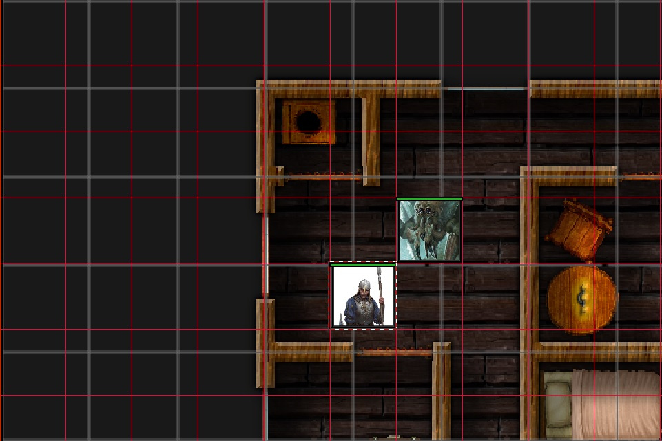
The red grid is the default 50px per 5' that MapTool uses, whereas the grey grid is a 5.0 grid spacing that I was using in CC3+. In the next picture, I've scaled the grid and aligned it as best I could. If you look at the top left corner you can see it's pretty spot on, however the grid still drifts apart:
This leaves me with a couple questions.
1: Is there a way to set up the grid overlay in CC3+ to fit MapTool's 50px 5' grid? I've tried a few different spacing settings and I always seem to get grid drift which then screws up the sense of scale and alignment in the maps I make (also apparent in the token sizes in the two screenshots).
2: Is there some sort of 'best practice' when it comes to exporting maps from CC3+ for use in VTTs? I feel like I'm probably missing something important when it comes to resolution, pixels-per-inch or even just overall resolution.
I had searched through the forum a bit and tried a few different things but couldn't seem to get rid of that grid drift. If anyone has any tips or tricks that might help, or just general advice for using CC3+ to do what I'm trying to do, I would greatly appreciate it!
Comments
When you need to to a precise export, make sure that you only export the map itself, and not any border/screen, as this will mess up your calculation. This is typically what causes the drifting you describe since then borders steal some of the pixels you calculated for the grid cells, they suddenly aren't 50 pixels anymore. Use the save as rectangular section to accomplish saving just the map. Make sure that the export size is calculated correctly, for example, a 11 by 12 squares map sghould be exported as 550 by 600 pixels to fit with 50px/square
Also note that 50 px/square does not give you a very high quality result if you like to zoom in as in your image above. I recommend at least 100px/square, MapTools handles that fine (Of course, that also means that the players get sent a bigger file, so you need to weight quality against bandwidth/transfer times here)
Generally, I also prefer to leave the grid off from my CC3+ export, as it generally isn't needed. That also minimizes the effect of drift a bit, but again, drift won't be an issue if the export size is correct.
Maybe my blog article here can also help you a bit:
Thank you for the info! I'll have a look at your blog post too and see if it helps things click in my head more. I'm totally new to using both CC3+ and MapTools so from what I understand I have a bit of a learning curve ahead of me.
Still, I appreciate the tips. Cheers!
Alright, after I wound up with some free time again I read through Monsen's linked blog post above, as well as: https://rpgmaps.profantasy.com/scale-matters/
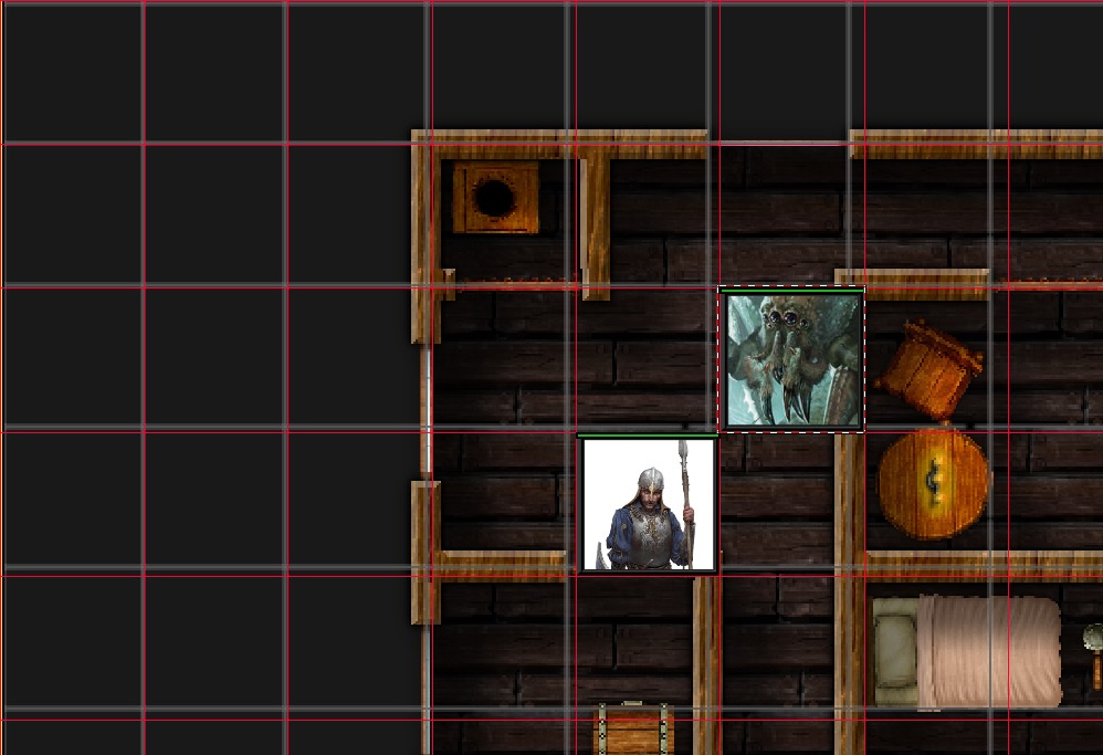
Turns out I was misinterpreting a few things, namely the export HxW dimensions and how they relate to the 5' grid squares in MapTool. I was also as Monsen pointed out above, not aware of how the border around the actual map itself was impacting things. I messed around with it again after reading up on those blogs and I'm happy to say I've got a nicely aligned grid now, straight from CC3+:
Those blogs and the info above got me on the right track. If anyone else is having issues with resolution/scaling when exporting your maps I highly recommend giving Monsen's blogs a read, they're chock full of info.
Thanks again for the help Monsen!
Cheers!
You're welcome. Happy mapping :)