FT3: Removing an inland sea?
 argel1200
Traveler
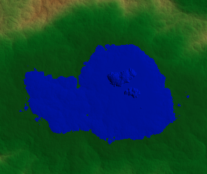
I've been trying to use the Raise and Smoother tools but there's o much height difference that I can never flatten it out to match the surrounding altitude. Is there a tool that can raise/lower the land to a user defined altitude?
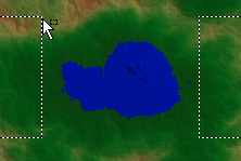
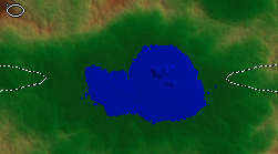
Also, when I use a selection tool (e.g. lasso), I get some weird behavior, almost like some kind of grid is being added to the selection, so I guess I don't understand how they work?
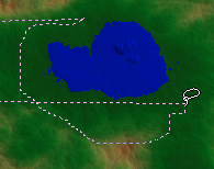
Lasso in progress:
I was going to try some global functions to adjust the terrain (hoping they were limited to the selection) but can't even elect the area I want. Spoiled by Cities Skylines I guess. :(
Anyway, look for a way to wipe this inland sea out. Thanks in advance!!
Edit: Since I've been following Sue's tutorial, I know how to get the fractal into Wilbur via MDR so if there's an easier way to do it in there that's an option.
Best Answer
-
 jslayton
Moderator, ProFantasy Mapmaker
The continental shelf in the middle of that sea suggests that it would respond best to gentle painting with a prescale brush tool, at least until the shelf edge is gone.
The strange behavior with the selection tool suggests strongly that the sea in question lies exactly across the -180/+180 longitude line. I strongly recommend that (as was done here on Earth) that you put ocean across as much of that seam at the back of the world as possible. Painting tools work across the seam pretty well, but the selection tools insist on going what appears to be the long way 'round because those are numerically closer with the basic cartesian algorithm used.


Answers
Are you using tools other than Prescale offset raise and lower tools?
Just the Raise, Lower and Smoother brushes (no prescale brushes).
Since I am not an expert by any means, and know even less about brushes other than the prescale offset brushes, I think that unless you have several backups saved that you might be able to work forward from again, you might need help from someone like jslayton (Joseph Slayton), or one of the other more seasoned FT3 users.
If this is a world you have re-imported back from Wilbur, having done something like CA155 to it, the only recommendation I can make that might help is to go back to the pre-Wilbur FT3 world and raise the lake using the prescale offset brushes at that stage and take it through the process again without the lake from the beginning.
At any rate, I recommend avoiding the tools that increase or decrease roughness. They are pretty difficult to control and can cause more problems than they solve unless you have an extremely light touch.
Thanks Sue. I'm going to go back to the original and export out a grayscale heightmap and Photoshop it. Hopefully I can re-import that. Right tool for the job. Takes me back to some of the ancient fractal terrain programs like Vista Pro (not the OS).
That's another way of doing it.
One thing to bear in mind is that 8-bit greyscale is insufficient and leaves steps in the gradients, a bit like that app which uses tiny pixel blocks to create 3D worlds. I'm not sure, though whether you need to set it to 16-bit, or even 32-bit.
The continental shelf in the middle of that sea suggests that it would respond best to gentle painting with a prescale brush tool, at least until the shelf edge is gone.
The strange behavior with the selection tool suggests strongly that the sea in question lies exactly across the -180/+180 longitude line. I strongly recommend that (as was done here on Earth) that you put ocean across as much of that seam at the back of the world as possible. Painting tools work across the seam pretty well, but the selection tools insist on going what appears to be the long way 'round because those are numerically closer with the basic cartesian algorithm used.