

Issues with CA41, "Abstract Maps" annual style

Ahoy all! Firstly: I like this forum redesign! Everything looks more clean. And adding images is much easier! Nice job.
So I've started playing around with the above style (Annual volume 4, May 2010, "Abstract Maps") because I might use it to create metro/railway service maps at some point soon. Immediately I ran into a baffling issue. I noticed that in the example images and sample map, the lines (representing subway lines) are smooth paths with rounded "joints", but the default tool to make them is straight. That's a bit odd, but what's REALLY weird is editing. When I draw a line with that tool, I cannot then edit that line. I can't edit ANY of the subway lines in the sample map... except the red one which is a closed polygon (the line is a loop), which can be edited for some reason despite being a smooth path.
I created a new map with the "CA41 Subway Maps" template. Same result: once I have created some subway lines, I cannot edit them (despite the fact that they are straight, not smooth, and the tool itself is set to "straight"; the E for edit option is appearing in the command line, but when I click to "pick start node", I get nothing). No layers are frozen or hidden, no sheets are hidden, and the drawtool IS sending the lines to the correct sheet and layer (though I had to create the "SUBWAY LINES" layer myself - the default tool is set to use that layer out of the box but no such layer exists out of the box).
Also weird is the fact that the "canvas" - that is to say, the background outside the map border - of my created map is a kind of off-yellow color, instead of the normal white, and I can't figure out why. The color of the boxes that the symbols are in (in the list of symbols on the left) is similarly off-yellow. Image here:
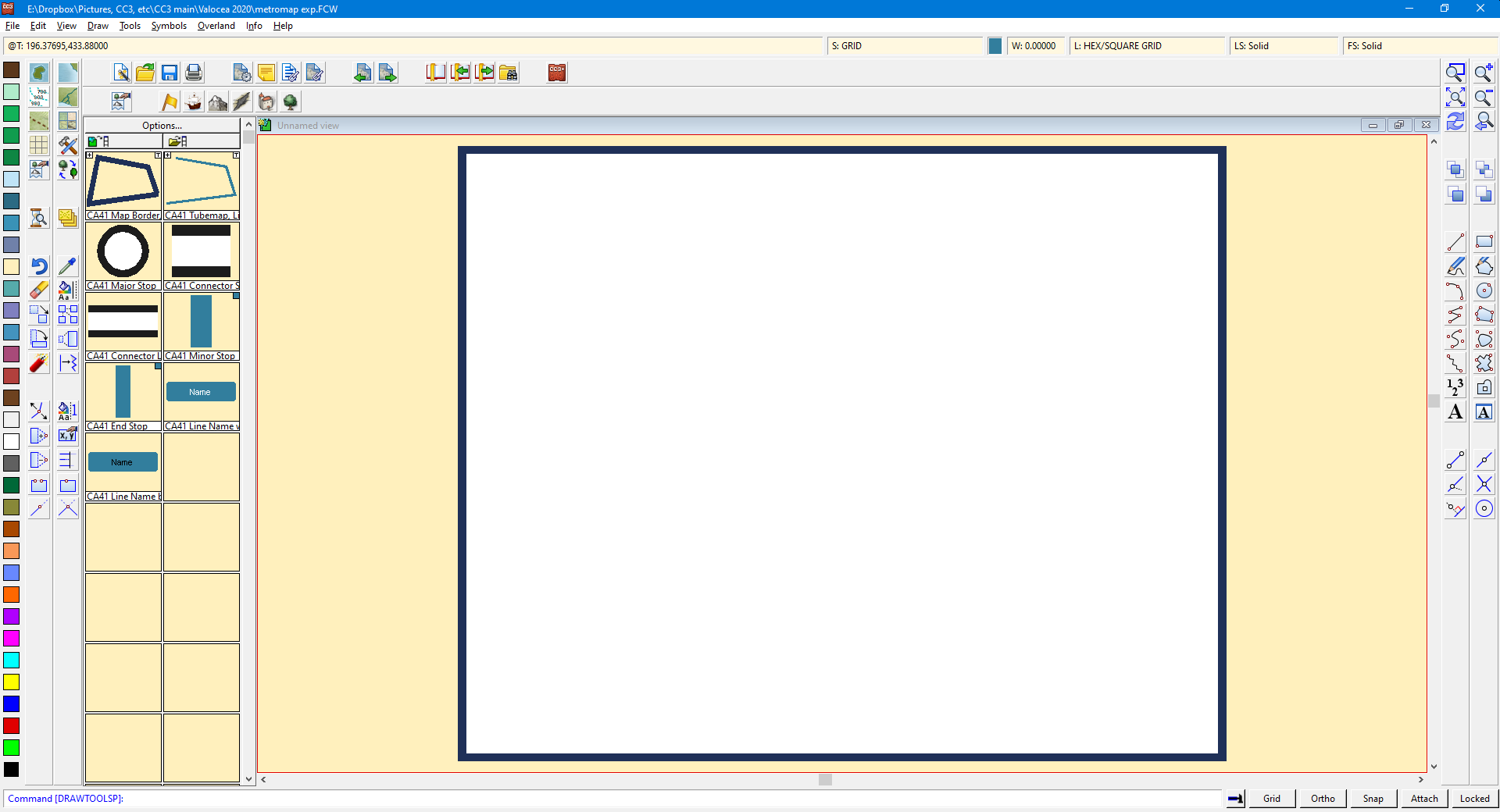
It's rather distracting as I'm used to (and prefer the look of) the regular white backgrounds and have no idea why it's different. Is there a way to change this?
I've included both maps (the CA41 subway sample map and the other map I created in that style) as FCW files.
Now... this may be an unrelated problem, but I wanted to ask: I've also had issues lately with the wrong symbol catalogs loading (in multiple maps, and in different styles) and the "show symbols in map" button sometimes causes CC3+ to immediately close. I assume that one thing I'll need to do before taking too many troubleshooting steps on that is to just reinstall everything - CC3+ itself and my annuals. So I bring this up because: would reinstalling the 2010 annual be a good step to take to try and solve this weird "can't edit" issue, as well? If so, then I may be doing that anyway, but before I prepare for that whole uninstall/reinstall process I wanted to see if there was a simpler fix first. Thanks!
Comments
Hi Ciel :)
This is an annual issue from way back in 2010, so I'm not terribly familiar with the way the templates are set up, but I am hoping that someone with greater experience than me will be along shortly to help you with the sheets and layers. I am not having an issue with editing any of the lines. Maybe you are trying to click them on the outside edge of the line? Lines have to be clicked in the middle - along the centre line.
To change the background colour I would normally go to the Edit menu and pick "Change Background colour", but it doesn't seem to work with the abstract example you gave us. Not sure why that might be, but rest assured it won't print that colour. It may have been set like that to make the map area itself more visible - the map background being white.
Some templates have a green background outside the mapping border, and some have a parchment looking background.
I don't think its part of the map, and I have no idea how to change it.
Jim
I don't think the edit option works on lines, only on polygons.
The color is the view window color. You can change it from the View menu
When in doubt, LIST the suspect entities to see exactly what and where they are. Sometimes they are on a frozen layer, sometimes they are the wrong type for the attempted operation. You won't know unless you LIST.
Re: the view window color - neat! I never knew about this! Really handy just in general to know I can change that. Thanks!
Re: the edit option - well I'll be damned. I could have sworn I remember editing line-type entities in the past... but after I read all the posts in this thread just now, I opened up my main national-level map and tried to edit some (straight) lines, and nope. So you're right: "edit" only works on polys, apparently. I was remembering incorrectly... at least, I think.
Loopysue, in your post, you said "I am not having an issue with editing any of the lines." (Not using the quote function on your post because as far as I can tell, I can't quote only PART of your post, only the whole thing). Are you sure you're able to use the Edit function on lines created with the "Tubemap, Line" drawtool in the Subway Maps style maps? And not just the red one in the example CA41 map (which is a closed poly, not a line - which would explain why it was the only one that can be edited if Monsen is indeed correct about that). Cause that does seem to be right based on my experimentation just now - I cannot edit any lines in my other maps, even if they're straight. I can only edit closed shapes, i.e. polys. But if you ARE able to edit lines (and we didn't just have a misunderstanding somehow) then I would love to know how you're doing it, haha. Thanks!
Yes, I can edit any of those lines. I think you may either not be using the right tools, or not clicking right in the centre of the line. Here is a screen shot of me using the move node tool on one of the non-red lines.
The tools you need are arranged at the bottom of the far left toolbar. Move node, add node, subtract node... etc.
The exact tools are as follows:
Node Edit The main tool for moving nodes around.
Insert Node To add new nodes if you need them.
Delete Node To delete nodes.
Break To break a line into two parts as necessary.
If you are working with smooth lines like this it might be easier to see what you are doing if you turn on the guides by pressing CTRL+F. To switch them off again afterwards just press the same shortcut again. It's a toggle switch.
Oops!
A little bird just whispered in my ear...
You are talking about editing with the drawing tool by pressing E with the drawing tool active? What I've told you is how you would more generally edit lines and polygons whether or not they have been drawn using a drawing tool, and is an emergency workaround if you can't get the drawing tool edit to work.
Remy is probably right about drawing tool edits only working on polygons not lines. I tend to use the editing tools I described above, so I couldn't say.
Sorry about the confusion there!
@Ciel wrote
Now... this may be an unrelated problem, but I wanted to ask: I've also had issues lately with the wrong symbol catalogs loading (in multiple maps, and in different styles) and the "show symbols in map" button sometimes causes CC3+ to immediately close. I assume that one thing I'll need to do before taking too many troubleshooting steps on that is to just reinstall everything - CC3+ itself and my annuals. So I bring this up because: would reinstalling the 2010 annual be a good step to take to try and solve this weird "can't edit" issue, as well? If so, then I may be doing that anyway, but before I prepare for that whole uninstall/reinstall process I wanted to see if there was a simpler fix first.
I don't recommend reinstalling CC3+ at all. It is very unlikely to fix anything. Wrong symbols being loaded are usually a case of the map having the wrong settings, or is missing the OnLoadMacro map note so that no settings are loaded on open.
Reinstalling would only help if the actual filters have been messed with, which is very unlikely.
@Loopysue: aha! No worries - I knew there had to be a disconnect somewhere in what we were talking about. You're correct that I was talking about the "press E to Edit" function when using drawtools. Everything in the first two of your most recent posts (about how to edit with those node changing tools) was a big TIL. I've never used those! Except Break, that one I've used when I simply need to break up lines, but that's it. I've been using CC3 for almost 8 years but it feels like every time I post in this forum with some kind of inquiry or problem, I learn some new thing in the program!
So that's another thing for me to take a look at, as I can definitely see how those tools could come in handy. Thanks for clarifying, because now you've given me a new tool to play around with and make use of!
As for the normal "Edit" function, it does indeed seem to be the case that it can't be used on lines and I just somehow had forgotten that that is the case, lol. Whoops. At least now I know that when I use the Abstract Maps annual style, there isn't actually anything in the program wigging out - it was just me wigging out!
Thanks for your help everyone.
Didn't see this before I wrote my previous post but I wanted to comment on it - I see. Thanks for the heads-up, as reinstalling would obviously be something of a pain considering all the ways I've customized CC3+ for my use with various maps. So I won't do that unless it seemed absolutely necessary, and instead I'll come at this another way.
Just to be sure: Is it "OnOpenMacro" or "OnLoadMacro"? I remember tweaking one of these ages ago (back when it was still CC3, not CC3+) but I'm not 100% certain it's right. What I have in my main national map now is OnOpenMacro, and the contents are:
MENUDM #fcw32.mnu
SYMICONMR;SYMICONFLOAD CA42
CATALOG #Symbols/Maps/Modern Political/CA42_All NV2.FSC
And there IS an extra space at the bottom; I found an old thread where I'd asked about these macros and you advised me to make sure I hit enter "exactly once" after the end of the last line to make sure that extra newline character is there at the end of the macro. So I made sure that extra blank line is there in my current map.
Does that all look right? The file name is correct for the custom symbol catalog file that I want it to load, and the path is... correct, though it's obviously missing stuff (since the FULL path would actually be C:\ProgramData\Profantasy\CC3Plus\Symbols\Maps\Modern Political, but my recollection is that the macro doesn't need the full path). Let me know if anything looks off. Thanks!
OnOpenMacro is correct.
That being an old CC3 macro, you should update it by replacing the #-signs with @-signs
Also make sure that symbol catalog exists, CA42_All NV2.FSC is not a standard symbol catalog, so I guess it is a custom one you made. If that catalog isn't present, CC3+ won't be able to load anything either.
Wow, that was it apparently! I changed the "#" symbols to "@", closed CC3+, and reopened it a couple moments later, and hey presto - there's my symbol catalog, auto-loaded like it should be. So thanks!
I assume I can make similar macros in the Map Notes of every map I make so the correct catalog is always auto-loaded, which is a big time-saver. I hadn't realized that there'd been any kind of "syntax" change at some point with these macros (# vs @), but it's good to know that sometime so simple was the problem.
Re: the program crashing immediately when I hit the "show symbols in map" button - could be related? It's something that happens sometimes, but not all the time, when opening a map, and seemed to be more likely to happen if I opened CC3+ from the taskbar icon (and less likely to happen if I opened it by navigating to an FCW file in Windows Explorer and opening CC3+ by simply opening that file). I'll have to see if it happens again on my national map now that the correct symbol catalog loads automatically - as I said it was sporadic, so I'll have to keep an eye on it for a while to see if the problem still occurs.
This happened when CC3+ was released. It introduced the data directory, whereas before everything had been stored in the installation directory. The # refers to the installation directory, while @ refers to the data directory. So not so much a macro syntax change than a change of file paths that macros needed to be updated to point correctly.
As for the crashes, it is difficult to say. Not something that normally happens to me, and I am thinking it might be related to a corrupt symbol definition in the map.