

Depicting Towns
 mike robel
🖼️ 15 images Surveyor
mike robel
🖼️ 15 images Surveyor
It's me again. I'm working on yet another topographic map for a different game. (No, covering force is not finished yet, but I am currently on the horns of dilemma about it over counters, and a friend would like this map for one of his next games.)
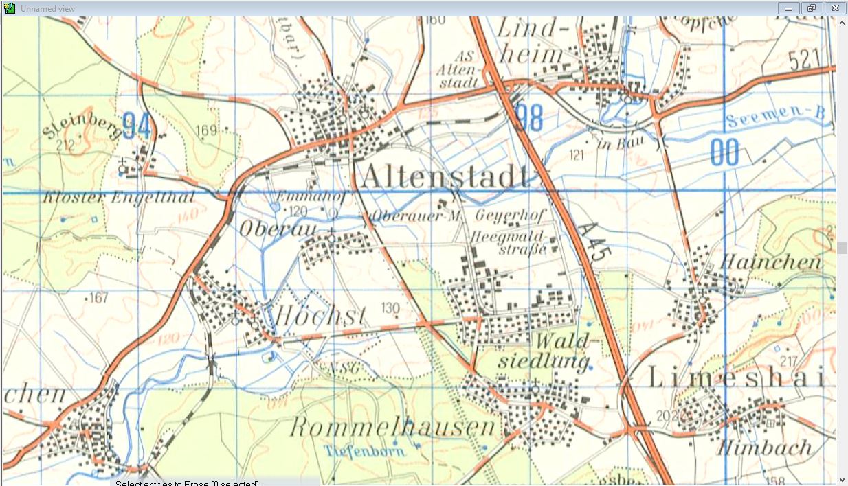
The subject is towns. Does anyone have a recommendation for how to do these towns like they are portrayed on the map below. Placing individual symbols would of course work* (and has the benefit of being a brute force and ignorance method) But its very tedious. There are probably all sorts of issues. (1) these are tiny (2) there are roads everywhere (3) to look really good, you have to rotate them, and (4) I'm sort of tired of just using the different shades of pink to portray built up areas.
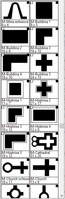
I tried Symbols in Area with the symbols found in Overland.FSC but it doesn't seem to work. I read the Command of the Week thread on it as well as the other thread I started, and all other threads dealing with it, but have failed to get anything to look even close to right. IN some cases, the symbols don't print. It seems some things I just have to learn everytime I use them.
I'd be okay with some generic ones that I could rotate. Most of the towns are about as big shown below, but some of course have very dense city centers and span several grid squares.
* But I do not have anywhere near Quenton's store of patience for such detailed work.
The subject is towns. Does anyone have a recommendation for how to do these towns like they are portrayed on the map below. Placing individual symbols would of course work* (and has the benefit of being a brute force and ignorance method) But its very tedious. There are probably all sorts of issues. (1) these are tiny (2) there are roads everywhere (3) to look really good, you have to rotate them, and (4) I'm sort of tired of just using the different shades of pink to portray built up areas.
I tried Symbols in Area with the symbols found in Overland.FSC but it doesn't seem to work. I read the Command of the Week thread on it as well as the other thread I started, and all other threads dealing with it, but have failed to get anything to look even close to right. IN some cases, the symbols don't print. It seems some things I just have to learn everytime I use them.
I'd be okay with some generic ones that I could rotate. Most of the towns are about as big shown below, but some of course have very dense city centers and span several grid squares.
* But I do not have anywhere near Quenton's store of patience for such detailed work.
Comments
All in all, it might just be easier to make a handful of small single poly shapes that are your houses, turn them into vector symbols, and place them one by one with your fingers hovering over the SHIFT and CTRL keys to continually scale and rotate between placings.
That second option would be more accurate too.
Of course, for a more generic map, perhaps I could make various sizes and orientations of towns, with "built in" roads and place them on the map more or less aligning the roads of the map with the town's roads.
This comes to mind from the game "sands of war":
I would also sort them by number of roads in and out of the hex, make 5-6 variants of each, and then sort them into collections that would be randomly chosen from when placing.
It would, of course, take more time upfront to create the symbol set, but in the long run it would probably save time.
Some good resources for guides on making your own symbol are in the Tome of Ultimate Mapping and Cartographer's Annual 2008 (volume 2) - February issue.
I'm sure there are others around if you don't have one of those.