

Hexes and 'Super' Hexes
 mike robel
🖼️ 15 images Surveyor
mike robel
🖼️ 15 images Surveyor
In the middle of the night (actually early this morning for me) I woke up thinking it would be neat to have a paper map that would be made up of large hexagons rather than individual sheets of paper. Obviously, there are no ready made large sheets of single hexes that will fit into a printer, so I thought putting it on an 11 x 17 (or larger) inch map, then "cropping" it to a "Super Hex" which I would then cut out. Then one would merely line up the hexes on the table to play.
For whatever reason, I thought this would made isometric maps a little easier to draw (at least for me).
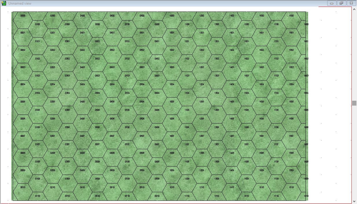
So, my first step was to make an 11 x 17 inch map sheet (in this case it will be 11 x 17 kilometers) and then put a 1km hex onto it. (first photo). I was somewhat amazed by the resulting hexgird because it lined up correctly vertically with the top and bottom edge of the map, but not the left and right sides. Usually when I make a grid, it overlaps it in all directions.
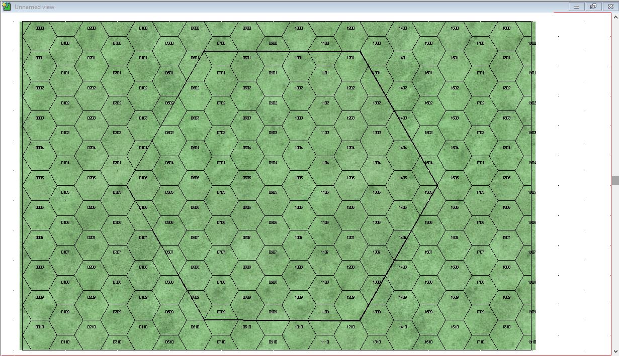
Then, I messed around until I got what looked like a properly apportioned 'super hex' placed. It seems to look right and scale right, but it makes me uneasy when I look at the middle left corner and then look at the middle right corner and note it does not end in the same way. But like I said, it seems to look okay and moving or rotating the hex didn't really seem to make it look right. Still, I think it will line up fine when you lay grids out on the table.
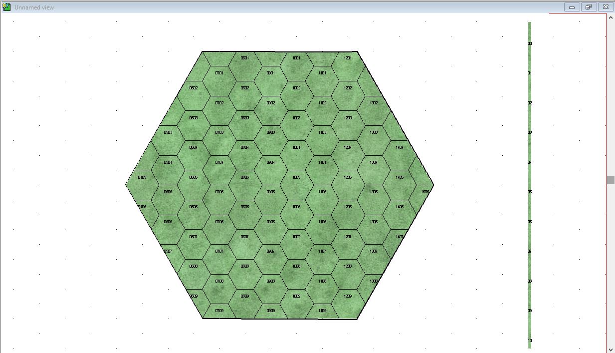
Then, because I want the map section itself to be a hex, I covered up the rest of the sheet with two white polygons although perhaps I could have used the Polygon within a Polygon tool, but that confuses me.
Is there another way to approach this? I know it is somewhat convoluted because one could certainly make isometric rectangular maps sheets to put together with a lot less effort.
Lastly, how to get rid of the box on the right hand side? Just extend the white polygon to fill it, even though the points are not on the hex grid?
We can also discuss why I think this is a good approach since it takes extra time to construct the sheet and I will have to cut them out by hand. But maybe it will make isometric maps easier for me.
Thanks
Mike
For whatever reason, I thought this would made isometric maps a little easier to draw (at least for me).
So, my first step was to make an 11 x 17 inch map sheet (in this case it will be 11 x 17 kilometers) and then put a 1km hex onto it. (first photo). I was somewhat amazed by the resulting hexgird because it lined up correctly vertically with the top and bottom edge of the map, but not the left and right sides. Usually when I make a grid, it overlaps it in all directions.
Then, I messed around until I got what looked like a properly apportioned 'super hex' placed. It seems to look right and scale right, but it makes me uneasy when I look at the middle left corner and then look at the middle right corner and note it does not end in the same way. But like I said, it seems to look okay and moving or rotating the hex didn't really seem to make it look right. Still, I think it will line up fine when you lay grids out on the table.
Then, because I want the map section itself to be a hex, I covered up the rest of the sheet with two white polygons although perhaps I could have used the Polygon within a Polygon tool, but that confuses me.
Is there another way to approach this? I know it is somewhat convoluted because one could certainly make isometric rectangular maps sheets to put together with a lot less effort.
Lastly, how to get rid of the box on the right hand side? Just extend the white polygon to fill it, even though the points are not on the hex grid?
We can also discuss why I think this is a good approach since it takes extra time to construct the sheet and I will have to cut them out by hand. But maybe it will make isometric maps easier for me.
Thanks
Mike
Comments
[Edit:] That looks more betterer. Had to reposition it to do what I really wanted,but it lines up correctly. Thanks!
The problem for me is isometric maps always look artificial to me and don't have the richness of a topographic map. But with the topo map, you are restricted to one layout. Grr.
http://forum.profantasy.com/comments.php?DiscussionID=9781&page=1
Thankfully, topo maps hold no mystery for me. I'm far from an expert but I'd be able to navigate from A-B with nothing but a quality compass & map. A valuable skill I learned as a Cub Scout Leader a few years ago...and a skill anyone who spends time in the outdoors should learn. It doesn't matter whether you just hike along known fire trails or the like, you should still learn to use a map & compass, even at basic level like me, and have same for the area with you at all times - you never know when conditions can throw you a curve ball...