

The Dwimmerhorn - my new dungeon mapping project.
 clithgow
Traveler
clithgow
Traveler
Greetings all!
I'm gonna dive back into a project after many months of lurking around and enjoying Ralfs live mapping videos.
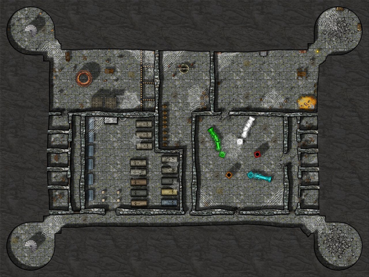
I want to put together a battlemap scaled plan of this complex:

The intent will be to import it into a VTT (Roll20) after its completed. The whole complex is about 300' (60 D&D square across) by 150'.Since I want to detail each buildings interiors up to a decent degree - probably like this:
so what I'm first worried about is the size. Do you think it will be unwieldy to be all on one map file?
The other way to go of course would be to simply map each building seperately. That would allow me to align each building nice and square to a grid too but it would take a way a little bit of immersion and force players into one map at a time (generally speaking.) Additionally, since I've not done any dungeon mapping before there would be the added benefit of it being in nice bite size project chunks.
Realizing there are lots of variables in performance from PC to PC and internet connections and how much lighting and such I set up - I just was hoping for some thoughts before I dive into one direction or the other.
Thanks in advance!
I'm gonna dive back into a project after many months of lurking around and enjoying Ralfs live mapping videos.
I want to put together a battlemap scaled plan of this complex:
The intent will be to import it into a VTT (Roll20) after its completed. The whole complex is about 300' (60 D&D square across) by 150'.Since I want to detail each buildings interiors up to a decent degree - probably like this:
so what I'm first worried about is the size. Do you think it will be unwieldy to be all on one map file?
The other way to go of course would be to simply map each building seperately. That would allow me to align each building nice and square to a grid too but it would take a way a little bit of immersion and force players into one map at a time (generally speaking.) Additionally, since I've not done any dungeon mapping before there would be the added benefit of it being in nice bite size project chunks.
Realizing there are lots of variables in performance from PC to PC and internet connections and how much lighting and such I set up - I just was hoping for some thoughts before I dive into one direction or the other.
Thanks in advance!
Comments
Then again, they also have a pretty crappy resolution by default (70 pixels per grid square), so no map on Roll20 following the guidelines really look nice at close zoom anyway.
For CC3+, a map of 300 by 150 foot is nothing, and shouldn't be a problem at all. That map of mine you showed as an example is 300 by 225. I used that as a battlemap in MapTool, but that can handle bigger file sizes than Roll20 allows. But exporting it at appropriate resolution for Roll 20, still let me get it small enough to fit there (Even though I personally don't think 70 pixels/grid square is good enough for me)
So, you should easily be able to map that as a single dungeon, which is probably the easiest approach, especially if you can live with your houses not having visible roofs since those kinda need to go when you want PC's exploring inside.
Say, I'm having an issue as I dive back in. I'm finding that the dungeon designer tools add room and add floor are taking a full 15 seconds from click to showing the menu for the first time. What can cause that?
The only reason I could thing about is if accessing the bitmaps used for the preview is very slow. This can be caused by a very slow drive, by your computer being out of memory so it needs to swap, or by your antivirus locking access temporarily while it scans the files on access. I would probably start by rebooting the computer, defragmenting the disk if it isn't an SSD and make sure both the system drive and the drive CC3+ is installed on do have a reasonable amount of free space, and if the issues continue, temporarily disable the antivirus (or at least on-access scans) and see if that helps.
However, I have come to the realization that I'm going to have to export each of the buildings as they're own .jpg file. I've got this much created:
Settings are 4200x2520 Pixel size, 70 pixels per inch, no anti-aliasing upon trying test exports I can't get this thing to spit out at anything less than 15MB - and I've got a 10MB limit with Roll20. Am I missing something? Or is this the file size limit issue you talked about, Monsen?
Thanks as always!
I also see that you are getting a lot of wasted space around the outside of the frame. Your settings might need to be tweaked to crop to map border. If that doesn't get rid of it the map border layer may have something on it that shouldn't be there. You can find out what's on it by hiding all but the map border layer (not sheet) and picking any tool then right clicking and choosing select all. There should just be markers around the outside extent of the frame. Sometimes I have accidentally ended up with quite a lot on the map border layer by mistake while I have been mapping, but it is no trouble to use change properties at that point to put all those other things back on their correct layer.
This opens the second dialog, where you can set the parameters of the export. You can see that when I exported my map I set both the height and width to the maximum length of the long side in pixels. It's just something I do to make sure there is enough space for the shorter side no matter what it is.
Look down at the bottom of the dialog and you will see several checkboxes. The one that will get rid of that white border for you (assuming that the map border markers are in exactly the right place) is the Restrict image to map border one that I have underlined. This will crop the shorter dimension to fit the box described by the map border markers on the map border layer.
The jpg quality was set to 90 - so my apologies. I thought I had set it to 75%, but apparently I didn't actually do it. It's right at the bottom there ringed in red.
[Image_15050]
Here is the file size of that very file:
You're welcome
If you ever end up in a mess with your settings done that way, the first thing to check is the map border layer to find out if there is anything in the wrong place.
Next up...mask that cage symbol so it turns into a round grate - or find a better one, not sure yet.
All the third party art packs are linked from the resources sticky thread at the top of the forum.
Orcs or goblins are going to use what they have. Humans and elves would construct something so they match.
@Loopysue Interesting that you can search dundjinni from directly within Roll20 and drag those assets directly in that app.
@Shessar - Thanks for the head up on that annual - I'll check it out.
@JimP - Its an orc stronghold, but older than that...I think the rusted look of what I found works pretty good.