Ricko
Ricko
About
- Username
- Ricko
- Joined
- Visits
- 6,928
- Last Active
- Roles
- Member
- Points
- 10,582
- Birthday
- February 7, 1977
- Location
- merlo san luis argentina
- Rank
- Mapmaker
- Badges
- 22
Latest Images
Reactions
-
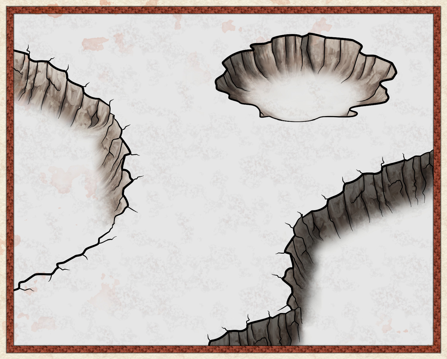
Craters for Mike Schley's maps
A good option might be the Dark Lands style crater, an Overland produced by Sue Richards. Just like the cliffs, this crater works very well with the Mike Schley style and vice versa.


-
Hey Everybody!
Welcome @RyanosRealm
I recomend Mr. Joe's videos, here is the link to the first one https://www.youtube.com/watch?v=eq5-T12055Y
These are the oldest videos on how to use the program, are very complete and are a solid foundation in using the program..
After these, on Remmy's channel https://www.youtube.com/@RemyMonsen or even on the official Pro Fantasy channel https://www.youtube.com/@ProfantasySoftware there are many more explanatory videos.
As for the rest and any other questions, we are here on the forum.
Salut!

-
[WIP] Elves v. Dark Empire
Hey Royal my friend! I am really impressed with the amount of detail in this map. It took a lot of time and work to arrange all these elements together. Congratulations! The transition from the background to the "civilized" part of the kingdom is very subtle and progressive.
The only suggestion/challenge is to listen to the words of the master @Dak and make all the trees by hand, one by one. Also for my understanding it is a monastic task - lol - and aesthetically where I notice the difference in the finishing.
Whenever possible, I usually use this technique to facilitate my work in speed, because giving variety to a forest or chain of mountains/hills is a task that really requires a lot of patience, but once it is automated, it is usually relatively fast.
So before I start drawing, I preselect all the mountains, hills and trees that I want (mostly) beforehand. One by one (group), I press the tab key incessantly until I "go back" through all the images in that segment (I don't know the technical terms, sorry).
Once I've done the whole process on all the mountains, hills and trees I want (including cities and buildings in case I want to make a cityscape for example) I start drawing.
Then I switch to the folder on the bottom left, the options (selected items) and work there more quickly, choosing the image I want to give more variety.
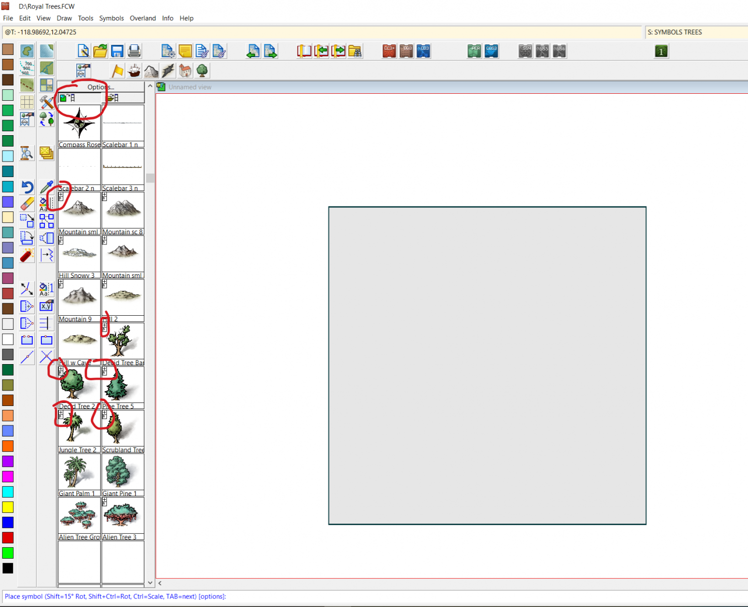
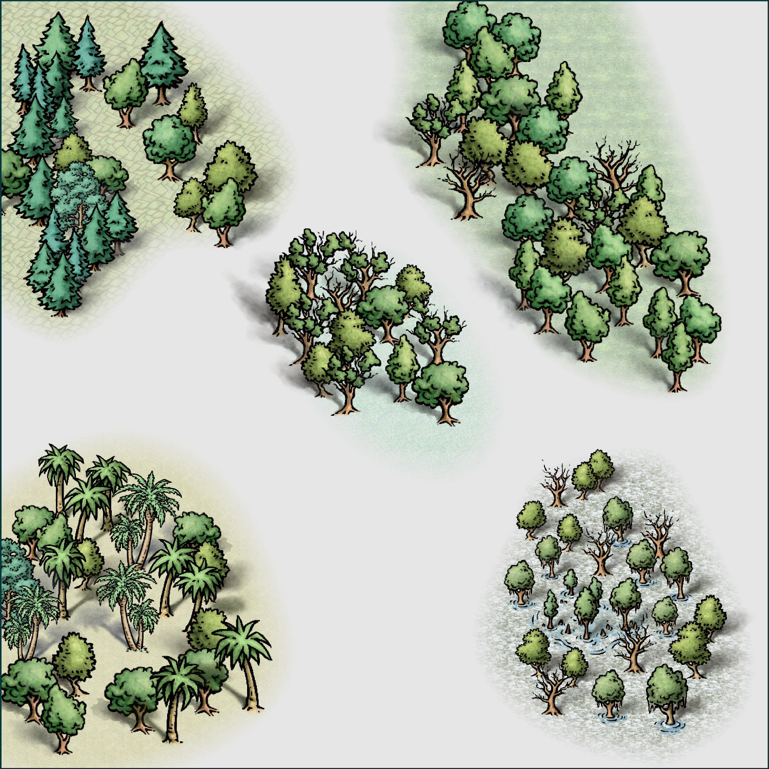
With the attached file, I made this quick image of five examples of mixing trees from different image sets to compose a certain vegetation environment.
Default terrains are just to "separate" the groups.


-
The Other DM Lucy Introduction
Welcome <3
Master @Quenten mentioned Mr. Joe's videos, here is the link to the first one https://www.youtube.com/watch?v=eq5-T12055Y
These are the oldest videos on how to use the program, are very complete and are a solid foundation in using the program..
After these, on Remmy's channel https://www.youtube.com/@RemyMonsen or even on the official Pro Fantasy channel https://www.youtube.com/@ProfantasySoftware there are many more explanatory videos.
As for the rest and any other questions, we are here on the forum.
Salut!
-
WIP Thyra