Ricko
Ricko
About
- Username
- Ricko
- Joined
- Visits
- 6,850
- Last Active
- Roles
- Member
- Points
- 10,580
- Birthday
- February 7, 1977
- Location
- merlo san luis argentina
- Rank
- Mapmaker
- Badges
- 22
Latest Images
Reactions
-
Community Atlas - Ezrute - Ukra Dor Pass
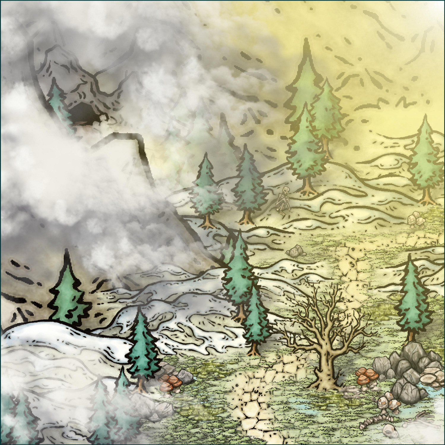
The idea for Azroun came to me after watching - long ago - a documentary about the dead left in the Everest Death Zone. What caught my attention was how many of the bodies remained in positions that resembled people resting, which gave an eerie feeling, almost as if they were still alive.
Some of these dead ended up gaining well-known names — such as Green Boots, Sleeping Beauty, and the Frenchman — and became landmarks on the mountain. This combination of constant presence and anonymity seemed interesting to me to apply to a fantasy setting.
So when I created the mountain pass that leads to Ukra Dor, I decided to include a skeleton sitting on the side of the road as part of the environment. From this, I created a quick mini-adventure, which may seem small, but has the potential to have a bigger impact on the valley or even the continent, depending on the players' decisions.
Cheers


-
Community Atlas - Ezrute - Fertile Valley
This scenario inspired me (again) to one day play there — or something similar — with my friends when we meet again.
I created a small introductory adventure, low level and without specific rules, to be easily adapted to any system.
The structure allows you to choose a side and fit it either in any village of the Bearers or in some distant corner of another world.
It comes with a free A1 Battlemap 😎
Cheers!
-
Top down campfire?
If I want something more realistic, I would definitely go for Forest or Winter Trail (or both), something more "cartoon" certainly Mike Schley who has even more icons for variations.
-
The adventures of Jack
As eccentric as this book is, I remember there is an RPG that my friends played in Brazil and talked to me about. Uncaging Nicolas - Players take on different versions of Nicolas Cage, representing characters from his filmography. The goal is to rescue a "main" version of Cage that is trapped somewhere in the cinematic multiverse and return him to his original film.

-
Spyro Giro - Another SpellJammer Map
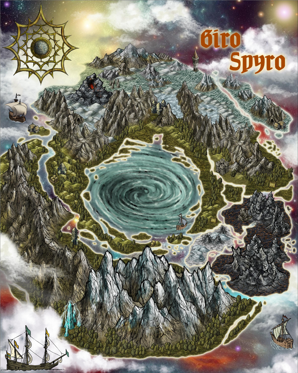
Finished image withou post processing
-
Spyro Giro - Another SpellJammer Map
-
Hex Crawl Test
north-facing cliffs are also a good addition to the style.
-
Community Atlas - The Ruins of Shurublau
The Ruins of Shurublau
In the heart of the peninsula, where the sun scorches the earth and the wind carries the sound of oblivion, lies Shurublau—a reliquary of power and sacrifice. Ancient ruins, now reduced to rubble, rest silently beside a lake of crystal-clear waters, unaltered by time.
No one who lives or passes through these lands dares to remember what once was. Only the foolish, the bold, or the beasts themselves know the secret of this place. Here, indecipherable runes—perhaps the writing of ancient deities or forgotten demons—still hold an enigmatic essence that has not been completely erased.
Some say it was a place of veneration of the ancient gods, a connection between the mortal world and the dark forces of the Abyss or elemental planes. Others whisper that it is home to an ancient and forgotten entity, from a time when magic was pure and blood-soaked.
A nearly invisible trail, hidden among dead bushes, misaligned rocks, and a parched pasture crying out for rain, wanders until it reaches this spot. Most of those who dared follow this path, driven by greed or the mad desire to unravel its secrets, disappeared without a trace. A few victims returned mute, almost as if their minds had been consumed by forces beyond this world, their stories reduced to frightened whispers and empty stares.
During full moon nights, the lake becomes a mirror of the magnificent sky, emitting a light of its own that seems to pulse with ancient life. Its glow is an invitation or an omen—a promise of forbidden knowledge or a dire warning of forgotten forces.
Game Play Suggestions - The Dangers of Shurublau
The greatest danger lies not in the ruins themselves, but in the forgotten forces that lie dormant—or awakened—there. The indecipherable runes guard an ancient essence, and an unknown force, perhaps an entity or a primordial magic, still protects the place. This force is unpredictable; it can manifest as paranoid visions, shadowy tendrils that attempt to grasp the soul of an intruder, or even a presence that slowly drains the lifeblood of those who challenge its defenses.
Furthermore, the relics and remains themselves may conceal traps—threads of ancient magic, protective symbols that trigger waves of deadly energy, or the vengeful spirits of priests and worshippers who sacrificed their lives there to seal or offer themselves to a greater evil. The chances of encountering dangerous creatures or spectral manifestations are also high, as the forces of the past do not accept invaders easily.
How to Defeat or Bypass Dangers
To face most of these threats, more than brute force is required: knowledge, intelligence, and respect for what you're up against are required.
• Study of runes: Deciphering or understanding inscriptions can offer clues to deactivating traps or appeasing spiritual forces. Using protective symbols or ancient magic helps create barriers against hostile manifestations.
• Use of magic or ancient artifacts: Protective magical artifacts, such as amulets or enchanted weapons, can prevent destructive energies from manifesting. Magicians or rune specialists can manipulate ancient energy to weaken the force protecting the location.
• Contacting the forces: A risky but potentially effective approach is to attempt to appease or establish communication with the dark force or entity guarding the secret, using specific rituals or incantations.
• Operate with caution and speed: Most dangers arise when the intruder overreacts or delays too much. Swift attacks, diversionary strategies, and caution when exploring the ruins can prevent evil forces from being fully awakened.
The Treasures of Shurublau
Despite the danger, the ruins hide riches of unimaginable power and value in the right hands:
• Artifacts of ancient power: Relics of gods or ancient beings, enchanted weapons, and amulets that glow with their own energy, capable of granting special abilities or enhancing magical powers.
• Runes and writings: Scrolls, inscriptions, and symbols with the potential to unlock forgotten magic—if one can decipher them and use them wisely.
• Magical crystals and minerals: Stones that store energy, capable of channeling ancient powers or serving as components in spells and rituals.
• Secrets of blood magic: Relics and remains that offer access to primal magic, a force as pure as it is dangerous, capable of altering realities or awakening dormant forces.
-
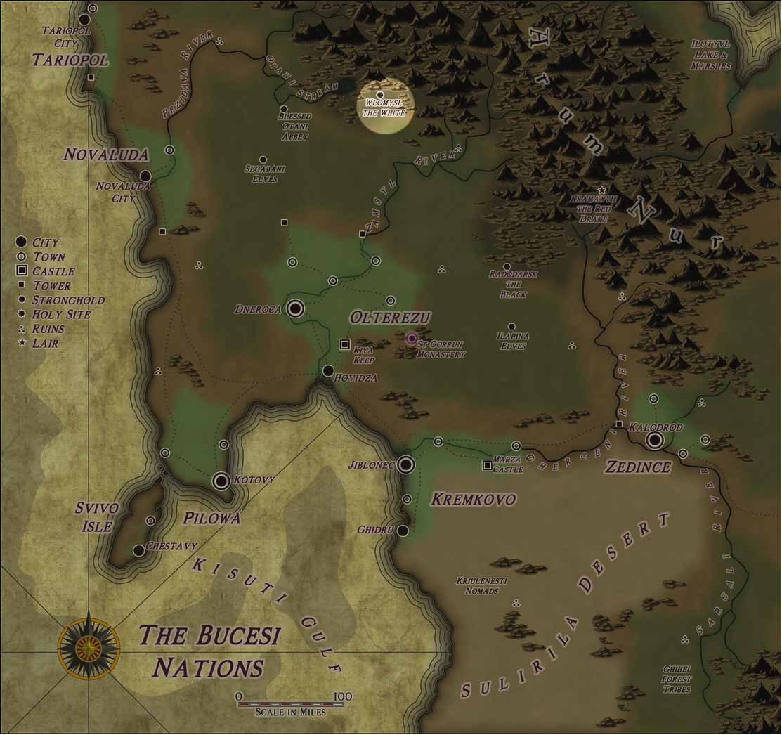
cOMMUNITY ATLAS - The Bucesi Nations - Wlomisl the White
My new habit now is to invade Master Quenten's maps to add something. This time, creating an NPC for this environment and, why not, another map for the community atlas.
-
Community Atlas - Alarius - Environs of the Southern Scar - Haas