Ricko
Ricko
About
- Username
- Ricko
- Joined
- Visits
- 6,850
- Last Active
- Roles
- Member
- Points
- 10,580
- Birthday
- February 7, 1977
- Location
- merlo san luis argentina
- Rank
- Mapmaker
- Badges
- 22
Latest Images
Reactions
-
New user from the Netherlands, nice to meet you all!
I always have 3 morning tasks on the computer every day (they are not in order): world football game schedule, my email and the pro fantasy forum 🤣


-
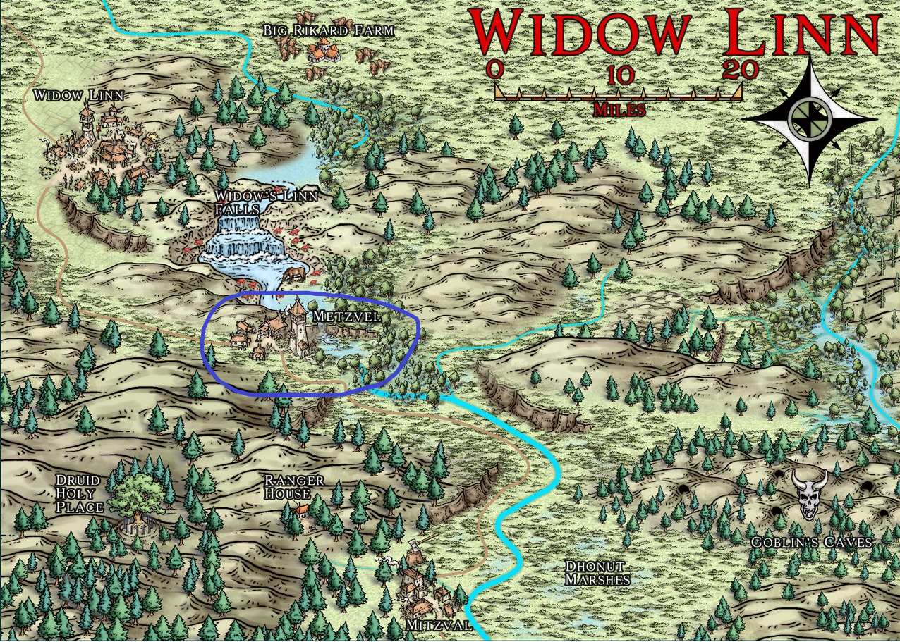
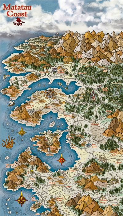
Community Atlas - Irisian City States - Dimitrios island
I'm primitive and have little knowledge of computers in general, these windows with lots of numbers and information make me afraid of clicking on something and deleting everything, completely unconfigure and I can never go back to the default stats or blowing up the machine😅

-
floathing Island and Babel Tower style city
Some time ago I made a "similar" image. Due to the absence of floating islands in the CC3 images, I also inverted a mountain for this purpose.
-
Community Atlas 1000th map Competition - with Prizes [August/September]


-
Hex map
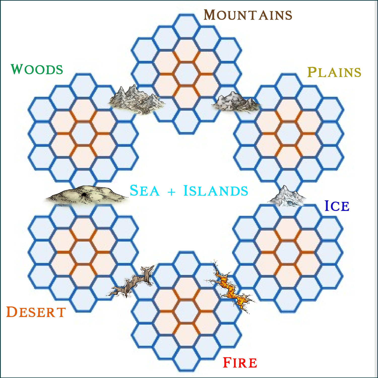
"something" like that.
the idea of using the icons of the intersections between the "kingdoms" as if it depended on a passage from one to the other.
Or... yet another possibility would be to use different races/cultures/construction colors in each sector.
-
The Lands of Strauvuvrorr
a large pack of structures expansion for Spectrum overland would be amazing
-
Community Atlas: Lonely lighthouse environs - fisher island - fonlorn arquipelago
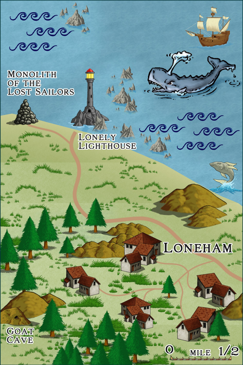
Where the reefs rise like the teeth of a sleeping leviathan, the Monolith of Lost Sailors stands. A pile of dark rocks and reefs, each bearing the weight of a soul swallowed by the sea before the Lonely Lighthouse was built.
It is said that ancient fishermen began to build the mound in memory of those who never returned, each stone a silent epitaph. But legends whisper that the monolith grows alone, fueled by the cries of victims the ocean will not forgive.
On stormy nights, the winds carry wailing voices that can be heard from the nearest hamlet, and those who dare approach swear they see spectral figures wandering among the rocks.
-
[WIP] Community Atlas: Kumarikandam - SE Tiantang Region
This time, Master @Quenten sent me to map an "eastern" region. I chose the Empire of the Sun style to create the overland map and then I will use Mike Schley's new oriental images to create the smaller plans within this first map. The names have Chinese influence.
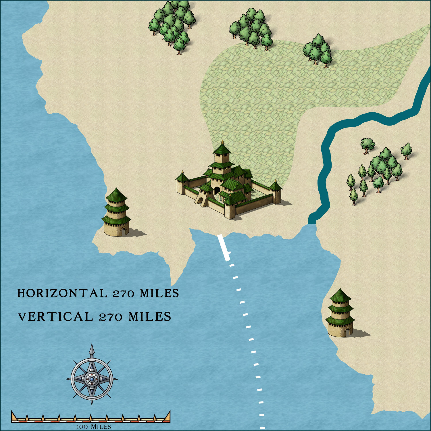
My little piece of land in its original image at 270x270 miles.

-
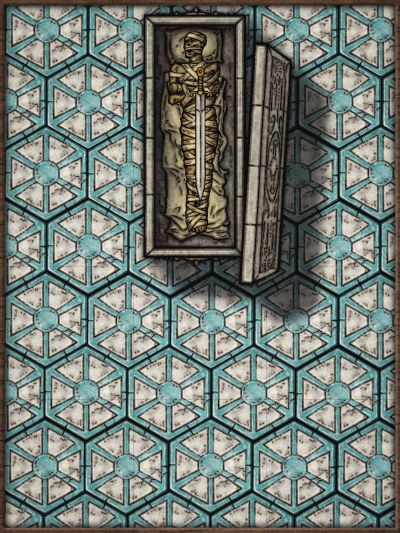
Community Atlas - Tombs - Fonlorn Archipelago - Bleakness - Plains of Ash
-
Community Atlas - Tombs - Fonlorn Archipelago - Bleakness - Plains of Ash
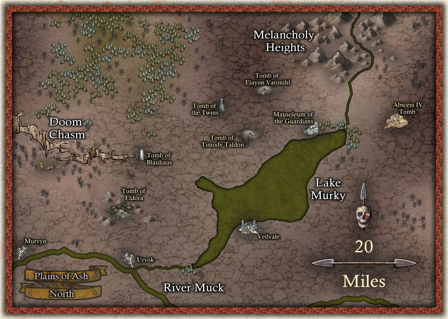
Plains of Ash - North
The winds that sweep across the Plains of Ash carry with them the unbreathable dust of volcanic eruptions, sometimes bringing with them the voices of the ancient dead - whispering tales of forgotten times. Once known as the Plains of Dawn, these lands were a verdant paradise, where rivers danced silver in the sunlight and forests rose in reverence to the heavens. The great Murky Lake reflected the vastness of the sky, its crystalline mirror nourishing life in all directions.
These were times of glory and life. The tribes that inhabited these lands saw them as a gift from the gods. It was sacred ground, where only the noblest sorcerers and warriors deserved to rest in their tombs. The ancients said that the spirits of these honored dead rose on nights of the full moon, watching over the crops, spreading their strength across the fertile soil. The power of the past flowed like invisible blood through the roots of the trees and through the golden grains of the fields.
But the old gods are capricious and merciless.
The Great Hecatomb came, and the earth roared like a caged beast, the mountains convulsed, spewing fire and destruction in every direction. Columns of black smoke rose like pillars from the underworld itself, and a storm of ash fell upon the earth, suffocating all life. Lake Murky bubbled in its own death, its waters poisoned by sulfur. The rivers became putrid veins, winding through the barren land, dooming any form of existence that dared venture there.
Now, the Plains of Ash are a wasteland of desolation. The ground is hard as iron, cracked and barren. Charred trees rise like twisted specters. The sky, often veiled in sulfuric mists, refuses to shine over this cursed place. The few who dare to cross this land swear they hear voices carried on the wind—murmurs of the ancient warriors and sorcerers who rest there, perhaps furious that their rest has been disturbed, perhaps still watching over something deep beneath the scorched earth.
Are their tombs strong enough to withstand the eruption? Do the spirits of old still lie sealed beneath the ashes, or have they awakened as dark guardians of a forgotten realm?