Ricko
Ricko
About
- Username
- Ricko
- Joined
- Visits
- 6,851
- Last Active
- Roles
- Member
- Points
- 10,580
- Birthday
- February 7, 1977
- Location
- merlo san luis argentina
- Rank
- Mapmaker
- Badges
- 22
Latest Images
Reactions
-
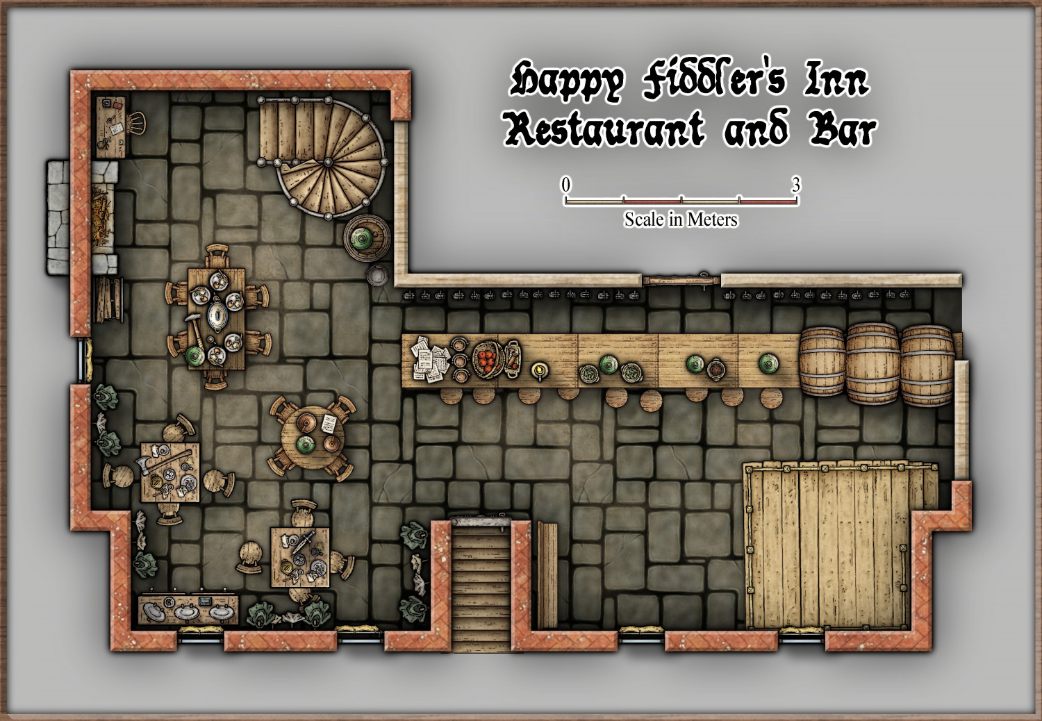
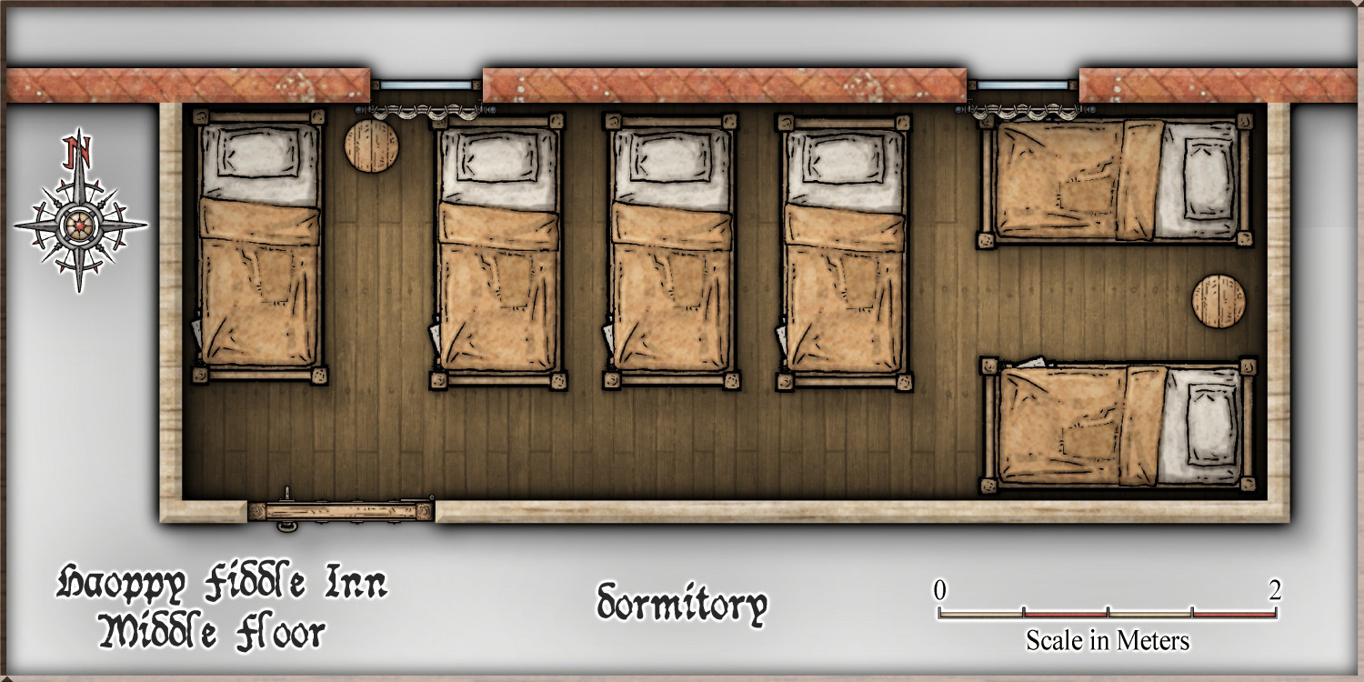
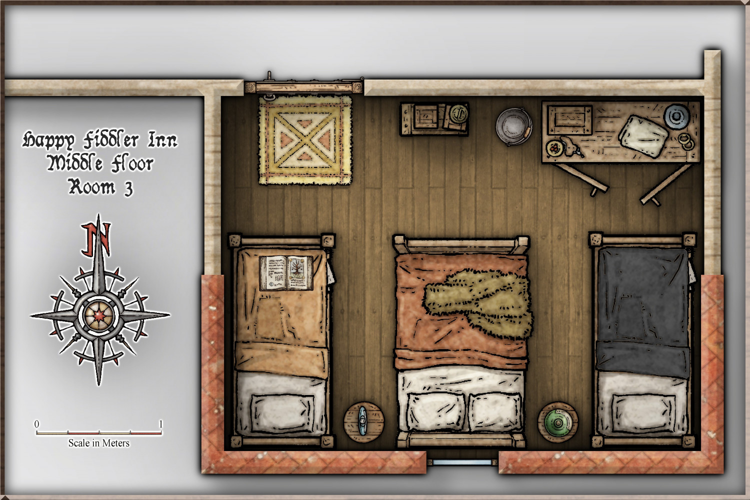
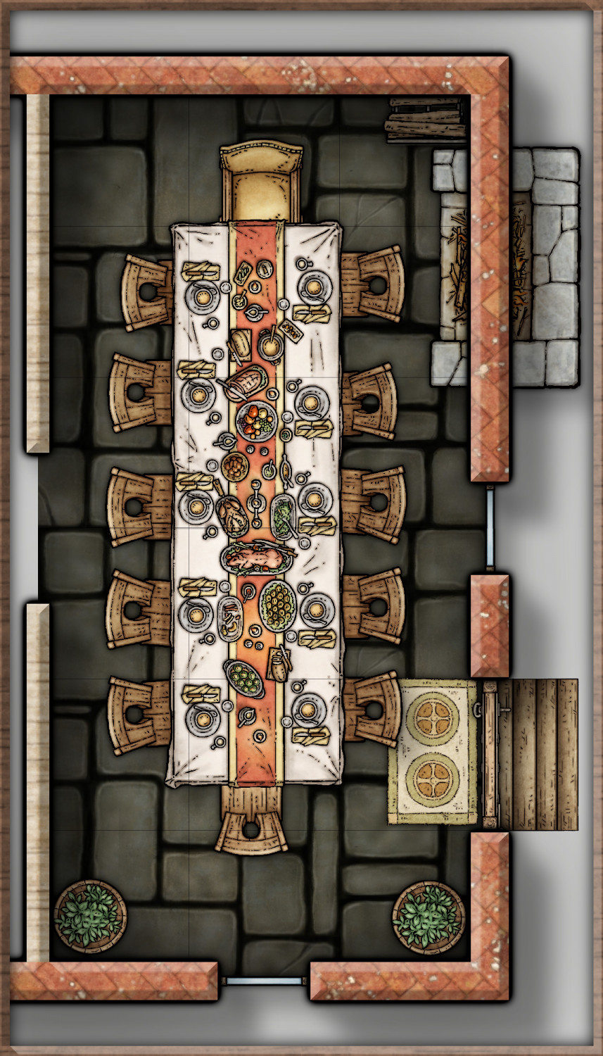
Community Atlas - Torstan Holy District - Happy Fiddler's Inn - a joint collaboration.


-
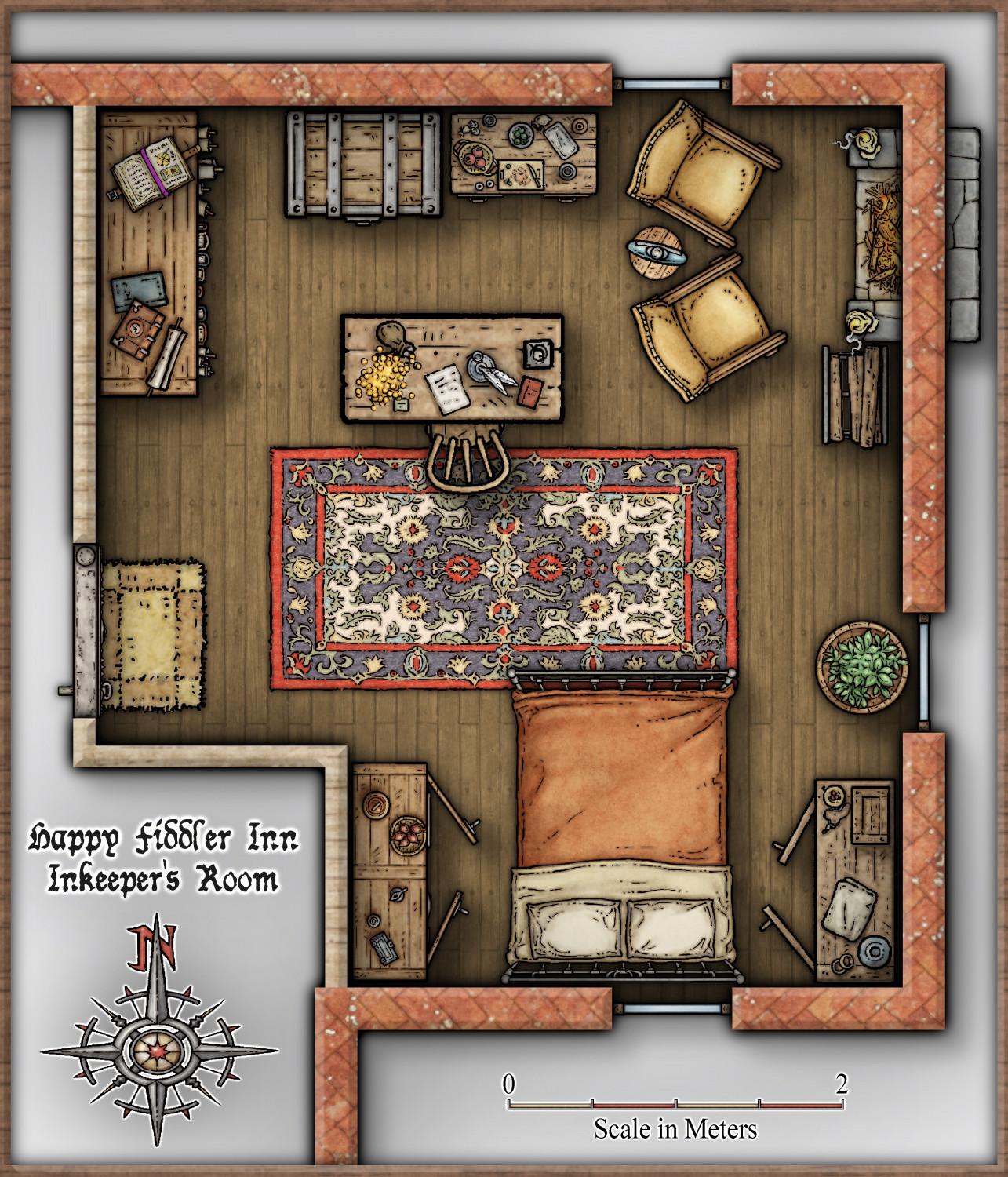
Community Atlas - Torstan Holy District - Happy Fiddler's Inn - a joint collaboration.
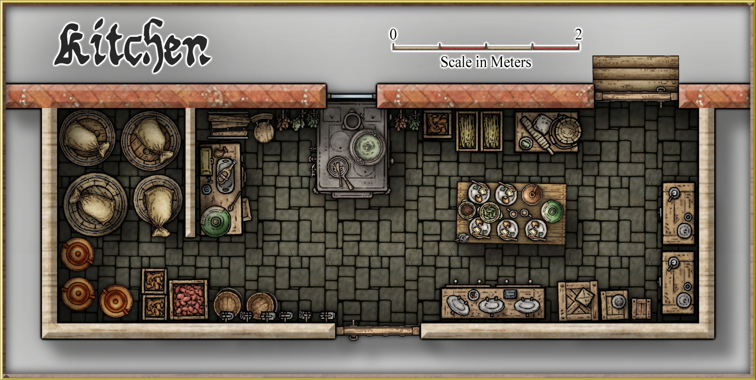
Now the kitchen version with the missing door fixed. @Quenten
-
Community Atlas - Torstan Holy District - Happy Fiddler's Inn - a joint collaboration.
And with this we finish the Ground Floor. Let's go underground.
-
Community Atlas - Torstan Holy District - Happy Fiddler's Inn - a joint collaboration.
-
Community Atlas - Torstan Holy District - Happy Fiddler's Inn - a joint collaboration.
-
Community Atlas - Torstan Holy District - Happy Fiddler's Inn - a joint collaboration.

-
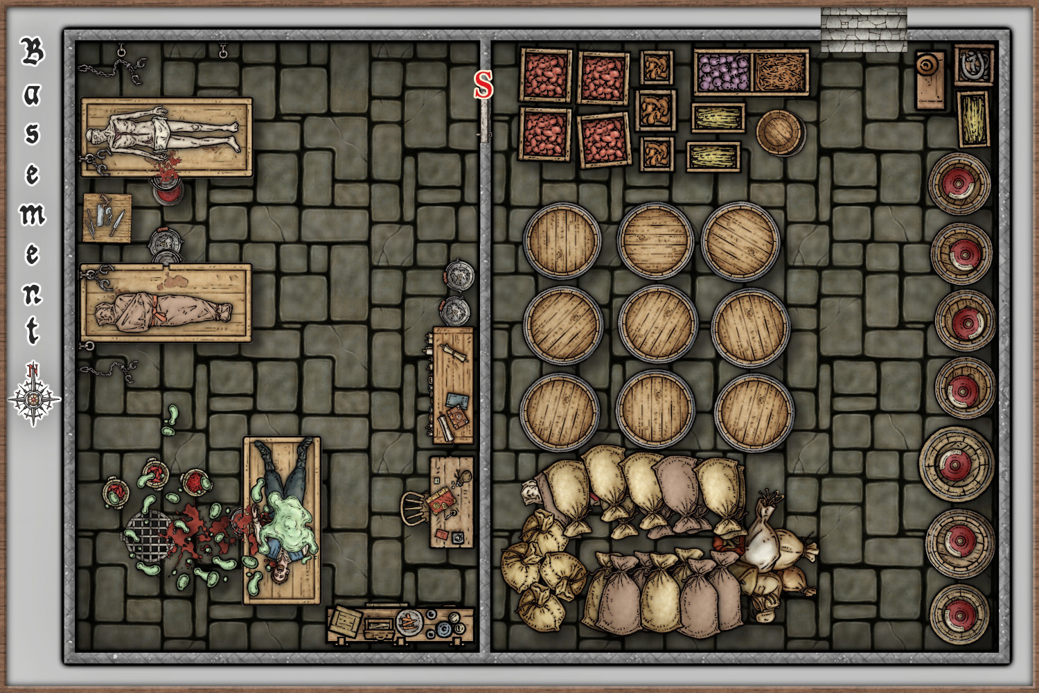
Community Atlas - Torstan Holy District - Happy Fiddler's Inn - a joint collaboration.
After discussions, we decided on changes to Basement. Here is the new version.
Cheers

-
My first completed map utilizing CC3+
@OwlishlyTaboo i have same perception of @Wyvern on #3.
When this situation happen to me - and is most part of the time, i adjust the proportion not by numbers but by visual (not zooming in), simple way: i select a mountain, hill etc already placed and compare with the new selected one.
When i get the "correct proportion" i continue mapping.
in last few weeks i start a new usual behaviour in those situations, i write on paper all main sizes (and color number used... plus you can add size/color records to background, medium ground and fore ground on map):
back ground middle ground (optional) fore ground (optional)
mountain : 0,5 color 35
hills : 0.4 color 37
tree : 0.35 XXX
city : XXXX XXX
This helps me remind fast witch size/color i use as base refference in a great size scenario.
Nice Work mate, keep on!
Cheers

-
Small Landscape - Newest Mr. Schley Art
its nice idea, but in this map i selected sea as first back ground to use at same time as sky and river.
Just added symbols and then a small portion of land on low border... i forgot to use edge stripes.
Cheers


-
Magic Mushrooms Valley
this is another user brother Darwin XD