Ricko
Ricko
About
- Username
- Ricko
- Joined
- Visits
- 6,854
- Last Active
- Roles
- Member
- Points
- 10,580
- Birthday
- February 7, 1977
- Location
- merlo san luis argentina
- Rank
- Mapmaker
- Badges
- 22
Latest Images
Reactions
-
Quo Vadis Monthly Symbols?
Since pro fantasy chose to release new monthly content focused on the Dungeon/battlemap style, I suggest considering elements where action takes place.
I would think of it as something very useful for future releases, villain stuff like cemeteries, necromancers, ancient libraries, temples, ruins, statues of unholy gods, more sarcophagi, dead bodies, items (magical or otherwise) like axes, gloves, bows, crossbows etc... Elements very useful in the elaboration of more characterized battlemaps.
Added to this in the concept of cities, I would not fail to evaluate the launch of Asian (Japanese - Chinese) constructions, which was the most requested topic in Overland's suggestions.


-
Snowy lands
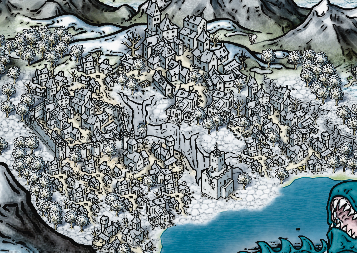
some details zoom 100%


-
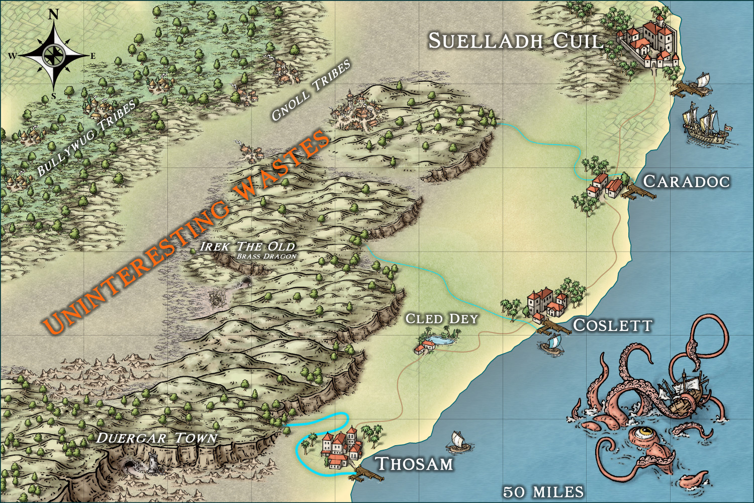
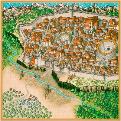
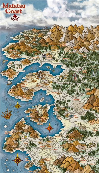
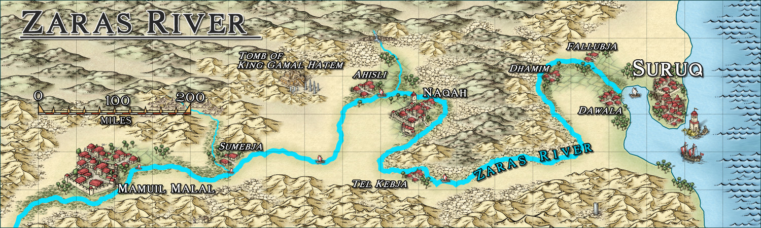
Community Atlas - Berenur - Urtrah Desert
-
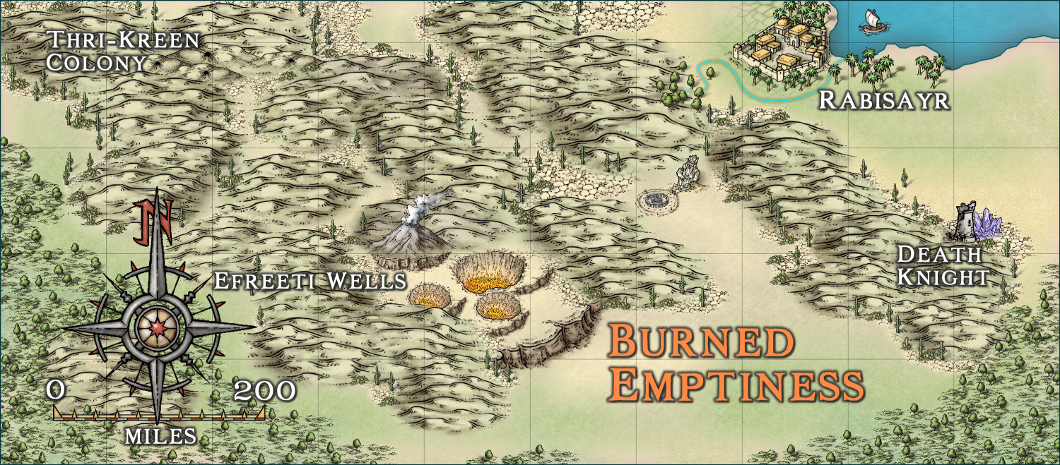
Community Atlas - Arthenn / Berenur
-
Community Atlas - Arthenn / Berenur
-
Community Atlas - Berenur - Urtrah Desert
Thanks @Glitch .
When I'm about to start making a zone map for our atlas, I always imagine myself as a cartographer hired by the head of the area or just a traveling tourist.
So before starting, I create a tourist itinerary where I describe the main points of my trip. You never finish knowing every place you travel to so there's always something missing for the next traveling cartographer.
Unfortunately I live many years far away from my group that we have been playing with for over 30 years. In this rpgistic solitude I only have the maps to ease my creativity and create stories for when we meet next time.
Karkaroff region and Shrimp Tony are the last 2 brand new little sagas. (i make the adventures now in tv series format, more easy. we meet... i master around 6 chapters and finish a season with a conexion to the next one)
-
Karkaroff region
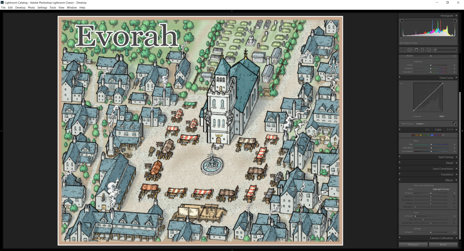
- original image open on light room no effects

-
Karkaroff region
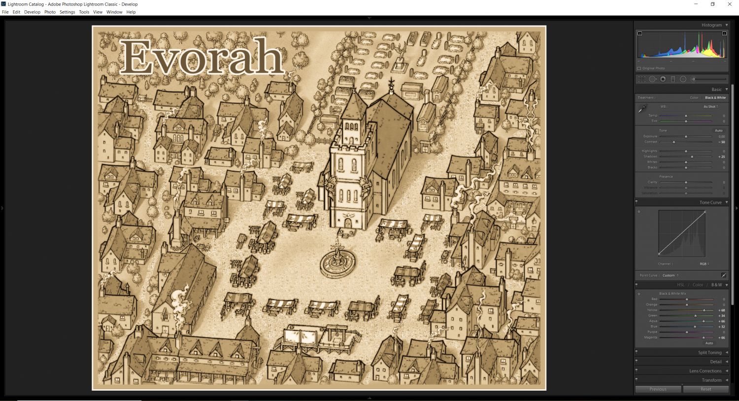
2 after some adjustments i have sepia image.
note on top right is selected default "black and white"
-
A Village
yes 🤣😅

-
Rotate by a specific number of degrees
Control + Shift allow you to smooth rotate and angle as you want in visual mode.


![[Deleted User]](https://secure.gravatar.com/avatar/c75d9a245b74d9c59be0999ea81ca541/?default=https%3A%2F%2Fvanillicon.com%2F92add7f8c954488718110edc4896ad39_200.png&rating=g&size=200)