Quenten
Quenten
About
- Username
- Quenten
- Joined
- Visits
- 8,145
- Last Active
- Roles
- Member
- Points
- 3,110
- Birthday
- November 29, 1950
- Location
- Australia
- Real Name
- Quenten Walker
- Rank
- Mapmaker
- Badges
- 16
Latest Images


Reactions
-
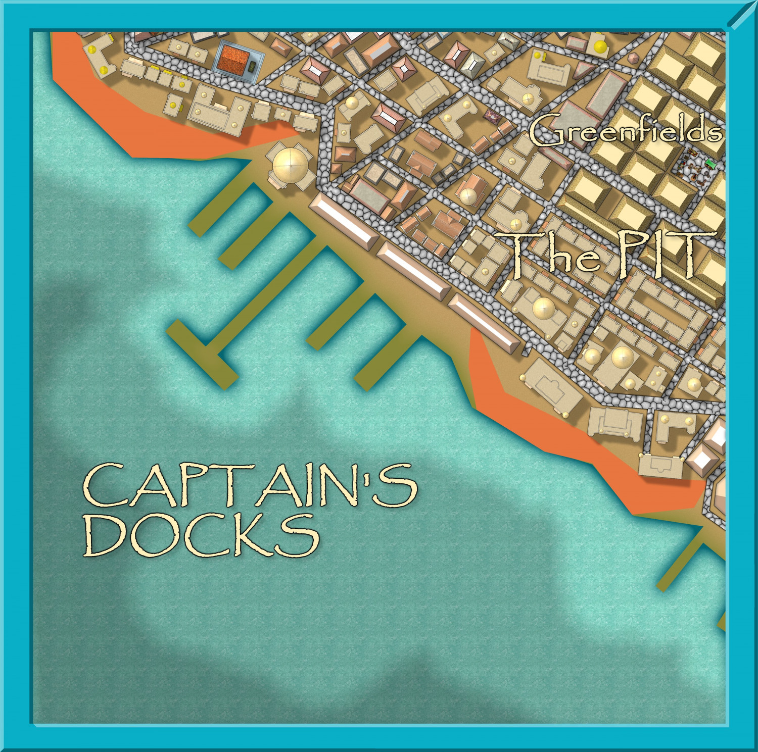
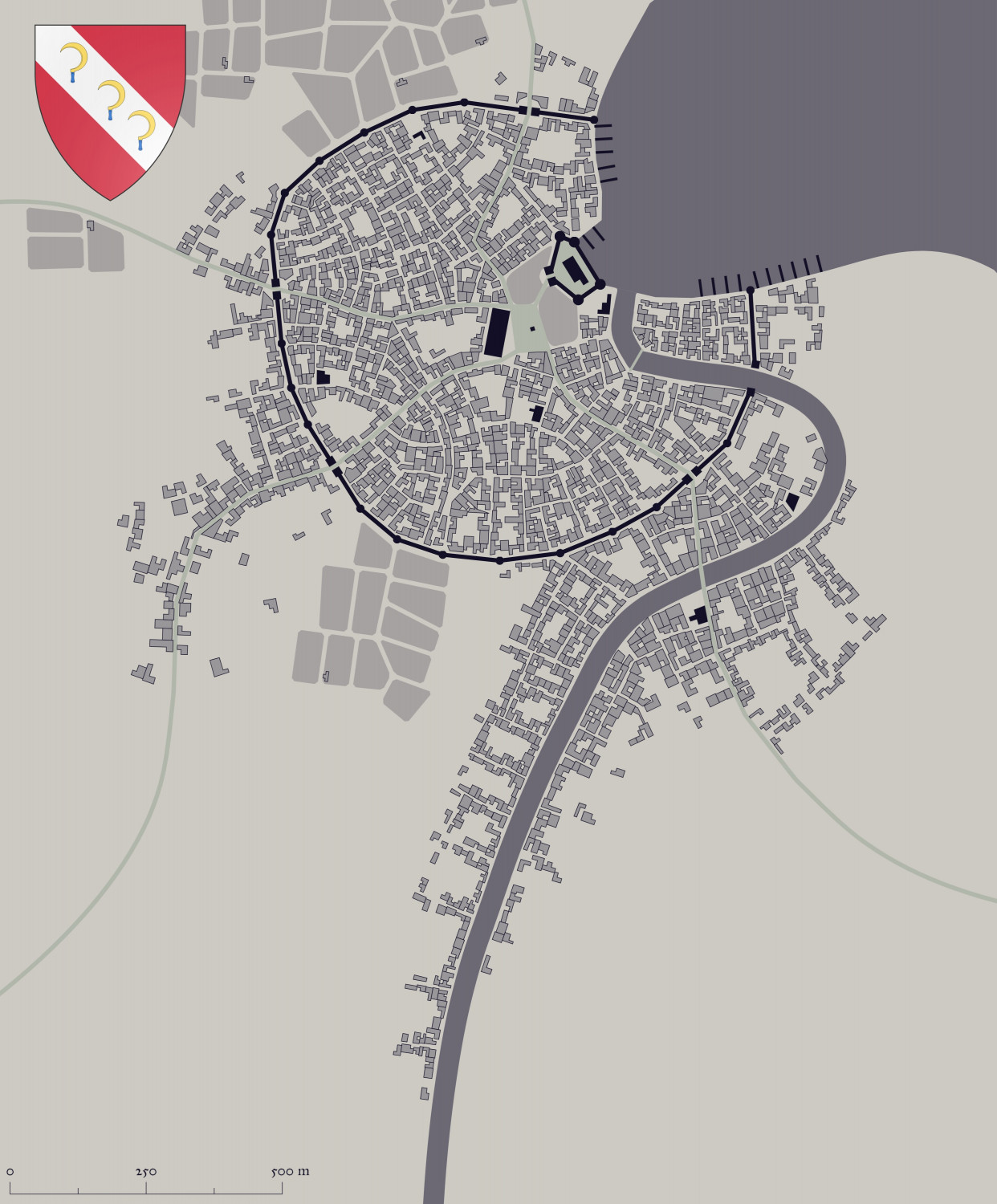
Community Atlas - Stromphe City - Captains Dock District
I am on my way to completing and submitting yet another district to the Stromphe City map. all the buildings are in, now just for the non-building features.


-
Watabou City REVISED (annual 157)
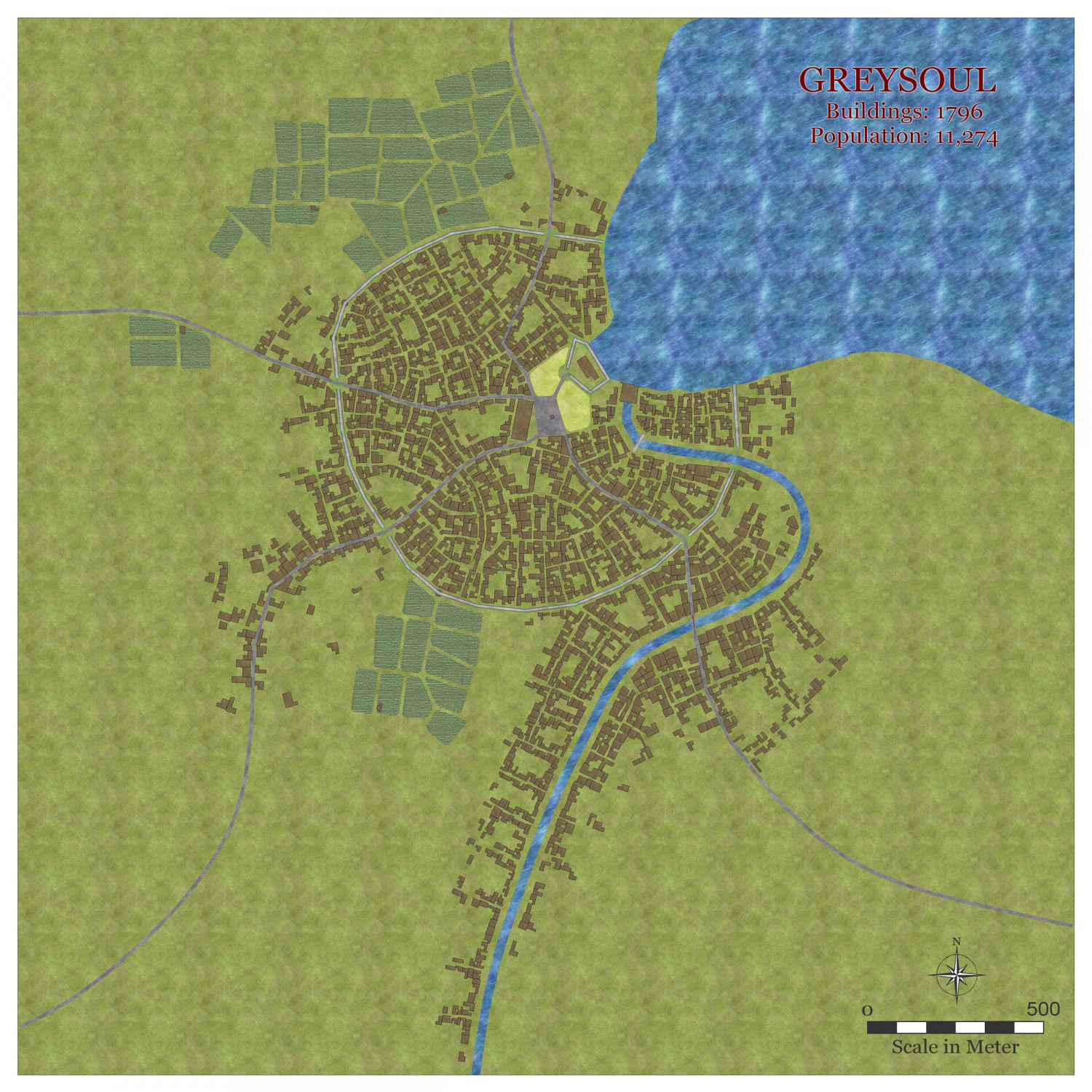
This took less than 10 minutes to go from starting to insert the DXF to this. I have solved the problem of the road and river - it lies in the original setup of the map to export as SVG - make sure river and roads are NOT outlined. Even if they seem to disappear, they will be present on your svg, therefore DXF.
Once I am completely satisfied with the whole process, i will upload the whole process along with a new Template and DrawTools for both metric and (ugh) imperial. And the fills I use for the fields.
I will be renaming the CITY BLOCK sheet to SYMBOLS BUILDINGS.


-
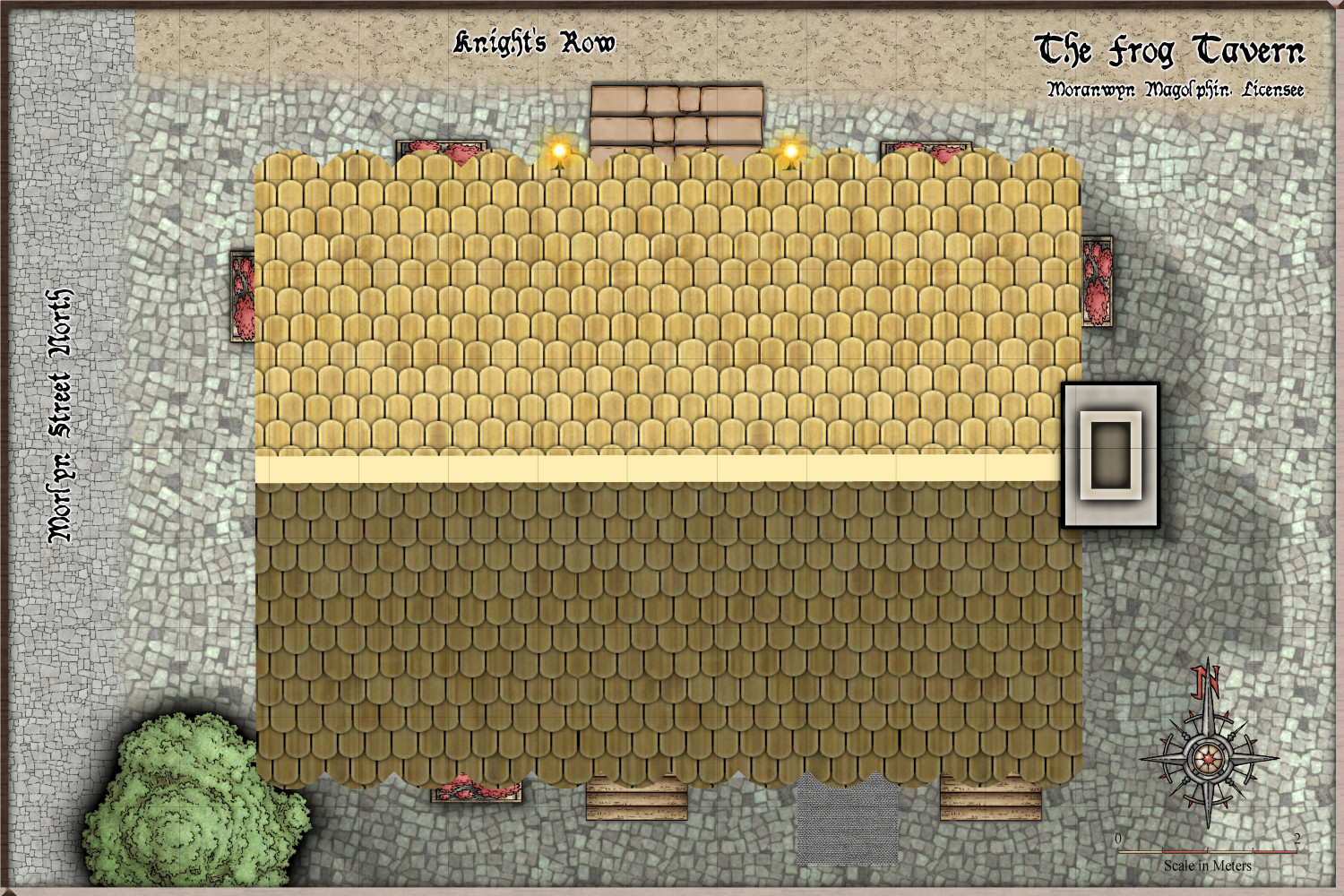
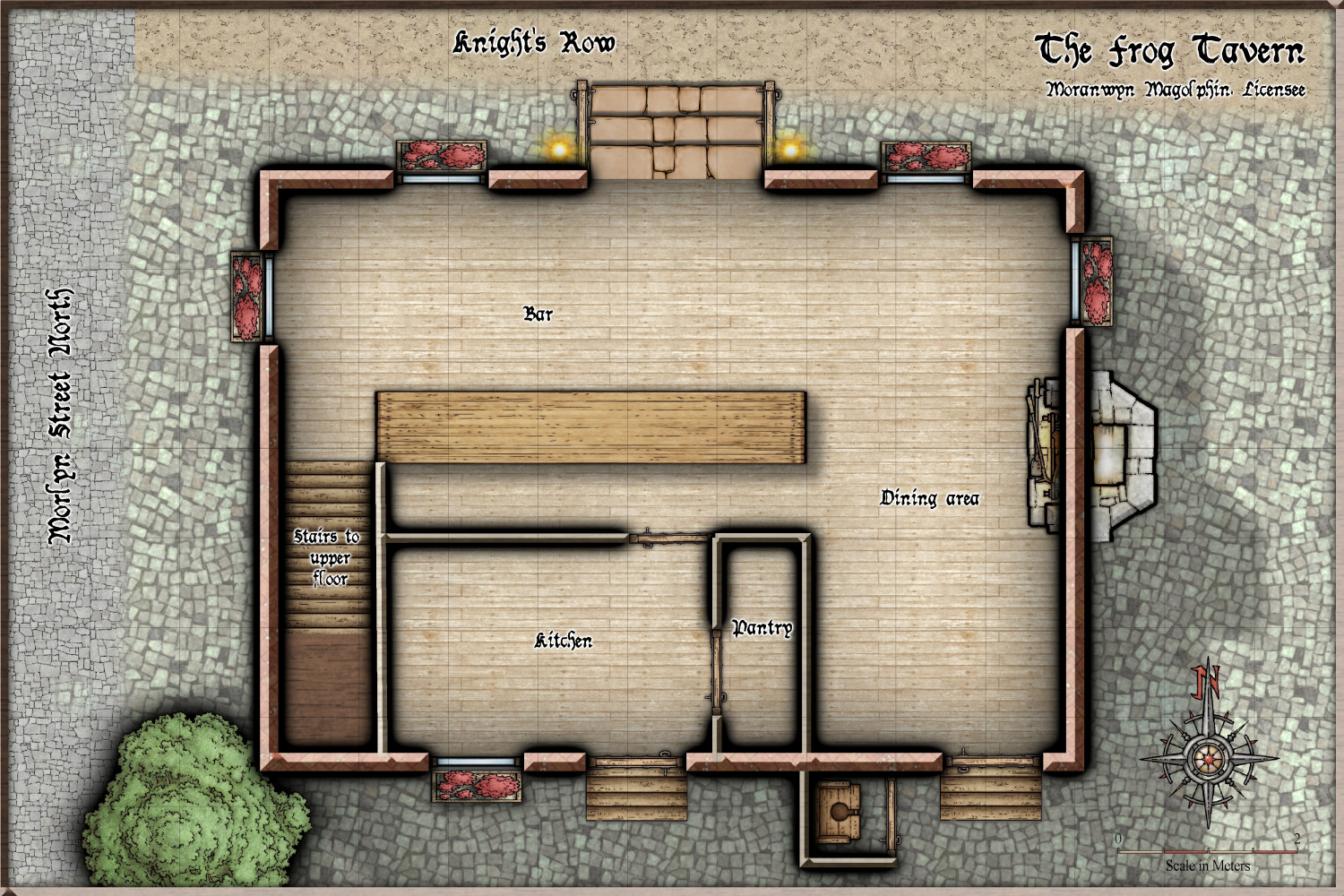
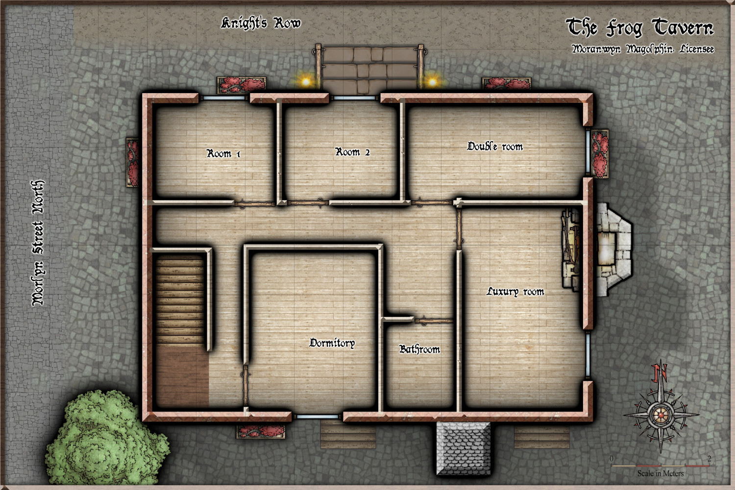
Community Atlas - Torstan Holy District - the Frog Tavern - a joint collaberation
Hi everyone. @Ricko and I are doing a joint project for the atlas, with myself outlining the outward structure is a tavern, and later, an inn, and Ricko will detail all the rooms, in the MS SS4 style.
The Tavern is N0 97 on the Holy Head District map - the Frog Tavern. (Peredur, Kingdom of Ruma Helrevy)
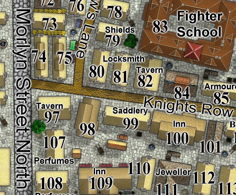
Here is the roof, Ground floor and Upper floor. A basement will be added later.
I leave the rest to Ricko.


-
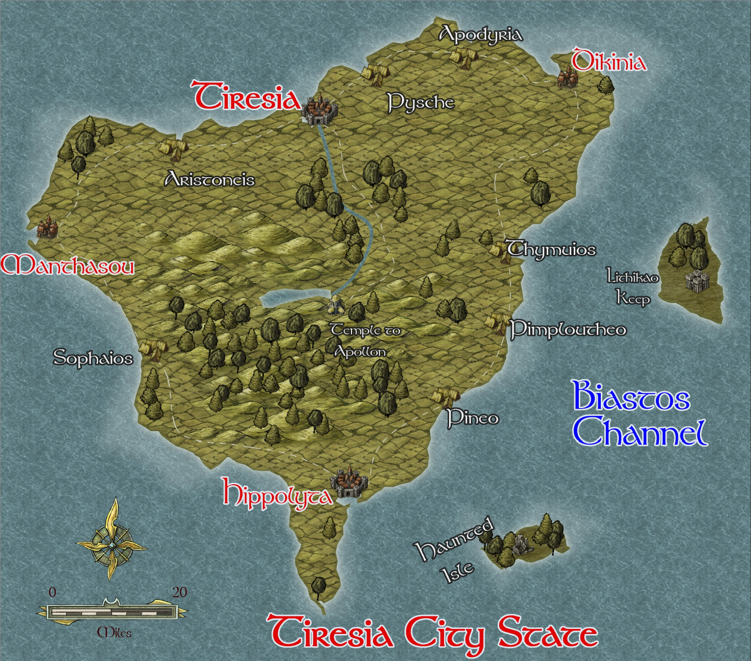
Community Atlas - Irisian City States - Tiresia City State
I have decided to map all the islands in the irisian City map style while I am waiting to get my new computer back from the repairers under warranty. Since I have to send it to the manufacturers - overseas - it will only take 6 weeks - outrageous!!
Anyway, here is the first - the biggest of the remaining islands, Tiresia City State, which has hegemony over the whole island. It is mainly agricultural and fishing, and is the least wealthy of the City States. It is also the closest to the hostile Kingdom of Helmonte.
I am using the same style as I did for Helmonte - Herwin Wielink, not my favourite style by a long shot.
This is the beginning of the map - interesting features to be added later.
-
Community Atlas - Irisian City States - Xenothon and Demydice Isles
I think this is finished, but await further suggestions. Map notes to come.
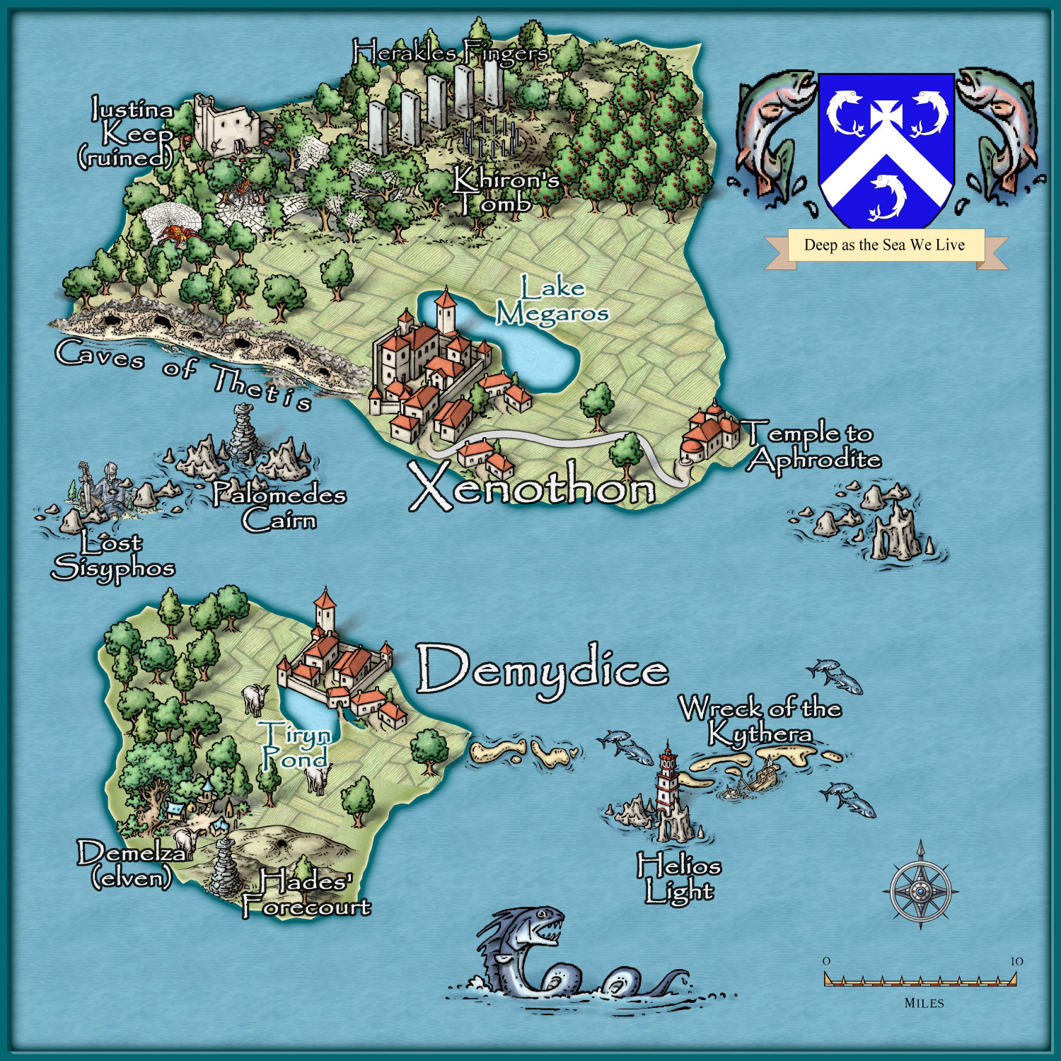
Three islands to go.


-
Community Atlas - A huge metropolis somewhere
Here is progress on the Palace area. Next will be the other area.
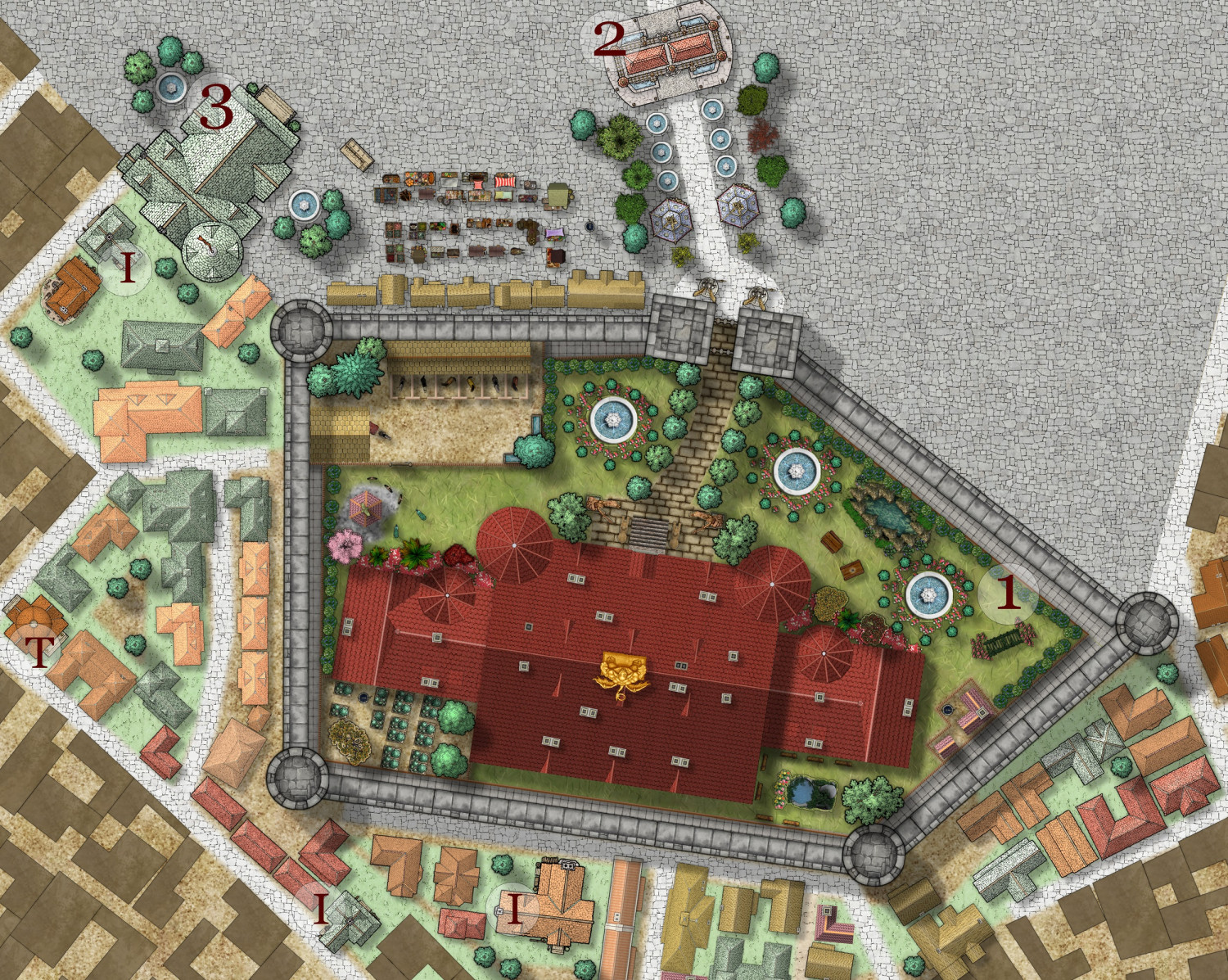
I = Inns and Taverns
T = Temples and Shrines
1 = Palace
2 = Triumphal arch
3 = City Hall

-
Ancient Realms revised - a test map with new icons
I have decided to revisit this style myself - it is a favourite of mine, especially with the use of icons. I was delighted that Ralf showed how to make new icons, so I have been making some for myself.
I have decided that even the major settlements will be represented by icons rather than usual symbols - just for fun.
Here is the beginning.
I am happy to share the icons if anyone wants them - all from free images on the internet.
Here are the 4 I have done so far:

-
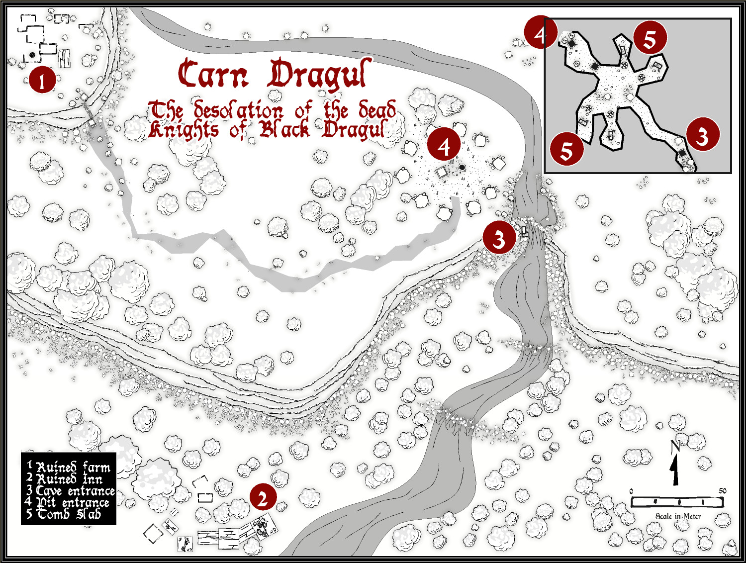
Carn Dum - using Inked Ruins annual
This is a slightly updated version, ready to go into the Atlas.


-
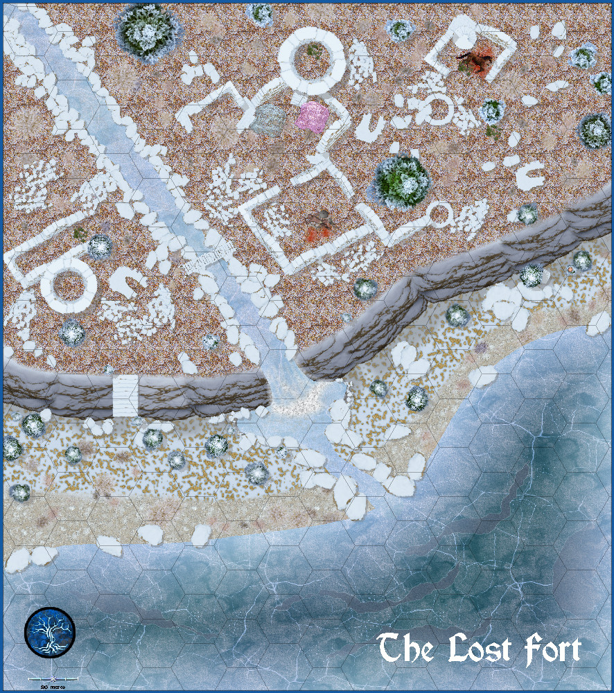
Community Atlas - Alarius - North Central Region - Silver Spring - battlemap
Here is the Lost fort region - I am a bit happier this time - critique welcomed.

-
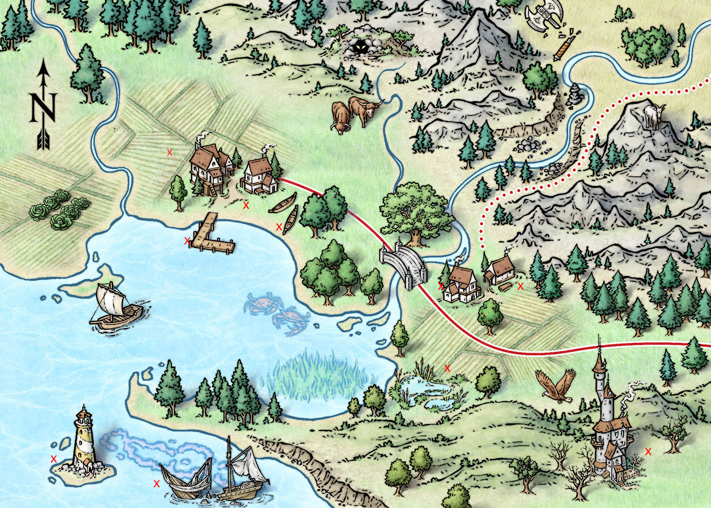
Schley Symbols - MUST HAVE!!
Just saw this map by Mike Schley on his FB page. I have marked with a red cross the overland building symbols not present in the ProFantasy suite of Schley symbols, which I absolutely love. Can I persuade Ralf to persuade Mike to make them available for proFantasy? <On knees , begging>