


Quenten
Quenten
About
- Username
- Quenten
- Joined
- Visits
- 8,145
- Last Active
- Roles
- Member
- Points
- 3,110
- Birthday
- November 29, 1950
- Location
- Australia
- Real Name
- Quenten Walker
- Rank
- Mapmaker
- Badges
- 16
Latest Images


Reactions
-
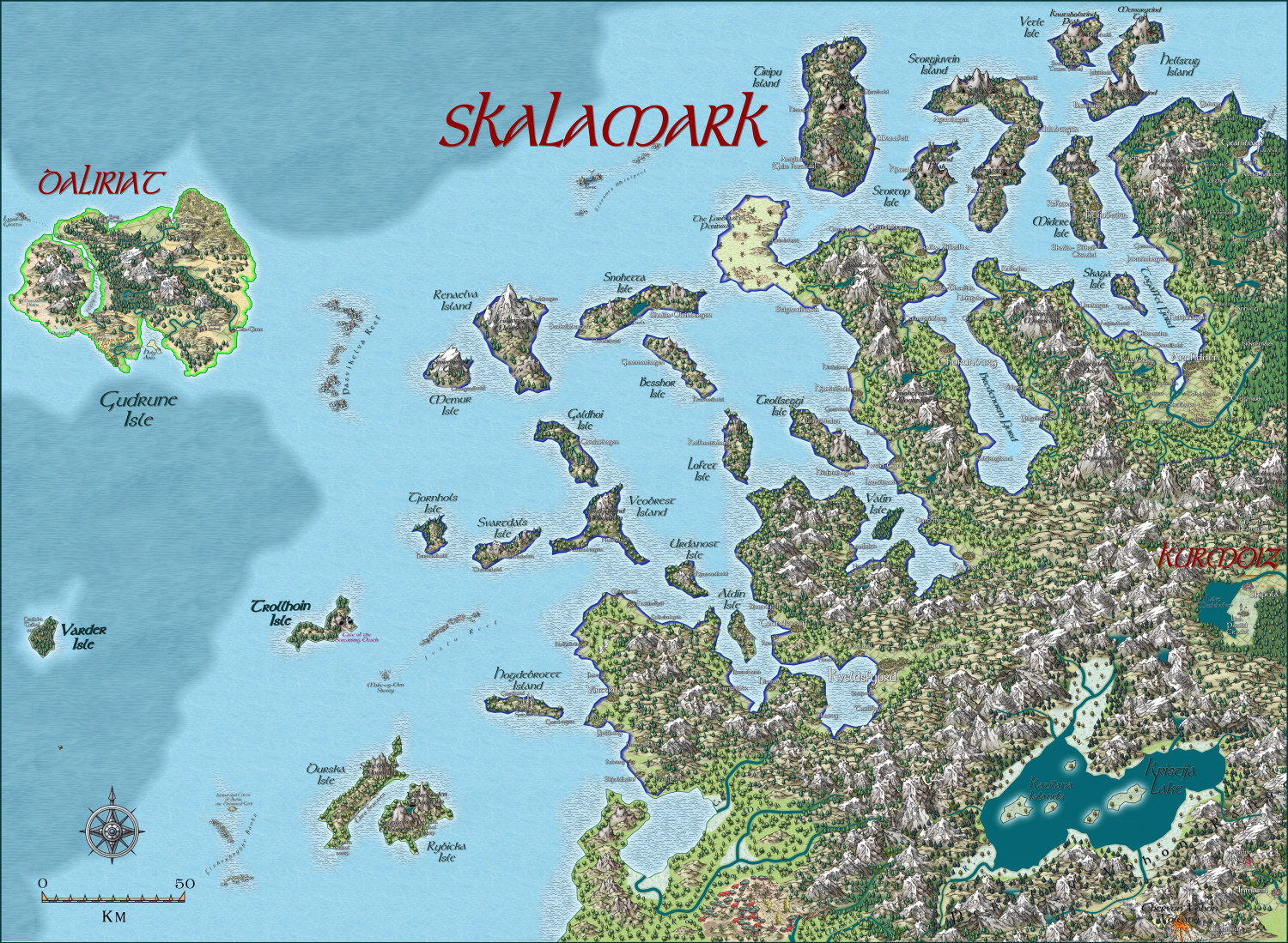
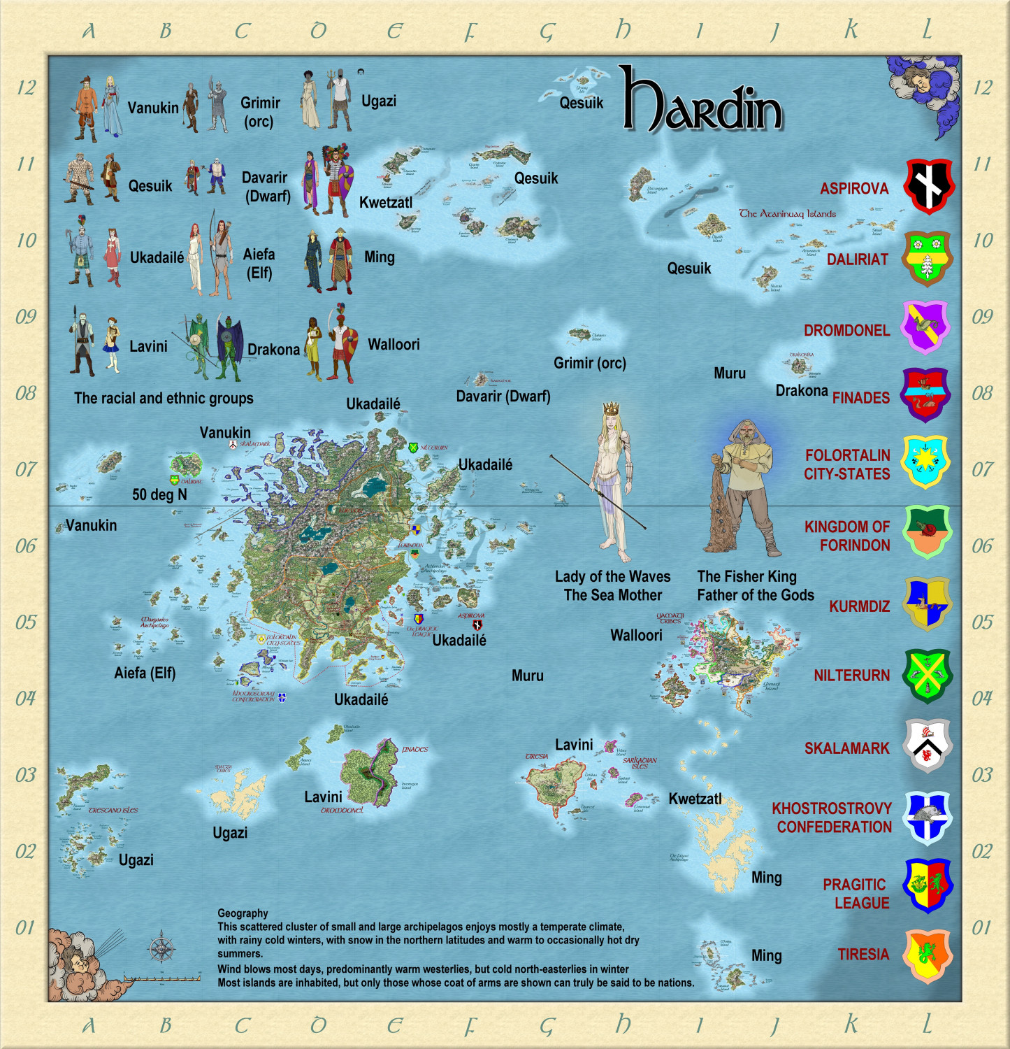
Myirandios - Hardin Region - Skalamark
Well, I have amazed myself, and finished this map in a rather short time. A Norwegian feel, I hope.
Sorry the resolution isn't so good on the forum.


-
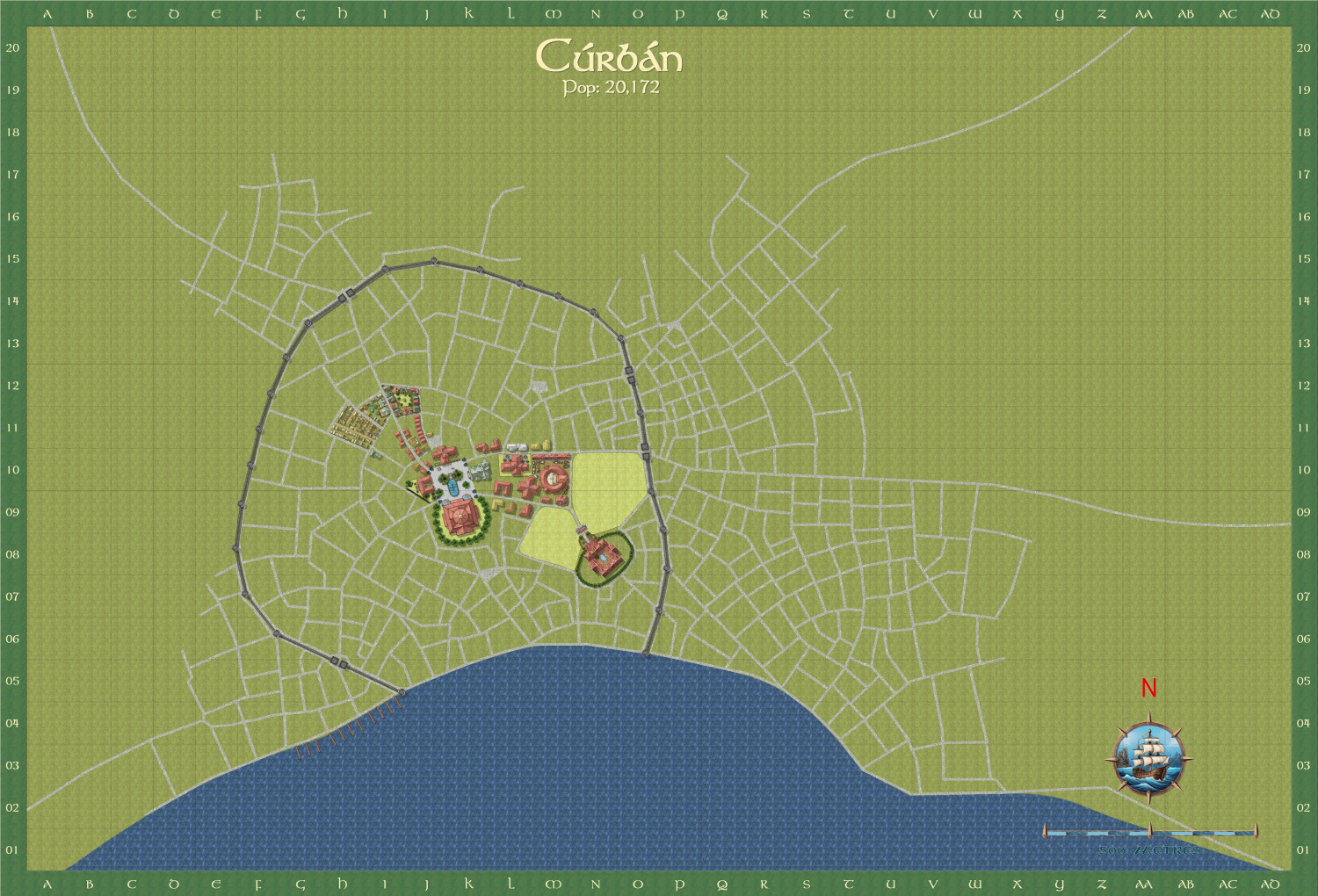
Curban - an Elven City WIP
I am now doing another city (my favourite type of map) - the capital city of the Elven Queendom of Aillte-Lonrach. I will show it as I progress - almost finished the city centre.
The street layout i got by using the Watabou city layout, and The style I am using is a mix of SS5 and Watabou revised. And Shessar's magnificent compass and scales.
Here is the total city.
Here is a close up of the city centre. The text is deliberately small at this stage - more a reminder to me of the sort of buildings I need to put in.
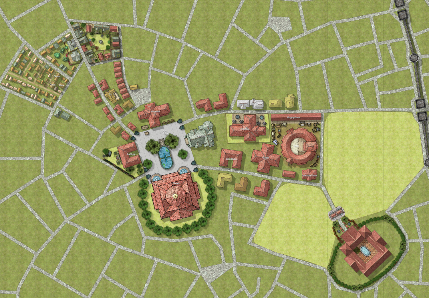
After I finish the centre, I am going to concentrate on the dockside area.


-
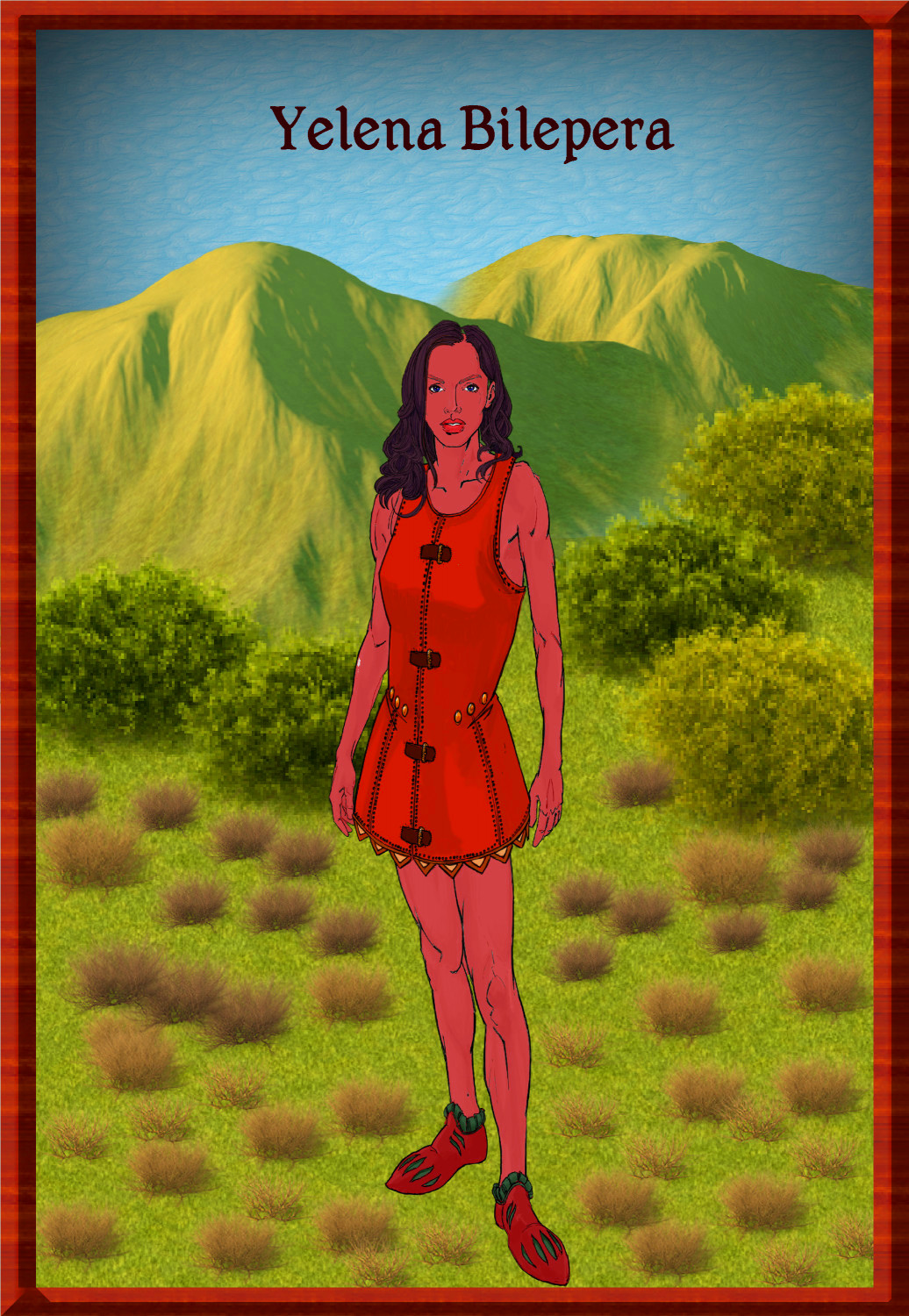
Tatilana - Western Sergeevna
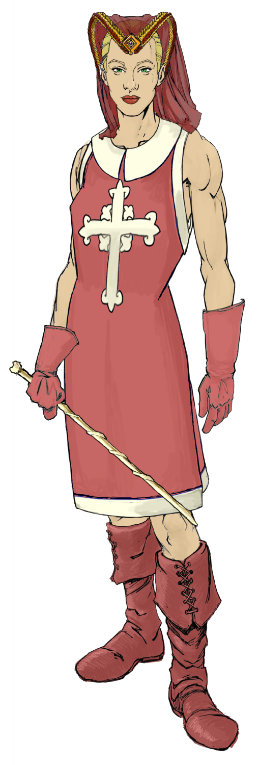
And the female. The race is supposed to have black hair, blue eyes and red skin, suitable for the tropics. Tall and slim.


-
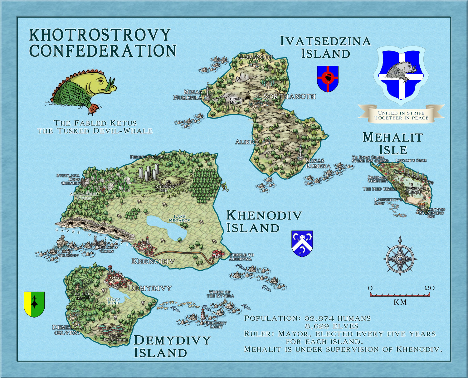
Myirandios - Hardin Region - Khotrostovy Confederation
Here is the map of the Khotrostovy Confederation - I reused the maps for the Community Atlas of Xenothon and Demydice, and Megalith Isle - yet to be included in the Atlas, but waiting for Remy to get time to put them in (I have asked him to wait till I finish the other islands' map notes, so the delay is my doing). In addition, I have changed the names to a more Slavic feel, and added another mainly wooded elven isle. Another advantage to reusing these maps, is that I already have map notes, which I can expand upon for my own world.
-
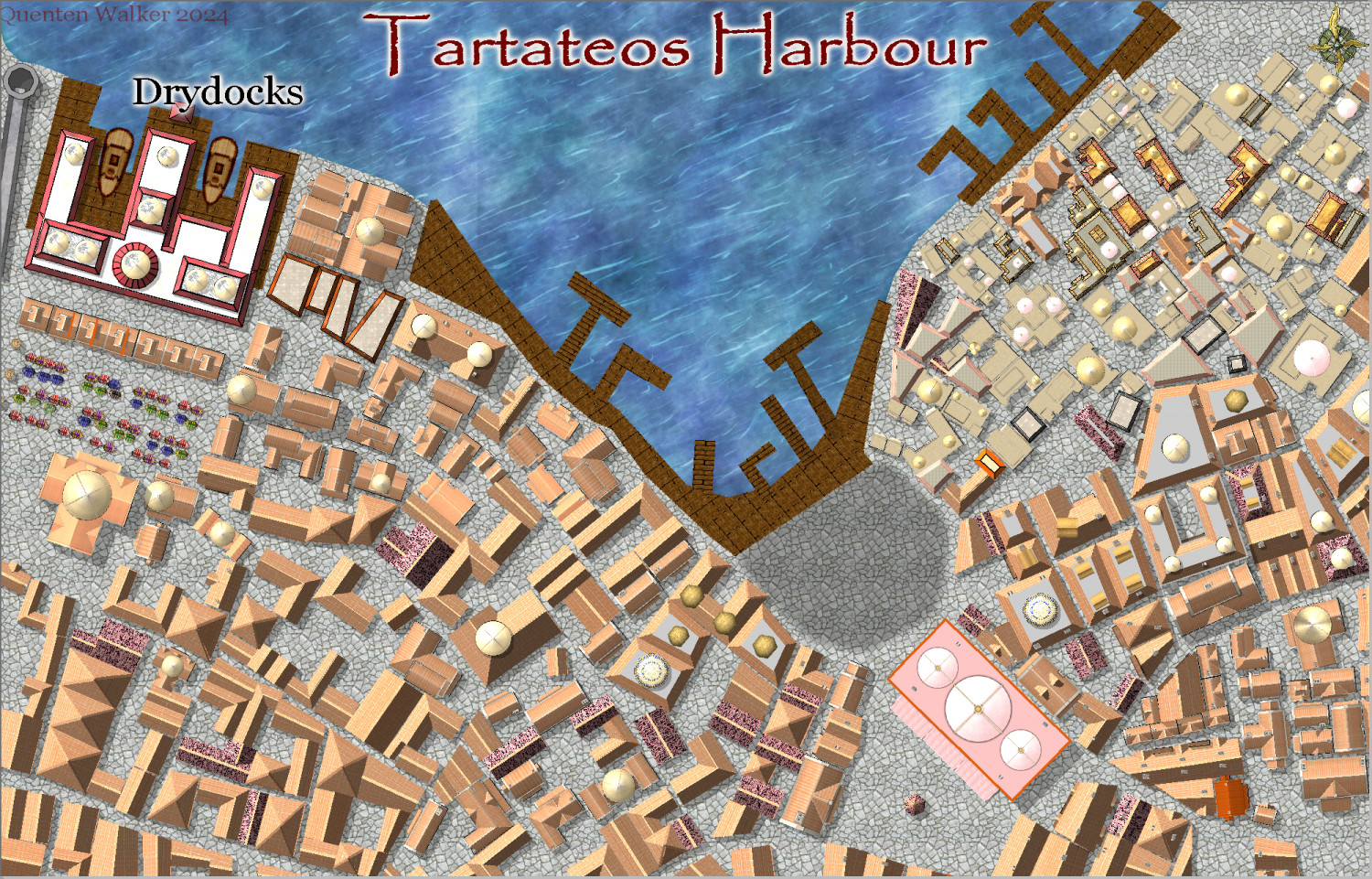
Community Atlas City of Tartateos - Shipyards District
Progress - now for house trimmings, and street furniture, and some ships.
Comments welcome, especially on improvements needed or things added or subtracted.

-
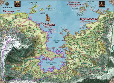
Hardin region of Myirandios
Second last map in the region to be completed - the Lavini (Italian-like) nations of Finedesa and Dromidonla. Needless to say, the outlying islands are run by the 'benign' La Familia (aka the Mafia).
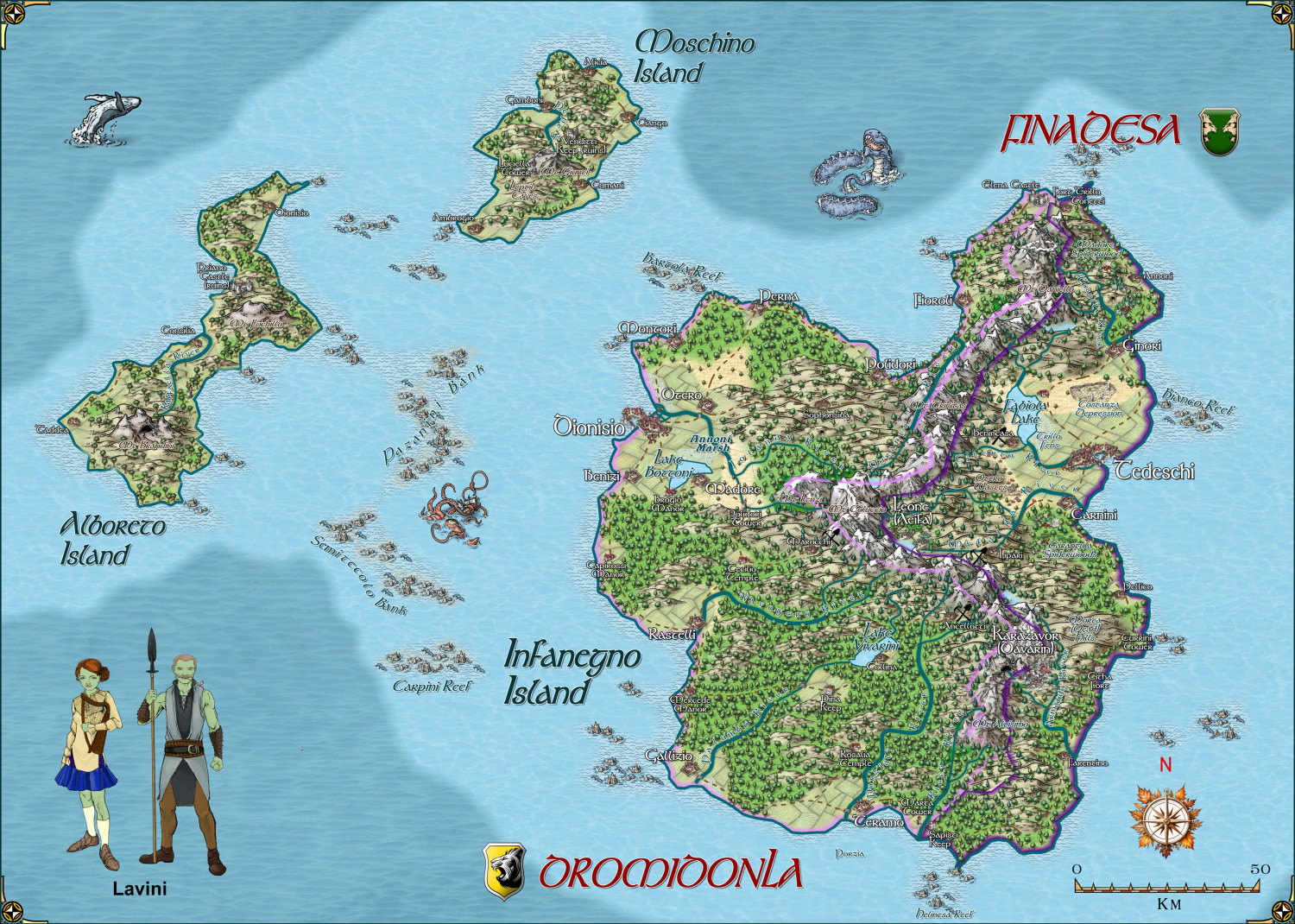
Larger version in the gallery.
-
Hardin region of Myirandios
Here is a revised map of the whole Hardin region - not fully complete yet. Ranges from subarctic to subtropical.
-
Ukadarlia
The Kratirim - a Slavic -like people

-
Creating large cities without crashing
My advice is to show only all the buildings by hiding all sheets without Buildings on them, then dividing the buildings into various districts suing layers. Then hiding all building layers except the district you are working on. And the more bitmap symbols you use, the better - i know it takes longer, but the map will actually look better as well as run better.
Here is your FCW with the buildings divided into 5 separate layers - North, South, East, West and Central. You can hide those layers except for the district you are working on. I suggest you use bitmap buildings for at least 20% of the buildings you have in the map - just delete a few houses here and there and use bitmap ones instead.
Incidentally, I had no trouble or even much of a delay in redrawing the map with all buildings showing, with Sheet effects on.


-
Hardin region of Myirandios
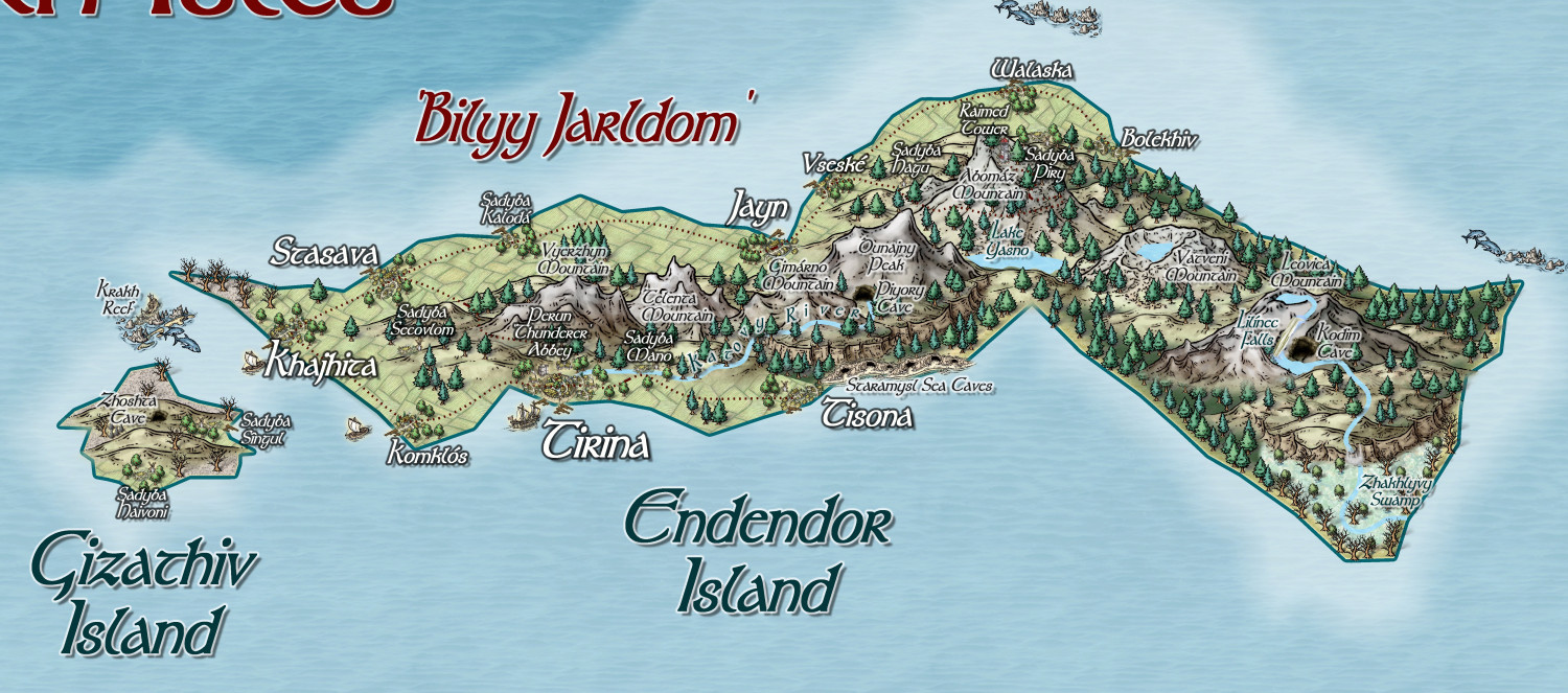
Finally, the one island that has seemingly got its act together, and formed the nascent Jarldom of Bilyy (White), under the charismatic leadership of Melodiva Tirina, who also has her eyes on uniting the whole island archipelago. Unfortunately, not only does she have to deal with the fierce independence of each individual settlement, but also agents of evil chaos from the Dumyano Recluse Tower; and the general trouble-making of the sea-people.


