Quenten
Quenten
About
- Username
- Quenten
- Joined
- Visits
- 8,145
- Last Active
- Roles
- Member
- Points
- 3,110
- Birthday
- November 29, 1950
- Location
- Australia
- Real Name
- Quenten Walker
- Rank
- Mapmaker
- Badges
- 16
Latest Images


Reactions
-
Watabou City REVISED (annual 157)
Here are some of the Drawing tools I am working on for a new version of Watabou Cities.
Please comment.
And if any of you have better ways to do crenalations with a drawing tool or macro, please let me know.


-
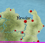
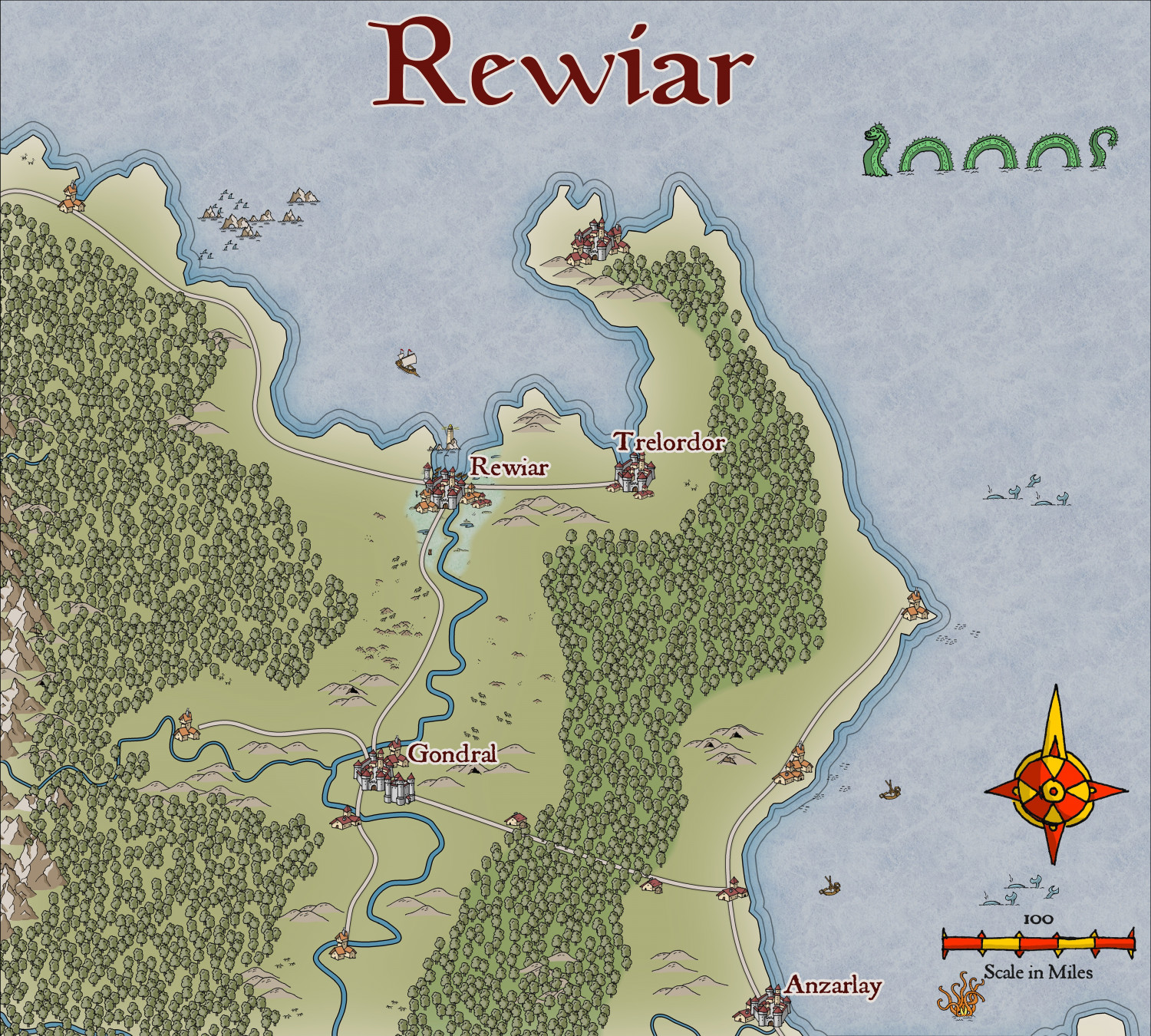
Community Atlas - Berenur - Rewiar
Here is the beginning of the region of Rewiar on the Berenur Continent, using the new style, which I think looks so gorgeous. @Ralf - more structure and marine symbols, PLEASE.
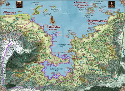
This is the region on the continent map:
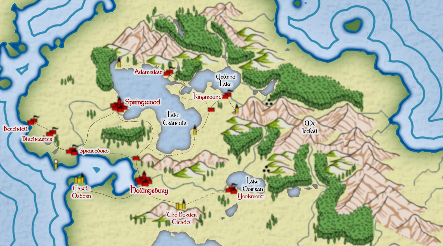
This is the map so far:


-
Pantheon of Gods, based on CA41 - Abstract Graphics
Here is my Pantheon of Gods, based loosely on Slavic Gods. I used the example in CA41 as a guide. The pics came from a few YouTube videos on Slavic Deities.
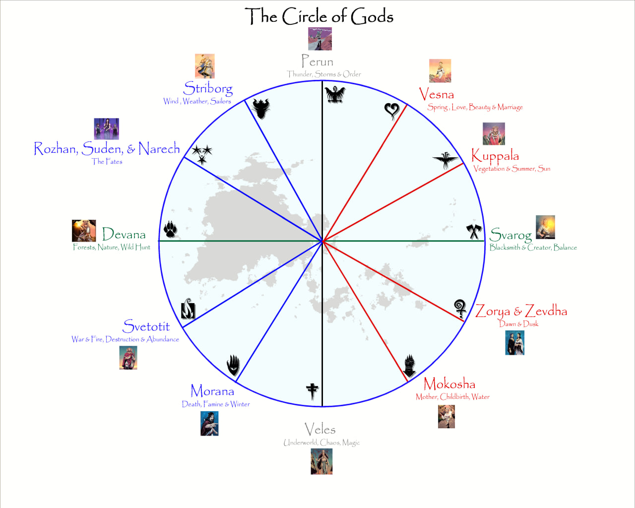
The landmass is the region I am using for a RPG Gaming aid.

-
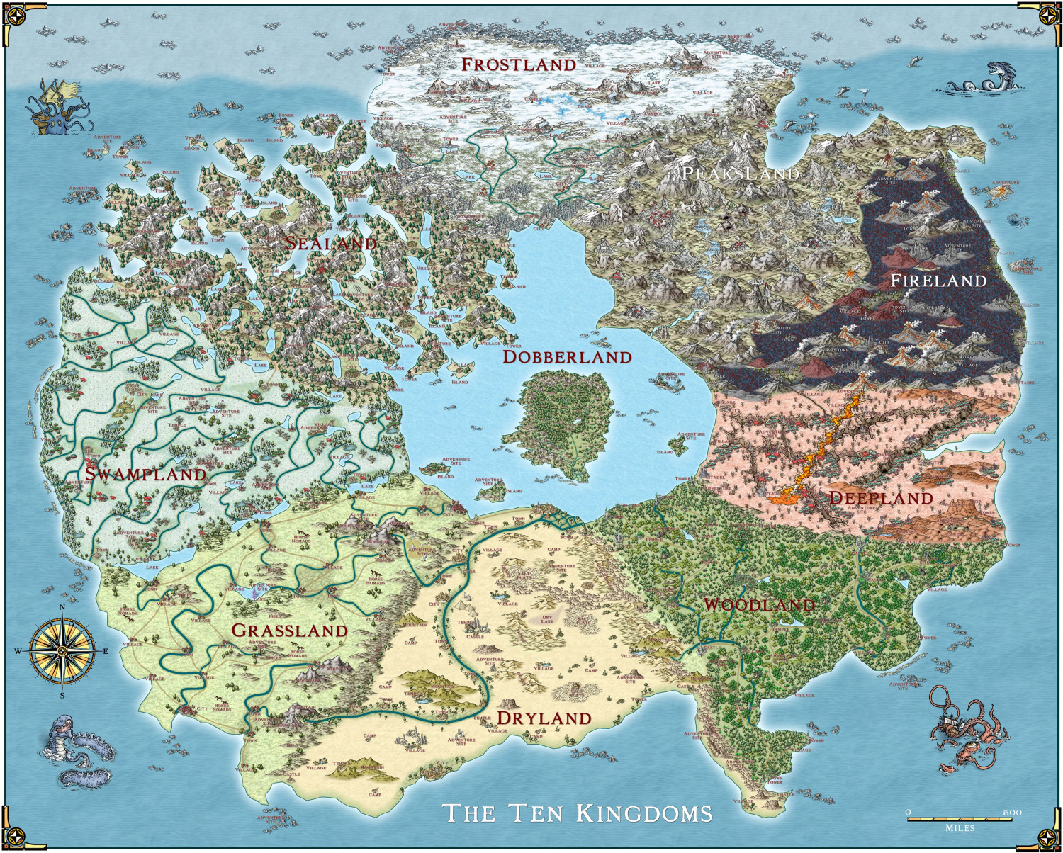
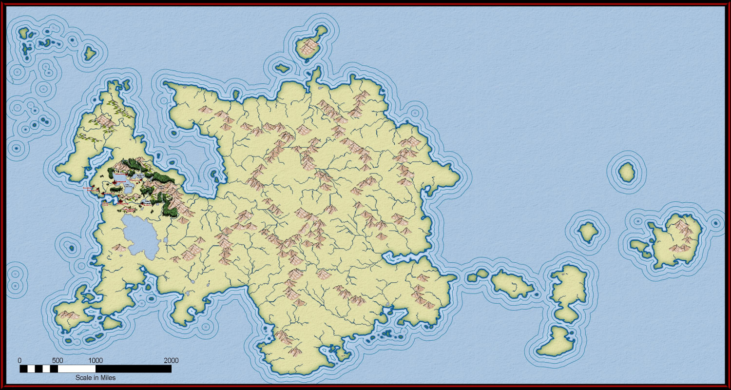
The Ten Kingdoms
And the final map (except for changing the generic names for specific ones).


-
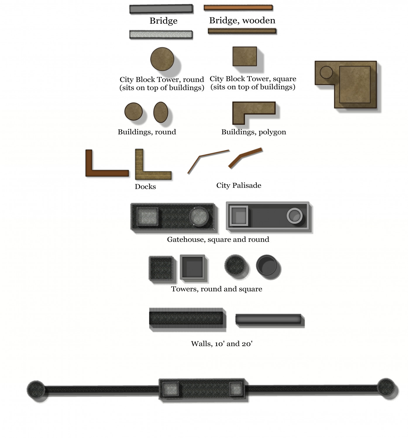
Using Mike Schley symbols
Open the FSC file you wish the new pngs to go to - usually in a folder in the Symbols folder on your CC3+Data folder.
Click on Symbols menu, then Symbol manager. You will get a screen like this:
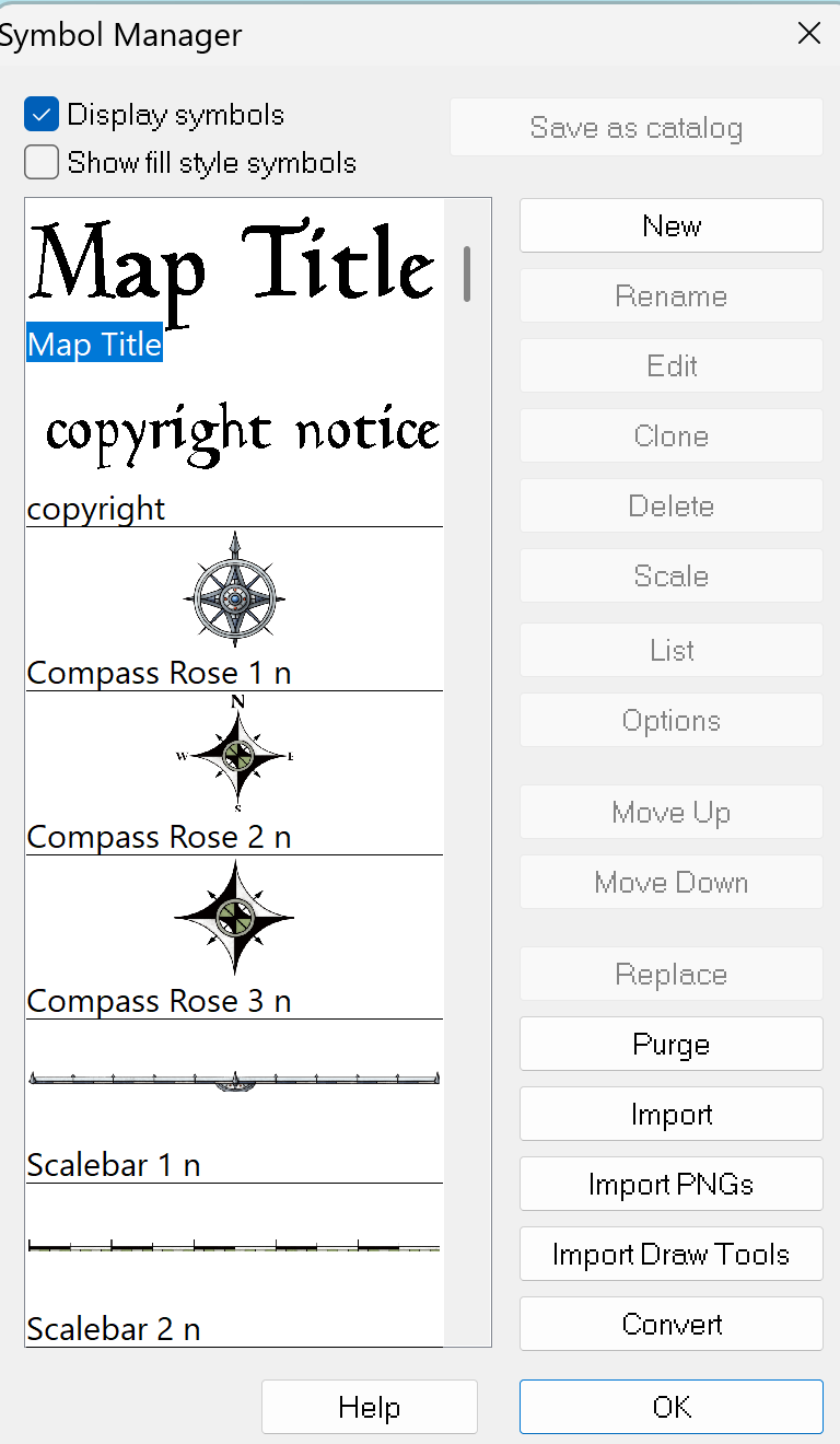
Click on Import PNGs and you will get a screen like this:
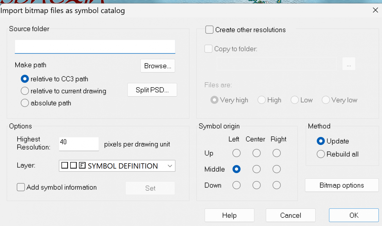
Click on Browse, and go to the folder which contains the PNGs you want. Open the folder and click on any of the pngs.
If the pngs already are in the 4 resolutions (Hi, Lo, VH or VL) then DO NOT CLICK 'Create other resolutions. If the png you want is NOT in the 4 resolutions, then do click on that. Then click OK.
When it is finished it will tell you how many symbols in the catalog and how many were updated or new ones created.
Then Open the Symbol manager again, and go through the symbols - the ones you added will be at the end of the list. You may have added pngs you don't want - just select them and press the delete button on the symbol manager menu (see above).
You can also reorder the symbols as they appear in the catalog.
Finally, click on the first symbol on the list, then select all the rest by using the Shift key on your computer and clicking on the last symbol. Then click Save as Catalog. Then click Save on the main menu, and you will have the new png along with all the other symbols that were in the catalog.
If you make changes to an existing official catalog, it is often better to give it a new name, otherwise it may be overwritten when there are updates, or if you have to reinstall everything.
Hope this is a little clearer than mud. Good luck.

-
City-State of Badirov - Modern Journeys style
I have decided to use Spectrum overland, as it fits better with photos than Mike Schley, I think.
Here is the Island of Kalihirin, with 4 sites as photos.

-
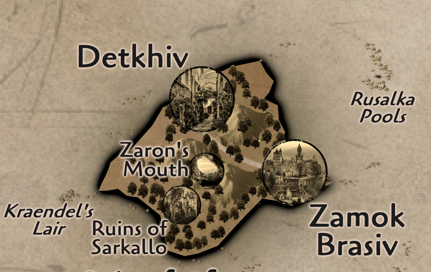
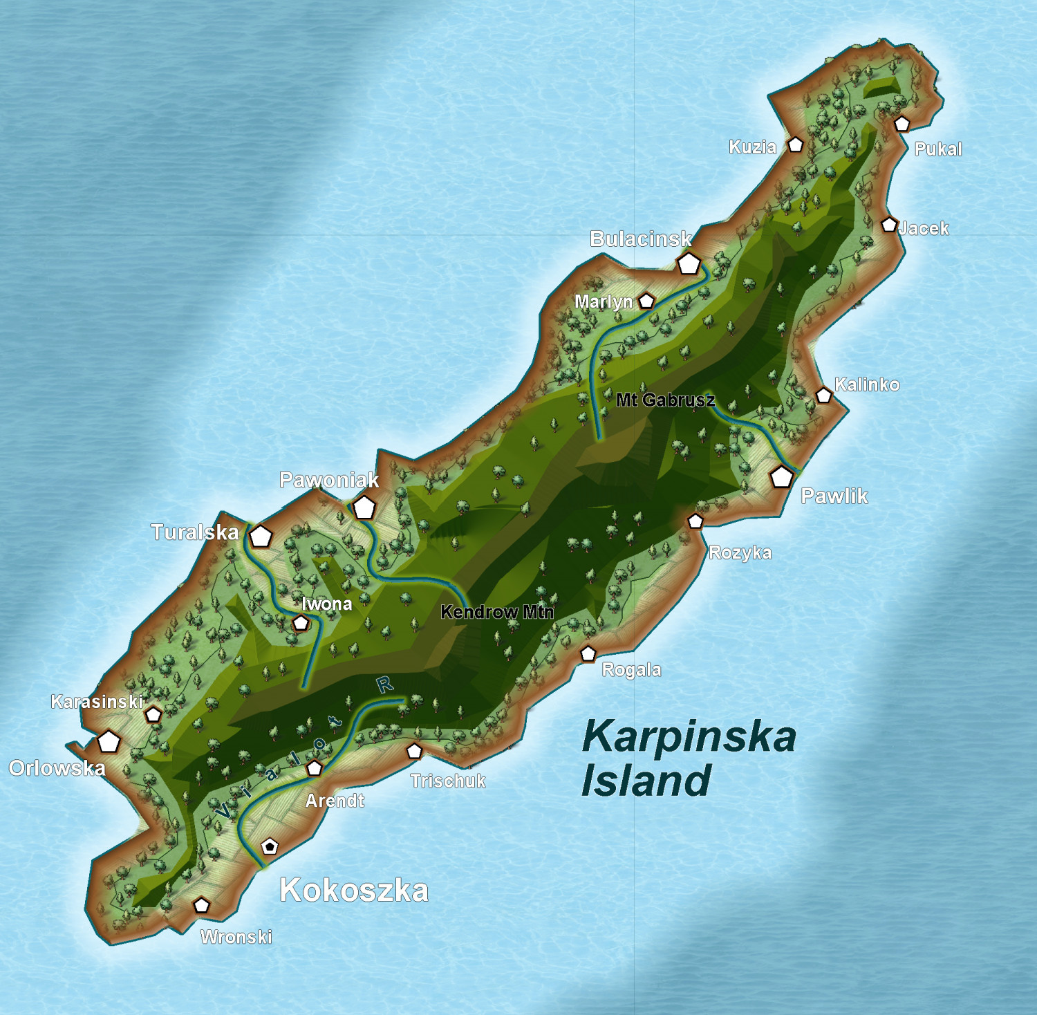
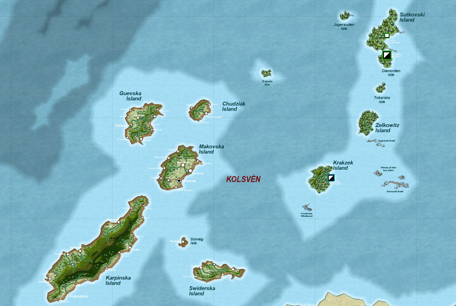
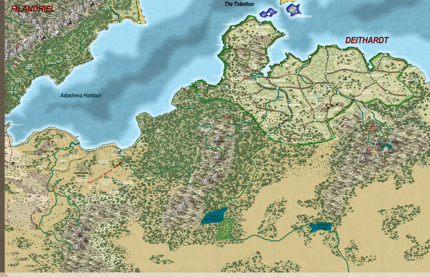
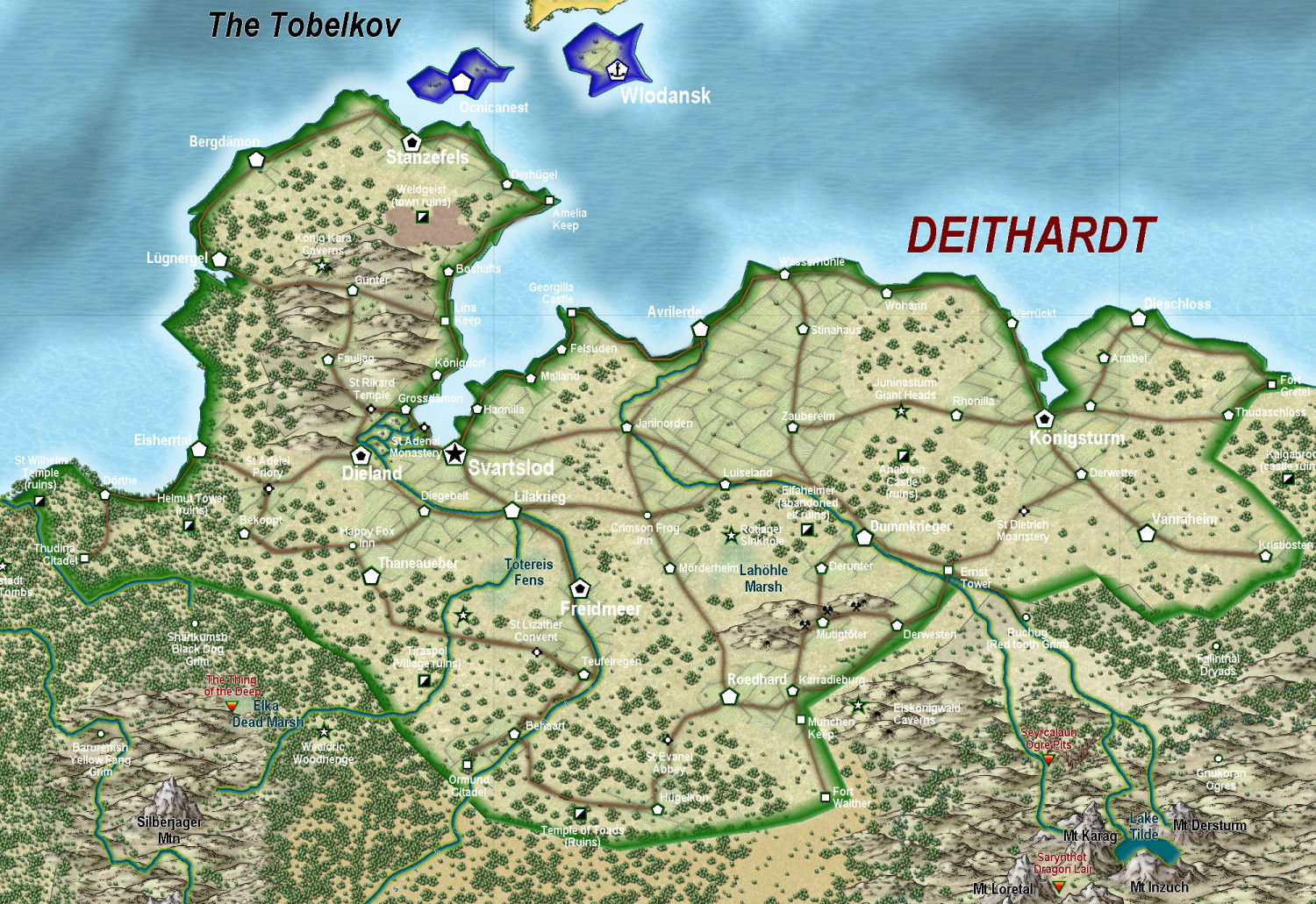
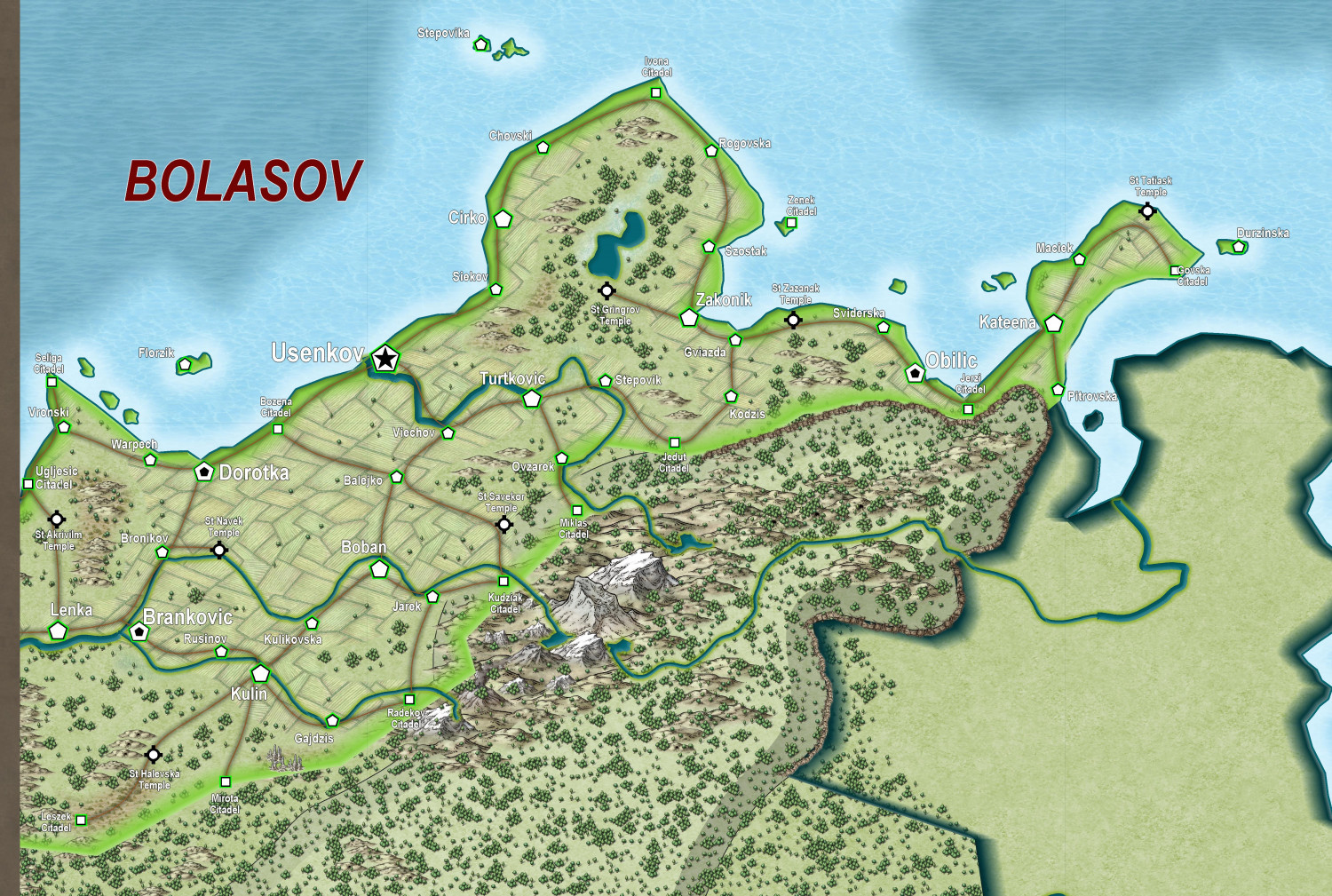
Deithardt-Kolsven Region
This is the thread where all discussion on this region will now be held.
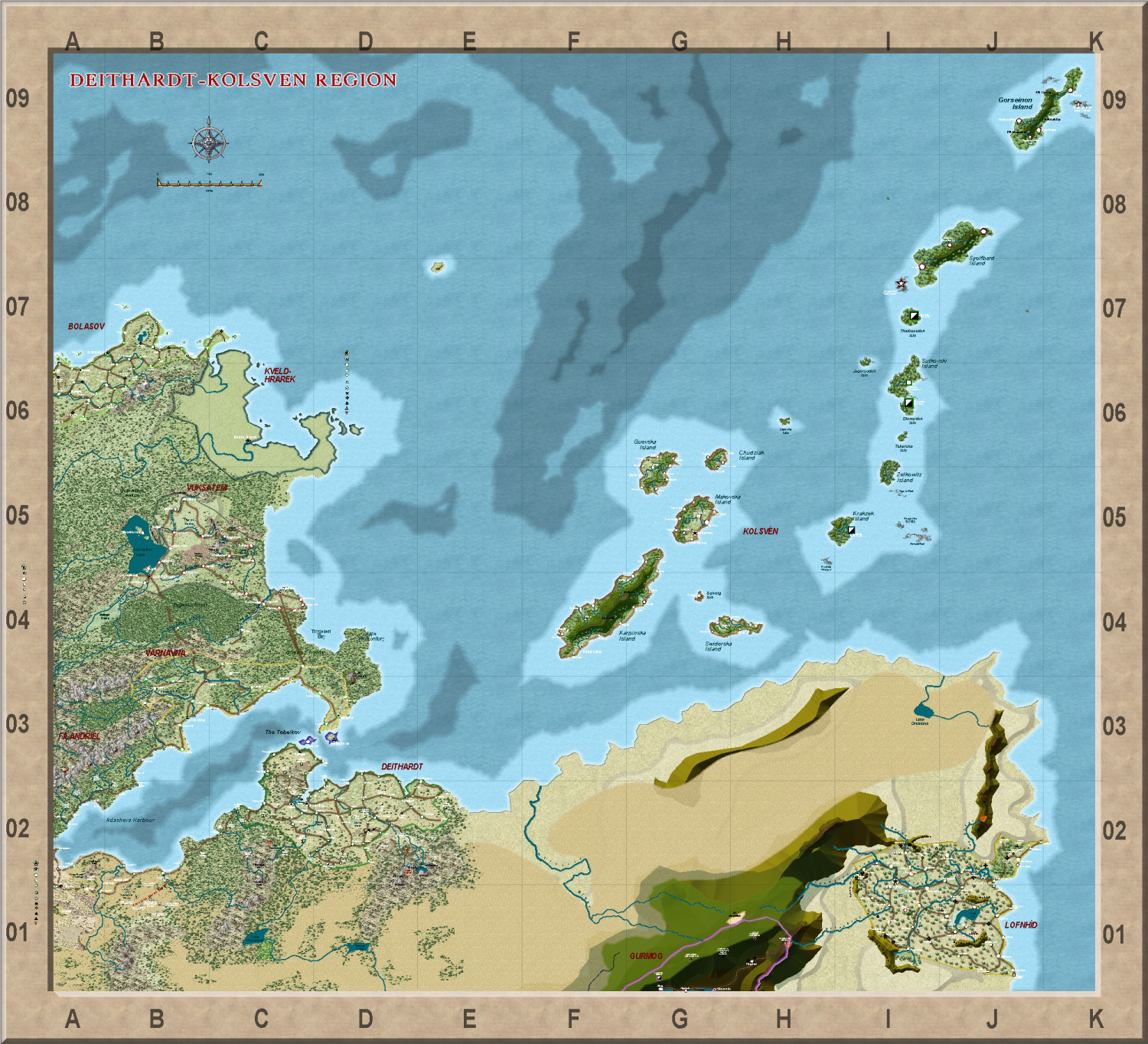
Here are three regions fairly completely mapped - the last being the least complete.
First, the 'Viking' kingdom of Kolsven
Next, the once great empire of Deithardt
With a close up of the remnants of Deithardt itself
Two nations to the north of Deithardt - Varnavna - not so complete
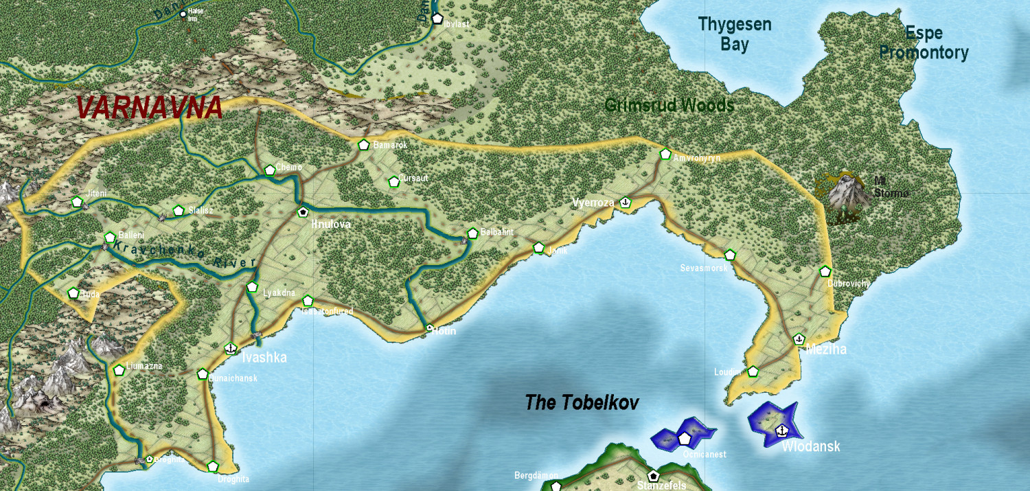
And Vuksatem
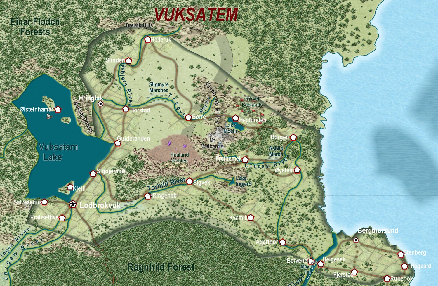
Finally, the least complete (what I am working on at present, East Bolasov (I had to divide Bolasov into two, as otherwise the overall map became too large - and perhaps that will make for a regional and perhaps ethnic difference - eg like East and West Ukraine).

-
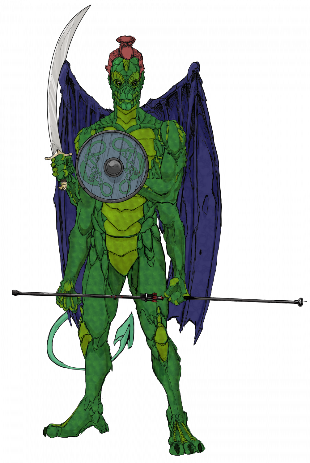
Ukadarlia
The Qesuik - adapted for colder climes.
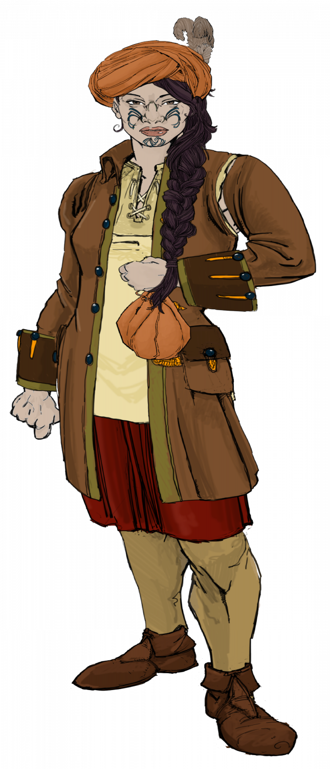
Revised characters. Hope this meets the comments below - I feel these are better as well.


-
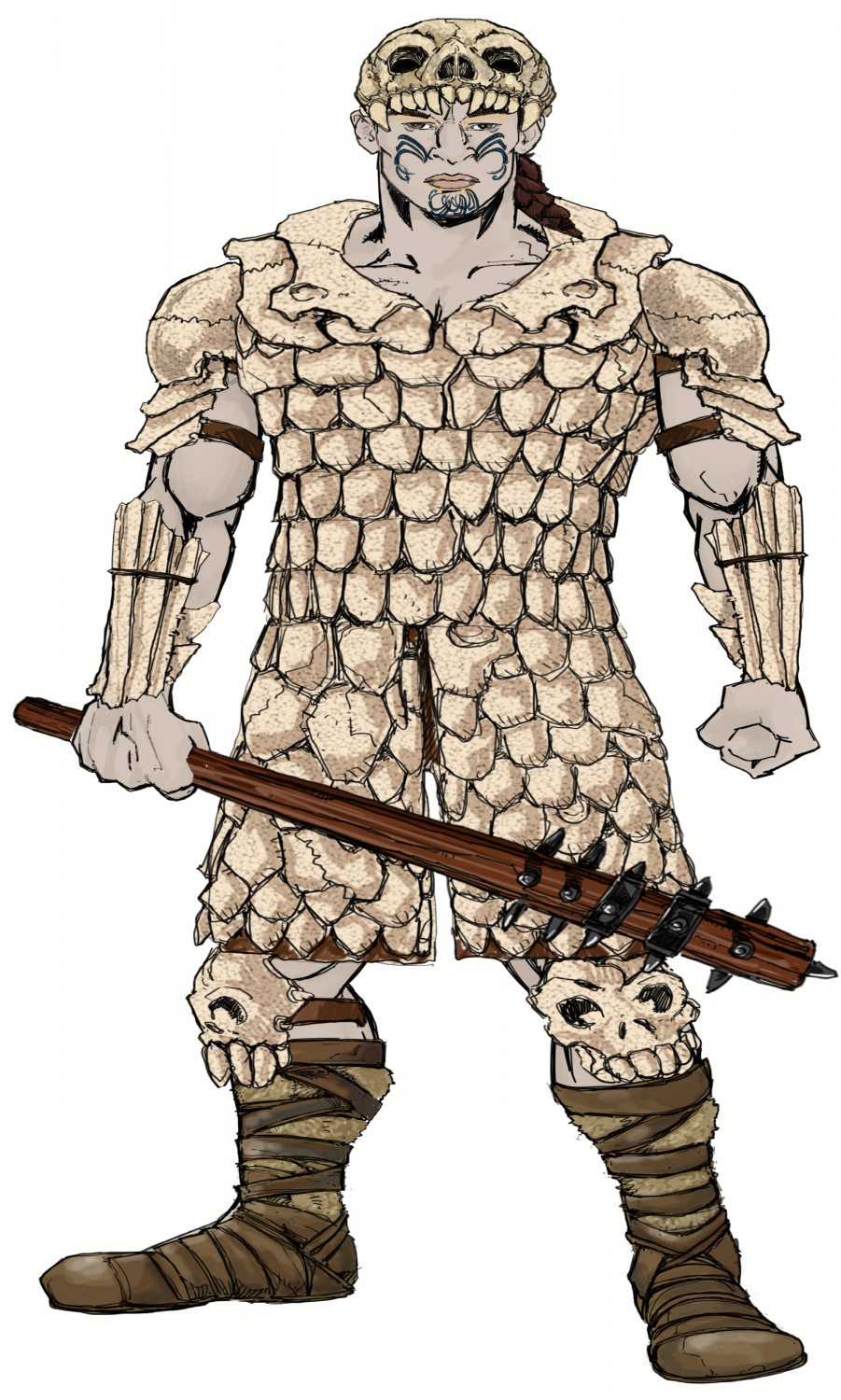
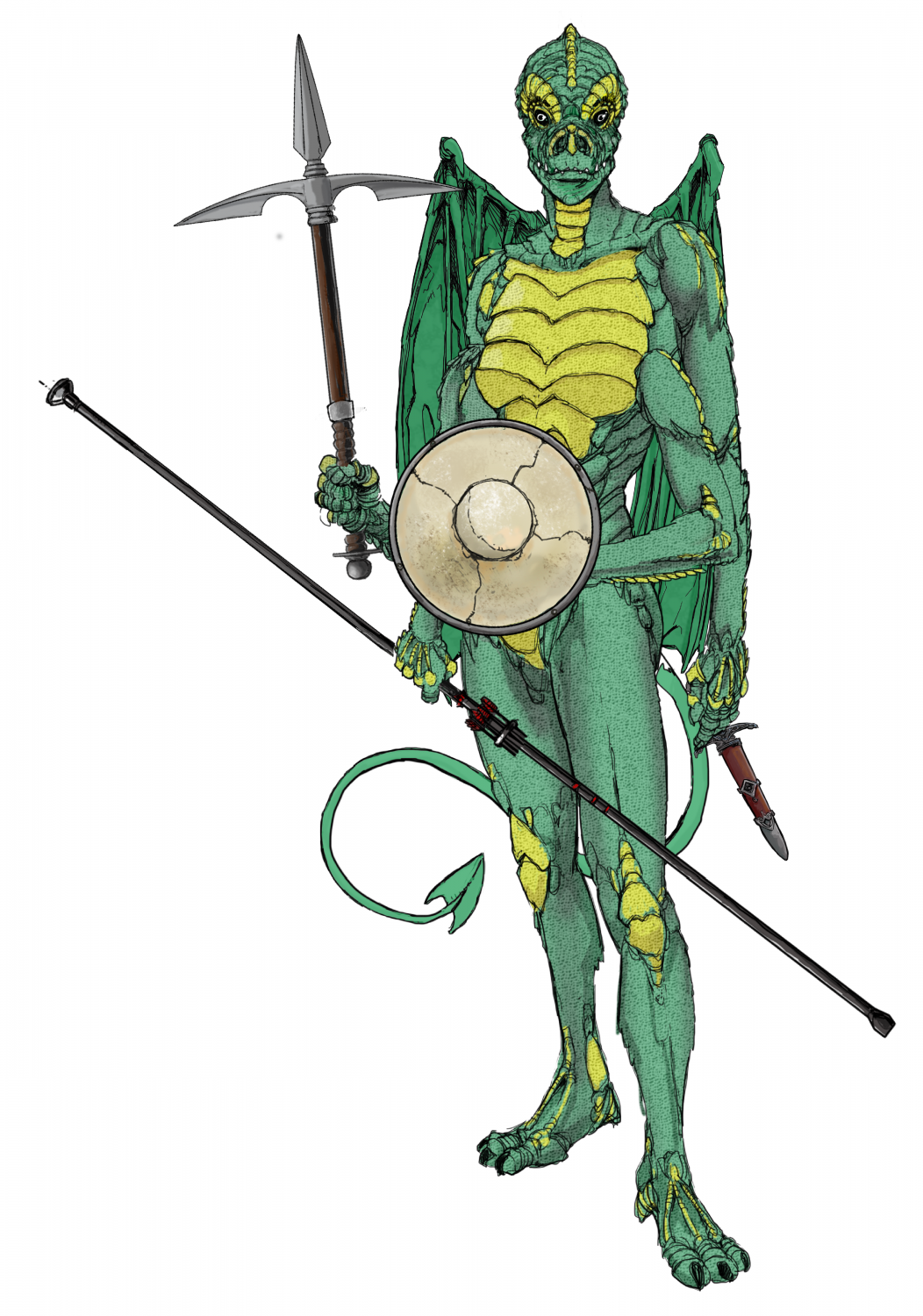
Ukadarlia
I have decided to make the Drakona 6 limbed - I am not so sure it works with CA, but this will do, I think
-
FT3 to CC3+ as per recent Live Mapping Tutorial
I was really impressed with this video, as it has made things a lot easier for me to translate FT3 world to s CC3+ style I like. Thanks Ralf.
In my example below, I have decided to translate a FT3 section to a Pete Fenlon Style (revisited), but I have also used the rivers that were created in the FT3 map.
Here is the FT3 map:
Here is the translation to Pete Fenlon, and it was SO easy. Again, thanks Ralf.
Obviously not completed.
Here is an insert.