


Quenten
Quenten
About
- Username
- Quenten
- Joined
- Visits
- 8,145
- Last Active
- Roles
- Member
- Points
- 3,110
- Birthday
- November 29, 1950
- Location
- Australia
- Real Name
- Quenten Walker
- Rank
- Mapmaker
- Badges
- 16
Latest Images


Reactions
-
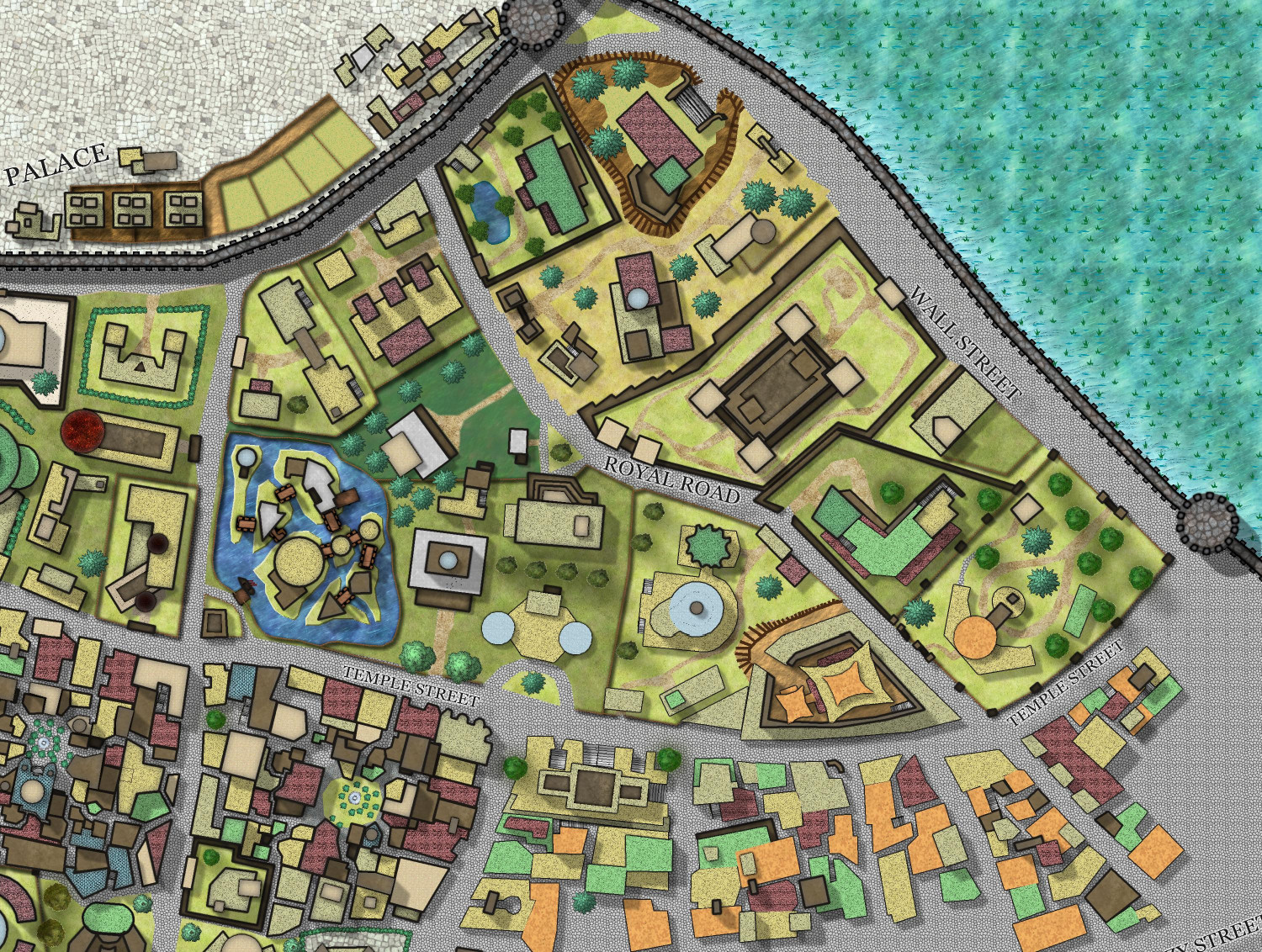
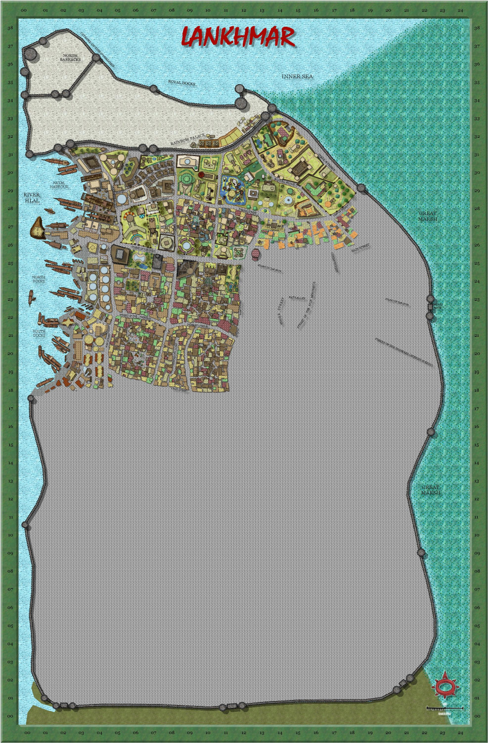
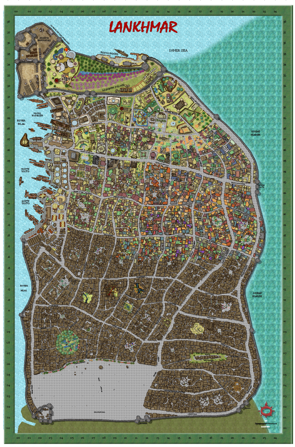
My version of Lankhmar
Here is progress over the last 4 days – I took a full day off as I had to go to perth – a 9 hour return trip, and recovery thereafter. Still, significant progress, I think. And certainly more than 1 block a day, so ahead of schedule.


-
My version of Lankhmar
A small addition today. The end of filling in all the buildings is in sight at last - then comes the 'colouring-in' of the roofs, and that will be it, I think.
I might go to some of the modules and see if there are important buildings to label.

-
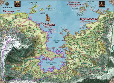
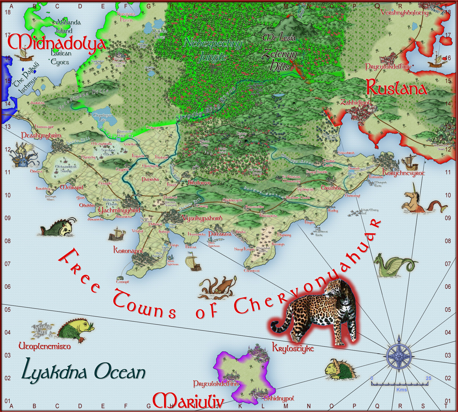
World of Tatilana - Free Towns of Chervonyahuar (Red Jaguar)
Here is a regional map of Western Sergeevna. It is the free towns of Chervonyahuar (Ukrainian for Red Jaguar). It is a tropical region.
Not yet complete. Larger version in gallery


-
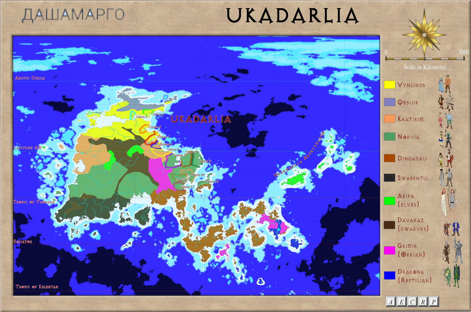
Ukadarlia
Update on Mercator style map.
Forests, deserts, swamps, some volcanoes, cities and a few names to go.

The grey mountains represent the highest altitude mountains.


-
Watabou City REVISED (annual 157)
The final step is adding all the extra bits and pieces - forests and trees, wetlands, roads and squares and city backgrounds, hills and contours, maybe extra buildings, buildings and towers on top of one another, even a gatehouse to replace the open walls in some places. And text and scale and compass, of course.
Here it is, partly completed.


-
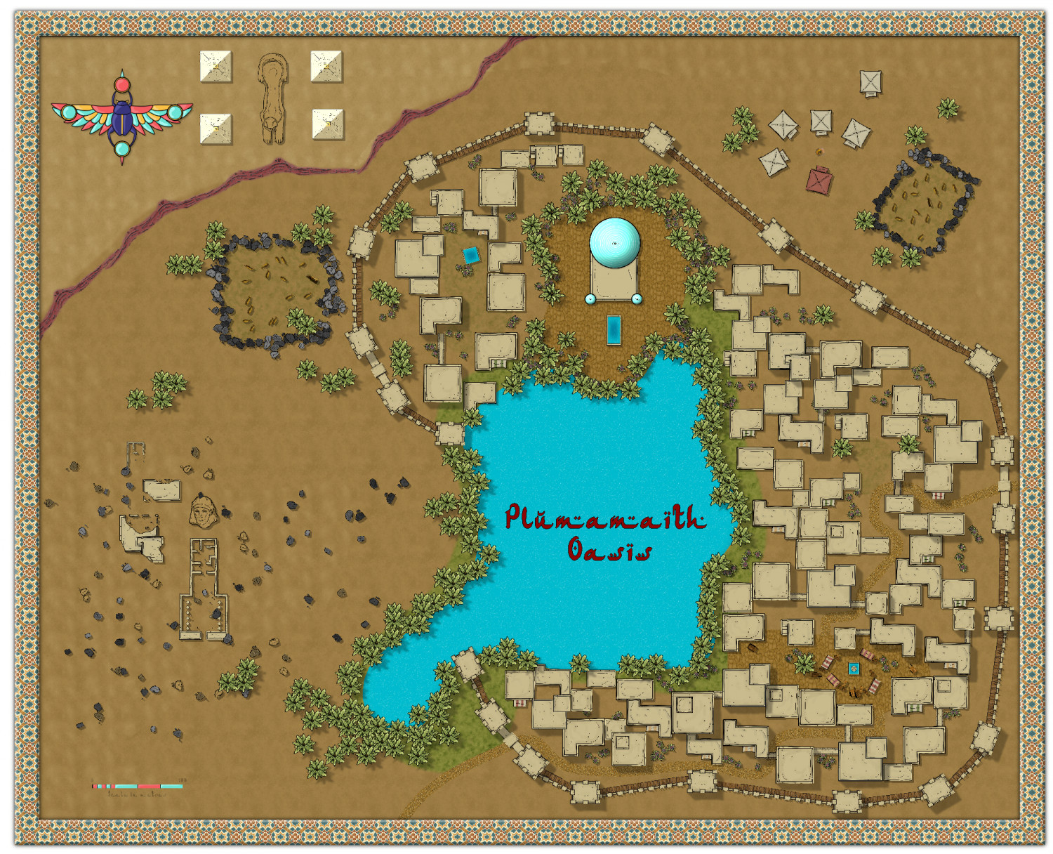
Community Atlas - Uaigneach - Plumamaith Oasis
A town in the desert region of Uaigneach region on Berenur, using Jon Robert's desert oasis style.
Plumamaith roughly corresponds to Plum Well in Irish Gaelic.
Not quite complete - awaiting labels and critique. An Atlas contribution


-
I couldn't help myself.


-
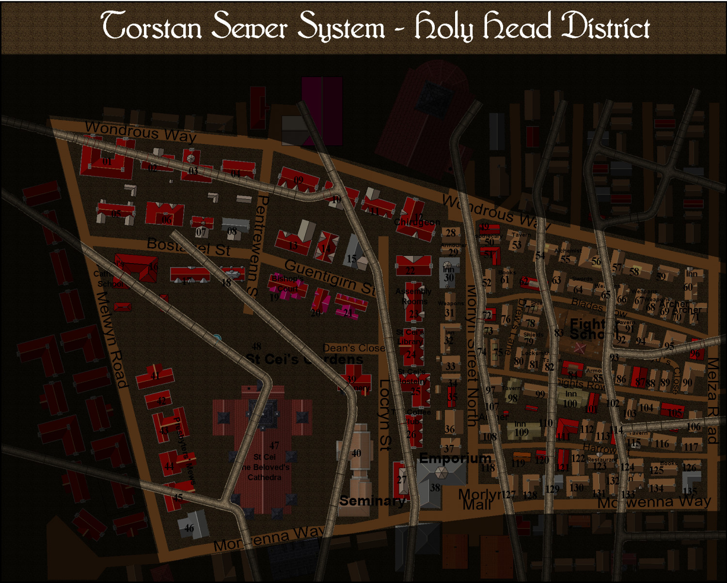
Torstan Holy Head Sewers
Well, thanks to everyone. Here is the start.
-
Ukadarlia
And here is the final Ethnic map of Ukadarlia.
-
Watabou City REVISED (annual 157)
I will post my revision of the Templates and Drawing tools later on. Unless @Ralf thinks that would violate the ProFantasy agreement. They will be titled Annual Watabou City QW, to distinguish them from the official version, and they will also have their own Drawing Tools and bitmaps - again, drawn from existing CC3+ bitmaps - hence I will await to hear what Ralf says before posting.
But they will fix the problem with the present annual, given all the developments in the watabou city generator since that annual came out.

