

Calibre
Calibre
About
- Username
- Calibre
- Joined
- Visits
- 1,366
- Last Active
- Roles
- Member
- Points
- 965
- Rank
- Mapmaker
- Badges
- 8
Latest Images
Reactions
-
Watabou City REVISED (annual 157)
Mr. Quenten, thanks for the hard work. I feel confident it will be awesome
Cal

-
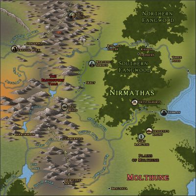
WIP: Nirmathas on Golarion
Greets!
I do not know if the following information is wanted; but I will reveal how I did this map.
First: I opened the map in Darklands overland. I inserted Spectrum Overland and Watabou Cities. These provided me with the Fills I knew I would need.
Then, draw your Land.
Then, once I had the Land to my liking, I went to the drawing tools on the right side of the screen, chose the various tools there to draw blobs of various colors. I put these on individual sheets, each color to a specific sheet. Now, add effects: blur, blend and edge fade till they 'look right to you'. WARNING: this will slow down everything. Turn off effects to help you draw out what you need.
Again: turn off effects to draw what you need. 😁
I draw what I know what I need or want. Sometimes, it takes many times to draw 'what looks right'. I can't describe this process any clearer than to say this: think outside the box.
Think outside the box.
Cal
PS: I hasten to add: You can do this with any style you have in CC3+. You don't have to have the ones I have listed here.


-
Tutorial - Between hills, rivers and trees
Greets!
Great info, Ricko!
For the river attaching to the coast, I have 2 other ways of 'getting it right' 😁
1: Use the Node Edit tool on the left; grab the node of the river closest to the coast and manipulate it so that the river aligns as you wish to the coast.
2: Edit>Reshape>Stretch: to pull the end of the river to the desired location.
You could, also, BREAK the river further up from the river end, then STRETCH it to the coast as you desire. Or, BREAK it and redraw the portion that is not aligning, making sure to use F5 to attach the new river line and then F9 to ON it to the coast again.
Cal

-
What I've been working on
Greets, Ralf
Here is one:

-
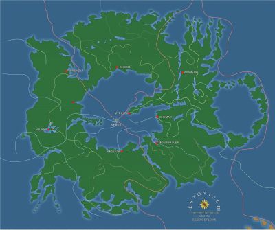
Possible map for roll20 game
I go with my own world, always. It always starts with a map. Once I have that settled, then I know the backstory/history, then on to current events and the adventures. I usually have a very large map showing what I feel would be known to players and that encompasses the entire continent. Then, I go for more regional maps for details and so on. Then, down to city maps, battlemaps, and a 'dungeon' or so (we tend not to run dungeon-crawl adventures in the style of RoleMaster).
Using this method keeps me constantly drawing maps heh. Which can be a good and bad thing. 😁
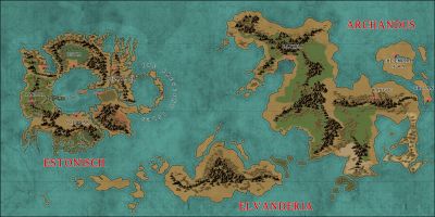
Dak, I absolutely love your maps and drawing style. Keep 'em coming!
Cal


