


Loopysue
Loopysue
About
- Username
- Loopysue
- Joined
- Visits
- 9,983
- Last Active
- Roles
- Member, ProFantasy
- Points
- 9,863
- Birthday
- June 29, 1966
- Location
- Dorset, England, UK
- Real Name
- Sue Daniel (aka 'Mouse')
- Rank
- Cartographer
- Badges
- 27
Latest Images


-
Live Mapping: Custom City Map
In this week's livestream Ralf will be returning to the custom city style, and the Rhodenstein map - to finish it up and add final details.
Come watch live and join in the discussion on Youtube here: https://www.youtube.com/watch?v=cg28Y9XxPq0
Or if you prefer you can watch it here on the forum*
*There's no live chat on the forum, but you are welcome to discuss the session below.


-
Birdseye Continental - style development thread
First stage of refinement for the now-named "Mountain Spine 01" symbol.
I've been staring and staring at Google Earth images of the Himalayas for ages and decided the easiest way to do this in a CC3 map from above is to make a spine and stick side ridges on it here and there.
The old bevel mountains are still visible at the moment. I'm using them as a reference for the colour and shade required.
Once I've worked out how to do the ends, and whether this is possibly a connecting symbol or better placed by hand, I can do variations in wiggly-ness, curve and length.

-
Cosmographer: select all icons based on currently selected icon?
What are your placeholders? Are they symbols, or polygons?
A particular symbol can be deleted using the Symbol Manager in the Symbols menu. Open the manager, pick the symbol you want to delete, and hit the delete button. That will remove all instances of the symbol from your map.
If your placeholders are polygons and are all on a unique sheet or layer you can hide all other sheets or layers and delete them en masse by box selecting with the delete tool.
If your placeholders aren't on a separate sheet or layer, you might have to use one of the many select options available when you pick delete and then right click in the map area.
-
Birdseye Continental - style development thread
Thanks Don :)
This is Affinity Designer, which is a vector graphics app that can also do most things Affinity Photo can do - if you pick the bitmap mode instead of the vector mode. Everything except the warping of bitmaps, and since that is such fun I also have Photo.
I used Krita to do nearly all of the Ferraris Style, but I don't use it that often these days now that Affinity has taken over most roles. The only thing I can't get it to do is, ironically, the really simple stuff, like alpha mask. For that I export a png and work in GIMP.
It pays to have a wide range of tools in your toolbox for making new assets. I sometimes use CC3 to make new seamless textures from symbols like trees.
The only kind of app I don't have in my toolbox is rental apps, like PS.

-
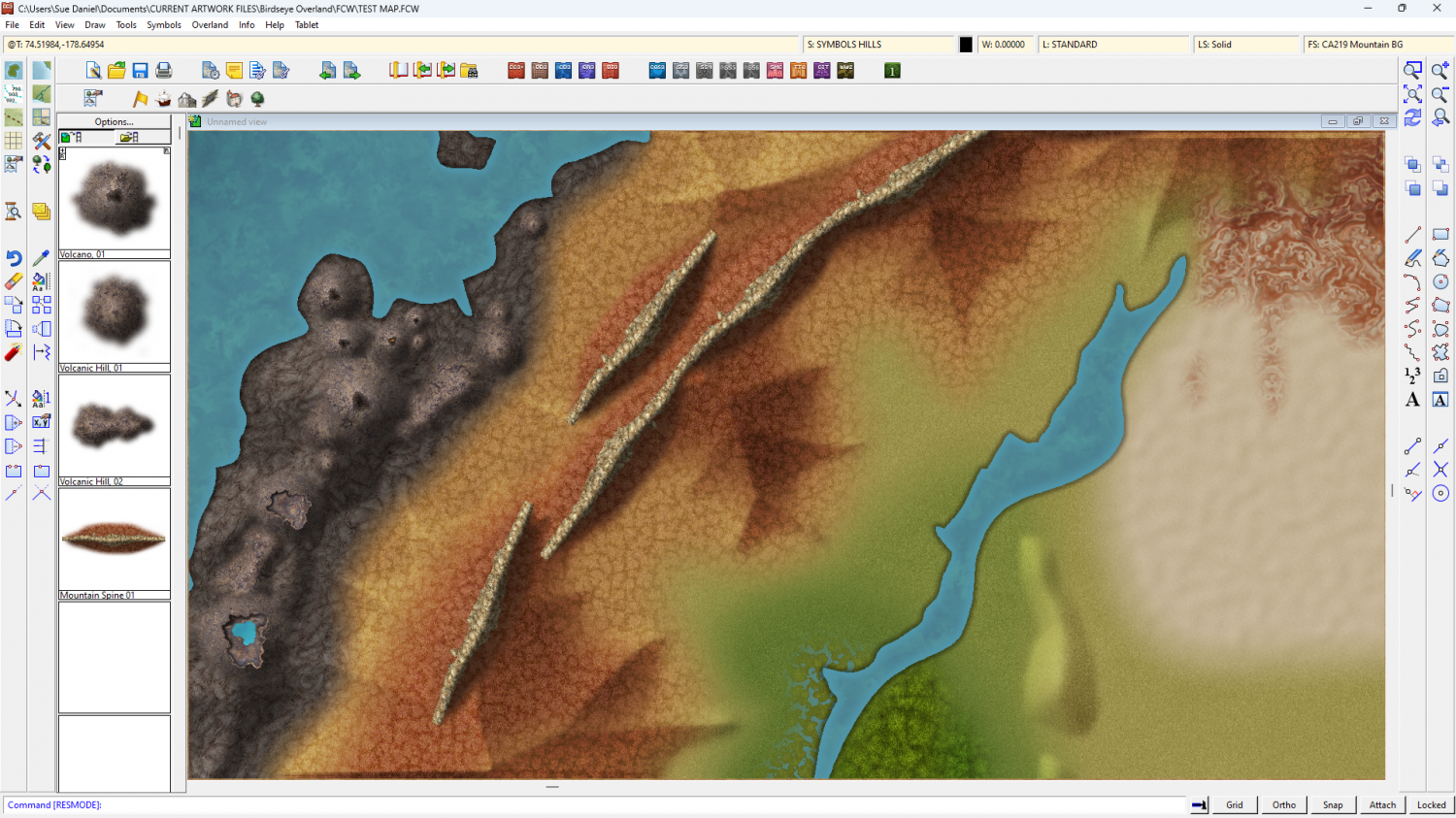
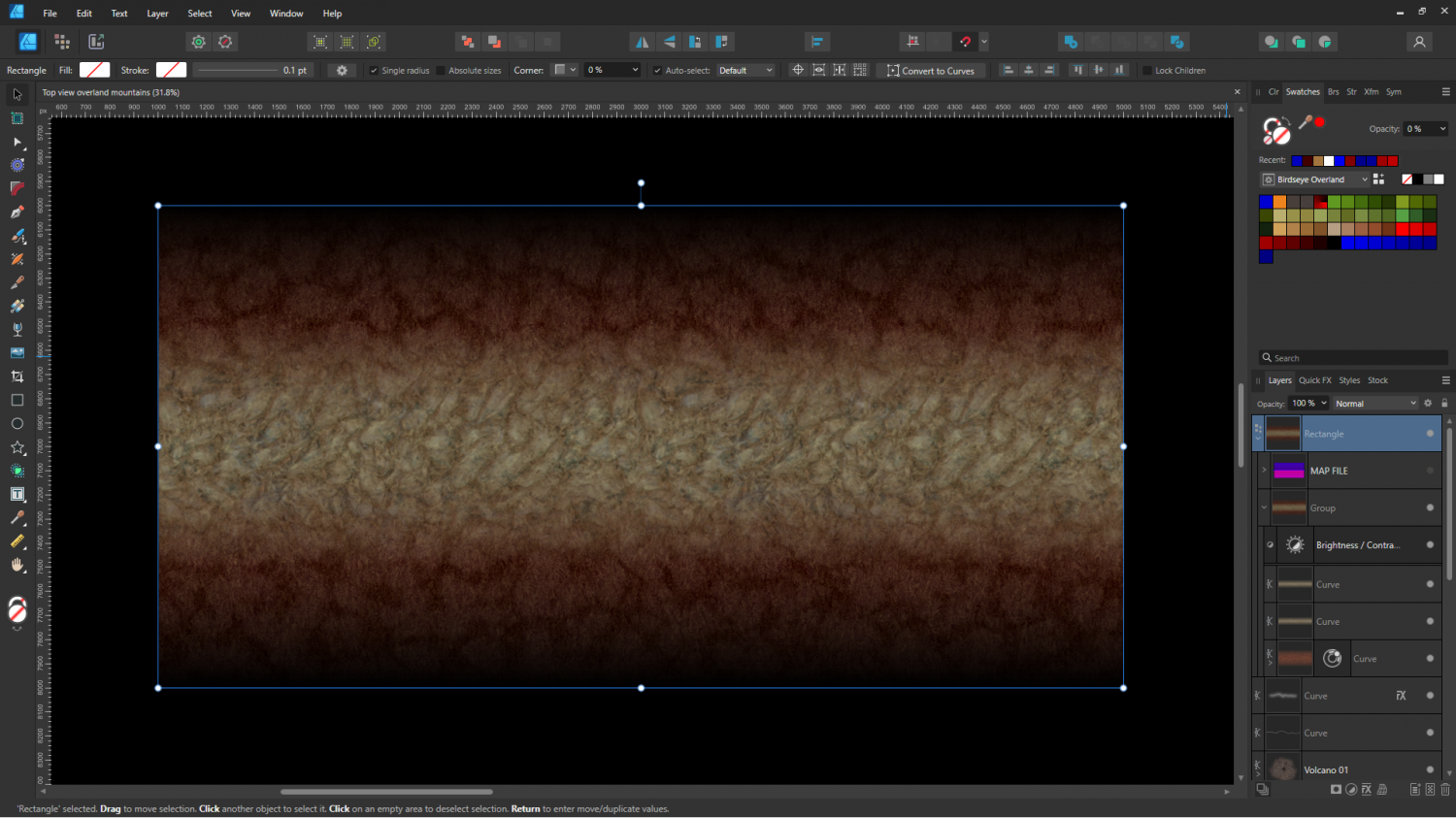
Birdseye Continental - style development thread
I thought you might like to see some of the process involved in creating the mapped mountains.
Here is the first prototype ridge - a simple edge faded thick line of the red tundra and a rocky texture for the spine.
And here it is in CC3 combined with a crude map file to test colours.
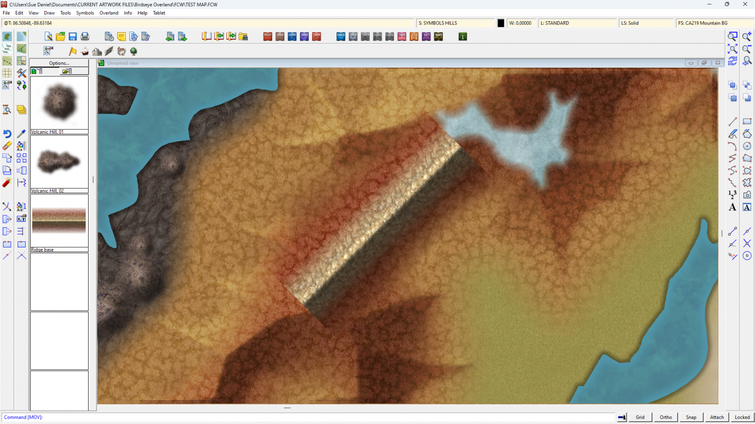
Don't worry - the volcanoes were just as crude when I started with them. This is just the initial stage - working out textures and colours.

