


Loopysue
Loopysue
About
- Username
- Loopysue
- Joined
- Visits
- 9,969
- Last Active
- Roles
- Member, ProFantasy
- Points
- 9,853
- Birthday
- June 29, 1966
- Location
- Dorset, England, UK
- Real Name
- Sue Daniel (aka 'Mouse')
- Rank
- Cartographer
- Badges
- 27
Latest Images


-
Supplemental to Humble Bundle
That's really strange. It worked for me just now. I will say that it took a few seconds to wake up and respond, but I guess that my download manager was doing a load of handshaking stuff with the host. The file is 1.87GB. That's fairly large because of the graphics it contains.
What browser are you using. Mine is Edge, and I'm actually using IDM (Internet Download Manager) which speeds things up considerably.

-
Project Spectrum - Part 2
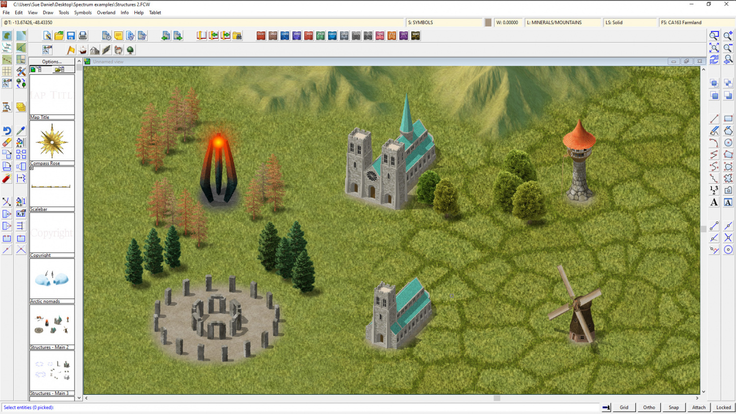
Well its a... it's a.... well... it's a... tower. Yes, that's what it is on the record :)
It's meant to be an 'evil tower', but it can be whatever you want it to be. My thinking about a tower of (or for) evil is that since evil is an inanimate thing of some kind it doesn't really need a house with windows and walls, but just a place to exist in a greater concentration. That greater concentration is symbolised by the glow.

-
October challenge: Drummond Street WIP
Hi everyone :)
This is area 2 on the challenge map.
When I commented earlier on the challenge thread I mentioned doing a dungeon scale map, but now I've really looked at my area I think I've changed my mind about that and now want to do a city map.
I've drawn 2 rectangles in white on the main reference map here. The smaller one shows the 6 houses that are wholly contained in the little oval on the challenge reference map. That doesn't really seem very many to me compared to the areas I've seen others are doing, so unless anyone objects with good reason I would like to do the 3 blocks contained in the larger rectangle and outlined in red below. That way I can do complete gardens, rather than just bits of them here and there.
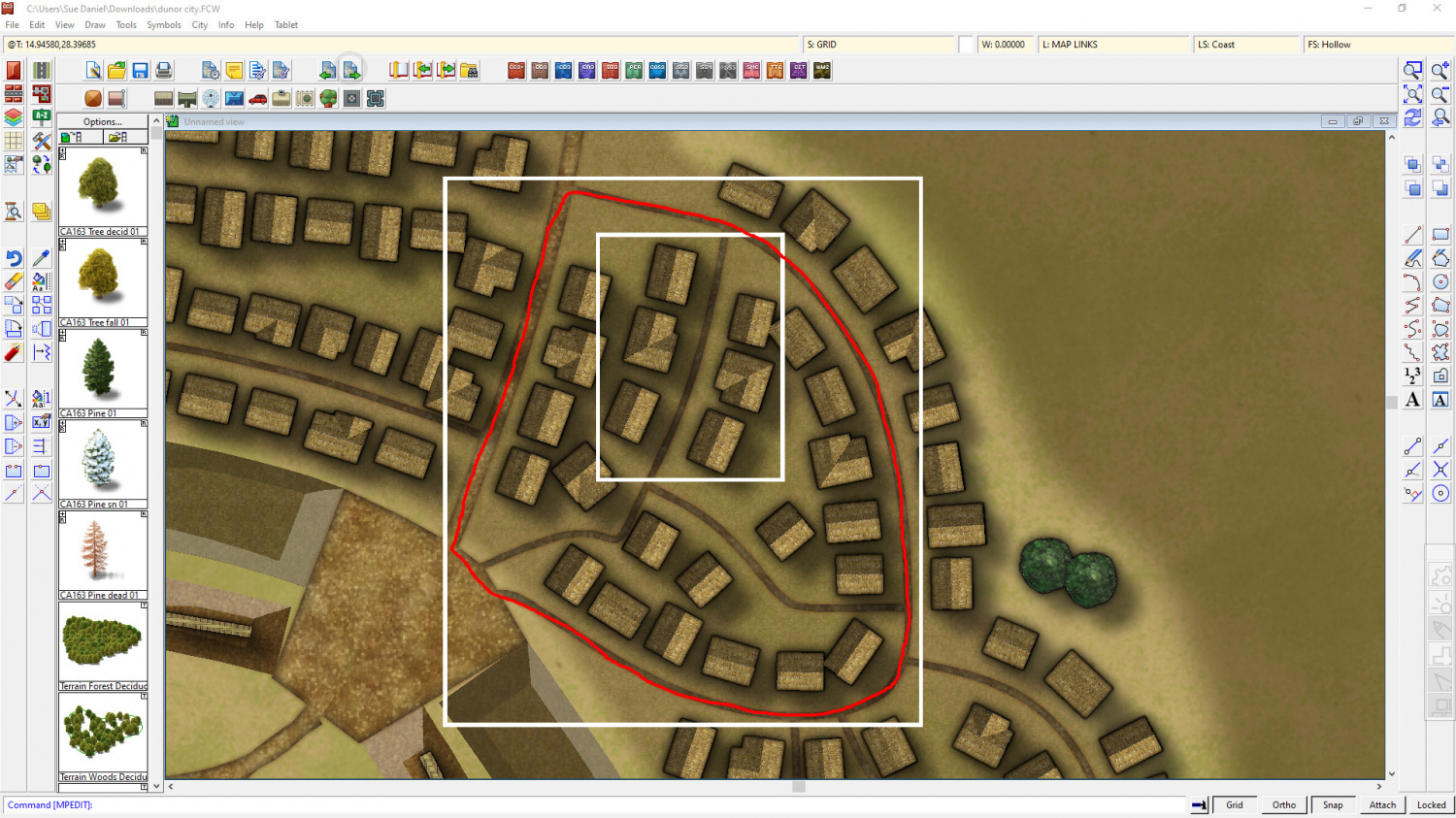
So, are you all fine with that?


-
Project Spectrum - Part 2
No, it's not just you, Medio. It does look better zoomed in. I think this is probably one of those styles that suit small regional maps more than world maps, but you can use it either way.
Here are the last few symbols for part 2. There are a few more in progress, but the completion date is today/tomorrow, so these are (officially at least) the last ones shown with a few of the existing trees and hills for scale. It might be worth noting that I have reduced the inner opacity on the edge fade of the farmland to 80 from 100. That makes it easier to see the symbols.

![[Deleted User]](https://secure.gravatar.com/avatar/c75d9a245b74d9c59be0999ea81ca541/?default=https%3A%2F%2Fvanillicon.com%2F92add7f8c954488718110edc4896ad39_200.png&rating=g&size=200)


-
October challenge: City Street submission WIP
It's good, but I feel like there is a fog or something. What blend mode are you using for the blue sheet?

