Loopysue
Loopysue
About
- Username
- Loopysue
- Joined
- Visits
- 9,977
- Last Active
- Roles
- Member, ProFantasy
- Points
- 9,857
- Birthday
- June 29, 1966
- Location
- Dorset, England, UK
- Real Name
- Sue Daniel (aka 'Mouse')
- Rank
- Cartographer
- Badges
- 27
Latest Images


-
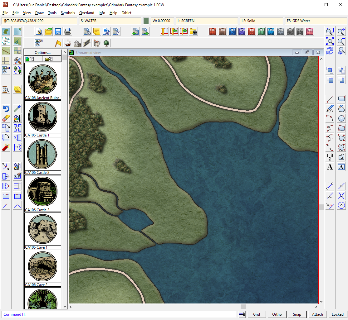
Grimdark Fantasy (renamed "Darklands") - development thread
I decided to work a bit on the coastline effects. I wanted to do a bevel, but at the same time leave myself (and eventually others) free to make coastlines as jagged as I want without the risk of those corner artefacts you sometimes get if you get a bit too ambitious with the Bevel. So instead of using the Bevel effect I put the water on top of the land like it would be in a city map, and added a pale glow and a dark directional shadow.
What do you think?


![[Deleted User]](https://secure.gravatar.com/avatar/c75d9a245b74d9c59be0999ea81ca541/?default=https%3A%2F%2Fvanillicon.com%2F92add7f8c954488718110edc4896ad39_200.png&rating=g&size=200)
-
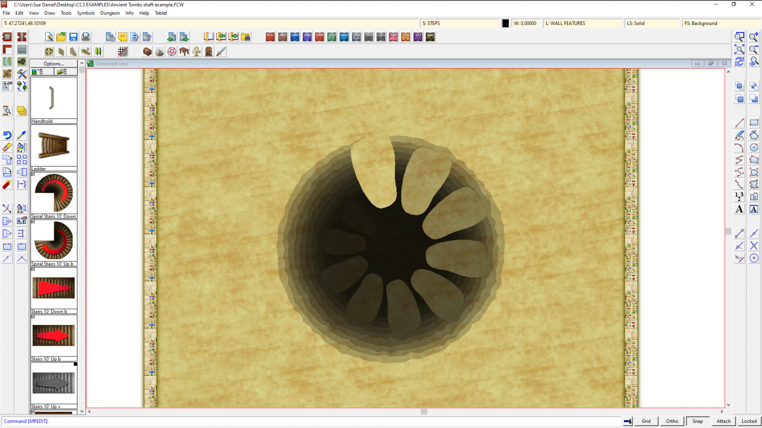
WIP Commission, Ancient Tombs
That's fine, Jim - just because I offer a potential solution doesn't mean it's the right one for you. There are always many different ways of creating something in a map, and I prefer what you've done anyway :)
As for the compass... I only know what I learned from the same video you watched, so I can't help you with that one. Sorry!
-
WIP Commission, Ancient Tombs
Would something like this help?

-
The Lakes of Michigami (Jerry's Map) - WIP thread
Thank you, @Raiko :)
@mahler - thanks :) I have no idea. I think this is probably too small a scale to show anything but the location of the settlements. Maybe Jerry will have the answer for that when the larger scale city maps are drawn.
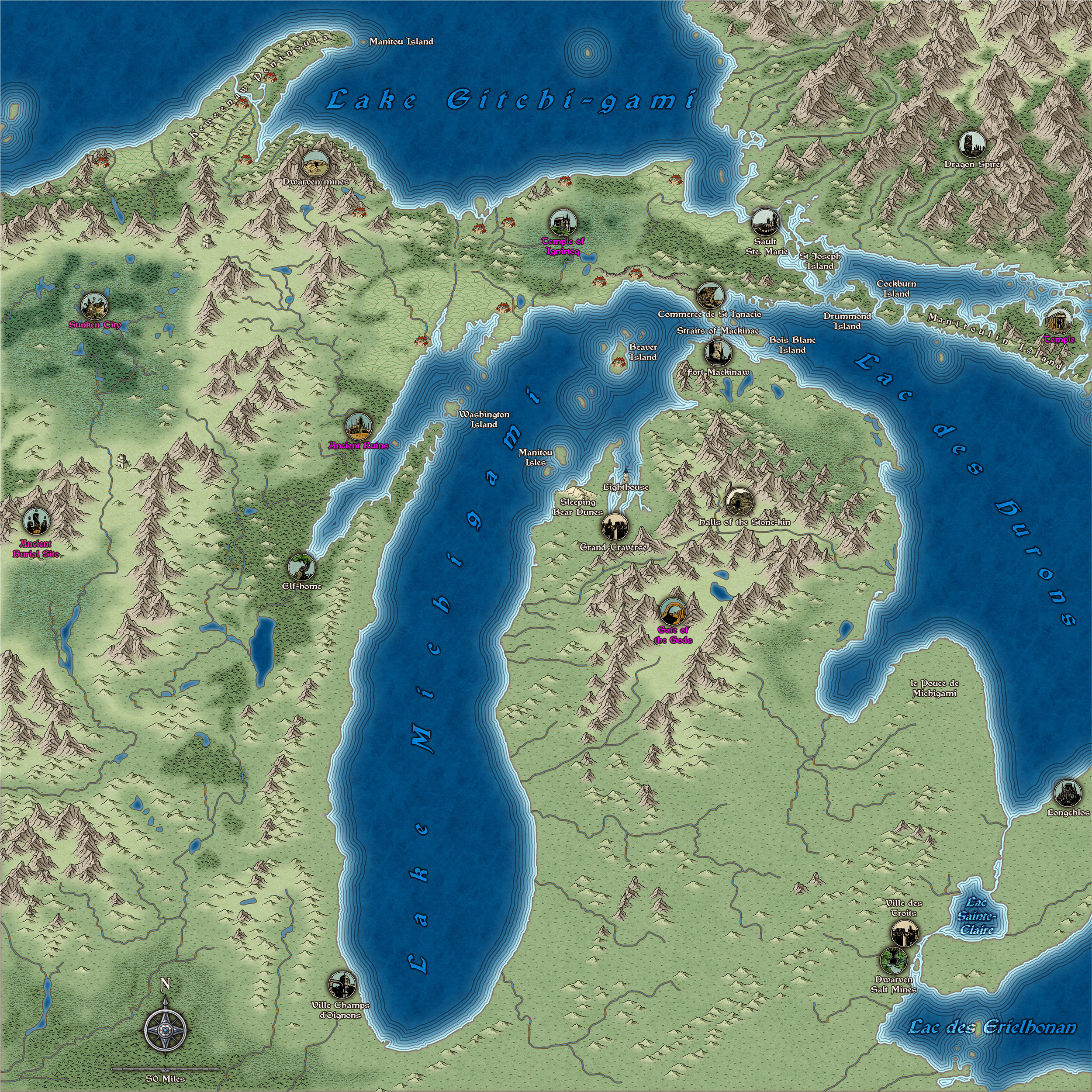
I've done a bit more work - adjusted the river system according to the US Geological Survey maps and then adjusted the mountain ranges and terrain around them. The locations labelled in pink are only vague suggestions from me, and may not appear in the final map.
And I've just noticed that by repairing the shoreline where it was missing bits (I did a trace from a heightmap from Tangram if you remember), the labelling of the water bodies in the south east now needs a bit of attention.
-
How would you create a fantasy port/harbour rpg battlemap?
Looks like a great start :)