


Loopysue
Loopysue
About
- Username
- Loopysue
- Joined
- Visits
- 9,972
- Last Active
- Roles
- Member, ProFantasy
- Points
- 9,853
- Birthday
- June 29, 1966
- Location
- Dorset, England, UK
- Real Name
- Sue Daniel (aka 'Mouse')
- Rank
- Cartographer
- Badges
- 27
Latest Images


-
Community Atlas - Tombs - Fonlorn Archipelago - Bleakness - Plains of Ash
Lovely idea with the background map.
I think the first sentence has been duplicated.

-
CC4 Overland Development Thread
Yes, I have been thinking of ranges. These models are basic inspiration and could be combined in a range symbol once I get past the basics of how big to make them and how much to modify the general appearance.
The smoother hills are a popular request.


-
CC4 Overland Development Thread
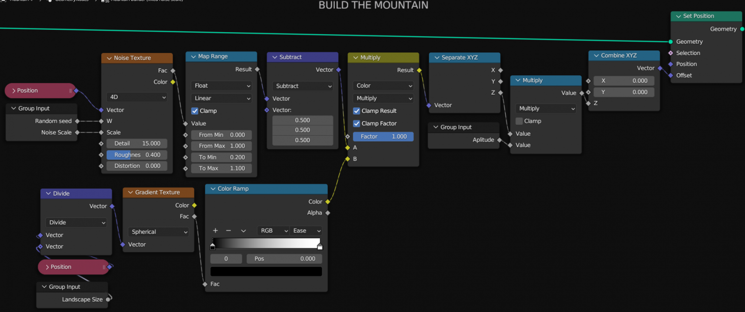
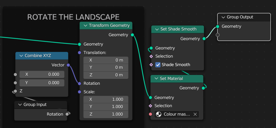
The image for the node setup turned out a bit blurry, so this is it again in a more readable fashion. I continue to work in Blender version 3.6.8 even though there are more up to date versions. They update/upgrade in a fashion that damages version compatibility. Some of these nodes no longer exist in the current version, or exist in such a changed state that they don't work the same way.
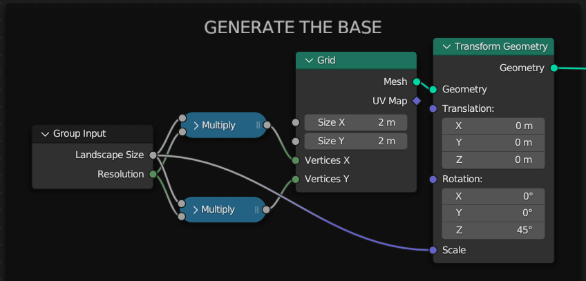
In the first image I use 2 Math nodes to do the same thing. This can be done with just one linked to the same inputs and outputs.
Have fun! :)


-
CC4 Overland Development Thread
Thank you for sharing all your favourite overland styles and giving me a little information about why they are your favourites. This was a very enlightening thread for me. I hope it was for you too.
This thread is to show the development of CC4 Overland, or as much as might be interesting to you. It's also an opportunity for you to express your thoughts on how it's going and make suggestions about improvements. Not all suggestions will necessarily be incorporated, but they will all be seriously considered.
So far, I've started with the textures. The initial Land texture I showed a glimpse of in the thread linked above ended up being too busy for it's own good, so it was dumbed down quite considerably to be more of a subtle blotchy background for the more important stuff - the terrain textures and symbols to come. There's also a draft ocean texture.
I usually start by doing all the textures first, but I've also been thinking about the mountains, hills, mesas, craters, etc. I needed good reference material and a way to keep my drawings consistent, so I used Blender to create models for myself.
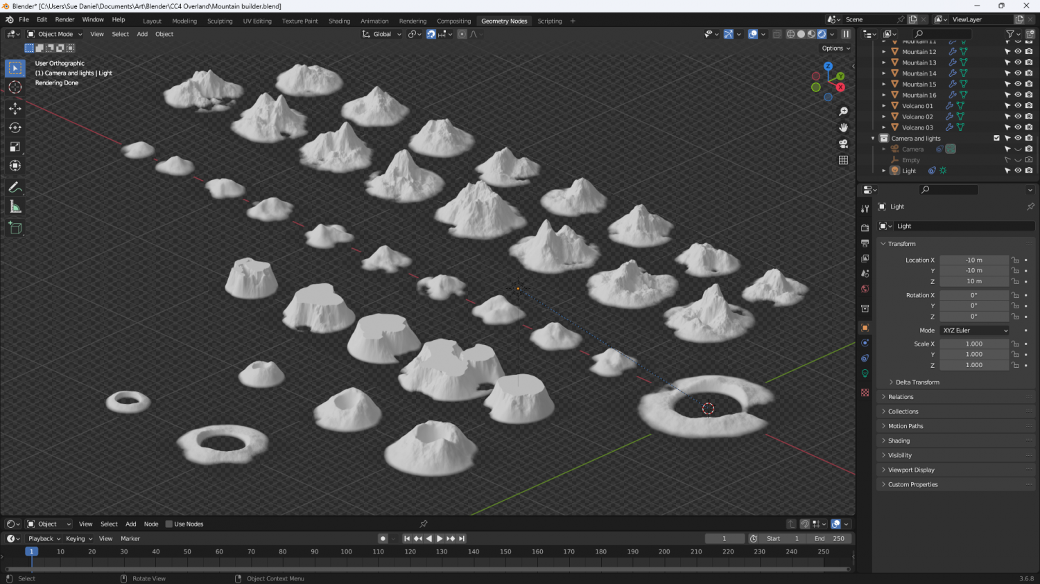
There is a landscape add on available in Blender, but it doesn't provide the right options for me to get what I wanted, so I made my own set of geometry nodes. I know there are other Blender enthusiasts among you, so here are the nodes for the mountains if you want to have a go at making one of your own. I've scrunched them all up as close as I can so you can read them.
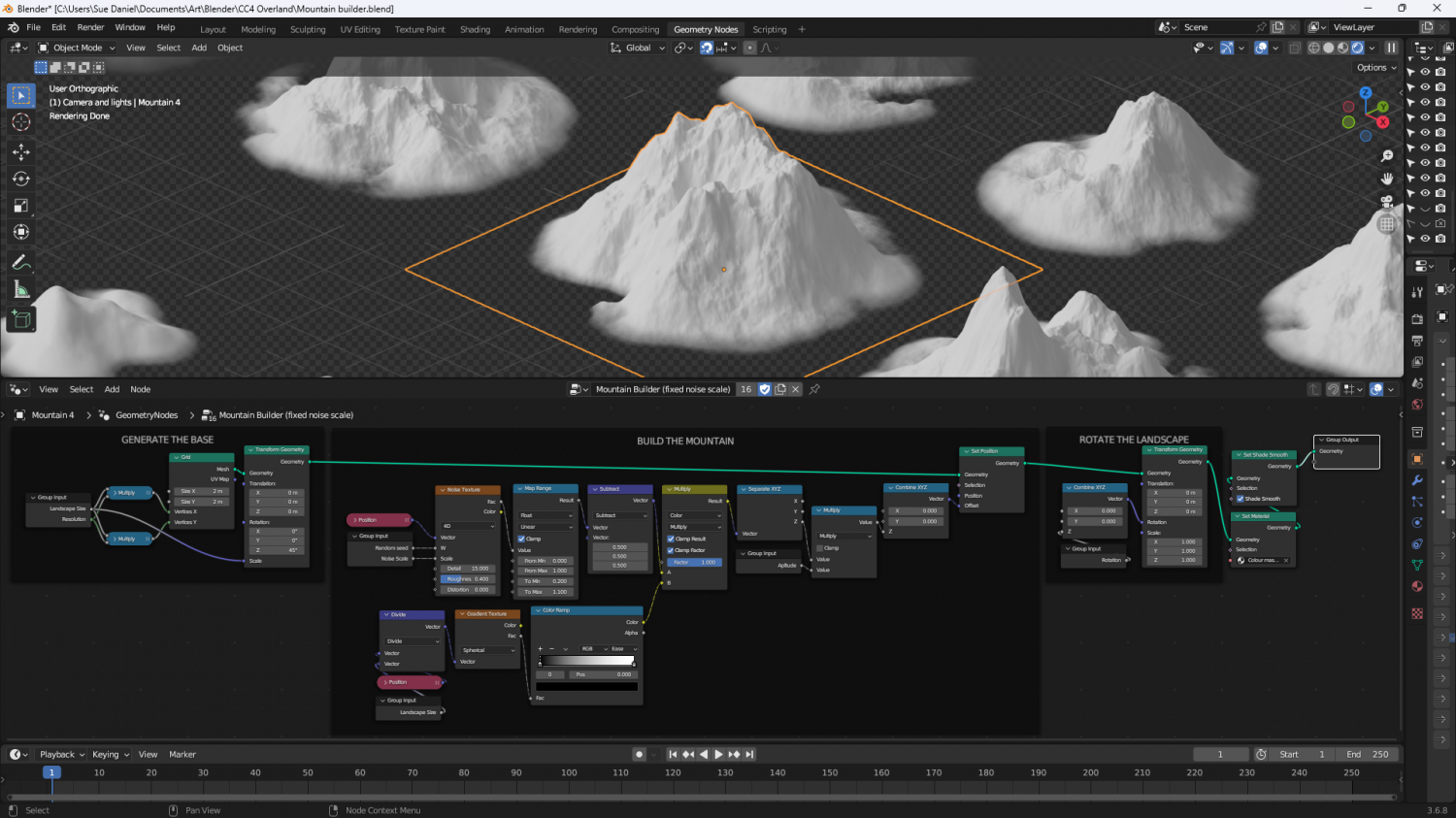
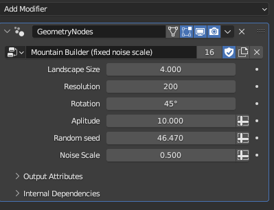
And here are the variables for the active mountain (outlined orange above). My spelling is still really bad. 'Aplitude' is meant to be 'Amplitude'.
Now begins the long process of hand drawing the mountains based on the models I've just made.
Please feel free to comment and make suggestions.


-
Trace Command Issues With Fractal Entities
Speed depends a lot on how many nodes you have in the object you are tracing (and also in the map as a whole). Maybe use SIMPLIFY first?
It would be nice to have better tracing tools, but for now we have what we have.

