Loopysue
Loopysue
About
- Username
- Loopysue
- Joined
- Visits
- 9,985
- Last Active
- Roles
- Member, ProFantasy
- Points
- 9,863
- Birthday
- June 29, 1966
- Location
- Dorset, England, UK
- Real Name
- Sue Daniel (aka 'Mouse')
- Rank
- Cartographer
- Badges
- 27
Latest Images


-
New Oxtail - WIP
There are several ways of doing the mountain. It depends how important it is to the map and how much time you want to take in creating it.
The quick and easy way is to use one or more sheets with a large and slightly smoothed "Bevel, Lighted" sheet effect, followed by an Edge Fade Inner sheet effect, and possibly a Blend Mode to blend the feet of the mountain into the flat ground. On that sheet you draw the extent of your mountain. I recommend using one of the transparent Solid fills, or a solid fill with transparency added in the Blend Mode.
The more detailed way that takes a lot longer is to actually draw the thing with lines and patches of shading on the darker side.
I will let you chose before I gallop off down a detailed description of either, or maybe someone else has an even better idea. There are always many ways of doing a thing in CC3.

-
Community Atlas 500th map and 4 year anniversary competition with prizes.
And this is mine.
These don't really qualify as map notes. They are more of a description, or a tourist guide if you like.

![[Deleted User]](https://secure.gravatar.com/avatar/c75d9a245b74d9c59be0999ea81ca541/?default=https%3A%2F%2Fvanillicon.com%2F92add7f8c954488718110edc4896ad39_200.png&rating=g&size=200)


 and 3 others.
 -
WHY DOES IT DO THIS??!?!?!
Transparency Acne is weird stuff. It only appears at certain zoom levels. If you zoom in and out you will see the dirt vanish and reappear. It tends to happen at closer zoom levels, which is unfortunate because most reasonably high res exports require the rendering engine to look at the map in a very closely zoomed way.
-
How to edit an already-drawn coastline?
The coastline is identical to the land, so if you copy the landmasses to the COASTLINE sheet using Copy to Sheet in the right click menu on the Sheets and Effects button |CC2SHEETS|, and then hide all sheets except the COASTLINE sheet, you can use change properties |CC2MCHANGE|to give the polygon a line width, change the fill to solid, and pick the colour you want. Giving a polygon a line width makes it hollow by default.
If you deleted the COASTLINE sheet don't worry. You can recreate it by hitting the NEW button in the Sheets and Effects dialog, and moving it to a position just above the LAND sheet on that list (which will appear behind the LAND sheet in the map)
-
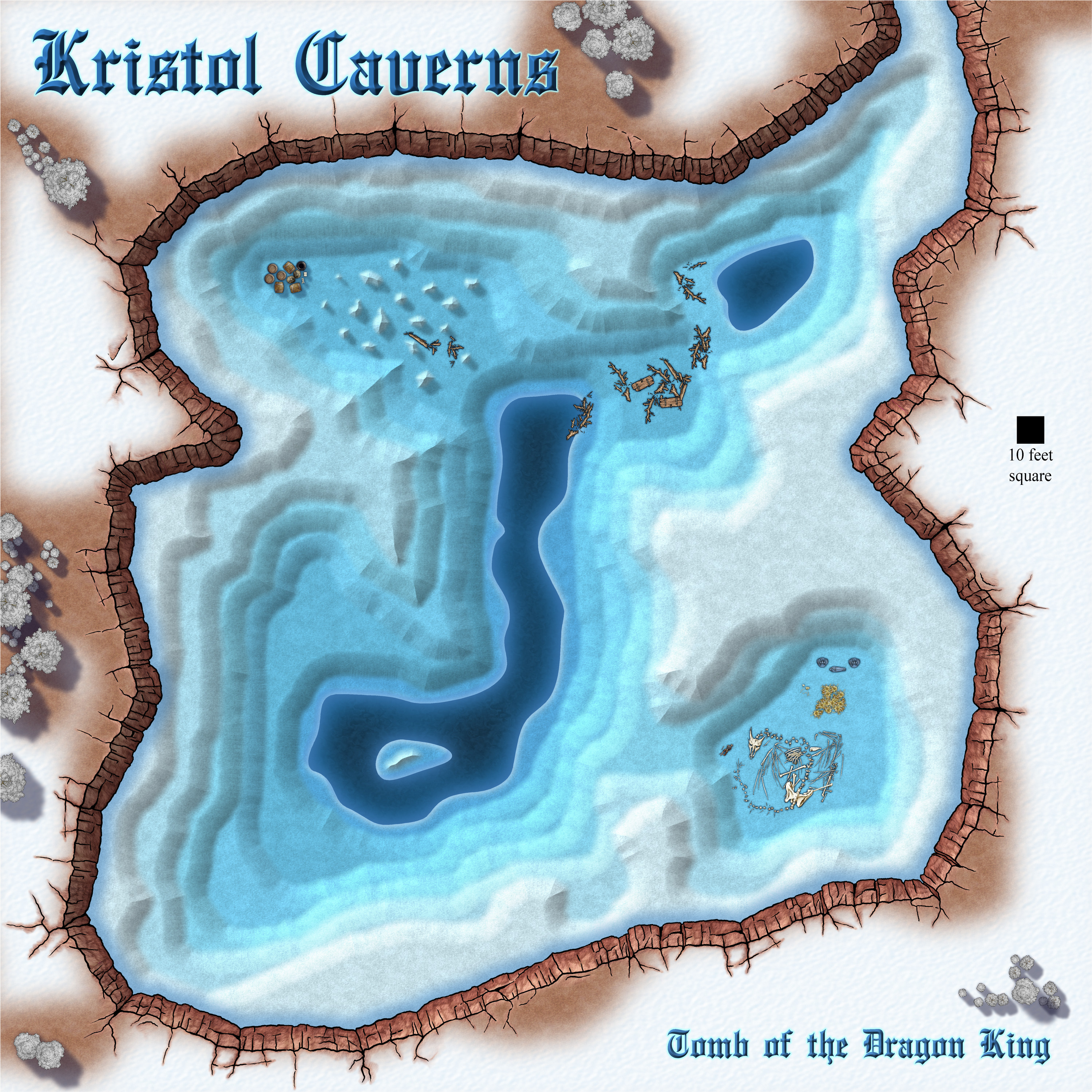
Community Atlas competition: Kristol Caverns
And now I am wondering if a longer bevel would be better.
I'm also thinking about adding something to that southern end. It looks a bit bland.
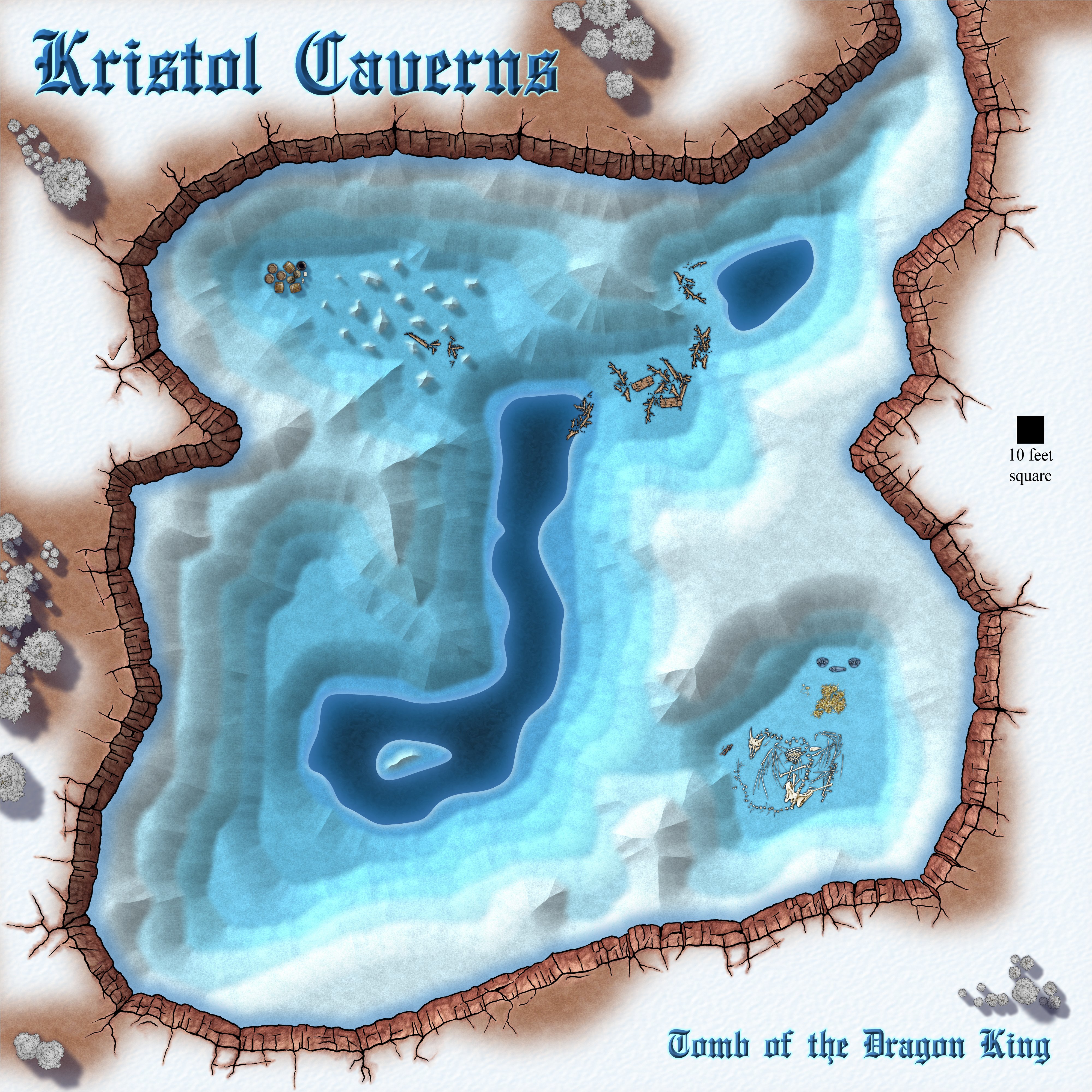
Long bevel, or short bevel - what do you think?