Loopysue
Loopysue
About
- Username
- Loopysue
- Joined
- Visits
- 9,990
- Last Active
- Roles
- Member, ProFantasy
- Points
- 9,866
- Birthday
- June 29, 1966
- Location
- Dorset, England, UK
- Real Name
- Sue Daniel (aka 'Mouse')
- Rank
- Cartographer
- Badges
- 27
Latest Images


-
Install Order?
Hmmm. It's there if you go looking, but its very out of date - all about how to do things with CC3, not CC3+
I reinstalled mine about 2 years ago when I got a new machine. I started with CC3+, then everything else starting with the major add-ons, and finished up with the latest update.
Each install was allowed to open CC3+ at the end of the install, which was then closed down before the next install.

-
Live Mapping: Connecting Symbols
Hi Everyone :)
This week, Ralf will be showing us how to make connecting symbols using the November issue of the 2007 Cartographer's Annual.
Hope to see you there! :D
![[Deleted User]](https://secure.gravatar.com/avatar/c75d9a245b74d9c59be0999ea81ca541/?default=https%3A%2F%2Fvanillicon.com%2F92add7f8c954488718110edc4896ad39_200.png&rating=g&size=200)


-
Floating City
This is getting to be quite a civilisation :)
-
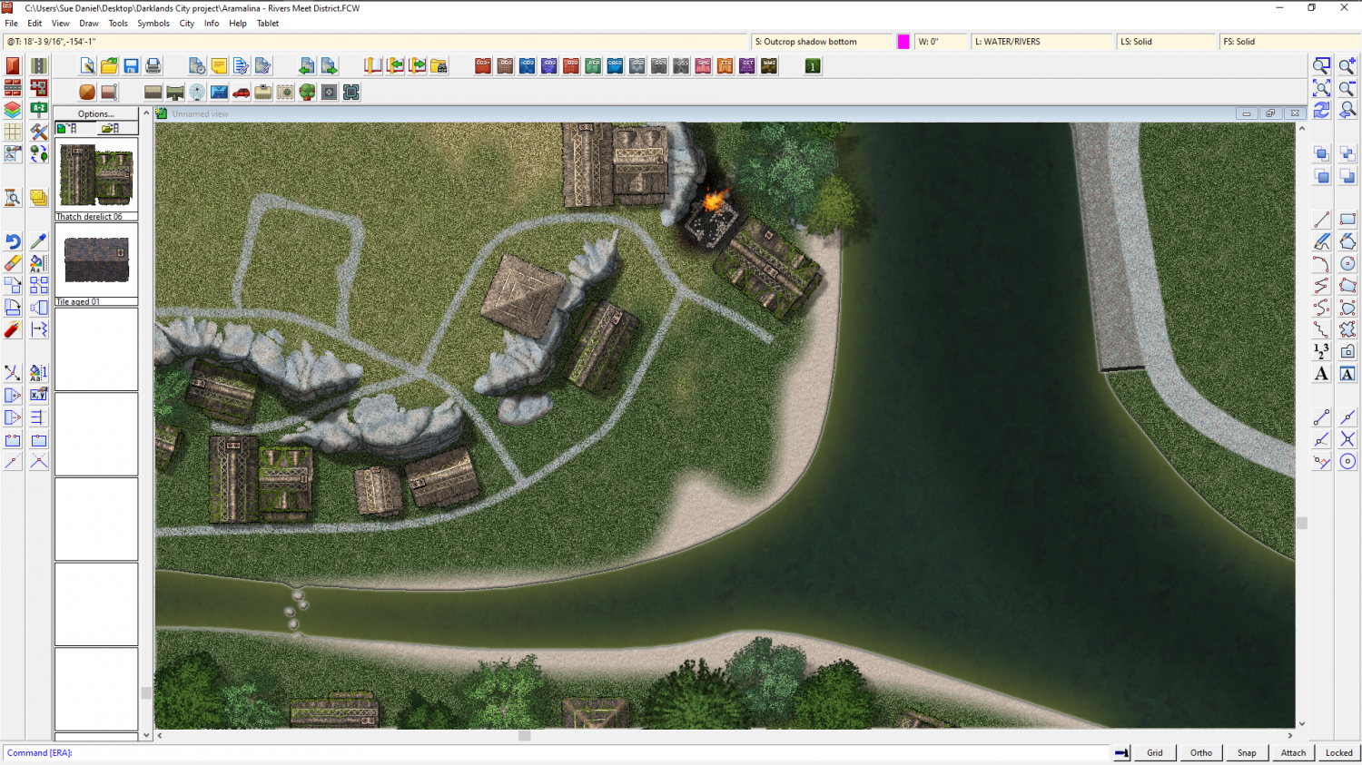
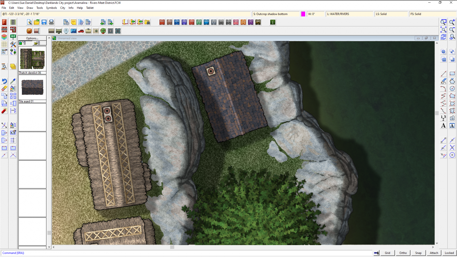
CA style development - "Darklands City" (issues for September and December 2021)
Thank you, dagorhir and Jim :)
I think a lot of the sweetness of the style was contributed by the water, so I've put an RGB Matrix Process on the default blue water and turned it considerably more murky. I've also started work on the tiled houses of the set.


 and 3 others.
 -
How to Represent Elevations in a Top Down DD3 Map?
Using sheets is probably the best way if you are quite happy to draw the shaded extent as a polygon shape.
The global sun only affects:
- how CD3 buildings are shaded, and
- which direction the shadows fall from objects on sheets with Wall Shadow, Direction sheet effects.
It doesn't affect the artificial shading you add using a sheet with black polygons on it. That sheet might have a Blur effect, and then a Blend Mode effect that is set to multiply. Transparency is controlled from within the Blend Mode.
---
An alternative that isn't quite so flexible is to use a Bevel Lighted on a sheet on which you then draw polygons of texture or one of the semi-transparent fills. If you adjust the bevel to a huge width and use masses of smoothing you can get recognizable hills. However, the width of the shading won't vary.