


Loopysue
Loopysue
About
- Username
- Loopysue
- Joined
- Visits
- 9,993
- Last Active
- Roles
- Member, ProFantasy
- Points
- 9,868
- Birthday
- June 29, 1966
- Location
- Dorset, England, UK
- Real Name
- Sue Daniel (aka 'Mouse')
- Rank
- Cartographer
- Badges
- 27
Latest Images


-
Making a Mountain
Height in a CC3 map is always an illusion. We don't currently have any heightmap features in CC3. Automatic roof shading is achieved by a specialised normal map applied to each building the moment it is placed in the map.
CC3 normal maps are linked with the symbol file in the symbol graphics folder, and only contain information about how steep the roof is, and which direction it is facing relative to the sun as blue and red components.
The connecting cliff symbols have normal maps that function in the same way, which is why they look darker on the face away from the global sun once they are pasted into the map. However, connecting symbols don't scale - as you have already discovered.
If you want to make the connecting cliff symbols bigger you have to draw the line of cliffs at the default scale, and then scale the whole thing up as one long snake of cliff symbols, which is easier to do if you group them first. That can still be tricky, though, because it requires that you can draw a miniature version of the cliff line by eye, perhaps to one side of the map.
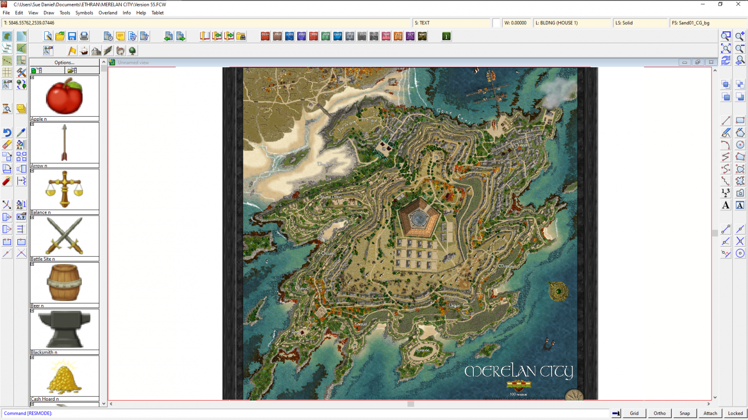
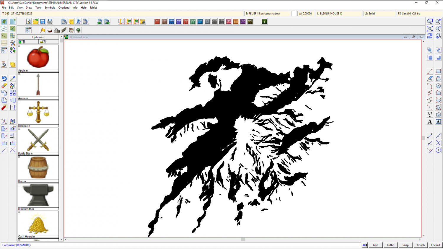
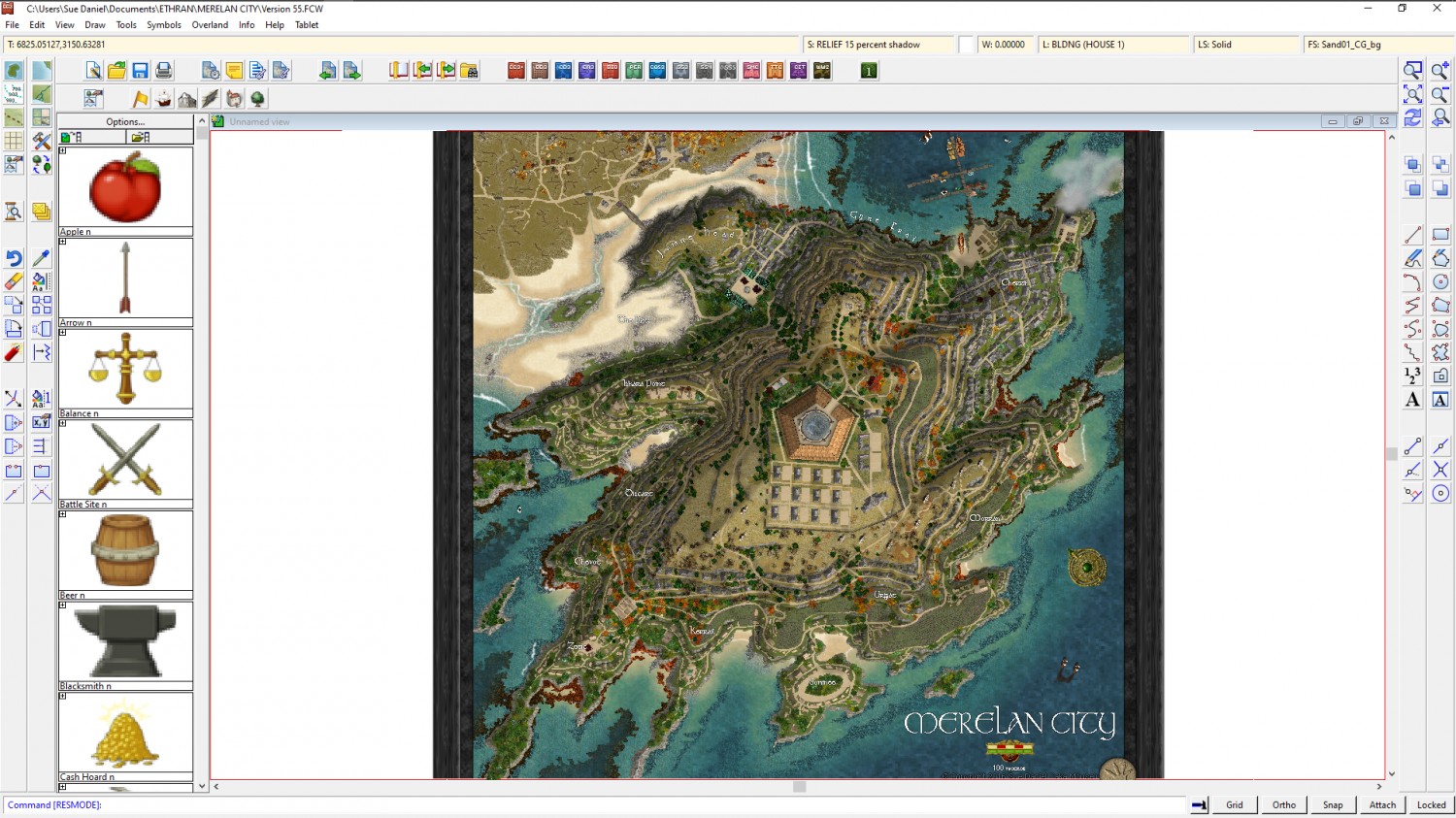
Alternative methods that you haven't already tried out are a bit more complicated. You could make your own relief shading sheet like this one I did for a city on a very steep island city, lit from the south east.
But that requires that you have an eye to see where the shadow needs to be in the first place. All good if you do, but if you can't see it in your imagination first I don't recommend it.
Another hand drawn method I've tried is explained in this blog article here: https://rpgmaps.profantasy.com/orde-on-the-rock-map-analysis/. It's a bit easier than Merelan City, but it will take a bit of time and care to set up. If I were trying to convert this map (image below) into a hollow mountain I would sink the entire city into a dungeon-style depression into the top of the plateau to give the illusion of a cave with the top of the mountain sliced off.

The FCW file for this map is contained in that blog article if you want to use it as a base for your own map.
These are not the only ways of generating the impression of height differences in a map. There are plenty more, like Shessar's tutorial here: https://forum.profantasy.com/discussion/9155/dd3-battlemap-tutorial-part-3-adding-contours


-
CA style development - "Darklands City" (issues for September and December 2021)
They're just too darn fast, Wyvern!
-
Community Atlas: Errynor - Aunty MacKassa's Home & Vehicles
Wonderful work, Wyvern :)
-
[WIP] Hyboria Map
Thanks :)
I copied the existing land shapes to the COASTLINE sheet, and then hid everything but the land sheet and turned that solid white. With the COASTLINE in place there was no longer a need for the glow, so I switched it off, though it is still there in case you want it in the future.
I thought, but couldn't be sure, that there was a COASTLINE entity as well as a LAND entity in this style. It sounded like there should be. The drawing tool draws an identical polygon on both sheets. All I have done is replace the missing poly on the COASTLINE sheet.

-
[WIP] Hyboria Map
Have you thought of making the continent lines thin enough to match the average thickness of the ink in the mountain lines? That will make the coastline look less distinct, but you can counteract that by adding a Glow effect to the LAND sheet, set to Outer and a dark grey, so that the water is shaded away from the land a set distance all around.
I know the old 'I'll know it when I see it' issue. I have that myself quite a lot. So lets try to get the coastline looking good first, and then maybe you will have a better idea of what you want for the land.
Are you going to use this with a pure white background, or are you looking to add a subtle paper texture? A plain white background is what you want if you intend to use the map printed on paper, which will be its own paper background, but if you only ever intend to use it as an image file you might want to add the paper texture in.

